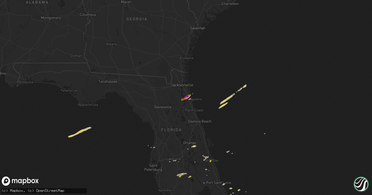
Hail Map on April 10, 2018
Get this storm
April 10 map
$229
one time, instant access
Download today. No call, no setup
Keep the $229
Bought the map and want the full workflow? Apply the entire $229 to a subscription within 7 days. None of it is wasted.
Every map, not just this one
This buys you this map. Subscription and you get every map we run, in the markets you choose from a few cities to whole states to nationwide. Plus real-time alerts the moment a storm fires.
Contact data
Name, contact info, occupancy, even credit band for addresses in the footprint. You go from where it hit to who to call.
Become the source they trust
Unlimited branding weather history reports on demand. You already have the documented answer ready for the property owner, and you are the one who showed up with it.
Property data and RoofTrace estimates
Pull up any address you have got, its value and the exact code rules for that jurisdiction, straight from One Click Code. Then RoofTrace estimates the squares, pitch, and roof value, priced the way you price.
States Impacted by Hail Map on April 10, 2018
Storm reports
Florida
| Date | Description |
|---|---|
| 04/10/20183:45 PM CDT | A trained weather spotter reported quarter sized hail along interstate 595 near sw 66th terrace. |
| 04/10/20183:32 PM CDT | A thunderstorm produced a wind gust of 63 mph at a mesonet site at port everglades. |
| 04/10/20183:25 PM CDT | Tornado touched down along nw side of fort lauderdale-hollywood int'l airport near i-595 and moved ese along airport's northern taxiway. Damaged fedex facility and a je |
| 04/10/20182:34 PM CDT | Weak tornado touched down near andrews ave and ne 5th st in fort lauderdale... Moving se through flagler village and rio vista towards port everglades. |
| 04/10/20182:15 PM CDT | A thunderstorm wind gust of 58 mph / 50 knots was recorded by mesonet weather station kfloxah26. The owner of the personal weather station also noted some small tree br |
| 04/10/20182:10 PM CDT | A video from social media shows a weak tornado touchdown in an open field south of 20 mile bend of us 98. |
| 04/10/201812:20 PM CDT | A few hail reports in the palm bay area... Estimated to be nickel to quarter size. |
| 04/10/201811:32 AM CDT | Public reported 1 inch hail. |
| 04/10/20187:21 AM CDT | Hail reported in murabella subdivision. |
| 04/10/20187:18 AM CDT | At 1217 PM EDT, a severe thunderstorm was located 10 miles east of Wauchula, moving east at 25 mph. HAZARD...60 mph wind gusts and quarter size hail. SOURCE...Radar indicated. IMPACT...Hail damage to vehicles is expected. Expect wind damage to roofs, siding, and trees. Locations impacted include... Sebring, Avon Park, Wauchula, Sweetwater, Zolfo Springs, Lake Josephine, Avon Park Executive Airport, Crewsville and Sebring Shores. |
| 04/10/20187:16 AM CDT | Numerous reports of ping pong to golf ball size hail in the world golf village in murabella... Pacetti bay middle school and sumara lakes. |
| 04/10/20187:15 AM CDT | 3 inch hail occurred in the trunberry neighborhood near edge of the woods road. |
| 04/10/20187:15 AM CDT | 1.5 miles south of pacetti road and sr-16 |
| 04/10/20186:35 AM CDT | At 1134 AM EDT, a severe thunderstorm was located over Lake Nona, or near Orlando International Airport, moving east at 20 mph. There was another potentially severe thunderstorm near Kissimmee and Doctor Phillips. HAZARD...60 mph wind gusts and quarter size hail. SOURCE...Radar indicated. IMPACT...Hail damage to vehicles is expected. Expect wind damage to roofs, siding, and trees. Locations impacted include... Orlando, Kissimmee, Wedgefield, Windermere and Christmas. |
| 04/10/20186:16 AM CDT | At 1115 AM EDT, a severe thunderstorm was located over Bay Lake, moving east at 20 mph. HAZARD...60 mph wind gusts and quarter size hail. SOURCE...Radar indicated. IMPACT...Hail damage to vehicles is expected. Expect wind damage to roofs, siding, and trees. Locations impacted include... Orlando, Kissimmee, Bay Lake, Celebration and Intercession City. |
| 04/10/20185:22 AM CDT | At 1022 AM EDT, a severe thunderstorm was located over Hollister, or near Interlachen, moving northeast at 25 mph. HAZARD...60 mph wind gusts and quarter size hail. SOURCE...Radar indicated. IMPACT...Hail damage to vehicles is expected. Expect wind damage to roofs, siding, and trees. Locations impacted include... Palatka, Hastings, East Palatka, Bostwick, Federal Point, Orange Mills, Bardin, Hollister, Spuds and Mannville. |
| 04/10/20184:33 AM CDT | At 933 AM EDT, a severe thunderstorm was located 9 miles west of Hudson, moving east at 35 mph. HAZARD...60 mph wind gusts. SOURCE...Radar indicated. IMPACT...Expect damage to roofs, siding, and trees. Locations impacted include... Spring Hill, New Port Richey, Hudson, Weeki Wachee, Jasmine Estates, New Port Richey East, Hernando County Airport, Timber Pines, Shady Hills, Moon Lake, Gowers Corner, Weeki Wachee Acres, Jay B Starkey Wilderness Park, Bayonet Point, Masaryktown and Elfers. |
| 04/10/20182:59 AM CDT | At 759 AM EDT, a severe thunderstorm was located near Picolata, or 9 miles southeast of Green Cove Springs, moving northeast at 40 mph. HAZARD...60 mph wind gusts and quarter size hail. SOURCE...Radar indicated. IMPACT...Hail damage to vehicles is expected. Expect wind damage to roofs, siding, and trees. Locations impacted include... Saint Augustine, World Golf Village, South Ponte Vedra, Vilano Beach, Picolata, Guana River State Park, Anastasia and Bakersville. |
| 04/09/201811:36 PM CDT | At 436 PM EDT, a severe thunderstorm was located over Pine Island Ridge, or over Plantation, moving northeast at 25 mph. HAZARD...60 mph wind gusts and quarter size hail. SOURCE...Radar indicated. IMPACT...Hail damage to vehicles is expected. Expect wind damage to roofs, siding, and trees. Locations impacted include... Fort Lauderdale, Hollywood, Pompano Beach, Davie and Plantation. |
| 04/09/201810:43 PM CDT | At 343 PM EDT, a severe thunderstorm was located over Greenacres, or near Lake Worth, moving southeast at 25 mph. HAZARD...60 mph wind gusts and penny size hail. SOURCE...Radar indicated. IMPACT...Expect damage to roofs, siding, and trees. Locations impacted include... West Palm Beach, Boynton Beach, Delray Beach, Lake Worth and Palm Beach. |
Cities Impacted by Hail Map on April 10, 2018
- Plant City, FL
- Fort Lauderdale, FL
- Orlando, FL
- Sebring, FL
- Avon Park, FL
- Zolfo Springs, FL
- Wauchula, FL
- Saint Augustine, FL
- Lakeland, FL
- Melbourne, FL
- Dania, FL
- Bartow, FL
- Winter Haven, FL
- Stuart, FL
- Malabar, FL
- Palm Bay, FL
- Kissimmee, FL
- Pompano Beach, FL
- Okeechobee, FL
- Miami Beach, FL
- Hallandale, FL
- North Miami Beach, FL
- Miami, FL
- Hollywood, FL
- Coral Springs, FL
- Vero Beach, FL
- Hudson, FL
- West Palm Beach, FL
- Jensen Beach, FL
- Saint Cloud, FL
- Green Cove Springs, FL