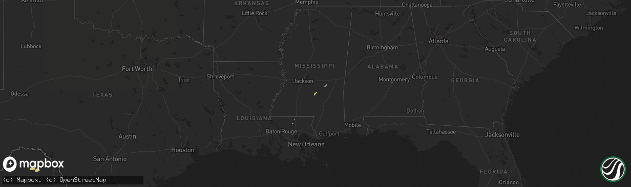
Hail Map on April 6, 2015
The weather event on April 6, 2015 includes Hail map. 6 states and 80 cities were impacted and suffered possible damage. The total estimated number of properties impacted is 214.
Want more than just the map?
Turn this storm into a full workflow.
- Owner + property data so you know who to knock
- OnDemand branded weather history reports to win the "did we even have hail?" argument
- RoofTrace estimate so reps stop guessing numbers at the door
Bought this map? Upgrade within 7 days and we'll credit the $230. (10-15 min setup call)
Hail
214
Estimated number of impacted properties by a 1.00" hail or larger0
Estimated number of impacted properties by a 1.75" hail or larger0
Estimated number of impacted properties by a 2.50" hail or largerStorm reports
Mississippi
| Date | Description |
|---|---|
| 04/06/20155:17 PM CDT | Two large tree limbs down in braxton. |
| 04/06/20155:05 PM CDT | Large tree limb down in magee. |
Missouri
| Date | Description |
|---|---|
| 04/06/20156:44 AM CDT | A local report indicates 1.50 inch wind near WILLIAMSBURG |
| 04/06/20156:42 AM CDT | A local report indicates 1.75 inch wind near WILLIAMSBURG |
| 04/06/20156:17 AM CDT | Reported in calwood...relayed via komu...time estimated by radar |
| 04/06/20156:05 AM CDT | Measurement taken 30 mins after hail fell...cocorahs report |
| 04/06/20156:02 AM CDT | Report via social media |
| 04/06/20155:35 AM CDT | A local report indicates 1.75 inch wind near 1 N COLUMBIA |
| 04/06/20154:54 AM CDT | A local report indicates 1.75 inch wind near 1 N NASHVILLE |
Kansas
| Date | Description |
|---|---|
| 04/06/20154:16 AM CDT | A local report indicates 1.00 inch wind near 3 N CHEROKEE |
Cities Impacted by Hail Map on April 6, 2015
- Franklin, MO
- Fayette, MO
- Montgomery City, MO
- New Florence, MO
- Auxvasse, MO
- Rocheport, MO
- Hallsville, MO
- Portland, MO
- Harrisburg, MO
- Kingdom City, MO
- Rhineland, MO
- Columbia, MO
- Williamsburg, MO
- Fulton, MO
- Richmond, MO
- Meadville, MO
- Asbury, MO
- Jasper, MO
- Liberal, MO
- Oronogo, MO
- Lamar, MO
- Kidder, MO
- Hamilton, MO
- Cameron, MO
- Corder, MO
- Barnhart, MO
- Clarkson, KY
- Galt, MO
- Hardin, MO
- Girard, KS
- Pittsburg, KS
- Norborne, MO
- Carrollton, MO
- Bogard, MO
- Pevely, MO
- Polo, MO
- Kingston, MO
- Magee, MS
- Mount Olive, MS
- Marshall, MO
- Walnut, KS
- McCune, KS
- Saint Paul, KS
- Cherokee, KS
- Weir, KS
- Mindenmines, MO
- Opolis, KS
- Hale, MO
- Hillsboro, MO
- Unionville, MO
- Hermann, MO
- Glasgow, MO
- Nelson, MO
- Centralia, MO
- New Franklin, MO
- Gallatin, MO
- Breckenridge, MO
- Parsons, KS
- Oswego, KS
- Altamont, MO
- Lockwood, MO
- Kentwood, LA
- Frontenac, KS
- Higginsville, MO
- Dover, MO
- Mize, MS
- Leitchfield, KY
- Dawn, MO
- Chillicothe, MO
- Spencer, IN
- Freedom, IN
- Lawson, MO
- Louin, MS
- Trenton, MO
- Chula, MO
- Jamesport, MO
- Stockton, MO
- Golden City, MO
- Caneyville, KY
- Amite, LA