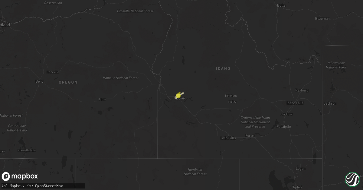
Hail Map on April 3, 2024
Get this storm
April 3 map
$229
one time, instant access
Download today. No call, no setup
Keep the $229
Bought the map and want the full workflow? Apply the entire $229 to a subscription within 7 days. None of it is wasted.
Every map, not just this one
This buys you this map. Subscription and you get every map we run, in the markets you choose from a few cities to whole states to nationwide. Plus real-time alerts the moment a storm fires.
Contact data
Name, contact info, occupancy, even credit band for addresses in the footprint. You go from where it hit to who to call.
Become the source they trust
Unlimited branding weather history reports on demand. You already have the documented answer ready for the property owner, and you are the one who showed up with it.
Property data and RoofTrace estimates
Pull up any address you have got, its value and the exact code rules for that jurisdiction, straight from One Click Code. Then RoofTrace estimates the squares, pitch, and roof value, priced the way you price.
Storm reports
Virginia
| Date | Description |
|---|---|
| 04/03/20243:35 PM CDT | 911 call center reported a tree down on lott cary road. Time estimated from radar. |
| 04/03/20243:09 PM CDT | Structural damage was reported including roof and siding damage off of us-360 in heathsville. Time estimated from radar. Possible tornado. |
| 04/03/20243:05 PM CDT | Multiple damage to homes on owltown road. Several trees and power poles downed. Debris partially blocking adjacent sections of us-360. |
| 04/03/20243:05 PM CDT | Possible tornado. Multiple damage to homes on owltown road. Several trees and power poles downed. |
| 04/03/20243:05 PM CDT | Possible tornado. Multiple damage to homes on owltown road. Several trees and power pole |
| 04/03/20242:43 PM CDT | Power lines down in roadway - near church hill rd at desha rd. |
| 04/03/20242:24 PM CDT | 911 call center reported a tree down on ap hill blvd northbound. Time estimated from radar. |
| 04/03/20242:05 PM CDT | Trees were uprooted in atlee. Time estimated from radar. |
| 04/03/20242:02 PM CDT | 911 call center reported a tree down on county line church road. Time estimated from radar. |
| 04/03/20242:00 PM CDT | Trees downed along us 1 just e of randolph-macon college. |
| 04/03/20241:47 PM CDT | 911 call center reported a tree down on hockett road. Time estimated from radar. |
| 04/03/20241:44 PM CDT | 911 call center reported a tree down on shallow well road. Time estimated from radar. |
| 04/03/20241:28 PM CDT | 911 call center reported a tree down on genito road in amelia county. Time estimated from radar. |
| 04/03/202412:11 PM CDT | Tree down across the left lane of the william f. Stone highway at the joseph martin highway exit. |
| 04/03/202411:55 AM CDT | Large tree down that has blocked town fork rd. |
| 04/02/202410:15 PM CDT | Weatherflow station at tangier island reported a wind gust to 59 mph. |
Florida
| Date | Description |
|---|---|
| 04/03/20242:33 PM CDT | Emergency manager reports a tree down along polo club drive in kissimmee. The tree damaged two vehicles. Time estimated via radar. |
| 04/03/20241:45 PM CDT | 911 call center reported single tree down. |
| 04/03/20241:45 PM CDT | 911 call center reported single tree down. |
| 04/03/20241:45 PM CDT | 911 call center reported single tree down. |
| 04/03/20241:35 PM CDT | State and county em report damage to homes and buildings along se 27th terrace near bushnell and webster... With further assessment ongoing. Time estimated from radar. |
| 04/03/20241:22 PM CDT | Sumter county em reports tree limbs and power lines near intersection of county roads 227 and 202 near oxford. |
| 04/03/20241:22 PM CDT | Sumter county em reports tree limbs and power lines near intersection of county roads 227 a |
| 04/03/20241:05 PM CDT | Damaged to a few mobile homes and an old barn located near platt rd. In plant city was reported by the public. |
| 04/03/202412:56 PM CDT | Ham radio operator reports trees down across power lines near moog rd and us hwy 19 in the vicinity of colonial hills. |
| 04/03/202412:55 PM CDT | Variety of storm related damaged relayed by em near nw highway 225a including a snapped water oak tree... And a flipped horse trailer. General time estimated via radar. |
| 04/03/202412:50 PM CDT | Skywarn spotter submitted a report of large tree branches down... Greater than 4 inches in diameter... Near the intersection of nw 15th avenue and nw 85th street in oca |
| 04/03/202412:14 PM CDT | Broadcast media had a photo showing a large tree branch blocking the left lane of arlington expressway eastbound near the southside connector ramp. |
| 04/03/202411:20 AM CDT | Levy county sheriff office reported a tree down across eastbound lane of fl hwy 500 east of chiefland. Time estimated from radar. |
| 04/03/202411:15 AM CDT | Pictures relayed via social media of various damage to a neighborhood near us1 and county rd 210w. Damage included large fence blown partially over... Several small tre |
| 04/03/202411:08 AM CDT | A nws storm survey discovered damage due to an ef0 tornado with a maximum width of 125 yards that briefly touched down in the beacon lake neighborhood in northern st jo |
| 04/03/20249:40 AM CDT | Tree down near sw 44th ave and sr 238. Time estimated by radar. |
| 04/03/20249:36 AM CDT | Tree down on powerline near sw 31st ln and w sr 238. Time is estimated by radar. |
| 04/03/20249:30 AM CDT | Branch fell on roof and root ball landed on a fence at 177 sw ferndale. |
| 04/03/20249:27 AM CDT | Tree down on home at the south end of columbia county. Home is off of 996 sw bluff... 2 miles west of sr 47. |
| 04/03/20249:24 AM CDT | Tree down near nw cr 241 and nw 49th ln. Time estimated by radar. |
| 04/03/20249:18 AM CDT | *** 1 inj *** tree fell on a single wide mobile home with one minor injury. Report from the state watch office and time is based on radar. |
Idaho
| Date | Description |
|---|---|
| 04/03/20246:37 PM CDT | Via social media. |
| 04/03/20246:29 PM CDT | Via social media. |
Maryland
| Date | Description |
|---|---|
| 04/02/20249:34 PM CDT | A local report indicates 59 MPH wind near Md-4 At Patuxent River |
Oregon
| Date | Description |
|---|---|
| 04/02/20247:08 PM CDT | Asos station kreo rome. |
North Carolina
| Date | Description |
|---|---|
| 04/03/20241:36 PM CDT | Tree fell on house at ayr court... Raleigh. |
New Jersey
| Date | Description |
|---|---|
| 04/03/20246:45 PM CDT | Time estimated. |
| 04/03/20244:11 PM CDT | Multiple reports of dime to quarter-sized hail near jackson. One photo of close comparison to quarter on social media. |
Cities Impacted by Hail Map on April 3, 2024
- Lake City, FL
- Sanderson, FL
- Lake Butler, FL
- Raiford, FL
- Glen Saint Mary, FL
- Jacksonville, FL
- Gainesville, FL
- Newberry, FL
- Alachua, FL
- Powhatan, VA
- Callao, VA
- Walkerton, VA
- Bruington, VA
- Dunnsville, VA
- King And Queen Court House, VA
- Center Cross, VA
- Tappahannock, VA
- Warsaw, VA
- Farnham, VA
- Lottsburg, VA
- Scotland, MD
- Chase City, VA
- Nampa, ID
- Meridian, ID
- Dewitt, VA
- McKenney, VA
- Boise, ID
- Garden City, ID
- Eagle, ID
- Barnegat, NJ
- Waretown, NJ
- Forked River, NJ
- Lanoka Harbor, NJ
- Lakehurst, NJ
- Jackson, NJ
- Freehold, NJ
- Howell, NJ
- Farmingdale, NJ
- Saint Augustine, FL
- Paris, KY
- Winchester, KY