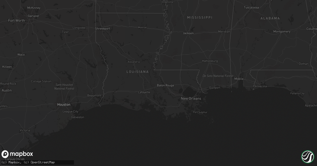
Hail Map on April 3, 2022
Get this storm
April 3 map
$229
one time, instant access
Download today. No call, no setup
Keep the $229
Bought the map and want the full workflow? Apply the entire $229 to a subscription within 7 days. None of it is wasted.
Every map, not just this one
This buys you this map. Subscription and you get every map we run, in the markets you choose from a few cities to whole states to nationwide. Plus real-time alerts the moment a storm fires.
Contact data
Name, contact info, occupancy, even credit band for addresses in the footprint. You go from where it hit to who to call.
Become the source they trust
Unlimited branding weather history reports on demand. You already have the documented answer ready for the property owner, and you are the one who showed up with it.
Property data and RoofTrace estimates
Pull up any address you have got, its value and the exact code rules for that jurisdiction, straight from One Click Code. Then RoofTrace estimates the squares, pitch, and roof value, priced the way you price.
Storm reports
Texas
| Date | Description |
|---|---|
| 04/03/20224:23 AM CDT | At 922 PM CDT, a severe thunderstorm was located near Arden, moving east at 45 mph. HAZARD...60 mph wind gusts and penny size hail. SOURCE...Radar indicated. IMPACT...Expect damage to roofs, siding, and trees. This severe thunderstorm will be near... Tankersley around 925 PM CDT. San Angelo State Park and Twin Buttes Reservoir around 935 PM CDT. O.c. Fisher Reservoir and Lake Nasworthy around 940 PM CDT. San Angelo and Goodfellow Air Force Base around 945 PM CDT. Wall and Harriet around 955 PM CDT. Veribest around 1000 PM CDT.Other locations impacted by this severe thunderstorm include Us-67 Near The Irion-Tom Green County Line. |
| 04/03/20223:33 AM CDT | At 832 PM CDT, a severe thunderstorm was located over Wylie, moving east at 25 mph. HAZARD...60 mph wind gusts and quarter size hail. SOURCE...Radar indicated. IMPACT...Hail damage to vehicles is expected. Expect wind damage to roofs, siding, and trees. This severe thunderstorm will be near... Potosi around 855 PM CDT.Other locations impacted by this severe thunderstorm include KirbyLake.This includes Interstate 20 between Mile Markers 276 and 279, andbetween Mile Markers 289 and 292. |
| 04/03/20223:25 AM CDT | At 825 PM CDT, a severe thunderstorm was located near Breckenridge, moving east at 25 mph. HAZARD...Quarter size hail. SOURCE...Radar indicated. IMPACT...Damage to vehicles is possible. Locations impacted include... Breckenridge and Necessity. |
| 04/03/20222:47 AM CDT | At 746 PM CDT, a severe thunderstorm was located 15 miles south of McCamey, moving southeast at 25 mph. HAZARD...60 mph wind gusts and quarter size hail. SOURCE...Radar indicated. IMPACT...Hail damage to vehicles is expected. Expect wind damage to roofs, siding, and trees. Locations impacted include... Sheffield, Iraan and Iraan Municipal Airport. This includes Interstate 10 between mile markers 298 and 327. |
Oklahoma
| Date | Description |
|---|---|
| 04/03/20225:41 AM CDT | At 1040 PM CDT, severe thunderstorms were located along a line extending from near Sterling to 9 miles southeast of Elgin to 4 miles southeast of Lawton, moving east at 35 mph. HAZARD...60 mph wind gusts and quarter size hail. SOURCE...Radar indicated. IMPACT...Hail damage to vehicles is expected. Expect wind damage to roofs, siding, and trees. Locations impacted include... Eastern Lawton, Duncan, Marlow, Rush Springs, Bray, Fletcher, Sterling, eastern Fort Sill, Central High, Acme, Hulen and Cox City. |
| 04/03/20225:27 AM CDT | At 1027 PM CDT, a severe thunderstorm was located near Coyle, moving east at 35 mph. HAZARD...60 mph wind gusts and quarter size hail. SOURCE...Radar indicated. IMPACT...Hail damage to vehicles is expected. Expect wind damage to roofs, siding, and trees. Locations impacted include... Stillwater, Perkins, Yale, Ripley, Quay and Ingalls. |
| 04/03/20225:22 AM CDT | At 1022 PM CDT, a severe thunderstorm was located 4 miles east of Medicine Park, moving east at 30 mph. HAZARD...60 mph wind gusts and quarter size hail. SOURCE...Trained weather spotters reported quarter size hail near Medicine Park. IMPACT...Hail damage to vehicles is expected. Expect wind damage to roofs, siding, and trees. Locations impacted include... Northeastern Lawton, Elgin, Sterling, Medicine Park and eastern Fort Sill. |
| 04/03/20225:13 AM CDT | At 1013 PM CDT, severe thunderstorms were located along a line extending from 8 miles northwest of Apache to near Boone to near Lake Lawtonka, moving east at 35 mph. HAZARD...60 mph wind gusts and quarter size hail. SOURCE...Trained weather spotters reported quarter size hail east of Meers. IMPACT...Hail damage to vehicles is expected. Expect wind damage to roofs, siding, and trees. Locations impacted include... Elgin, Apache, Fletcher, Cyril, Lake Lawtonka, Lake Ellsworth, Boone, northeastern Fort Sill and Stecker. |
| 04/03/20225:01 AM CDT | At 1001 PM CDT, severe thunderstorms were located along a line extending from near Pocasset to near Chickasha to 3 miles west of Norge, moving east at 35 mph. HAZARD...60 mph wind gusts and quarter size hail. SOURCE...Radar indicated. IMPACT...Hail damage to vehicles is expected. Expect wind damage to roofs, siding, and trees. Locations impacted include... Chickasha, Blanchard, Alex, Amber, Norge, Middleberg, Tabler and Ninnekah. |
| 04/03/20224:41 AM CDT | At 941 PM CDT, a severe thunderstorm was located 5 miles east of Cooperton, moving east at 30 mph. HAZARD...60 mph wind gusts and quarter size hail. SOURCE...Radar indicated. IMPACT...Hail damage to vehicles is expected. Expect wind damage to roofs, siding, and trees. Locations impacted include... Cooperton, Lake Lawtonka, Meers, Boone and northern Wichita Mountains Wildlife Refuge. |
| 04/03/20224:31 AM CDT | At 931 PM CDT, a severe thunderstorm was located near Anadarko, moving east at 35 mph. HAZARD...60 mph wind gusts and quarter size hail. SOURCE...Radar indicated. IMPACT...Hail damage to vehicles is expected. Expect wind damage to roofs, siding, and trees. Locations impacted include... Chickasha, Anadarko, Verden, Amber, Lake Chickasha and Laverty. |
| 04/03/20223:47 AM CDT | At 847 PM CDT, a severe thunderstorm was located 4 miles northwest of Alfalfa, moving east at 30 mph. HAZARD...Ping pong ball size hail and 60 mph wind gusts. SOURCE...Radar indicated. IMPACT...People and animals outdoors will be injured. Expect hail damage to roofs, siding, windows, and vehicles. Expect wind damage to roofs, siding, and trees. Locations impacted include... Binger, Fort Cobb, Eakly, Fort Cobb Reservoir, Alfalfa, Albert and Cowden. |
| 04/03/20223:34 AM CDT | At 833 PM CDT, a severe thunderstorm was located 7 miles west of Lookeba, moving east at 25 mph. HAZARD...60 mph wind gusts and quarter size hail. SOURCE...Radar indicated. IMPACT...Hail damage to vehicles is expected. Expect wind damage to roofs, siding, and trees. Locations impacted include... Hinton, Binger, Lookeba, Cogar and Cedar Lake. |
| 04/03/20223:15 AM CDT | At 815 PM CDT, a severe thunderstorm was located near Cordell, moving east at 25 mph. HAZARD...60 mph wind gusts and quarter size hail. SOURCE...Radar indicated. IMPACT...Hail damage to vehicles is expected. Expect wind damage to roofs, siding, and trees. Locations impacted include... Cordell, Colony, Cloud Chief and Cowden. |
| 04/03/20223:05 AM CDT | At 805 PM CDT, a severe thunderstorm was located 5 miles northeast of Corn, moving east at 25 mph. HAZARD...60 mph wind gusts and quarter size hail. SOURCE...Radar indicated. IMPACT...Hail damage to vehicles is expected. Expect wind damage to roofs, siding, and trees. Locations impacted include... Hinton, Corn and Bridgeport. |
| 04/02/202210:07 PM CDT | A local report indicates 1.00 inch wind near 2 E MEERS |
| 04/02/20228:25 PM CDT | Corrects location from previous report 13 s hydro based on radar. |
| 04/02/20228:25 PM CDT | Time estimated from radar. |
| 04/02/20227:57 PM CDT | A local report indicates 1.18 inch wind near 5 NE SENTINEL |
Florida
| Date | Description |
|---|---|
| 04/03/20225:57 PM CDT | Trained spotter reported quarter sized hail near baptist hospital in kendall |
| 04/03/20225:55 PM CDT | Trained weather spotter reported quarter sized hail |
| 04/03/20225:43 PM CDT | Trained weather spotter report quarter sized hail near 122nd at 106th in west kendall. |
| 04/03/20225:26 PM CDT | Trained spotter reports quarter sized hail on 154th terrace south of tmb in country walk. |
| 04/03/20221:41 AM CDT | At 640 PM EDT, a severe thunderstorm was located over Kendall, moving northeast at 20 mph. HAZARD...60 mph wind gusts and quarter size hail. SOURCE...Radar indicated. IMPACT...Hail damage to vehicles is expected. Expect wind damage to roofs, siding, and trees. Locations impacted include... Miami, Hialeah, Miami Beach, Coral Gables and Key Biscayne. |
| 04/03/20221:20 AM CDT | At 619 PM EDT, a severe thunderstorm was located over Richmond West, or near Kendall, moving northeast at 20 mph. HAZARD...60 mph wind gusts and quarter size hail. SOURCE...Radar indicated. IMPACT...Hail damage to vehicles is expected. Expect wind damage to roofs, siding, and trees. Locations impacted include... Coral Gables, South Miami, Black Point, Kendall and The Redland. |
Cities Impacted by Hail Map on April 3, 2022
- Guthrie, OK
- Crescent, OK
- Perkins, OK
- Coyle, OK
- Cordell, OK
- Homestead, FL
- Miami, FL
- Iraan, TX
- Dill City, OK
- Sentinel, OK
- Hydro, OK
- Abilene, TX
- Corn, OK
- Apache, OK
- Carnegie, OK
- Mountain View, OK
- Roosevelt, OK
- Lawton, OK
- Elgin, OK
- Graham, TX
- Breckenridge, TX
- Ozona, TX
- Lookeba, OK
- McCamey, TX
- Woodson, TX
- Colony, OK
- Fort Cobb, OK
- Catoosa, OK
- Hobart, OK
- Crane, TX
- Chickasha, OK
- Cement, OK
- Anadarko, OK
- Verden, OK
- Lone Wolf, OK
- Gracemont, OK
- Alex, OK
- Albany, TX
- Caddo, TX