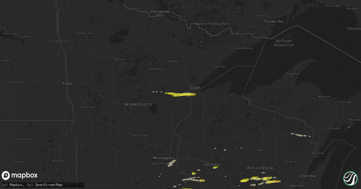
Hail Map on March 28, 2025
Get this storm
March 28 map
$229
one time, instant access
Download today. No call, no setup
Keep the $229
Bought the map and want the full workflow? Apply the entire $229 to a subscription within 7 days. None of it is wasted.
Every map, not just this one
This buys you this map. Subscription and you get every map we run, in the markets you choose from a few cities to whole states to nationwide. Plus real-time alerts the moment a storm fires.
Contact data
Name, contact info, occupancy, even credit band for addresses in the footprint. You go from where it hit to who to call.
Become the source they trust
Unlimited branding weather history reports on demand. You already have the documented answer ready for the property owner, and you are the one who showed up with it.
Property data and RoofTrace estimates
Pull up any address you have got, its value and the exact code rules for that jurisdiction, straight from One Click Code. Then RoofTrace estimates the squares, pitch, and roof value, priced the way you price.
States Impacted by Hail Map on March 28, 2025
Storm reports
Minnesota
| Date | Description |
|---|---|
| 03/28/20256:15 PM CDT | A local report indicates 1.25 inch wind near 3 SSE Berne |
| 03/28/20256:15 PM CDT | One inch hail also reported by another spotter in zumbrota and also by a broadcast meteorologist. Time based on radar. |
| 03/28/20256:04 PM CDT | A local report indicates 1.00 inch wind near 4 NW Dodge Center |
| 03/28/20254:15 PM CDT | Time estimated from radar. |
| 03/28/20254:14 PM CDT | Report from mping: quarter |
| 03/28/20254:11 PM CDT | Dimes to quarter sized hail with over an inch of it on the ground and it is still hailing. |
| 03/28/20254:10 PM CDT | Facebook message with image and coin reference. |
| 03/27/20257:44 PM CDT | 61 mph gust measured by personal weather station. |
| 03/27/20257:00 PM CDT | A local report indicates 1.25 inch wind near Elgin |
Texas
| Date | Description |
|---|---|
| 03/28/20251:48 PM CDT | This tornado began se of shelbyville near the hurstown community at the intersection of tx hwy 87 and cr 2130. Most of the damage consisted of snapped and uprooted tree |
Wisconsin
| Date | Description |
|---|---|
| 03/28/20254:29 PM CDT | Video of half dollar size hail shared via social media. Largest hail was bigger than quarters. Most were penny to nickel size. Hail accumulated deep enough to shovel. |
| 03/27/20259:07 PM CDT | Report from mping: quarter |
| 03/27/20257:40 PM CDT | A local report indicates 1.00 inch wind near Plover |
| 03/27/20257:36 PM CDT | A local report indicates 1.25 inch wind near Plover |
| 03/27/20257:35 PM CDT | A local report indicates 1.00 inch wind near 4 W Plover |
Louisiana
| Date | Description |
|---|---|
| 03/27/20258:33 PM CDT | A tornado began just south of hwy 20 between vivian and hosston and then crossed black bayou lake. After crossing the lake... Tree damage was found on the north-central |
Michigan
| Date | Description |
|---|---|
| 03/27/20259:25 PM CDT | Large tree downed onto home. Roof blown off of campground building. Time approximated from radar and other nearby wind reports. |
Cities Impacted by Hail Map on March 28, 2025
- Burkeville, TX
- Newton, TX
- Wiergate, TX
- Hemphill, TX
- Many, LA
- Zwolle, LA
- Palisade, MN
- Mcgregor, MN
- Vivian, LA
- Ida, LA
- Tamarack, MN
- Kettle River, MN
- Cromwell, MN
- Barnum, MN
- Carlton, MN
- Wrenshall, MN
- Superior, WI
- South Range, WI
- Haughton, LA
- Bossier City, LA
- Aitkin, MN
- Fouke, AR
- Texarkana, AR
- Fulton, AR
- Owatonna, MN
- Claremont, MN
- Dodge Center, MN
- Kenyon, MN
- West Concord, MN
- Pine Island, MN
- Byron, MN
- Mantorville, MN
- Oronoco, MN
- Rochester, MN
- Elgin, MN
- Armstrong, TX
- Arkansaw, WI
- Durand, WI
- Maiden Rock, WI
- Stockholm, WI
- Alma Center, WI
- Plum City, WI
- Pepin, WI
- Pittsville, WI
- Saint James, MN
- Madelia, MN
- Lake City, MN
- Warrens, WI
- Goodhue, MN
- Mazeppa, MN
- Vesper, WI
- Wisconsin Rapids, WI
- Laona, WI
- Lake Crystal, MN
- Garden City, MN
- Vernon Center, MN
- Rudolph, WI
- Plover, WI
- Stevens Point, WI
- Amherst, WI
- Amherst Junction, WI
- Eau Claire, WI
- Wanamingo, MN
- Dunbar, WI
- Athelstane, WI
- Goodman, WI
- Fall Creek, WI
- Eleva, WI
- Zumbrota, MN
- Good Thunder, MN
- Mankato, MN
- Lewisville, MN
- Alma, WI
- Nelson, WI
- Amberg, WI
- Pembine, WI
- Osmond, NE
- Wabasha, MN
- Bancroft, WI
- Reads Landing, MN
- Nekoosa, WI
- Babcock, WI
- Garden, MI
- Almond, WI
- Pierce, NE
- Saint Paul, MN
- Waupaca, WI
- Medford, WI
- Scandinavia, WI
- Holcombe, WI
- Newport, MN
- Afton, MN
- Inver Grove Heights, MN
- South Saint Paul, MN
- Saint Paul Park, MN
- Cottage Grove, MN
- Rosemount, MN
- Weyauwega, WI
- Elko New Market, MN
- Webster, MN
- Lonsdale, MN
- Junction City, WI
- Bloomer, WI
- New Auburn, WI
- Plainview, MN
- Zumbro Falls, MN
- Brunswick, NE
- Neligh, NE
- Plainview, NE