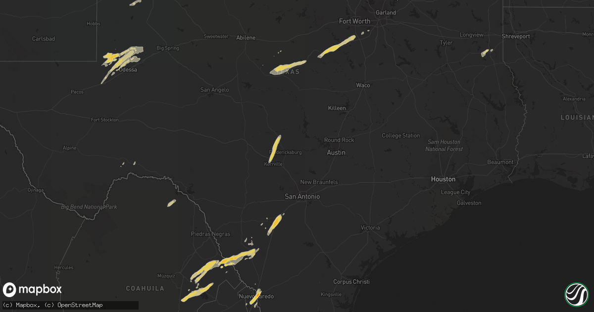
Hail Map on March 27, 2018
Get this storm
March 27 map
$229
one time, instant access
Download today. No call, no setup
Keep the $229
Bought the map and want the full workflow? Apply the entire $229 to a subscription within 7 days. None of it is wasted.
Every map, not just this one
This buys you this map. Subscription and you get every map we run, in the markets you choose from a few cities to whole states to nationwide. Plus real-time alerts the moment a storm fires.
Contact data
Name, contact info, occupancy, even credit band for addresses in the footprint. You go from where it hit to who to call.
Become the source they trust
Unlimited branding weather history reports on demand. You already have the documented answer ready for the property owner, and you are the one who showed up with it.
Property data and RoofTrace estimates
Pull up any address you have got, its value and the exact code rules for that jurisdiction, straight from One Click Code. Then RoofTrace estimates the squares, pitch, and roof value, priced the way you price.
States Impacted by Hail Map on March 27, 2018
Storm reports
Oklahoma
| Date | Description |
|---|---|
| 03/27/20188:00 AM CDT | Barn/mobile home damage. Sm report via kten. |
| 03/27/20184:40 AM CDT | At 940 AM CDT, a severe thunderstorm was located over Bonanza, moving east at 30 mph. HAZARD...60 mph wind gusts. SOURCE...Radar indicated. IMPACT...Expect damage to roofs, siding, and trees. Locations in or near the path include... Fort Smith... Greenwood... Barling... Lavaca... Bonanza... Excelsior... Burnville... Jenny Lind... Central City... Rye Hill...This includes Interstate 540 between mile markers 13 and 14. |
Texas
| Date | Description |
|---|---|
| 03/27/20187:39 AM CDT | At 1239 AM CDT, a severe thunderstorm was located 14 miles northeast of Sanderson, moving northeast at 35 mph. HAZARD...60 mph wind gusts and quarter size hail. SOURCE...Radar indicated. IMPACT...Hail damage to vehicles is expected. Expect wind damage to roofs, siding, and trees. Locations impacted include... Sheffield and Terrell County Gas Plant. |
| 03/27/20187:39 AM CDT | A local report indicates 1.50 inch wind near 9 NNW GOLDSMITH |
| 03/27/20187:12 AM CDT | At 1211 AM CDT, a severe thunderstorm was located near Buffalo Gap, or 15 miles southwest of Abilene, moving east at 25 mph. HAZARD...60 mph wind gusts and half dollar size hail. SOURCE...Radar indicated. IMPACT...Hail damage to vehicles is expected. Expect wind damage to roofs, siding, and trees. This severe thunderstorm will be near, View around 1215 AM CDT. Tuscola and Buffalo Gap around 1220 AM CDT. Potosi and Dudley around 1250 AM CDT. Clyde and Eula around 100 AM CDT. Other locations impacted by this severe thunderstorm include LakeAbilene, Camp Tonkawa, Kirby Lake and Ovalo.This includes Interstate 20 between Mile Markers 286 and 302. |
| 03/27/20186:52 AM CDT | At 1151 PM CDT, a severe thunderstorm was located 9 miles southwest of Chupadera Ranch Airport, or 28 miles south of El Indio, moving northeast at 35 mph. HAZARD...Two inch hail and 70 mph wind gusts. SOURCE...Radar indicated. IMPACT...People and animals outdoors will be injured. Expect hail damage to roofs, siding, windows, and vehicles. Expect considerable tree damage. Wind damage is also likely to mobile homes, roofs, and outbuildings. Locations impacted include... Chupadera Ranch Airport. |
| 03/27/20186:52 AM CDT | At 1152 PM CDT, a severe thunderstorm was located near Derby, or 7 miles southwest of Pearsall, moving northeast at 35 mph. HAZARD...60 mph wind gusts and half dollar size hail. SOURCE...Radar indicated. IMPACT...Hail damage to vehicles is expected. Expect wind damage to roofs, siding, and trees. Locations impacted include... Pearsall, North Pearsall, Moore, Derby, Divot, Bigfoot, Schattel, Bluff and Three Oaks. |
| 03/27/20186:46 AM CDT | At 1146 PM CDT, a severe thunderstorm was located 14 miles west of Chupadera Ranch Airport, or 24 miles south of El Indio, moving east at 50 mph. HAZARD...Golf ball size hail and 60 mph wind gusts. SOURCE...Radar indicated. IMPACT...People and animals outdoors will be injured. Expect hail damage to roofs, siding, windows, and vehicles. Expect wind damage to roofs, siding, and trees. Locations impacted include... Asherton, Gilson Groves and Carrizo Hill. |
| 03/27/20185:41 AM CDT | At 1039 PM CDT, a severe thunderstorm was located over Texas A&M International University, or near Laredo, moving northeast at 20 mph. Golf ball size hail reported in Laredo. HAZARD...Golf ball size hail and 70 mph wind gusts. SOURCE...Public. IMPACT...People and animals outdoors will be injured. Expect hail damage to roofs, siding, windows, and vehicles. Expect considerable tree damage. Wind damage is also likely to mobile homes, roofs, and outbuildings. Locations impacted include... Laredo, Laredo International Airport, Botines, Unitec Industrial Park, Ranchitos Las Lomas, Doctors Hospital Of Laredo, St Augustine High School South Laredo, Laredo Community College, Laredo Country Club, Orvil, United South High School and Texas A&M International University. |
| 03/27/20185:29 AM CDT | At 1028 PM CDT, a severe thunderstorm was located over Glen Rose, or 13 miles south of Granbury, moving northeast at 50 mph. HAZARD...60 mph wind gusts and quarter size hail. SOURCE...Radar indicated. IMPACT...Hail damage to vehicles is expected. Expect wind damage to roofs, siding, and trees. Locations impacted include... Mansfield, Burleson, Cleburne, Keene, Joshua, Alvarado, Pecan Plantation, Venus, Godley, Cross Timber, Cleburne State Park, Rio Vista and Briaroaks.This includes Interstate 35W between mile markers 20 and 37. |
| 03/27/20185:18 AM CDT | At 1017 PM CDT, a severe thunderstorm was located near Dinosaur Valley State Park, or 17 miles south of Granbury, moving northeast at 55 mph. HAZARD...60 mph wind gusts and quarter size hail. SOURCE...Radar indicated. IMPACT...Hail damage to vehicles is expected. Expect wind damage to roofs, siding, and trees. Locations impacted include... Glen Rose and Dinosaur Valley State Park. |
| 03/27/20185:12 AM CDT | At 1011 PM CDT, a severe thunderstorm was located over Wickett, or near Monahans, moving northeast at 25 mph. HAZARD...60 mph wind gusts and quarter size hail. SOURCE...Radar indicated. IMPACT...Hail damage to vehicles is expected. Expect wind damage to roofs, siding, and trees. Locations impacted include... Monahans, Wickett, Thorntonville, Monahans Sandhills State Park, Penwell and Roy Hurd Memorial Airport. |
| 03/27/20185:06 AM CDT | At 1005 PM CDT, a severe thunderstorm was located near El Cenizo, or 13 miles southwest of Laredo, moving northeast at 20 mph. HAZARD...Golf ball size hail and 60 mph wind gusts. SOURCE...Radar indicated. IMPACT...People and animals outdoors will be injured. Expect hail damage to roofs, siding, windows, and vehicles. Expect wind damage to roofs, siding, and trees. Locations impacted include... Laredo, Rio Bravo, El Cenizo, Laredo International Airport, Unitec Industrial Park, Ranchos Penitas West, United South High School, Texas A&M International University, Doctors Hospital Of Laredo, St Augustine High School South Laredo, Laredo Community College, Laredo Country Club, Orvil and Ranchitos Las Lomas. |
| 03/27/20184:57 AM CDT | In the early morning hours of wednesday morning march 28... A cluster of storms moved east across portions of caldwell county. Along the leading edge of the thunderstor |
| 03/27/20184:01 AM CDT | At 901 PM CDT, a severe thunderstorm was located near Lenorah, or 12 miles northwest of Stanton, moving northeast at 35 mph. HAZARD...Ping pong ball size hail and 60 mph wind gusts. SOURCE...Radar indicated. IMPACT...People and animals outdoors will be injured. Expect hail damage to roofs, siding, windows, and vehicles. Expect wind damage to roofs, siding, and trees. Locations impacted include... Big Spring, Lenorah, Brown, Fairview, Tarzan, Big Spring McMahon-Wrinkle Airpark, Grady, Knott and Stanton Municipal Aiport. |
| 03/27/20183:58 AM CDT | At 858 PM CDT, a severe thunderstorm was located near Blanket, or 12 miles west of Comanche, moving northeast at 55 mph. HAZARD...65 mph wind gusts and half dollar size hail. SOURCE...Radar indicated. IMPACT...Hail damage to vehicles is expected. Expect wind damage to roofs, siding, and trees. Locations impacted include... Comanche and De Leon. |
| 03/27/20183:56 AM CDT | At 855 PM CDT, a severe thunderstorm was located near May, or 10 miles northeast of Early, moving northeast at 55 mph. HAZARD...60 mph wind gusts and quarter size hail. SOURCE...Radar indicated. IMPACT...Hail damage to vehicles is expected. Expect wind damage to roofs, siding, and trees. this severe thunderstorm will remain over mainly rural areas of northeastern Brown County, including the following locations: Owens. |
| 03/27/20183:23 AM CDT | At 822 PM CDT, a severe thunderstorm was located 16 miles southeast of Andrews, moving east at 30 mph. HAZARD...Ping pong ball size hail and 60 mph wind gusts. SOURCE...Radar indicated. IMPACT...People and animals outdoors will be injured. Expect hail damage to roofs, siding, windows, and vehicles. Expect wind damage to roofs, siding, and trees. Locations impacted include... Tarzan. |
| 03/27/20182:26 AM CDT | At 726 PM CDT, a severe thunderstorm was located 8 miles northwest of Goldsmith, or 20 miles northwest of West Odessa, moving northeast at 35 mph. HAZARD...60 mph wind gusts and quarter size hail. SOURCE...Radar indicated. IMPACT...Hail damage to vehicles is expected. Expect wind damage to roofs, siding, and trees. Locations impacted include... Goldsmith and Notrees. |
| 03/27/20181:15 AM CDT | At 615 AM CDT, a severe thunderstorm was located over Annetta, or near Weatherford, moving northeast at 45 mph. HAZARD...60 mph wind gusts. SOURCE...Radar indicated. IMPACT...Expect damage to roofs, siding, and trees. Locations impacted include... Fort Worth, Flower Mound, Euless, Bedford, Grapevine, Haltom City, Keller, Hurst, Southlake, Weatherford, Watauga, Colleyville, Benbrook, Saginaw, White Settlement, Azle, Trophy Club, Richland Hills, River Oaks and Sansom Park.This includes the following interstates... Interstate 35W between mile markers 50 and 75. Interstate 20 between mile markers 410 and 430. Interstate 30 between mile markers 1 and 21. |
| 03/27/201812:45 AM CDT | Half dollar sized hail reported north of catarina via twitter. |
| 03/27/201812:15 AM CDT | Hail up to the size of quarters was reported via facebook near n cherry st in pearsall... Tx. |
| 03/27/201812:15 AM CDT | Hail report of 1.5 inches with tree branch damage on the north side of pearsall via kabb facebook. |
| 03/27/201812:04 AM CDT | Quarter sized hail reported via twitter near the petro shopping center west of i-35 in pearsall. |
| 03/26/201810:37 PM CDT | Social media reports of golf ball size hail in central laredo. |
| 03/26/201810:33 PM CDT | Quarter size hail falling near laredo intl airport |
| 03/26/20189:27 PM CDT | Mping report of quarter sized hail |
| 03/26/20188:15 PM CDT | Quarter-sized hail reported covering road at us 385 and co. Rd. Se6000. |
| 03/26/20187:51 PM CDT | Spotter also reported a funnel 3mi south of his location. |
| 03/26/20187:39 PM CDT | A local report indicates 1.50 inch wind near 9 NNW GOLDSMITH |
Arkansas
| Date | Description |
|---|---|
| 03/27/201810:56 AM CDT | Trees reported to be down. Out building reported as detroyed. |
| 03/27/201810:45 AM CDT | Tree down |
| 03/27/201810:45 AM CDT | Roof damage to two homes |
| 03/27/201810:43 AM CDT | Tree down |
| 03/27/20189:50 AM CDT | Several trees damaged... Limbs snapped. Time estimated based on radar. |
| 03/27/20189:44 AM CDT | A tornado damaged several barns and snapped large tree limbs. Based on this damage... Estimated maximum wind in the tornado was 75 to 85 mph...thus it will be rated ef- |
| 03/27/20185:49 AM CDT | At 1049 AM CDT, severe thunderstorms were located along a line extending from 7 miles northeast of Wiederkehr Village to near Hartman to near Paris, moving northeast at 45 mph. HAZARD...60 mph wind gusts. SOURCE...Radar indicated. IMPACT...Expect damage to roofs, siding, and trees. Locations impacted include... Russellville... Clarksville... Paris... Lamar... London... Knoxville... Subiaco... Hartman... Scranton... Devils Knob... Hoyt... Midway in Logan County... Holman... Rosetta... Dillen... Woodland... Hinkle... Lake Dardanelle... Spadra... Bertha... |
| 03/27/20185:26 AM CDT | At 1025 AM CDT, a severe thunderstorm was located 6 miles northwest of Branch, moving east at 35 mph. HAZARD...60 mph wind gusts. SOURCE...Radar indicated. IMPACT...Expect damage to roofs, siding, and trees. Locations in or near the path include... Ozark... Charleston... Altus... Branch... Denning... Ratcliff... Wiederkehr Village... Caulksville... Etna... Alix... Meg... Peter Pender... Vesta... Cecil...This includes Interstate 40 in Arkansas between mile markers 36 and42. |
| 03/27/20185:04 AM CDT | At 1003 AM CDT, a severe thunderstorm was located near Lavaca, moving northeast at 40 mph. HAZARD...60 mph wind gusts. SOURCE...Radar indicated. IMPACT...Expect damage to roofs, siding, and trees. Locations in or near the path include... Ozark... Lavaca... Mulberry... Dyer... Jethro... Etna... Meg... Toney... Peter Pender... Vesta... Cecil... Lonelm... Ursula... Cravens...This includes Interstate 40 in Arkansas between mile markers 22 and33. |
Cities Impacted by Hail Map on March 27, 2018
- Tahoka, TX
- Brownfield, TX
- Moore, TX
- Pearsall, TX
- Lubbock, TX
- May, TX
- Early, TX
- Carthage, TX
- Asherton, TX
- Laredo, TX
- Blanket, TX
- Sidney, TX
- Brownwood, TX
- Comanche, TX
- Dublin, TX
- Godley, TX
- Bluff Dale, TX
- Nemo, TX
- Granbury, TX
- Rainbow, TX
- Burleson, TX
- Cleburne, TX
- Walnut Springs, TX
- Glen Rose, TX
- Joshua, TX
- Hico, TX
- Stephenville, TX
- Gardendale, TX
- Midland, TX
- Eagle Pass, TX
- Catarina, TX
- Carrizo Springs, TX
- Odessa, TX
- Goldsmith, TX
- Andrews, TX
- Harper, TX
- Kerrville, TX
- Fredericksburg, TX
- Mansfield, TX
- Kermit, TX
- Stanton, TX
- Long Branch, TX
- Beckville, TX
- Rising Star, TX
- Mason, TX
- Doss, TX
- Ingram, TX
- Dilley, TX
- Bangs, TX
- Carbon, TX
- Santa Anna, TX
- Dryden, TX
- Monahans, TX
- Big Wells, TX
- Cedar Hill, TX
- Lillian, TX
- Venus, TX
- Alvarado, TX
- Bigfoot, TX