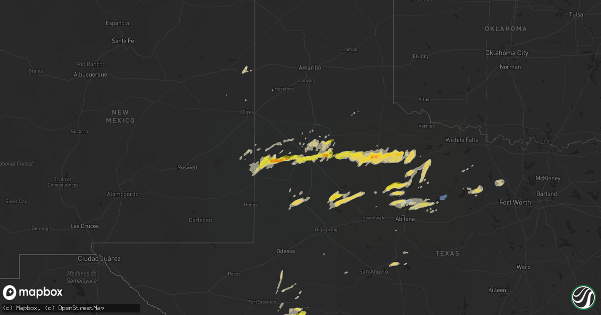
Hail Map on March 17, 2020
Get this storm
March 17 map
$229
one time, instant access
Download today. No call, no setup
Keep the $229
Bought the map and want the full workflow? Apply the entire $229 to a subscription within 7 days. None of it is wasted.
Every map, not just this one
This buys you this map. Subscription and you get every map we run, in the markets you choose from a few cities to whole states to nationwide. Plus real-time alerts the moment a storm fires.
Contact data
Name, contact info, occupancy, even credit band for addresses in the footprint. You go from where it hit to who to call.
Become the source they trust
Unlimited branding weather history reports on demand. You already have the documented answer ready for the property owner, and you are the one who showed up with it.
Property data and RoofTrace estimates
Pull up any address you have got, its value and the exact code rules for that jurisdiction, straight from One Click Code. Then RoofTrace estimates the squares, pitch, and roof value, priced the way you price.
States Impacted by Hail Map on March 17, 2020
Storm reports
New Mexico
| Date | Description |
|---|---|
| 03/17/20206:24 PM CDT | A local report indicates a tornado near PLEASANT HILL |
| 03/17/20202:38 AM CDT | At 738 AM CDT, severe thunderstorms were located along a line extending from 4 miles east of Lingo to 14 miles south of Bledsoe to 4 miles northeast of Bronco, moving northeast at 40 mph. HAZARD...60 mph wind gusts and quarter size hail. SOURCE...Radar indicated. IMPACT...Hail damage to vehicles is expected. Expect wind damage to roofs, siding, and trees. Locations impacted include... Littlefield, Morton, Earth, Sundown, Sudan, Amherst, Needmore, Bronco, Bledsoe, Enochs, Muleshoe Wildlife Refuge, Bula, Pep, Lehman, Maple and Whiteface. |
Texas
| Date | Description |
|---|---|
| 03/17/20204:25 PM CDT | A local report indicates a tornado near 8 NW THROCKMORTON |
| 03/17/202010:45 AM CDT | A local report indicates 1.00 inch wind near RALLS |
| 03/17/20209:45 AM CDT | Occurred at msf and slide |
| 03/17/20209:13 AM CDT | A local report indicates 1.00 inch wind near SMYER |
| 03/17/20206:42 AM CDT | At 1142 AM CDT, a severe thunderstorm was located 6 miles south of Mcadoo, or 7 miles west of Dickens, moving east at 30 mph. HAZARD...Quarter size hail. SOURCE...Radar indicated. IMPACT...Damage to vehicles is expected. Locations impacted include... Spur, Dickens, Afton and Mcadoo. |
| 03/17/20206:07 AM CDT | At 1107 AM CDT, a severe thunderstorm was located near Crosbyton, moving east at 30 mph. HAZARD...Quarter size hail. SOURCE...Radar indicated. IMPACT...Damage to vehicles is expected. Locations impacted include... Crosbyton, Spur, Dickens, Afton and Mcadoo. |
| 03/17/20205:57 AM CDT | At 1057 AM CDT, a severe thunderstorm was located 6 miles north of Cone, or 7 miles south of Floydada, moving northeast at 25 mph. HAZARD...Quarter size hail. SOURCE...Radar indicated. IMPACT...Damage to vehicles is expected. Locations impacted include... Floydada and Dougherty. |
| 03/17/20205:54 AM CDT | At 1052 PM CDT, a severe thunderstorm was located near Arden, or 14 miles north of Mertzon, moving east at 30 mph. HAZARD...60 mph wind gusts and penny size hail. SOURCE...Radar indicated. IMPACT...Expect damage to roofs, siding, and trees. This severe thunderstorm will be near... Twin Buttes Reservoir around 1115 PM CDT. O.c. Fisher Reservoir and San Angelo State Park around 1120 PM CDT. San Angelo and Lake Nasworthy around 1125 PM CDT. Goodfellow Air Force Base around 1130 PM CDT.Other locations impacted by this severe thunderstorm include Harrietand Us-67 Near The Irion-Tom Green County Line. |
| 03/17/20205:46 AM CDT | At 1045 PM CDT, a severe thunderstorm was located over Graford, or 14 miles northwest of Mineral Wells, moving east at 25 mph. HAZARD...60 mph wind gusts and nickel size hail. SOURCE...Radar indicated. IMPACT...Expect damage to roofs, siding, and trees. Locations impacted include... Mineral Wells, Graford, Cool and Mineral Wells State Park. |
| 03/17/20205:18 AM CDT | At 1018 AM CDT, a severe thunderstorm was located 4 miles south of Idalou, or 11 miles north of Slaton, moving east at 30 mph. HAZARD...Quarter size hail. SOURCE...Radar indicated. IMPACT...Damage to vehicles is expected. Locations impacted include... Slaton, Crosbyton, Idalou, Ralls, Lorenzo and Caprock. |
| 03/17/20204:24 AM CDT | At 923 AM CDT, severe thunderstorms were located along a line extending from 4 miles south of Anton to 5 miles west of Reese Center to 8 miles southwest of Wolfforth, moving east at 25 mph. HAZARD...Quarter size hail. SOURCE...Radar indicated. IMPACT...Damage to vehicles is expected. Locations impacted include... Lubbock, Abernathy, Wolfforth, Shallowater, Idalou, Ransom Canyon, Lubbock South Plains Mall, Texas Tech University, Lubbock International Airport, Slide, Downtown Lubbock, Woodrow, Reese Center, New Deal, Smyer, Ropesville and Lubbock Science Spectrum. |
| 03/17/20204:05 AM CDT | At 904 PM CDT, a severe thunderstorm was located 9 miles southeast of Fort Griffin, or 12 miles northwest of Breckenridge, moving east at 40 mph. HAZARD...65 mph wind gusts and quarter size hail. SOURCE...Radar indicated. IMPACT...Hail damage to vehicles is expected. Expect wind damage to roofs, siding, and trees. Locations impacted include... Graham, Breckenridge, Crystal Falls, Newcastle and Us- 180 Near The Shackelford-Stephens County Line. |
| 03/17/20203:44 AM CDT | At 844 AM CDT, a severe thunderstorm was located 4 miles southwest of Levelland, moving east at 25 mph. HAZARD...60 mph wind gusts and quarter size hail. SOURCE...Radar indicated. IMPACT...Hail damage to vehicles is expected. Expect wind damage to roofs, siding, and trees. Locations impacted include... Levelland, Sundown, Whitharral, Reese Center, Smyer, Ropesville and Opdyke West. |
| 03/17/20202:49 AM CDT | At 749 PM CDT, a severe thunderstorm was located near Anson, moving east at 35 mph. HAZARD...60 mph wind gusts and quarter size hail. SOURCE...Radar indicated. IMPACT...Hail damage to vehicles is expected. Expect wind damage to roofs, siding, and trees. This severe thunderstorm will be near... Nugent and Avoca around 805 PM CDT. Lueders around 810 PM CDT. Albany around 840 PM CDT. Fort Griffin around 845 PM CDT.Other locations impacted by this severe thunderstorm include Funston,Hodges, Mccarty Lake, Tuxedo, Big Country Baptist Assembly, Lake FortPhantom Hill, Stith, The Intersection Of Us-283 And Ranch Road 209, Truby and Us-180 Near The Shackelford-Stephens County Line. |
| 03/17/20202:43 AM CDT | At 743 PM CDT, a severe thunderstorm was located 7 miles south of Elbert, or 8 miles east of Throckmorton, moving east at 45 mph. HAZARD...60 mph wind gusts and quarter size hail. SOURCE...Radar indicated. IMPACT...Hail damage to vehicles is expected. Expect wind damage to roofs, siding, and trees. This severe thunderstorm will remain over mainly rural areas of eastern Throckmorton County. |
| 03/17/20201:41 AM CDT | At 641 PM CDT, a severe thunderstorm was located 17 miles west of Sheffield, moving northeast at 30 mph. HAZARD...60 mph wind gusts and quarter size hail. SOURCE...Radar indicated. IMPACT...Hail damage to vehicles is expected. Expect wind damage to roofs, siding, and trees. Locations impacted include... Sheffield.This includes Interstate 10 between mile markers 316 and 327. |
| 03/17/20201:29 AM CDT | At 629 PM CDT, a severe thunderstorm was located over Stamford, moving east at 40 mph. HAZARD...60 mph wind gusts and quarter size hail. SOURCE...Radar indicated. IMPACT...Hail damage to vehicles is expected. Expect wind damage to roofs, siding, and trees. This severe thunderstorm will be near... Avoca around 635 PM CDT. Stamford around 650 PM CDT. |
| 03/17/20201:26 AM CDT | At 626 AM MDT, a severe thunderstorm was located near Lingo, or 23 miles west of Morton, moving northeast at 40 mph. HAZARD...60 mph wind gusts and half dollar size hail. SOURCE...Radar indicated. IMPACT...Hail damage to vehicles is expected. Expect wind damage to roofs, siding, and trees. Locations impacted include... Causey and Lingo. |
| 03/17/202012:58 AM CDT | At 558 PM CDT, a severe thunderstorm was located over Sagerton, or 14 miles northwest of Stamford, moving northeast at 35 mph. HAZARD...60 mph wind gusts and quarter size hail. SOURCE...Radar indicated. IMPACT...Hail damage to vehicles is expected. Expect wind damage to roofs, siding, and trees. This severe thunderstorm will be near... Rule around 615 PM CDT. Haskell around 625 PM CDT. Rochester around 630 PM CDT. Weinert around 640 PM CDT.Other locations impacted by this severe thunderstorm include Us-277 Near The Haskell-Knox County Line and Us-380 Near The Haskell-Stonewall County Line. |
| 03/16/202011:35 PM CDT | At 434 PM CDT, a severe thunderstorm was located 9 miles southwest of Westover, or 15 miles north of Throckmorton, moving northeast at 25 mph. HAZARD...60 mph wind gusts and nickel size hail. SOURCE...Radar indicated. IMPACT...Expect damage to roofs, siding, and trees. This severe thunderstorm will remain over mainly rural areas of northern Throckmorton County, including the following locations... Us-183 Near The Throckmorton-Baylor County Line. |
| 03/16/202011:13 PM CDT | At 412 PM CDT, a severe thunderstorm was located 8 miles south of Seymour, moving northeast at 20 mph. HAZARD...60 mph wind gusts and quarter size hail. SOURCE...Radar indicated. IMPACT...Hail damage to vehicles is expected. Expect wind damage to roofs, siding, and trees. Locations impacted include... Seymour, Westover and Mabelle. |
| 03/16/202011:09 PM CDT | At 409 PM CDT, a severe thunderstorm was located 12 miles west of Lamesa, moving northeast at 40 mph. HAZARD...60 mph wind gusts and quarter size hail. SOURCE...Radar indicated. IMPACT...Hail damage to vehicles is expected. Expect wind damage to roofs, siding, and trees. Locations impacted include... Lamesa, Welch, Lamesa Municipal Airport, Los Ybanez, Punkin Center, Arvana, Hancock and McKenzie Lake. |
| 03/16/202010:47 PM CDT | At 347 PM CDT, a severe thunderstorm was located 9 miles northeast of Gail, moving northeast at 10 mph. HAZARD...60 mph wind gusts and quarter size hail. SOURCE...Radar indicated. IMPACT...Hail damage to vehicles is expected. Expect wind damage to roofs, siding, and trees. Locations impacted include... Fluvanna. |
| 03/16/202010:02 PM CDT | At 300 PM CDT, severe thunderstorms were located along a line extending from 5 miles south of Truscott to near Benjamin, moving east-northeast at 20 mph. Other strengthening storms area located just west of Rhineland and near Knox City. HAZARD...60 mph wind gusts and quarter size hail. SOURCE...Radar indicated. IMPACT...Hail damage to vehicles is expected. Expect wind damage to roofs, siding, and trees. Locations impacted include... Munday, Knox City, Benjamin, Goree, Vera, Gilliland, Rhineland and Truscott. |
| 03/16/20209:08 PM CDT | At 208 PM CDT, severe thunderstorms were located along a line extending from 11 miles southwest of Truscott to 10 miles west of Benjamin, moving east-northeast at 25 mph. HAZARD...60 mph wind gusts and quarter size hail. SOURCE...Radar indicated. IMPACT...Hail damage to vehicles is expected. Expect wind damage to roofs, siding, and trees. Locations impacted include... Benjamin, Truscott, Gilliland and Rhineland. |
| 03/16/20208:55 PM CDT | A local report indicates 1.00 inch wind near ALBANY |
| 03/16/20208:00 PM CDT | At 1259 PM CDT, a severe thunderstorm was located 8 miles southwest of Guthrie, moving east at 30 mph. HAZARD...Quarter size hail. SOURCE...Radar indicated. IMPACT...Damage to vehicles is expected. Locations impacted include... Guthrie. |
Hawaii
| Date | Description |
|---|---|
| 03/17/202012:14 AM CDT | At 513 AM HST, a severe thunderstorm was located just southwest of Kekaha, moving northeast at 10 mph. HAZARD...60 mph wind gusts. SOURCE...Radar indicated. IMPACT...Expect damage to roofs, siding, and trees. Locations impacted include... Kekaha, Waimea, Kikiaola Harbor and Pakala Village. |
Cities Impacted by Hail Map on March 17, 2020
- Seymour, TX
- Ropesville, TX
- Idalou, TX
- Abernathy, TX
- Petersburg, TX
- Bard, NM
- San Jon, NM
- Breckenridge, TX
- Throckmorton, TX
- Lubbock, TX
- Hawley, TX
- Stamford, TX
- Anson, TX
- Albany, TX
- Lueders, TX
- Tuscola, TX
- Paducah, TX
- Gail, TX
- Fluvanna, TX
- Munday, TX
- Goree, TX
- Hamlin, TX
- Weinert, TX
- Mertzon, TX
- Crosbyton, TX
- Dickens, TX
- Spur, TX
- Welch, TX
- Decatur, TX
- Levelland, TX
- Whiteface, TX
- Graford, TX
- Floydada, TX
- Lorenzo, TX
- Ralls, TX
- Imperial, TX
- Wolfforth, TX
- Aspermont, TX
- Haskell, TX
- Old Glory, TX
- Rule, TX
- Paradise, TX
- Boyd, TX
- Slaton, TX
- Plains, TX
- Rowena, TX
- Milnesand, NM
- Shallowater, TX
- Snyder, TX
- Smyer, TX
- Turkey, TX
- Roby, TX
- Fort Stockton, TX
- Rotan, TX
- Morton, TX
- Pep, TX
- Amherst, TX
- Littlefield, TX
- Ballinger, TX
- Garden City, TX
- Crane, TX
- Perrin, TX
- Lamesa, TX
- Seagraves, TX
- Moran, TX
- Ransom Canyon, TX
- Dryden, TX
- Sheffield, TX
- Ira, TX
- Abilene, TX
- Tatum, NM
- New Deal, TX
- Graham, TX
- Nara Visa, NM
- Seminole, TX
- Jacksboro, TX
- McCamey, TX
- Hereford, TX
- Anton, TX
- Ozona, TX
- Paint Rock, TX
- Plainview, TX
- Hale Center, TX
- Loving, TX
- Mcadoo, TX
- Knox City, TX
- Talpa, TX
- Rochester, TX
- Crowell, TX
- Benjamin, TX