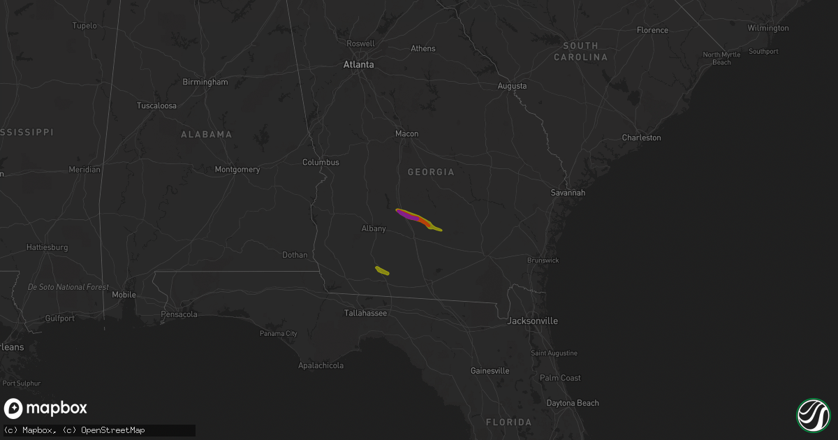
Hail Map on March 11, 2019
Get this storm
March 11 map
$229
one time, instant access
Download today. No call, no setup
Keep the $229
Bought the map and want the full workflow? Apply the entire $229 to a subscription within 7 days. None of it is wasted.
Every map, not just this one
This buys you this map. Subscription and you get every map we run, in the markets you choose from a few cities to whole states to nationwide. Plus real-time alerts the moment a storm fires.
Contact data
Name, contact info, occupancy, even credit band for addresses in the footprint. You go from where it hit to who to call.
Become the source they trust
Unlimited branding weather history reports on demand. You already have the documented answer ready for the property owner, and you are the one who showed up with it.
Property data and RoofTrace estimates
Pull up any address you have got, its value and the exact code rules for that jurisdiction, straight from One Click Code. Then RoofTrace estimates the squares, pitch, and roof value, priced the way you price.
Storm reports
Florida
| Date | Description |
|---|---|
| 03/11/201912:37 AM CDT | At 537 PM EDT, a severe thunderstorm was located over Ochlocknee, or 10 miles northwest of Thomasville, moving southeast at 35 mph. HAZARD...60 mph wind gusts and quarter size hail. SOURCE...Radar indicated. IMPACT...Hail damage to vehicles is expected. Expect wind damage to roofs, siding, and trees. Locations impacted include... Quitman, Thomasville, Boston, Ochlocknee, Pavo, Coolidge, Morven, Barwick, Thomasville Municipal A/P, Grooverville, Dillon, Enon, Merrillville, Chastain, Quality, Brooks Co A/p, Dixie, Patten, Eason and Oaklawn. |
Texas
| Date | Description |
|---|---|
| 03/11/20192:31 AM CDT | At 731 PM CDT, a severe thunderstorm was located 9 miles northeast of Lake Alan Henry, moving northeast at 30 mph. HAZARD...Quarter size hail. SOURCE...Radar indicated. IMPACT...Damage to vehicles is expected. Locations impacted include... Jayton, Girard and Clairemont. |
Georgia
| Date | Description |
|---|---|
| 03/11/20195:52 PM CDT | Report of trees and powerlines downed. Time estimated by radar. |
| 03/11/20195:15 PM CDT | Reported via irwin county 911 facebook page. |
| 03/11/20195:15 PM CDT | Estimated via photo from tifton highway. |
| 03/11/20195:13 PM CDT | Estimated based off picture. |
| 03/11/20195:10 PM CDT | Estimated via photo from the town of mystic. |
| 03/11/20195:03 PM CDT | Tree down on a power line. |
| 03/11/20195:03 PM CDT | A local report indicates 1.25 inch wind near 1 NE IRWINVILLE |
| 03/11/20194:50 PM CDT | Estimated via photo from eisenhower road. |
| 03/11/20194:50 PM CDT | Tin roof blown off a barn. |
| 03/11/20194:42 PM CDT | A local report indicates 1.00 inch wind near 1 NE OCHLOCKNEE |
| 03/11/20194:40 PM CDT | Trees down in north ochlocknee. |
| 03/11/20194:33 PM CDT | Golf ball sized hail report between ashburn and rebecca ga. |
| 03/11/20194:30 PM CDT | Person from the amboy area submitted photo of very large hail and estimated the sizes from golf ball to baseball. |
| 03/11/20194:30 PM CDT | Estimated half dollar to ping pong ball size hail based on pictures. |
| 03/11/20192:45 AM CDT | At 745 PM EDT, a severe thunderstorm was located over Needmore, or near Fargo, moving southeast at 30 mph. HAZARD...60 mph wind gusts and quarter size hail. SOURCE...Radar indicated. IMPACT...Hail damage to vehicles is expected. Expect wind damage to roofs, siding, and trees. Locations impacted include... Fargo. |
| 03/11/20191:32 AM CDT | At 632 PM EDT, a severe thunderstorm was located near Ambrose, moving southeast at 30 mph. HAZARD...60 mph wind gusts and quarter size hail. SOURCE...Radar indicated. IMPACT...Hail damage to vehicles is expected. Expect wind damage to roofs, siding, and trees. Locations impacted include... Douglas, Broxton and Ambrose. |
| 03/11/201912:48 AM CDT | At 548 PM EDT, a severe thunderstorm was located near Mystic, or 10 miles west of Fitzgerald, moving east at 25 mph. HAZARD...60 mph wind gusts and quarter size hail. SOURCE...Radar indicated. IMPACT...Hail damage to vehicles is expected. Expect wind damage to roofs, siding, and trees. Locations impacted include... Fitzgerald, Ocilla, Mystic, Osierfield, Waterloo, Pinetta, Ashton, Irwinville, Fitzgerald Municipal A/P, Irwinville Airport, Wray, Arp and Abba. |
| 03/11/201912:41 AM CDT | At 541 PM EDT, a severe thunderstorm was located near Turner City, or near Leesburg, moving east at 25 mph. HAZARD...60 mph wind gusts. SOURCE...Radar indicated. IMPACT...Expect damage to roofs, siding, and trees. Locations impacted include... Sylvester, Leesburg, Albany, Ashburn, Poulan, East Albany, Marine Corps Logistics Base, Turner City, Terrell, Sycamore, Sumner, Stocks, Scooterville, Forrester, Sylvester Airport, South Albany, Tempy, Palmyra, Inaha and Red Rock. |
| 03/11/201912:11 AM CDT | At 511 PM EDT, a severe thunderstorm was located over Arabi, or 7 miles northwest of Ashburn, moving east at 25 mph. HAZARD...60 mph wind gusts and quarter size hail. SOURCE...Radar indicated. IMPACT...Hail damage to vehicles is expected. Expect wind damage to roofs, siding, and trees. Locations impacted include... Ashburn, Worth, Sycamore, Rebecca, Amboy, Waterloo, Sibley, Inaha, Irwinville, Hobby, Turner Co Airport, Irwinville Airport, Dakota, Arp and Abba. |
Cities Impacted by Hail Map on March 11, 2019
- Sycamore, GA
- Ocilla, GA
- Arabi, GA
- Fitzgerald, GA
- Rebecca, GA
- Wray, GA
- Ashburn, GA
- Coolidge, GA
- Ochlocknee, GA
- Meigs, GA
- Thomasville, GA
- Pelham, GA
- Chula, GA
- Garvin, OK
- Idabel, OK
- Bagwell, TX
- Valliant, OK
- Ambrose, GA
- Warwick, GA
- Detroit, TX
- Whigham, GA
- Sunset, TX
- Alvord, TX
- Hugo, OK
- Coffee Springs, AL
- Geneva, AL
- Chancellor, AL
- Boswell, OK
- Leesburg, GA
- Willacoochee, GA
- Camilla, GA
- Sanderson, FL