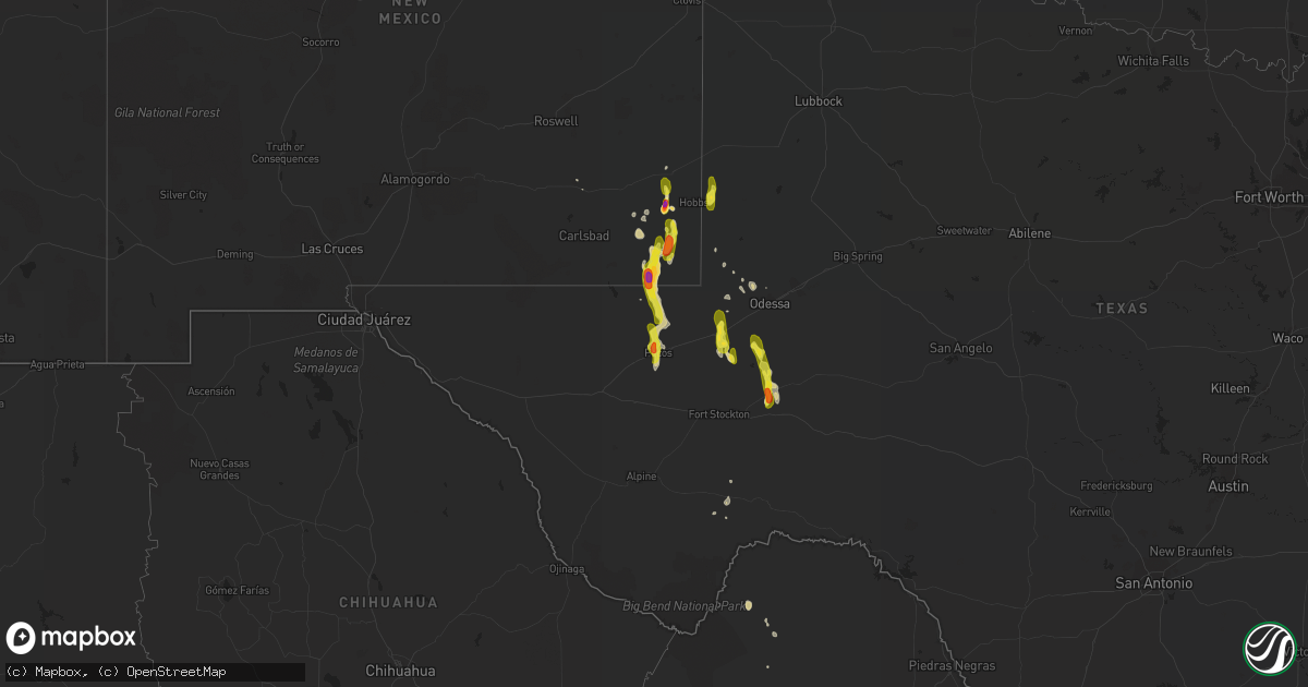
Hail Map on March 11, 2017
Get this storm
March 11 map
$229
one time, instant access
Download today. No call, no setup
Keep the $229
Bought the map and want the full workflow? Apply the entire $229 to a subscription within 7 days. None of it is wasted.
Every map, not just this one
This buys you this map. Subscription and you get every map we run, in the markets you choose from a few cities to whole states to nationwide. Plus real-time alerts the moment a storm fires.
Contact data
Name, contact info, occupancy, even credit band for addresses in the footprint. You go from where it hit to who to call.
Become the source they trust
Unlimited branding weather history reports on demand. You already have the documented answer ready for the property owner, and you are the one who showed up with it.
Property data and RoofTrace estimates
Pull up any address you have got, its value and the exact code rules for that jurisdiction, straight from One Click Code. Then RoofTrace estimates the squares, pitch, and roof value, priced the way you price.
States Impacted by Hail Map on March 11, 2017
Storm reports
Texas
| Date | Description |
|---|---|
| 03/11/20175:21 PM CST | A local report indicates 60 MPH wind near 18 W RED BLUFF |
| 03/10/20178:35 PM CST | A local report indicates 68 MPH wind near 2 S PECOS |
| 03/10/20178:26 PM CST | A local report indicates 1.00 inch wind near PECOS |
| 03/10/20177:26 PM CST | Down powerlines were reported in the city of pecos along with windows broken on about 15 homes... Damaged trees... And stalled vehicles due to flooding. |
New Mexico
| Date | Description |
|---|---|
| 03/10/20176:14 PM CST | A local report indicates 2.00 inch wind near 10 WNW MONUMENT |
| 03/10/20176:00 PM CST | Hen egg size hail fell for 10 minutes. |