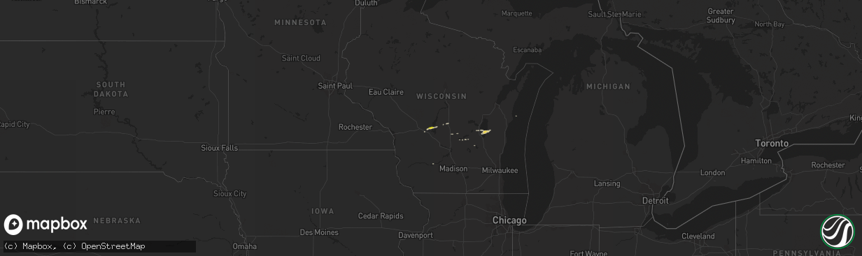
Hail Map on March 6, 2016
The weather event on March 6, 2016 includes Hail map. 1 state and 19 cities were impacted and suffered possible damage. The total estimated number of properties impacted is 504.
Want more than just the map?
Turn this storm into a full workflow.
- Owner + property data so you know who to knock
- OnDemand branded weather history reports to win the "did we even have hail?" argument
- RoofTrace estimate so reps stop guessing numbers at the door
Bought this map? Upgrade within 7 days and we'll credit the $230. (10-15 min setup call)
Hail
504
Estimated number of impacted properties by a 1.00" hail or larger0
Estimated number of impacted properties by a 1.75" hail or larger0
Estimated number of impacted properties by a 2.50" hail or largerStates Impacted by Hail Map on March 6, 2016
Storm reports
California
| Date | Description |
|---|---|
| 03/06/20165:53 AM CST | Large tree down in roadway at hwy 101 and and hwy 1 |
| 03/06/20165:37 AM CST | Large tree down and blocking roadway at elm st and paso robles st |
| 03/06/20165:25 AM CST | Tree down on the 2700 block of halcyon rd. |
| 03/06/20165:20 AM CST | Large tree blocking roadway near pecho valley rd and doris ave in los osos |
| 03/06/20164:55 AM CST | Several trees down in cayucos |
Utah
| Date | Description |
|---|---|
| 03/06/20165:30 PM CST | Lakeside mountain lmr 5039ft |
| 03/06/20165:20 PM CST | Diddle knoll dpg27 4265 ft |
| 03/06/20164:30 PM CST | Sr-30 at curlew utcur 4766 ft |
| 03/06/20164:20 PM CST | White sage dpg05 4363 ft |
| 03/06/20164:00 PM CST | Hat island sensor hatut |
| 03/06/20164:00 PM CST | Camel back mountain sensor dpg06 |
| 03/06/20163:45 PM CST | Upper cedar mtn sensor dpg16 |
| 03/06/20163:35 PM CST | West granite sensor dpg31 |
| 03/06/20163:35 PM CST | Granite peak ku19 4298ft |
| 03/06/20163:30 PM CST | I-80 at grassey sensor utgrs |
| 03/05/20169:00 PM CST | Bullfrog marina bullf 3700 ft |