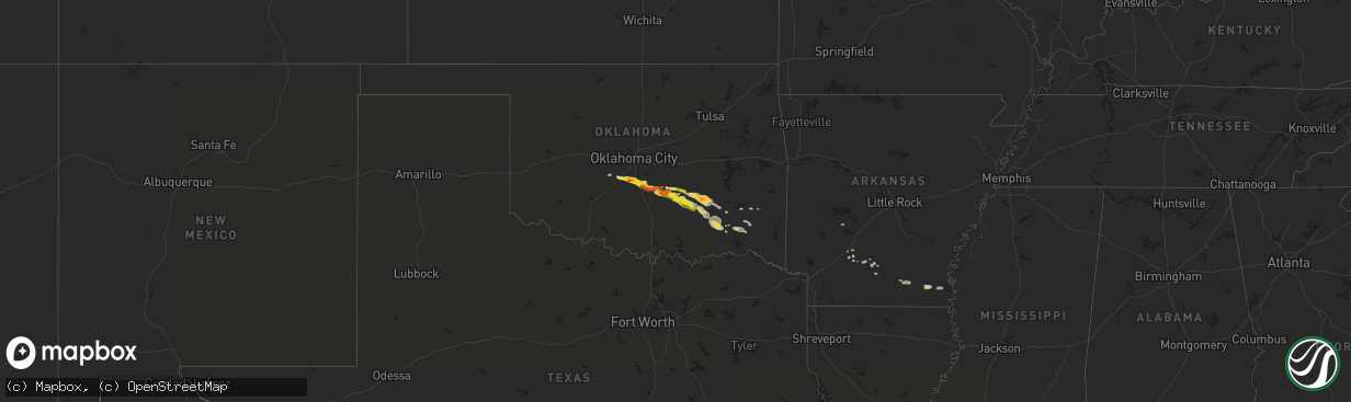
Hail Map on March 2, 2016
The weather event on March 2, 2016 includes Hail map. 2 states and 50 cities were impacted and suffered possible damage. The total estimated number of properties impacted is 26,621.
Want more than just the map?
Turn this storm into a full workflow.
- Owner + property data so you know who to knock
- OnDemand branded weather history reports to win the "did we even have hail?" argument
- RoofTrace estimate so reps stop guessing numbers at the door
Bought this map? Upgrade within 7 days and we'll credit the $230. (10-15 min setup call)
Hail
26,621
Estimated number of impacted properties by a 1.00" hail or larger2,208
Estimated number of impacted properties by a 1.75" hail or larger0
Estimated number of impacted properties by a 2.50" hail or largerStorm reports
Arkansas
| Date | Description |
|---|---|
| 03/02/20161:35 AM CST | A roof was peeled off of a mobile home along highway 67 northeast of prescott. A large pine tree was also downed across highway 67 as well. |
Oklahoma
| Date | Description |
|---|---|
| 03/01/201611:55 PM CST | Several trees down near the intersection of miller jumbo road and hwy 3. Time estimated by radar. |
| 03/01/201610:30 PM CST | Relayed by hughes co em |
| 03/01/201610:27 PM CST | A local report indicates 1.25 inch wind near 1 NE ADA |
| 03/01/201610:15 PM CST | A local report indicates 1.00 inch wind near 7 NW ADA |
| 03/01/201610:07 PM CST | A local report indicates 1.25 inch wind near 9 E BYARS |
| 03/01/20169:40 PM CST | A local report indicates 1.00 inch wind near PURCELL |
| 03/01/20169:37 PM CST | A local report indicates 1.00 inch wind near 5 NNW PURCELL |
| 03/01/20169:28 PM CST | A local report indicates 1.00 inch wind near DIBBLE |
| 03/01/20169:06 PM CST | A local report indicates 1.00 inch wind near BLANCHARD |
| 03/01/20169:05 PM CST | A local report indicates 1.75 inch wind near 1 SW COLE |
| 03/01/20169:02 PM CST | A local report indicates 1.25 inch wind near 1 E BLANCHARD |
Cities Impacted by Hail Map on March 2, 2016
- Wilmar, AR
- Fountain Hill, AR
- Hermitage, AR
- Kiowa, OK
- Stuart, OK
- Pittsburg, OK
- Coalgate, OK
- Mcalester, OK
- Allen, OK
- Wardville, OK
- Calvin, OK
- Rattan, OK
- Washington, OK
- Blanchard, OK
- Purcell, OK
- Lexington, OK
- Stratford, OK
- Byars, OK
- Ada, OK
- Sasakwa, OK
- Wanette, OK
- Chidester, AR
- Konawa, OK
- Bearden, AR
- Camden, AR
- Stonewall, OK
- Tupelo, OK
- Centrahoma, OK
- Montrose, AR
- Hamburg, AR
- Atoka, OK
- Asher, OK
- Stringtown, OK
- Lake Village, AR
- Portland, AR
- Lane, OK
- Antlers, OK
- Holdenville, OK
- Amber, OK
- Tuttle, OK
- Clayton, OK
- Pocasset, OK
- Noble, OK
- Bonnerdale, AR
- Hampton, AR
- Nashoba, OK
- Moyers, OK
- Finley, OK
- Daisy, OK
- Wayne, OK