Hail Map on February 21, 2018
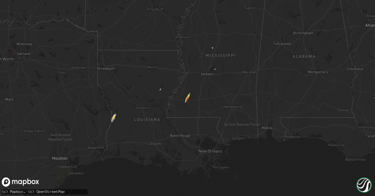
Get this storm
February 21 map
$229
one time, instant access
Download today. No call, no setup
Keep the $229
Bought the map and want the full workflow? Apply the entire $229 to a subscription within 7 days. None of it is wasted.
Every map, not just this one
This buys you this map. Subscription and you get every map we run, in the markets you choose from a few cities to whole states to nationwide. Plus real-time alerts the moment a storm fires.
Contact data
Name, contact info, occupancy, even credit band for addresses in the footprint. You go from where it hit to who to call.
Become the source they trust
Unlimited branding weather history reports on demand. You already have the documented answer ready for the property owner, and you are the one who showed up with it.
Property data and RoofTrace estimates
Pull up any address you have got, its value and the exact code rules for that jurisdiction, straight from One Click Code. Then RoofTrace estimates the squares, pitch, and roof value, priced the way you price.
States Impacted by Hail Map on February 21, 2018
Storm reports
Louisiana
| Date | Description |
|---|---|
| 02/21/201812:30 PM CST | Tree down on highway 84 near oldfield road. |
| 02/21/20186:48 AM CST | At 1248 PM CST, severe thunderstorms were located along a line extending from near Columbia to Aimwell to near Archie, moving northeast at 35 mph. HAZARD...60 mph wind gusts. SOURCE...Radar indicated. IMPACT...Expect damage to roofs, siding, and trees. Severe thunderstorms will be near... Jonesville around 100 PM CST. Wildsville, Enterprise and Wallace Ridge around 105 PM CST. Liddieville and Frogmore around 115 PM CST. Winnsboro, Ferriday and West Ferriday around 125 PM CST. Mangham and Wisner around 130 PM CST. Other locations impacted by these severe thunderstorms includeHarrisonburg, Gilbert, Baskin and Sicily Island. |
| 02/21/20186:31 AM CST | At 1230 PM CST, severe thunderstorms were located along a line extending from 13 miles northeast of Winnfield to near Midway to 8 miles northeast of Holloway, moving northeast at 35 mph. HAZARD...60 mph wind gusts. SOURCE...Radar indicated. IMPACT...Expect damage to roofs, siding, and trees. Locations impacted include... Columbia, Jena, Olla, Clarks, Grayson, Midway, Urania, Tullos, Sikes, Nebo, Spaulding, Vixen, Catahoula Lake, Hudson, Riverton, Standard, Kelly, Zenoria and Burlington. |
| 02/21/20185:50 AM CST | At 1150 AM CST, a severe thunderstorm was located 7 miles southeast of Winnfield, moving northeast at 55 mph. HAZARD...60 mph wind gusts. SOURCE...Radar indicated. IMPACT...Expect damage to roofs, siding, and trees. Locations impacted include... Sikes and Joyce. |
| 02/21/20184:49 AM CST | At 1049 AM CST, a severe thunderstorm was located over Colfax, or over Lena, moving northeast at 25 mph. HAZARD...60 mph wind gusts. SOURCE...Radar indicated. IMPACT...Expect damage to roofs, siding, and trees. Locations impacted include... Colfax, Aloha, Lake Iatt and Williana. |
| 02/20/20188:28 PM CST | At 228 PM CST, a severe thunderstorm was located near Newlight, or 16 miles southeast of Winnsboro, moving northeast at 45 mph. HAZARD...60 mph wind gusts. SOURCE...Radar indicated. IMPACT...Expect damage to roofs, siding, and trees. This severe thunderstorm will be near... Newlight around 235 PM CST. Somerset around 250 PM CST. |
| 02/20/20187:28 PM CST | At 128 PM CST, a severe thunderstorm was located 7 miles southwest of Wisner, or 17 miles south of Winnsboro, moving northeast at 35 mph. HAZARD...60 mph wind gusts and nickel size hail. SOURCE...Radar indicated. IMPACT...Expect damage to roofs, siding, and trees. This severe thunderstorm will be near... Wisner and Jigger around 140 PM CST. Newlight around 205 PM CST. Other locations impacted by this severe thunderstorm include Gilbertand Sicily Island. |
Mississippi
| Date | Description |
|---|---|
| 02/21/20184:40 PM CST | Tree down on clinton-raymond rd... Report via social media. |
| 02/20/201811:49 PM CST | At 549 PM CST, a severe thunderstorm was located over Union, or 9 miles west of Pinola, moving northeast at 35 mph. HAZARD...60 mph wind gusts and quarter size hail. SOURCE...Radar indicated. IMPACT...Hail damage to vehicles is expected. Expect wind damage to roofs, siding, and trees. This severe thunderstorm will be near... Harrisville around 600 PM CST. Star and Piney Woods around 615 PM CST. Cato around 625 PM CST. Johns around 630 PM CST. Other locations impacted by this severe thunderstorm include Braxtonand Georgetown. |
| 02/20/201810:38 PM CST | At 438 PM CST, a severe thunderstorm was located over Raymond, or near Clinton, moving northeast at 35 mph. HAZARD...60 mph wind gusts and quarter size hail. SOURCE...Radar indicated. IMPACT...Hail damage to vehicles is expected. Expect wind damage to roofs, siding, and trees. This severe thunderstorm will be near... Jackson around 445 PM CST. Clinton around 450 PM CST. Pocahontas around 505 PM CST. Flora around 510 PM CST. Annandale around 515 PM CST. Gluckstadt around 520 PM CST. |
| 02/20/20189:36 PM CST | At 335 PM CST, a severe thunderstorm was located over Barlow, or 17 miles west of Hazlehurst, moving northeast at 35 mph. HAZARD...60 mph wind gusts and quarter size hail. SOURCE...Radar indicated. IMPACT...Hail damage to vehicles is expected. Expect wind damage to roofs, siding, and trees. This severe thunderstorm will be near... Dentville and Carpenter around 355 PM CST. Utica around 405 PM CST. Dry Grove around 415 PM CST. |
| 02/20/20188:53 PM CST | At 252 PM CST, a severe thunderstorm was located near New Hope, or 26 miles north of Liberty, moving northeast at 30 mph. HAZARD...60 mph wind gusts and quarter size hail. SOURCE...Radar indicated. IMPACT...Hail damage to vehicles is expected. Expect wind damage to roofs, siding, and trees. This severe thunderstorm will be near... Union Church around 315 PM CST. Blue Hill and Caseyville around 320 PM CST. Pleasant Hill and Mcbride around 325 PM CST. Allen and Peyton around 330 PM CST. Other locations impacted by this severe thunderstorm includeMeadville. |
Indiana
| Date | Description |
|---|---|
| 02/20/201811:23 PM CST | At 523 AM EST, a severe thunderstorm was located near Patriot, moving east at 55 mph. HAZARD...60 mph wind gusts. SOURCE...Radar indicated. IMPACT...Expect damage to trees and power lines. Locations impacted include... Covington, Florence, Independence, Alexandria, Walton, Claryville, Union, Crittenden, Ryland Heights, Visalia, Atwood, Richwood, Grants Lick, Ryle, Big Bone Lick, Bracht, Gubser Mill, White Villa, Peach Grove and Campbell County Lake.This includes the following Interstates... I-71 in Kentucky between mile markers 68 and 77. I-75 in Kentucky between mile markers 167 and 178. |
Cities Impacted by Hail Map on February 21, 2018
- Rocksprings, TX
- Meadville, MS
- Union Church, MS
- Roxie, MS
- Rio Grande City, TX
- Kendalia, TX
- Harrisonburg, LA
- Goldthwaite, TX
- Leesville, LA
- Deridder, LA
- Round Rock, TX
- Georgetown, TX
- Leander, TX
- Brandon, MS
- Evans, LA
- Blanco, TX
- Spring Branch, TX
- Merryville, LA
- Austin, TX
- West, MS
- Uvalde, TX
- Boerne, TX
- Lexington, MS
- Concan, TX
- Sabinal, TX
- Utopia, TX