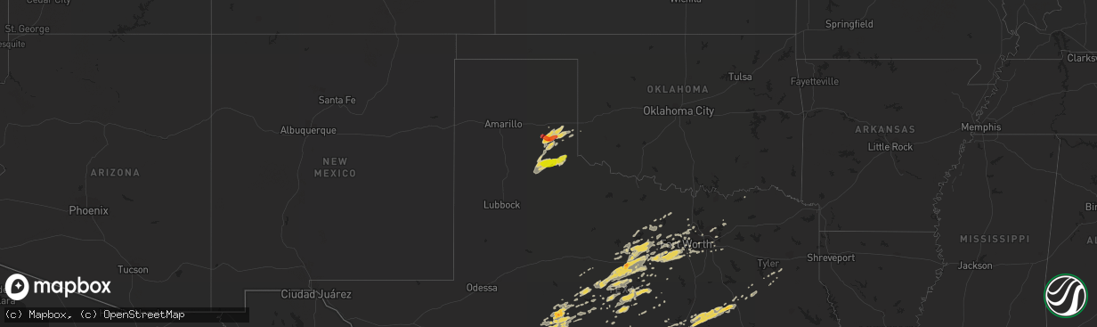
Hail Map on February 9, 2013
The weather event on February 9, 2013 includes Hail map. 2 states and 217 cities were impacted and suffered possible damage. The total estimated number of properties impacted is 1,110.
Want more than just the map?
Turn this storm into a full workflow.
- Owner + property data so you know who to knock
- OnDemand branded weather history reports to win the "did we even have hail?" argument
- RoofTrace estimate so reps stop guessing numbers at the door
Bought this map? Upgrade within 7 days and we'll credit the $230. (10-15 min setup call)
Hail
1,110
Estimated number of impacted properties by a 1.00" hail or larger1,379
Estimated number of impacted properties by a 1.75" hail or larger0
Estimated number of impacted properties by a 2.50" hail or largerStorm reports
Texas
| Date | Description |
|---|---|
| 02/09/20135:50 AM CST | Tree down on power line |
| 02/09/20135:15 AM CST | Power line down |
| 02/09/20135:00 AM CST | Tree down |
| 02/09/20133:54 AM CST | A local report indicates 1.00 inch wind near 1 N JARRELL |
| 02/09/20133:22 AM CST | Northwest highway and central |
| 02/09/20133:21 AM CST | Between richardson and addison |
| 02/09/20133:15 AM CST | Gusts to 65mph. Shingles off roof. Large tree branches down. |
| 02/09/20133:15 AM CST | Telephone pole snapped in half. Power lines down. |
| 02/09/20133:15 AM CST | 65 mph winds were estimated on the southwest side of temple near loop 363 and 57th st. |
| 02/09/20133:02 AM CST | Estimated 60+ mph winds in west plano. Power poles were knocked down on midway rd north of plano pkwy |
| 02/09/20133:00 AM CST | Trees were knocked down on fences and a hay ring was thrown around in south sherman/north howe |
| 02/09/20132:49 AM CST | A 66 mph wind gust was reported at nolan high school in fort worth. |
| 02/09/20132:44 AM CST | 63 mph gust on waco asos at 244am |
| 02/09/20132:25 AM CST | Huffins and 10 mile bridge road. |
| 02/09/20132:25 AM CST | Two signs and two port-o-johns knocked over in white settlement. |
| 02/09/20132:24 AM CST | Longhorn at north main |
| 02/09/20132:21 AM CST | Business 287 at bonds ranch road |
| 02/09/20131:52 AM CST | Hail fell for 11 minutes. Largest 1.5 inches. |
| 02/09/20131:48 AM CST | A local report indicates 60 MPH wind near WEATHERFORD |
| 02/09/20131:27 AM CST | A local report indicates 1.50 inch wind near 14 W FREDERICKSBURG |
| 02/09/20131:08 AM CST | A local report indicates 1.00 inch wind near RISING STAR |
| 02/09/20131:00 AM CST | A local report indicates 60 MPH wind near EDEN |
| 02/09/201312:52 AM CST | A local report indicates 1.00 inch wind near 1 N ELDORADO |
| 02/09/201312:42 AM CST | A local report indicates 1.75 inch wind near CARBON |
| 02/09/201312:01 AM CST | Reported at fm 584 and us 277. |
| 02/08/20139:14 PM CST | A lot of pea-sized hail with a few stones to the size of quarters |
| 02/08/20138:44 PM CST | A local report indicates 1.00 inch wind near 6 WNW QUAIL |
| 02/08/20138:32 PM CST | A local report indicates 1.00 inch wind near TURKEY |
| 02/08/20138:00 PM CST | A local report indicates 1.75 inch wind near 2 SE LELIA LAKE |
| 02/08/20138:00 PM CST | A local report indicates 1.25 inch wind near 5 SE HEDLEY |
| 02/08/20137:47 PM CST | A local report indicates 1.00 inch wind near CLARENDON |
Cities Impacted by Hail Map on February 9, 2013
- Brookesmith, TX
- Early, TX
- Santa Anna, TX
- Bangs, TX
- Brownwood, TX
- Mason, TX
- Fredericksburg, TX
- San Angelo, TX
- Georgetown, TX
- Salado, TX
- Bartlett, TX
- Jarrell, TX
- Holland, TX
- Temple, TX
- Rogers, TX
- Florence, TX
- Liberty Hill, TX
- Rising Star, TX
- Cross Plains, TX
- Coleman, TX
- Valley Spring, TX
- Comanche, TX
- Sidney, TX
- Oakwood, TX
- Granbury, TX
- Weatherford, TX
- Lipan, TX
- Millsap, TX
- Mountain Home, TX
- Harper, TX
- Fort McKavett, TX
- Eldorado, TX
- May, TX
- Fort Worth, TX
- Troup, TX
- Llano, TX
- Gordon, TX
- Palo Pinto, TX
- Strawn, TX
- Willow City, TX
- Caddo, TX
- Breckenridge, TX
- Cisco, TX
- Priddy, TX
- Gustine, TX
- Hamilton, TX
- Rochelle, TX
- Zephyr, TX
- Carlton, TX
- Mullin, TX
- Clyde, TX
- Sonora, TX
- Godley, TX
- Cresson, TX
- Brady, TX
- Mclean, TX
- Jacksboro, TX
- Rosebud, TX
- Joshua, TX
- Lakeview, TX
- Hedley, TX
- Memphis, TX
- Vancourt, TX
- Burlington, TX
- Reagan, TX
- Kosse, TX
- Marlin, TX
- Bremond, TX
- Lott, TX
- Lelia Lake, TX
- Christoval, TX
- Palestine, TX
- Killeen, TX
- De Leon, TX
- Desdemona, TX
- Wellington, TX
- Quail, TX
- Jacksonville, TX
- Childress, TX
- Turkey, TX
- Quitaque, TX
- Clarendon, TX
- Mansfield, TX
- Ballinger, TX
- Ranger, TX
- Gorman, TX
- Eastland, TX
- Carbon, TX
- Doss, TX
- Paint Rock, TX
- Rowena, TX
- Dublin, TX
- Stephenville, TX
- Groesbeck, TX
- Jewett, TX
- Fort Hood, TX
- Gatesville, TX
- Jonesboro, TX
- Thornton, TX
- Eddy, TX
- Tell, TX
- Castell, TX
- Goldthwaite, TX
- Richland Springs, TX
- Mineral Wells, TX
- Santo, TX
- Burkett, TX
- Mingus, TX
- Matador, TX
- Flomot, TX
- Donie, TX
- Kingsland, TX
- Burnet, TX
- Buchanan Dam, TX
- Teague, TX
- Buffalo, TX
- Lohn, TX
- Chico, TX
- Ovalo, TX
- Winters, TX
- Marble Falls, TX
- Arlington, TX
- Grand Prairie, TX
- Mesquite, TX
- Dallas, TX
- Bridgeport, TX
- Crandall, TX
- Franklin, TX
- Troy, TX
- Chilton, TX
- Azle, TX
- Talpa, TX
- Graford, TX
- Crowley, TX
- Burleson, TX
- Bluff Dale, TX
- Tolar, TX
- Horseshoe Bay, TX
- Aledo, TX
- Desoto, TX
- Cedar Hill, TX
- Shamrock, TX
- Perrin, TX
- Round Mountain, TX
- Hunt, TX
- Midlothian, TX
- Lometa, TX
- Miles, TX
- Belton, TX
- Krum, TX
- Balch Springs, TX
- Lockney, TX
- Farmersville, TX
- Honey Grove, TX
- Eden, TX
- Garland, TX
- Rowlett, TX
- Millersview, TX
- Doole, TX
- Ingram, TX
- Garnett, KS
- Art, TX
- Richardson, TX
- Plano, TX
- Allen, TX
- Flower Mound, TX
- Kincaid, KS
- Purmela, TX
- Evant, TX
- Graham, TX
- Hext, TX
- Moran, TX
- Lancaster, TX
- Wilmer, TX
- Meridian, TX
- Walnut Springs, TX
- Alvarado, TX
- Rockwood, TX
- Menard, TX
- Argyle, TX
- Lewisville, TX
- Glen Rose, TX
- Nemo, TX
- Elkhart, TX
- Kennedale, TX
- Fredonia, TX
- San Saba, TX
- Voss, TX
- Gouldbusk, TX
- Wylie, TX
- Montalba, TX
- Eola, TX
- Goodfellow Afb, TX
- Mereta, TX
- Mertzon, TX
- Bullard, TX
- Hico, TX
- Blanket, TX
- Briggs, TX
- Justin, TX
- Denton, TX
- Poolville, TX
- Roanoke, TX
- Junction, TX
- Springtown, TX
- Harker Heights, TX
- Seagoville, TX
- Keller, TX
- Haslet, TX
- Marquez, TX
- North Richland Hills, TX
- Haltom City, TX
- Overton, TX
- Selman City, TX
- Tuscola, TX
- Carrollton, TX
- Alvord, TX