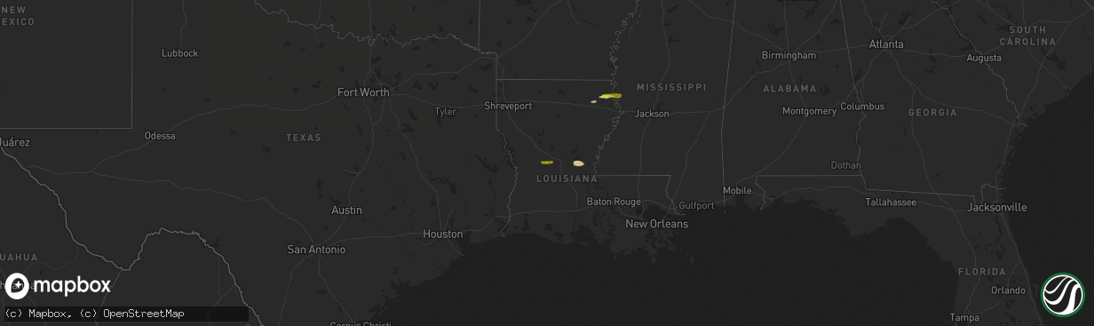
Hail Map on February 1, 2015
The weather event on February 1, 2015 includes Hail map. 2 states and 24 cities were impacted and suffered possible damage. The total estimated number of properties impacted is 1,327.
Want more than just the map?
Turn this storm into a full workflow.
- Owner + property data so you know who to knock
- OnDemand branded weather history reports to win the "did we even have hail?" argument
- RoofTrace estimate so reps stop guessing numbers at the door
Bought this map? Upgrade within 7 days and we'll credit the $230. (10-15 min setup call)
Hail
1,327
Estimated number of impacted properties by a 1.00" hail or larger0
Estimated number of impacted properties by a 1.75" hail or larger0
Estimated number of impacted properties by a 2.50" hail or largerStates Impacted by Hail Map on February 1, 2015
Storm reports
Mississippi
| Date | Description |
|---|---|
| 02/01/20155:55 PM CST | Trees downed in the hope community. |
| 02/01/20155:55 PM CST | 2 homes and 1 mobile home sustained minor damage. 1 chicken house with about 75 foot on roof removed. 6 sheds damaged or destroyed. This damage occurred along county ro |
| 02/01/20155:52 PM CST | Tree downed along mathis rd |
| 02/01/20155:46 PM CST | Trees downed in the freetrade and madden area |
| 02/01/20155:27 PM CST | Trees downed along the natchez trace near thomastown. |
| 02/01/20155:25 PM CST | Trees were downed along n west st in jackson |
| 02/01/20155:23 PM CST | A tree fell on a house on smith robinson st in jackson |
| 02/01/20155:22 PM CST | Recorded at hawkins field in jackson |
| 02/01/20155:20 PM CST | Several trees downed in the farmhaven area |
| 02/01/20155:09 PM CST | Utility wires downed along fisher ferry rd |
| 02/01/20155:08 PM CST | Trees downed |
| 02/01/20154:54 PM CST | Trees downed |
| 02/01/20154:35 PM CST | Tree downed partially blocking road at highway 61 intersection with iowa blvd and pemberton square blvd |
| 01/31/20156:32 PM CST | Roof blown off a house along neely town rd. Delayed report. |
Louisiana
| Date | Description |
|---|---|
| 02/01/20154:30 PM CST | Kalb tv reported public report of quarter sized hail near boyce/gardner area via facebook. |
| 02/01/20153:47 PM CST | Marble to quarter size hail occurred along with very gusty winds. Some small limbs were downed. |
| 02/01/20153:02 PM CST | Trees downed |