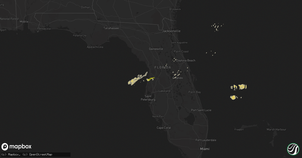
Hail Map on January 25, 2011
Get this storm
January 25 map
$229
one time, instant access
Download today. No call, no setup
Keep the $229
Bought the map and want the full workflow? Apply the entire $229 to a subscription within 7 days. None of it is wasted.
Every map, not just this one
This buys you this map. Subscription and you get every map we run, in the markets you choose from a few cities to whole states to nationwide. Plus real-time alerts the moment a storm fires.
Contact data
Name, contact info, occupancy, even credit band for addresses in the footprint. You go from where it hit to who to call.
Become the source they trust
Unlimited branding weather history reports on demand. You already have the documented answer ready for the property owner, and you are the one who showed up with it.
Property data and RoofTrace estimates
Pull up any address you have got, its value and the exact code rules for that jurisdiction, straight from One Click Code. Then RoofTrace estimates the squares, pitch, and roof value, priced the way you price.
States Impacted by Hail Map on January 25, 2011
Storm reports
Florida
| Date | Description |
|---|---|
| 01/25/20115:55 PM CST | News 13 reported carport thrown into power lines near tomoka ave. Time estimated from radar. |
| 01/25/20115:41 PM CST | Tornado in rural hardee county reported to hardee county s.o. No damage reported. Time estimated off or radar. |
| 01/25/20115:31 PM CST | A local report indicates 60 MPH wind near PORT ORANGE |
| 01/25/20115:23 PM CST | Sanford pd reported power lines down at osceola road and osceola bluff lane |
| 01/25/20115:15 PM CST | Public report of tornado touchdown near highway 64 and wingate road. No damage reported at this time. |
| 01/25/20115:14 PM CST | Sanford/orlando airport asos peak wind 27055/2314 |
| 01/25/20115:13 PM CST | Sanford pd reported power lines down at hayes road and east bahama road. This is a correction to previous report which inadvertently listed the event as dense fog. |
| 01/25/20115:11 PM CST | Trees down lakeview drive/n.brion rd. Also us441/boy scout rd. |
| 01/25/20115:09 PM CST | Power lines down laurel road and pine crest road |
| 01/25/20115:07 PM CST | Power lines down at wesley lake and meadow bay court |
| 01/25/20114:40 PM CST | Roof and siding damage to home in covington gardens subdivision. Nws survey team found straight line wind damage. Winds are estimated at 65mph. |
| 01/25/20114:40 PM CST | Trees down linden drive. East of sr436 and north of sr408. |
| 01/25/20114:35 PM CST | Gas station canopy collapsed near intersection of 38th ave n and 24th st n. |
| 01/25/20114:30 PM CST | Emergency management reported tree down at 12280 se 89th terrace in belleview. |
| 01/25/20114:28 PM CST | Emergency management reported a tree down near sw 144th place road and sw 33rd court road. |
| 01/25/20114:21 PM CST | Intersection of sr 19/50 trees down on 12 to 20 homes. Report from lake county em. |
| 01/25/20114:20 PM CST | Estimated 60-70 mph straight line winds. Area of sporadic wind damage approximately 1.5 miles in length. Several homes with structural damage due to fallen trees. One h |
| 01/25/20114:10 PM CST | Estimated wind gusts of 70 to 75 mph. Branches breaking off trees. |
| 01/25/20114:08 PM CST | *** 1 inj *** the storm survey team estimates 90mph straight line winds caused the damages and one injury at the gas station and the damages in the areas around 30th av |
| 01/25/20114:00 PM CST | Broadcast media reported damage to fences and pool screens on se 64th avenue in the belleview area. Time estimated by radar. |
| 01/25/20113:45 PM CST | Damage reported to two windows and garage door. Exact location not known at this time. |
| 01/25/20113:45 PM CST | The storm survey team estimates 60-70mph straight line winds downed numerous large trees near ferry avenue and the hernando county airport. |
| 01/25/20113:45 PM CST | Numerous reports of trees and some power lines down in different parts of the county. Mainly from south side of spring hill east northeast across hernando county airpor |
| 01/25/20113:44 PM CST | 50 knot wind gust reported at brooksville hernando county airport. |
| 01/24/20119:48 PM CST | A thunderstorm produced a wind gust of 64 mph at the intersection of west hillsboro and south powerline drive near parkland |
| 01/24/20119:47 PM CST | A thunderstorm produced a wind gust of 62 mph in deerfield beach |
| 01/24/20118:00 PM CST | Winds from a thunderstorm damaged 2 sheds just west of clewiston. The damage was to the siding of the shed. |
| 01/24/20117:09 PM CST | Public reported tornado touchdown relayed by sheriffs office in rural area near u.s. Hwy 98 and airport rd. Several trees and numerous branches down as well as fencing |
| 01/24/20116:45 PM CST | Large seagrape tree split in two and piece of metal off side of nearby building at spessard holland beach access parking lot. Time estimated from radar. |
| 01/24/20116:40 PM CST | Six mobile homes were damaged or destroyed near alva. Emergency management found a narrow path of damage. Time is estimated off of radar. |
| 01/24/20116:40 PM CST | Six mobile homes were damaged or destroyed near alva. Time is estimated off of radar. |
| 01/24/20116:40 PM CST | Florida today reported a tree fell on house causing three holes in roof on hawthorne lane in palm bay. |
| 01/24/20116:15 PM CST | Florida today reported trampoline lifted out of backyard and thrown 200 yards into house in indigo crossing subdivision in viera. |
| 01/24/20116:08 PM CST | Tornado in rural hardee reported to hardee e.m. No damage reported. Time estimated from radar. |
Cities Impacted by Hail Map on January 25, 2011
- Spring Hill, FL
- Lady Lake, FL
- The Villages, FL
- Fruitland Park, FL
- Apopka, FL
- Gotha, FL
- Orlando, FL
- Seville, FL
- Brooksville, FL
- Astor, FL
- Pierson, FL
- Sanford, FL
- Ocklawaha, FL
- Longwood, FL
- Hudson, FL
- Winter Garden, FL
- Windermere, FL
- Lake Mary, FL
- Maitland, FL
- Altamonte Springs, FL
- Casselberry, FL
- Winter Springs, FL
- Weirsdale, FL
- Edgewater, FL