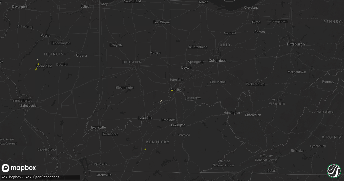
Hail Map on January 22, 2018
Get this storm
January 22 map
$229
one time, instant access
Download today. No call, no setup
Keep the $229
Bought the map and want the full workflow? Apply the entire $229 to a subscription within 7 days. None of it is wasted.
Every map, not just this one
This buys you this map. Subscription and you get every map we run, in the markets you choose from a few cities to whole states to nationwide. Plus real-time alerts the moment a storm fires.
Contact data
Name, contact info, occupancy, even credit band for addresses in the footprint. You go from where it hit to who to call.
Become the source they trust
Unlimited branding weather history reports on demand. You already have the documented answer ready for the property owner, and you are the one who showed up with it.
Property data and RoofTrace estimates
Pull up any address you have got, its value and the exact code rules for that jurisdiction, straight from One Click Code. Then RoofTrace estimates the squares, pitch, and roof value, priced the way you price.
Storm reports
Pennsylvania
| Date | Description |
|---|---|
| 01/22/20181:37 AM CST | Broadcast media aired video showing several softwood trees in the warrendale area snapped and in yards... With power lines brought down. One tree was on a roof. |
Illinois
| Date | Description |
|---|---|
| 01/22/20181:31 PM CST | Hail lasted about 15 minutes...started as dime and nickel size...couple of quarter size stones toward the end...delayed report...time estimated from radar |
| 01/22/20181:24 PM CST | A local report indicates 1.00 inch wind near NEW BERLIN |
| 01/21/20189:37 PM CST | At 336 PM CST, a severe thunderstorm was located over Tiskilwa, or near Princeton, moving northeast at 35 mph. HAZARD...Quarter size hail. SOURCE...Radar indicated. IMPACT...Damage to vehicles is expected. Locations impacted include... Princeton, Walnut, Wyanet, Tiskilwa, La Moille, Buda, Bureau Junction, Ohio, Malden, Manlius, Milo, Arlington, Dover, Providence, Coal Hollow, Zearing, Kasbeer, Van Orin, Normandy and Lake Thunderbird.This includes the following highways... Interstate 80 in Illinois between mile markers 45 and 65. Interstate 180 between mile markers 4 and 13. |
| 01/21/20187:29 PM CST | At 129 PM CST, a severe thunderstorm was located over Petersburg, or 15 miles southwest of Mason City, moving northeast at 55 mph. HAZARD...60 mph wind gusts and quarter size hail. SOURCE...Radar indicated. IMPACT...Hail damage to vehicles is expected. Expect wind damage to roofs, siding, and trees. Locations impacted include... Lincoln, Mason City, Petersburg, Athens, Pleasant Plains, Greenview, Tallula, Middletown, Easton, New Holland, Lincolns New Salem and Sweetwater.This includes the following highways... Interstate 155 near mile marker 0. Interstate 55 between mile markers 125 and 127. |
| 01/21/20187:27 PM CST | At 127 PM CST, a severe thunderstorm was located near New Berlin, or 9 miles west of Springfield, moving northeast at 55 mph. HAZARD...60 mph wind gusts and quarter size hail. SOURCE...Trained weather spotters. IMPACT...Expect damage to roofs, siding, and trees. Locations impacted include... Springfield, Sherman, Petersburg, Athens, Williamsville, New Berlin, Pleasant Plains, Greenview, Loami, Curran, Berlin, Cantrall, Capital Airport, Salisbury, Farmingdale, Lincolns New Salem, Fancy Prairie and Sweetwater.This includes the following highways... Interstate 55 between mile markers 102 and 110. Interstate 72 between mile markers 80 and 92. |
Kentucky
| Date | Description |
|---|---|
| 01/22/20183:59 AM CST | At 958 PM EST, a severe thunderstorm was located near Richmond, moving northeast at 65 mph. HAZARD...60 mph wind gusts and quarter size hail. SOURCE...Radar indicated. IMPACT...Hail damage to vehicles is expected. Expect wind damage to roofs, siding, and trees. Locations impacted include... Mount Sterling, Owingsville, Marshall, Camargo, Sharpsburg, Levee, Preston, Reynoldsville, Sideview, Peasticks, Flat Creek, Coons Station, Stepstone, Bourbon Furnace, Gatewoods Station, Slate Valley, Prewitt, Crooks, Polksville and Stoops. |
| 01/22/20183:56 AM CST | At 956 PM EST, a severe thunderstorm was located near Harris Ferry, moving northeast at 60 mph. HAZARD...60 mph wind gusts and quarter size hail. SOURCE...Radar indicated. IMPACT...Hail damage to vehicles is expected. Expect wind damage to roofs, siding, and trees. Locations impacted include... Harris Ferry, Goffs Corner, Vianna, Jackson Ferry, Mina, Hunt, College Hill, Cotton Branch, Hedges and Elkin. |
| 01/22/20183:16 AM CST | At 915 PM EST, a severe thunderstorm was located over Stanford, moving northeast at 45 mph. HAZARD...60 mph wind gusts and quarter size hail. SOURCE...Radar indicated. IMPACT...Hail damage to vehicles is expected. Expect wind damage to roofs, siding, and trees. Locations impacted include... Stanford, Lancaster, Mccreary, Berea, Round Hill, Boneyville, Gilbert, Geneva, Buggytown and Rowland. |
| 01/22/20182:37 AM CST | At 836 PM EST/736 PM CST/, a severe thunderstorm was located 10 miles northwest of Campbellsville, moving northeast at 50 mph. HAZARD...Quarter size hail. SOURCE...Radar indicated. IMPACT...Damage to vehicles is expected. Locations impacted include... Lebanon, Raywick, Saint Joseph, Bloyd, Calvary, White Rose, Greenbriar, Saint Mary, Riley and Coakley. |
| 01/21/201810:53 PM CST | Tree limb down on valley view drive... Time estimated from radar |
| 01/21/20188:35 PM CST | A few trees down. |
| 01/21/20188:35 PM CST | Tree was downed on a power line on highway 328 e. |
| 01/21/20187:53 PM CST | Time estimated by radar. |
| 01/21/20187:51 PM CST | Relayed twitter picture of hail with spikes. Time estimated based on radar. |
Missouri
| Date | Description |
|---|---|
| 01/21/20188:15 PM CST | At 215 AM CST, severe thunderstorms were located along a line extending from 9 miles west of Ellington to 8 miles west of Handy, moving northeast at 45 mph. HAZARD...60 mph wind gusts. SOURCE...Radar indicated. IMPACT...Expect damage to roofs, siding, and trees. Locations impacted include... Reynolds, Ellington, Garwood, Centerville, Corridon, Redford and Lesterville.This also includes Taum Sauk Mountain State Park and Clearwater LakeRecreational Area. |
| 01/21/20188:04 PM CST | At 204 AM CST, severe thunderstorms were located along a line extending from near Winona to 7 miles west of Ravenden, moving northeast at 40 mph. HAZARD...60 mph wind gusts. SOURCE...Radar indicated. IMPACT...Expect damage to roofs, siding, and trees. Locations impacted include... Doniphan, Van Buren, Naylor, Ellsinore, Hunter, Handy, Budapest, Gatewood, Oxly, Fairdealing, Fremont, Grandin, Freemont and Briar. |
| 01/21/20187:40 PM CST | At 140 AM CST, severe thunderstorms were located along a line extending from 7 miles southeast of Mountain View to 10 miles west of Alton to 7 miles west of Mammoth Spring, moving northeast at 55 mph. HAZARD...60 mph wind gusts. SOURCE...Radar indicated. IMPACT...Expect damage to roofs, siding, and trees. Locations impacted include... Grand Gulf State Park... Thayer... Winona... Alton... Birch Tree... Eminence... Koshkonong... Montier... Thomasville... Teresita... Myrtle... Wilderness... Midridge... Couch... Rover... Alley Spring... West Eminence... Greer... |
| 01/21/20187:06 PM CST | At 106 AM CST, severe thunderstorms were located along a line extending from Summersville to near Mountain View, moving northeast at 40 mph. HAZARD...60 mph wind gusts. SOURCE...Radar indicated. IMPACT...Expect damage to roofs, siding, and trees. Locations impacted include... Current River State Park... Mountain View... Eminence... Summersville... Montier... Teresita... Midridge... Arroll... Alley Spring... Hartshorn... Round Spring... West Eminence... Akers... Pine Crest... |
Ohio
| Date | Description |
|---|---|
| 01/22/20185:49 AM CST | At 1149 PM EST, severe thunderstorms were located along a line extending from Ironton to near Rush, moving northeast at 65 mph. HAZARD...60 mph wind gusts and quarter size hail. SOURCE...Radar indicated. IMPACT...Hail damage to vehicles is expected. Expect wind damage to roofs, siding, and trees. Locations impacted include... Huntington, Ashland, Ironton, Coal Grove, Chesapeake, Cannonsburg, Lake Vesuvius, Kenova, Catlettsburg, Ceredo, Princess, Coalton, Naples, Rush, Flatwoods, South Point, Russell, Raceland, Worthington and Burlington.THIS INCLUDES THE FOLLOWING HIGHWAYS... Interstate 64 in Kentucky between mile markers 180 and 191. Interstate 64 in West Virginia between mile markers 1 and 6. |
| 01/22/20185:41 AM CST | At 1141 PM EST, a severe thunderstorm was located near Marne, moving northeast at 55 mph. HAZARD...60 mph wind gusts. SOURCE...Radar indicated. IMPACT...Expect damage to trees and power lines. Locations impacted include... Newark, Heath, Granville, Utica, Hanover, Marne, St. Louisville, US Route 62 at State Route 661, Fallsburg, Purity and Fredonia. |
| 01/22/20182:59 AM CST | At 859 PM EST, a severe thunderstorm was located over Vandalia, moving northeast at 50 mph. HAZARD...60 mph wind gusts. SOURCE...Radar indicated. IMPACT...Expect damage to trees and power lines. Locations impacted include... Dayton, Huber Heights, Troy, Vandalia, Tipp City, New Carlisle, St. Paris, Brown, Union, Christiansburg, North Hampton, Fletcher, Casstown, Ginghamsburg, Thackery, Phoneton, Terre Haute, State Route 41 at State Route 235, Dayton International Airport and Grayson.This includes the following Interstates... I-70 in Ohio between mile markers 32 and 37. I-75 in Ohio between mile markers 59 and 78. |
| 01/21/201811:10 PM CST | Tree down along cr-2 |
| 01/21/201810:43 PM CST | A couple of trees down across northeast licking county |
| 01/21/201810:35 PM CST | Tree uprooted. Damage to a barn and playground equipment. |
| 01/21/201810:25 PM CST | Multiple trees down. |
| 01/21/201810:25 PM CST | Corrected event type. |
| 01/21/201810:00 PM CST | Barn off its foundation and now leaning. Another old building had its door blown open and the back wall... Which was made of old bricks... Got pushed out. Trees were do |
| 01/21/20189:43 PM CST | Barn roof and outbuilding damage. Tree down. Time estimated from radar. |
| 01/21/20189:35 PM CST | Newly built barn had its roof torn off and a section of the roof structure was ripped away from its base. |
| 01/21/20188:15 PM CST | Multiple tree down at baker rd and pence rd. |
| 01/21/20188:00 PM CST | One tree down on troy-frederick rd... Between neal-pearson rd and bard rd. |
| 01/21/20188:00 PM CST | One tree down on kelser fredricks rd. |
| 01/21/20187:51 PM CST | One tree down at sprindboro pike at ferndown road. |
| 01/21/20187:48 PM CST | One tree down at carlise pike and butter street. |
| 01/21/20187:48 PM CST | One tree down on wolf creek pike. |
| 01/21/20187:48 PM CST | One tree down at upper miamisburg rd and solders home rd. |
| 01/21/20187:47 PM CST | One tree down at north union rd and old dayton rd. |
Indiana
| Date | Description |
|---|---|
| 01/21/20189:30 PM CST | Trees down within grant county. Also reported pea sized hail at this location. |
| 01/21/20189:00 PM CST | Tree down. Time approximated from radar. |
| 01/21/20188:22 PM CST | Reports of trees down in peru and grissom. One tree was reported to be a sizable... Mature tree. Pea sized hail was also reported. |
| 01/21/20188:00 PM CST | Tree uprooted and fell on house. Twitter report. |
| 01/21/20187:06 PM CST | Tree blown down. Approximate location. |
Mississippi
| Date | Description |
|---|---|
| 01/22/201810:28 AM CST | Roof damage to first methodist church in quitman. |
| 01/22/20189:29 AM CST | Tornado damage reported. |
| 01/22/20189:21 AM CST | Trees down along hwy 37. |
| 01/22/20189:16 AM CST | *** 1 inj *** an ef-1 tornado touched down along highway 532 in covington county and tracked northeast. It caused minor tree damage along the path. It became its strong |
| 01/22/20187:37 AM CST | Barn destroyed... Roof damaged and multiple trees down. |
| 01/22/20183:18 AM CST | At 918 AM CST, a severe thunderstorm was located near Taylorsville, or 11 miles northeast of Collins, moving northeast at 40 mph. HAZARD...60 mph wind gusts. SOURCE...Radar indicated. IMPACT...Expect damage to roofs, siding, and trees. This severe thunderstorm will be near... Stringer and Moss around 940 AM CST. Vernon around 950 AM CST. Other locations impacted by this severe thunderstorm include Soso. |
| 01/22/201812:57 AM CST | At 657 AM CST, a severe thunderstorm was located near Annandale, or near Ridgeland, moving northeast at 50 mph. HAZARD...60 mph wind gusts. SOURCE...Radar indicated. IMPACT...Expect damage to roofs, siding, and trees. This severe thunderstorm will be near... Gluckstadt around 705 AM CST. Canton around 710 AM CST. Sharon around 720 AM CST. Farmhaven around 730 AM CST. |
| 01/22/201812:00 AM CST | At 600 AM CST, a severe thunderstorm was located near Rocky Springs, or 12 miles south of Vicksburg, moving northeast at 40 mph. HAZARD...60 mph wind gusts. SOURCE...Radar indicated. IMPACT...Expect damage to roofs, siding, and trees. This severe thunderstorm will be near... Vicksburg and Reganton around 605 AM CST. Newman around 615 AM CST. Edwards around 625 AM CST. Bolton around 640 AM CST. Other locations impacted by this severe thunderstorm include Learned. |
Arkansas
| Date | Description |
|---|---|
| 01/22/20186:53 AM CST | At 1253 AM CST, severe thunderstorms were located along a line extending from Guy to near Springhill to near Mayflower, moving northeast at 45 mph. HAZARD...60 mph wind gusts and penny size hail. SOURCE...Radar indicated. IMPACT...Expect damage to roofs, siding, and trees. Locations impacted include... Conway... Greenbrier... Vilonia... Mayflower... Guy... Rose Bud... Enola... Twin Groves... Mount Vernon... Pickles Gap... Springhill... Gravel Hill... Woolly Hollow State Park... Holland... Barney... Hamlet... Saltillo... El Paso... Romance... Enders...This includes Interstate 40 between mile markers 128 and 133. |
| 01/21/20189:36 PM CST | At 335 AM CST, a severe thunderstorm was located over Tillar, or 11 miles north of Dermott, moving northeast at 50 mph. HAZARD...60 mph wind gusts and penny size hail. SOURCE...Radar indicated. IMPACT...Expect damage to roofs, siding, and trees. Locations impacted include... Rohwer... Tillar... Winchester... Lucca Landing... McGehee... Jersey Point... Kelso... Reed... McArthur... Selma... Masonville... Yukon... |
Louisiana
| Date | Description |
|---|---|
| 01/22/20186:28 AM CST | At 1228 AM CST, a severe thunderstorm was located near Converse, or 18 miles south of Mansfield, moving northeast at 55 mph. HAZARD...60 mph wind gusts and quarter size hail. SOURCE...Radar indicated. IMPACT...Hail damage to vehicles is expected. Expect wind damage to roofs, siding, and trees. Locations impacted include... Coushatta, Campti, Converse, Allen, Oak Grove, Pleasant Hill, Martin, Clarence, Ashland, Powhatan, Lake End, Grand Ecore, Belmont, Hanna, Pelican, Black Lake, Marthaville, Rambin, Armistead and Ajax. |
| 01/22/20186:24 AM CST | At 1223 AM CST, a severe thunderstorm was located near Coushatta, or 17 miles east of Mansfield, moving northeast at 40 mph. HAZARD...60 mph wind gusts and penny size hail. SOURCE...Radar indicated. IMPACT...Expect damage to roofs, siding, and trees. Locations impacted include... Coushatta, Campti, Martin, Goldonna, Ashland, Edgefield, Powhatan, Lake End, Evelyn, Hanna, Black Lake, Chestnut, Clear Lake, Creston, Rambin, Armistead and Ajax. |
| 01/21/20188:21 PM CST | At 220 AM CST, a severe thunderstorm was located near Ruston, moving northeast at 45 mph. HAZARD...60 mph wind gusts. SOURCE...Radar indicated. IMPACT...Expect damage to roofs, siding, and trees. Locations impacted include... Ruston, Farmerville, Choudrant, Downsville, D Arbonne and Bayou D Arbonne Lake. |
Alabama
| Date | Description |
|---|---|
| 01/21/20187:12 PM CST | At 112 PM CST, a severe thunderstorm was located near Dallas Lake, or 14 miles southwest of Selmont-West Selmont, moving east at 35 mph. HAZARD...60 mph wind gusts and quarter size hail. SOURCE...Radar indicated. IMPACT...Hail damage to vehicles is expected. Expect wind damage to roofs, siding, and trees. Locations impacted include... Dallas Lake, Old Cahaba Park, Belknap, Dannelly Reservoir, Tyler, Tilden, Whites Bluff, Carlowville, Minter and Craig Field Aiport. |