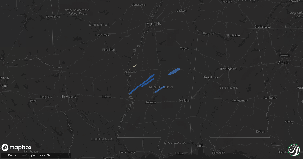
Hail Map on January 12, 2024
Get this storm
January 12 map
$229
one time, instant access
Download today. No call, no setup
Keep the $229
Bought the map and want the full workflow? Apply the entire $229 to a subscription within 7 days. None of it is wasted.
Every map, not just this one
This buys you this map. Subscription and you get every map we run, in the markets you choose from a few cities to whole states to nationwide. Plus real-time alerts the moment a storm fires.
Contact data
Name, contact info, occupancy, even credit band for addresses in the footprint. You go from where it hit to who to call.
Become the source they trust
Unlimited branding weather history reports on demand. You already have the documented answer ready for the property owner, and you are the one who showed up with it.
Property data and RoofTrace estimates
Pull up any address you have got, its value and the exact code rules for that jurisdiction, straight from One Click Code. Then RoofTrace estimates the squares, pitch, and roof value, priced the way you price.
Storm reports
Mississippi
| Date | Description |
|---|---|
| 01/12/20249:57 AM CST | Tree and power line down along hwy 493. |
| 01/12/20249:42 AM CST | Tree down across ridge road. |
| 01/12/20249:30 AM CST | Power pole broken and tin off a shed. |
| 01/12/20249:26 AM CST | Emergency management reports a tree down across kennedy dr near west point. |
| 01/12/20249:05 AM CST | Law enforcement reported several trees down across town creek rd. |
| 01/12/20248:55 AM CST | Two trees down on co line road. |
| 01/12/20248:35 AM CST | Tree downed across hwy 43. |
| 01/12/20248:33 AM CST | Significant damage to fish farm structure. |
| 01/12/20248:30 AM CST | Tree down and large limbs down on hwy 27. |
| 01/12/20248:28 AM CST | Tree down across hwy 43 near beamon road. |
| 01/12/20248:28 AM CST | Social media posts show roof damage on a home near west rd. |
| 01/12/20248:24 AM CST | Law enforcement reported several trees down near ackerman. Tin was blown off of a house near chester... A few miles northwest of ackerman. |
| 01/12/20248:17 AM CST | A couple trees and lines down around kilmichael. |
| 01/12/20248:17 AM CST | Tin was blow off the roof of a mobile home along hwy 433. A tree was down through home on scotland road. |
| 01/12/20248:15 AM CST | Several trees down around the city. |
| 01/12/20248:13 AM CST | A few trees and power lines down. |
| 01/12/20248:12 AM CST | A few trees down. |
| 01/12/20248:05 AM CST | A couple trees and power lines were down around winona. |
| 01/12/20248:04 AM CST | 100-198 main st... Indianola... Ms 38751 along main st. |
| 01/12/20247:58 AM CST | Local fire department reported a shed blown over near hwy 7 5 miles north of greenwood along with roof damage. |
| 01/12/20247:57 AM CST | Trees down around tchula. |
| 01/12/20247:45 AM CST | Multiple power lines down and a few trees in and around holly bluff. |
| 01/12/20247:45 AM CST | Corrects previous tstm wnd dmg report from 5 sw isola. Significant damage to fish farm structure. |
| 01/12/20247:44 AM CST | Trees down around lexington. |
| 01/12/20247:32 AM CST | Reports of tree limbs downed on power lines causing power outages. |
| 01/12/20247:30 AM CST | Corrects previous tstm wnd dmg report from indianola. 100-198 main st... Indianola... Ms 38751 along main st. |
| 01/12/20247:30 AM CST | Reports of multiple trees and power lines downed along hwy 48 and hwy 82. |
| 01/12/20247:25 AM CST | A couple trees down. |
| 01/12/20247:20 AM CST | Corrects previous tstm wnd dmg report from 1 nw mayersville. Roof damage... Tees downed. |
| 01/12/20247:20 AM CST | Several trees down around the eden area with a few lines down. |
| 01/12/20247:20 AM CST | Roof damage to a home in mayersville. |
| 01/12/20247:00 AM CST | Social media posts from this morning show a wooden fence knocked down near dogwood st in cary. |
| 01/12/20246:58 AM CST | Tree down across a road. |
| 01/12/20246:30 AM CST | Roof damage... Tees downed. |
| 01/12/20246:30 AM CST | Reports of tree downed along hwy 1 in beulah. |
Louisiana
| Date | Description |
|---|---|
| 01/12/20247:25 AM CST | Multiple powerlines snapped along hwy 65. |
| 01/12/20246:20 AM CST | Reports of powerlines and poles downed on hwy 65. |
Arkansas
| Date | Description |
|---|---|
| 01/12/20246:35 AM CST | Part of a roof was blown off near the intersection of highway 243 and county road 402. |
| 01/12/20246:30 AM CST | Report of downed trees. |
| 01/12/20246:30 AM CST | Report of downed powerlines. |
| 01/12/20246:22 AM CST | Part of a roof was lifted off a home and several trees were downed in moro. |
| 01/12/20246:20 AM CST | Tree down across old portland road. |
| 01/12/20246:15 AM CST | A few large trees were knocked down in this area... At least one house was damaged. |
| 01/12/20246:10 AM CST | Trees were knocked down in this area. |
Cities Impacted by Hail Map on January 12, 2024
- Dardanelle, AR
- Danville, AR
- Russellville, AR
- Pottsville, AR
- Delaware, AR
- New Blaine, AR
- Dover, AR
- Atkins, AR
- Jerusalem, AR
- Scotland, AR
- Clinton, AR
- Oden, AR
- Pencil Bluff, AR
- Dierks, AR
- Umpire, AR
- Mena, AR
- Newhope, AR
- Langley, AR
- Caddo Gap, AR
- Norman, AR
- Mount Ida, AR
- Glenwood, AR
- Bonnerdale, AR
- Houston, AR
- Perryville, AR
- Perry, AR
- Bigelow, AR
- Benton, AR
- Lonsdale, AR
- Paron, AR
- Little Rock, AR
- Alexander, AR
- Roland, AR
- Maumelle, AR
- Mayflower, AR
- North Little Rock, AR
- Sherwood, AR
- Jacksonville, AR
- Vilonia, AR
- Cabot, AR
- Malvern, AR
- Hot Springs National Park, AR
- Austin, AR
- El Paso, AR
- Beebe, AR
- Arlington, TX
- Grand Prairie, TX
- McRae, AR
- Searcy, AR
- Garner, AR
- Higginson, AR
- Kensett, AR
- Griffithville, AR
- Judsonia, AR
- Bald Knob, AR
- Augusta, AR
- Newport, AR
- McCrory, AR
- Amagon, AR
- Cash, AR
- Weiner, AR
- Jonesboro, AR
- Harrisburg, AR
- Fisher, AR
- Bay, AR
- Lake City, AR
- Black Oak, AR
- Monette, AR
- Beedeville, AR
- Hickory Ridge, AR
- Mount Vernon, TX
- Manila, AR
- Trumann, AR
- Foreman, AR
- Ashdown, AR
- Morrilton, AR
- Ola, AR
- Casa, AR
- Lonoke, AR
- Scott, AR
- Redfield, AR
- Sheridan, AR
- Sherrill, AR
- Pine Bluff, AR
- Altheimer, AR
- Grady, AR
- Wabbaseka, AR
- Humphrey, AR
- Ulm, AR
- Stuttgart, AR
- Earle, AR
- Crawfordsville, AR
- Turrell, AR
- Yazoo City, MS
- Tchula, MS
- Lexington, MS
- Mayersville, MS
- Rolling Fork, MS
- Cary, MS
- Louise, MS
- Silver City, MS
- Belzoni, MS
- Coila, MS
- Cruger, MS
- French Camp, MS
- Weir, MS
- Ackerman, MS
- Eupora, MS
- Mathiston, MS
- Maben, MS
- Sturgis, MS
- Pheba, MS
- Starkville, MS
- Canton, MS
- Camden, MS
- McCalla, AL
- Pelham, AL
- Cottondale, AL
- Brookwood, AL
- Heflin, AL
- Waco, GA
- Buhl, AL
- Vance, AL
- Knoxville, AL
- Alpine, AL
- Aliceville, AL
- Helena, AL
- Bessemer, AL
- Preston, MS
- Sterrett, AL
- Birmingham, AL
- Vincent, AL
- Talladega, AL
- Munford, AL
- Chelsea, AL
- Ralph, AL
- Delta, AL
- Tuscaloosa, AL
- Macon, MS
- Ranburne, AL
- Philadelphia, MS
- Shuqualak, MS
- Carrollton, GA
- De Kalb, MS
- Carthage, MS
- Kosciusko, MS
- Boyle, MS
- Shaw, MS
- Benoit, MS
- Greenville, MS