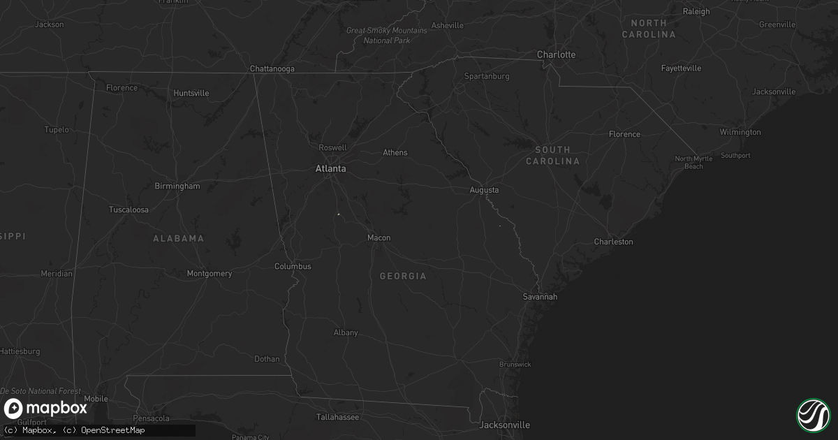
Hail Map on January 12, 2020
Get this storm
January 12 map
$229
one time, instant access
Download today. No call, no setup
Keep the $229
Bought the map and want the full workflow? Apply the entire $229 to a subscription within 7 days. None of it is wasted.
Every map, not just this one
This buys you this map. Subscription and you get every map we run, in the markets you choose from a few cities to whole states to nationwide. Plus real-time alerts the moment a storm fires.
Contact data
Name, contact info, occupancy, even credit band for addresses in the footprint. You go from where it hit to who to call.
Become the source they trust
Unlimited branding weather history reports on demand. You already have the documented answer ready for the property owner, and you are the one who showed up with it.
Property data and RoofTrace estimates
Pull up any address you have got, its value and the exact code rules for that jurisdiction, straight from One Click Code. Then RoofTrace estimates the squares, pitch, and roof value, priced the way you price.
States Impacted by Hail Map on January 12, 2020
Storm reports
West Virginia
| Date | Description |
|---|---|
| 01/11/202010:29 PM CST | Tree snapped... Major porch and lawn furniture damage at neighbors house... Numerous small branches down... Power out. |
South Carolina
| Date | Description |
|---|---|
| 01/12/20206:18 AM CST | At 1218 AM EST, severe thunderstorms were located along a line extending from near Hoffman to near Clio, moving northeast at 65 mph. HAZARD...60 mph wind gusts. SOURCE...Radar indicated. IMPACT...Expect damage to roofs, siding, and trees. Locations impacted include... Laurinburg, Raeford, Maxton, Wagram, Gibson, East Laurinburg, Silver City, Laurel Hill, Ashley Heights and Bowmore. |
| 01/12/20206:05 AM CST | At 1203 AM EST, a likely severe thunderstorm was located near Bowman, moving northeast at 65 mph. HAZARD...60 mph wind gusts. SOURCE...Radar indicated. IMPACT...Expect damage to roofs, siding, and trees. Locations impacted include... Holly Hill, Summerton, Santee Cooper Regional Airport, Santee State Park, Santee, Eutawville, Vance, St. Paul, Rocks Pond Campground and Marina, Foreston, Eautaw Springs, Indian Bluff Recreation Park, Davis Station, Blounts Landing and Mill Creek Marina and Campground.This includes Interstate 95 between mile markers 87 and 114. |
| 01/11/20207:10 PM CST | At 109 AM EST, severe thunderstorms were located along a line extending from near Tobermory to near Fairmont, moving northeast at 40 mph. HAZARD...60 mph wind gusts. SOURCE...Radar indicated. IMPACT...Expect wind damage to trees and power lines. Locations impacted include... Lumberton, Elizabethtown, Pembroke, Fairmont, St. Pauls, Bladenboro, Rex, Bladen Community College, Ammon, Butters, Hestertown, Buie, Robeson Community College, White Oak, Smiths, Howellsville, Tolarsville, Duart, Tobermory and Ruskin. |
Delaware
| Date | Description |
|---|---|
| 01/12/202012:47 AM CST | At 645 AM EST, intense showers were located along a line extending from West Deptford to Swedesboro to near New Castle, moving east at 40 mph. HAZARD...60 mph wind gusts. SOURCE...Radar indicated. A 55 mph wind gust was reported at the Wilmington Delaware airport. IMPACT...Damage to roofs, siding, trees, and power lines is possible. Locations impacted include... Vineland, Deptford, Voorhees, West Deptford, Glassboro, Lindenwold, Hammonton, Pennsville, Bellmawr, Woodbury, Pitman, Clayton, Carneys Point, Berlin, Tabernacle, Shamong, Paulsboro, Buena, Magnolia and Westville.This includes the following highways... Atlantic City Expressway between mile markers 25 and 44. Interstate 295 in New Jersey between mile markers 15 and 29, andnear mile marker 31. New Jersey Turnpike between exits 1 and 3. Interstate 76 in New Jersey near mile marker 0. |
North Carolina
| Date | Description |
|---|---|
| 01/12/20206:59 AM CST | At 1258 AM EST, severe thunderstorms were located along a line extending from 12 miles south of Smithfield to 8 miles northeast of Jerome, moving northeast at 45 mph. HAZARD...70 mph wind gusts. SOURCE...Radar indicated. IMPACT...Expect considerable tree damage. Damage is likely to mobile homes, roofs, and outbuildings. Locations impacted include... Kinston, Warsaw, La Grange, Mount Olive, Kornegay, Snow Hill, Bowdens, Beautancus, Dawson, Institute, Jason, Ormondsville, Maury, Albertson, Lizzie, Kinston Regional Jetport, Faison, Calypso, Hookerton and Sandy Bottom. |
| 01/12/20206:57 AM CST | At 1256 AM EST, severe thunderstorms were located along a line extending from 7 miles southeast of Littleton to 11 miles north of Clinton to near St. Pauls, moving northeast at 60 mph. HAZARD...60 mph wind gusts. SOURCE...Radar indicated. IMPACT...Expect damage to roofs, siding, and trees. Locations impacted include... Fayetteville, Rocky Mount, Goldsboro, Roanoke Rapids, Tarboro, Smithfield, Clinton, Nashville, Halifax and Wilson. |
| 01/12/20206:28 AM CST | At 1228 AM EST, severe thunderstorms were located along a line extending from 8 miles north of Raeford to 7 miles northwest of Brownsville, moving northeast at 75 mph. HAZARD...60 mph wind gusts. SOURCE...Radar indicated. IMPACT...Expect wind damage to trees and power lines. Locations impacted include... Lumberton, Dillon, Red Springs, Pembroke, Fairmont, Maxton, Mccoll, St. Pauls, Bladenboro, Latta, Rowland, Lake View, Clio, Sellers, Boardman, Rex, Hamer, Ammon, Brownsville and Hestertown. |
| 01/12/20206:12 AM CST | At 1212 AM EST, severe thunderstorms were located along a line extending from Saxe to near Virgilina, moving northeast at 70 mph. HAZARD...60 mph wind gusts. SOURCE...Radar indicated. IMPACT...Expect damage to roofs, siding, and trees. Locations impacted include... South Boston... Halifax... Turbeville... Hitesburg... Cluster Springs... Staunton River State Park... and Alton. |
| 01/12/20206:00 AM CST | At 1200 AM EST, severe thunderstorms were located along a line extending from near Scottsburg to 8 miles southwest of Cary, moving northeast at 65 mph. HAZARD...60 mph wind gusts. SOURCE...Radar indicated. IMPACT...Expect damage to roofs, siding, and trees. Locations impacted include... Rocky Mount, Henderson, Oxford, Nashville, Creedmoor, Louisburg, Warrenton, Butner, Franklinton and Norlina. |
| 01/11/20208:23 PM CST | At 223 AM EST, severe thunderstorms were located along a line extending from 6 miles northwest of Williamston to near Stokes to near Pactolus, moving northeast at 55 mph. HAZARD...60 mph wind gusts. SOURCE...Radar indicated. IMPACT...Expect damage to trees and powerlines. Severe thunderstorms will be near, Windsor around 235 AM EST. Valhalla and Rockyhock around 255 AM EST. Cape Colony around 305 AM EST.Other locations impacted by these severe thunderstorms include GoosePond, Whites Crossroads, Smalls Crossroads, Merry Hill, DrummondPoint, Mavaton, Edenhouse, Saint Johns, Mill Crossroads and MountGould. |
| 01/11/20208:09 PM CST | At 209 AM EST, severe thunderstorms were located along a line extending from La Grange to 9 miles northeast of Ammon, moving northeast at 55 mph. HAZARD...60 mph wind gusts. SOURCE...Radar indicated. IMPACT...Expect damage to roofs, siding, and trees. Locations impacted include... Goldsboro, Clinton, Mount Olive, Walnut Creek, Roseboro, Turkey, Seven Springs, Brogden, Cliffs Of The Neuse State Park and Elroy. |
| 01/11/20208:01 PM CST | At 201 AM EST, severe thunderstorms were located along a line extending from near Mount Olive to near Ammon, moving northeast at 45 mph. HAZARD...60 mph wind gusts. SOURCE...Radar indicated. IMPACT...Expect damage to roofs, siding, and trees. Locations impacted include... Greenville, Kinston, Winterville, Ayden, Warsaw, La Grange, Mount Olive, Grifton, Kornegay, Rose Hill, Deep Run, Bowdens, Beautancus, Kenansville, Dawson, Graingers, Institute, Jason, Ormondsville and Maury. |
| 01/11/20207:51 PM CST | At 149 AM EST, a severe thunderstorm was located 7 miles west of Goldsboro, moving northeast at 45 mph. HAZARD...60 mph wind gusts. SOURCE...Radar indicated. IMPACT...Expect damage to roofs, siding, and trees. Locations impacted include... Greenville, Williamston, Farmville, Bethel, Stokes, Snow Hill, Bell Arthur, Robersonville, House, Bruce, Maury, Lizzie, Pitt Greenville Airport, Dowdy Ficklen Stadium, East Carolina University, Gold Point, Fountain, Hamilton, Castoria and Oak City. |
Maryland
| Date | Description |
|---|---|
| 01/12/20206:57 AM CST | At 1257 AM EST, severe thunderstorms were located along a line extending from Clinton to near Saint Charles to near Quantico, moving east at 50 mph. HAZARD...60 mph wind gusts. SOURCE...Radar indicated. IMPACT...Damaging winds will cause some trees and large branches to fall. This could injure those outdoors, as well as damage homes and vehicles. Roadways may become blocked by downed trees. Localized power outages are possible. Unsecured light objects may become projectiles. Locations impacted include... Waldorf, Clinton, Fort Washington, La Plata, Chesapeake Beach, Deale, Upper Marlboro, Breezy Point, Port Tobacco River, Andrews Air Force Base, Rosaryville, Marlton, Dunkirk, Saint Charles, Accokeek, Bryans Road, Brandywine, Huntingtown, Hughesville and Owings. |
| 01/11/20207:05 PM CST | At 104 AM EST, severe thunderstorms were located along a line extending from Fort Meade to near Mitchellville to near Upper Marlboro, moving east at 50 mph. HAZARD...60 mph wind gusts. SOURCE...Radar indicated. IMPACT...Damaging winds will cause some trees and large branches to fall. This could injure those outdoors, as well as damage homes and vehicles. Roadways may become blocked by downed trees. Localized power outages are possible. Unsecured light objects may become projectiles. Locations impacted include... Bowie, Severn, Annapolis, Crofton, Riviera Beach, Forestville, Largo, Mayo, Shady Side, Deale, Naval Academy, Upper Marlboro, Severn River, South River, Fort Smallwood State Park, Gibson Island, Bodkin Point, Sillery Bay, Fedex Field and Rhode River. |
Virginia
| Date | Description |
|---|---|
| 01/12/20206:43 AM CST | At 1243 AM EST, a severe thunderstorm was located near Rehoboth, or 7 miles west of Victoria, moving northeast at 65 mph. HAZARD...60 mph wind gusts. SOURCE...Radar indicated. IMPACT...Expect damage to trees and powerlines. Locations impacted include... Blackstone, Crewe, Victoria, Kenbridge, Nottoway, Lunenburg, Alberta, Wilsons, Kells Corner, Fort Pickett, Rehoboth, Spainville, Dundas, Bacons Fork, North Wellville, Cochran, Irby, Wilburn, Gills Corner and Arvins Store. |
| 01/12/20206:34 AM CST | At 1234 AM EST, severe thunderstorms were located along a line extending from near Trenholm to Amelia Courthouse to near Green Bay, moving northeast at 60 mph. HAZARD...60 mph wind gusts. SOURCE...Radar indicated. IMPACT...Expect damage to trees and powerlines. Severe thunderstorms will be near, Goochland, Chula and Scotts Fork around 1240 AM EST. Oilville around 1245 AM EST. Moseley around 1250 AM EST. Spainville around 1255 AM EST. Mannboro around 100 AM EST. University Of Richmond, Bon Air, Downtown Richmond and Bensley around 105 AM EST. Richmond, Virginia Union University, Virginia Commonwealth University, East Highland Park, Lakeside, Laurel, Glen Allen and Kings Dominion around 110 AM EST. Mechanicsville, Highland Springs, Studley and Chesterfield Court House around 115 AM EST.Other locations impacted by these severe thunderstorms include NorthWellville, Ammon, Maidens, Gum Tree, Three Square, Montrose,Sandston, Pocahontas State Park, Skinquarter and Wellville. |
| 01/12/20206:28 AM CST | At 1227 AM EST, severe thunderstorms were located along a line extending from near Schuyler to 9 miles southeast of Clarksville, moving northeast at 55 mph. HAZARD...60 mph wind gusts. SOURCE...Radar indicated. IMPACT...Expect damage to roofs, siding, and trees. Locations impacted include... Buckingham... Keysville... Charlotte Court House... Dillwyn... Phenix... Redoak... and Clover. |
| 01/11/20207:18 PM CST | At 117 AM EST, a severe thunderstorm was located over Mannboro, moving northeast at 70 mph. HAZARD...60 mph wind gusts. SOURCE...Radar indicated. IMPACT...Expect damage to trees and powerlines. Locations impacted include... Richmond, Petersburg, Hopewell, Colonial Heights, Mannboro, Virginia State University, Chester, Highland Springs, Fort Lee, Bensley, Bellwood, Wilsons, Matoaca, Spainville, Sutherland, Ettrick, Chesterfield Court House, East Highland Park, Chesterfield and North Wellville. |
| 01/11/20206:57 PM CST | Trees and limbs blown down. Some minor structural damage to home. Timing estimated by radar. |