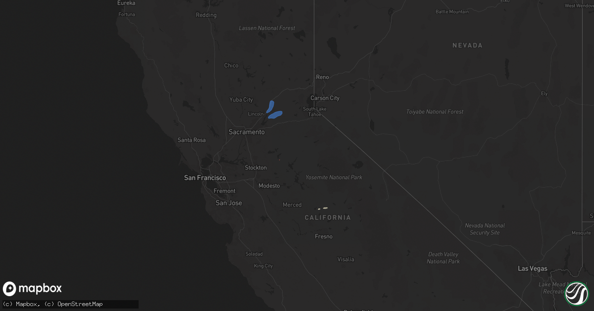
Hail Map on January 10, 2023
Get this storm
January 10 map
$229
one time, instant access
Download today. No call, no setup
Keep the $229
Bought the map and want the full workflow? Apply the entire $229 to a subscription within 7 days. None of it is wasted.
Every map, not just this one
This buys you this map. Subscription and you get every map we run, in the markets you choose from a few cities to whole states to nationwide. Plus real-time alerts the moment a storm fires.
Contact data
Name, contact info, occupancy, even credit band for addresses in the footprint. You go from where it hit to who to call.
Become the source they trust
Unlimited branding weather history reports on demand. You already have the documented answer ready for the property owner, and you are the one who showed up with it.
Property data and RoofTrace estimates
Pull up any address you have got, its value and the exact code rules for that jurisdiction, straight from One Click Code. Then RoofTrace estimates the squares, pitch, and roof value, priced the way you price.
States Impacted by Hail Map on January 10, 2023
Storm reports
California
| Date | Description |
|---|---|
| 01/10/20232:25 PM CST | Tree down blocking all lanes of traffic. |
| 01/10/20231:47 PM CST | Tree down in roadway. |
| 01/10/20231:47 PM CST | Tree down |
| 01/10/20231:16 PM CST | Redwood tree down in sb lane. Sb completely blocked. |
| 01/10/202312:53 PM CST | Power pole down. |
| 01/10/202312:40 PM CST | Tree and wires down in area. |
| 01/10/202312:24 PM CST | Power line and tree down blocking in residences. |
| 01/10/202311:54 AM CST | Several trees and power lines down... 2 inches of mud across road. |
| 01/10/202311:41 AM CST | Large tree... 30-50 ft tall down across lanes. |
| 01/10/202311:13 AM CST | Power lines down across both lanes. |
| 01/10/202310:57 AM CST | Huge tree down across #3 and 4 lanes. |
| 01/10/202310:41 AM CST | Powerlines down across both lanes of traffic. |
| 01/10/202310:40 AM CST | Tree and power lines down. |
| 01/10/202310:37 AM CST | Power lines hanging low over road. |
| 01/10/202310:36 AM CST | Tree down blocking eb lanes as well as mudslide. |
| 01/10/202310:19 AM CST | Tree fell against power lines and pole. Power lines sparking. |
| 01/10/202310:13 AM CST | Tree down blocking lane #1. |
| 01/10/202310:03 AM CST | Power pole leaning over road... Only hanging on by wires. |
| 01/10/20239:46 AM CST | Tree down blocking road on eb side. |
| 01/10/20239:34 AM CST | A roof was blown off of an apartment building after 70mph wind gusts. |
| 01/10/20238:36 AM CST | Tree down blocking left lane. |
| 01/10/20237:52 AM CST | Tree and powerlines down blocking roadway. |
| 01/10/20237:44 AM CST | Tree down blocking roadway. Comms lines down. |
| 01/10/20237:30 AM CST | Large tree down blocking both lanes. |
| 01/10/20237:06 AM CST | Tree down blocking most of both lanes. |
| 01/10/20236:48 AM CST | Tree and power lines down across whole roadway. |
| 01/10/20236:44 AM CST | Tree down in roadway. |
| 01/10/20236:39 AM CST | Large tree down blocking whole roadway. |
| 01/10/20236:35 AM CST | Tree in roadway. |
| 01/10/20236:35 AM CST | Tree in roadway. (sto |
| 01/10/20236:31 AM CST | Tree down across roadway. |
| 01/10/20236:30 AM CST | A local report indicates 61 MPH wind near 5 SSW TUTTLETOWN |
| 01/10/20236:30 AM CST | A local report indicates 72 MPH wind near 4 NE COPPEROPOLIS |
| 01/10/20236:30 AM CST | A local report indicates 65 MPH wind near 2 ENE CARSON HILL |
| 01/10/20236:30 AM CST | A local report indicates 59 MPH wind near 1 NE ANGELS CAMP |
| 01/10/20236:29 AM CST | Large tree down blocking both lanes. |
| 01/10/20236:27 AM CST | 2 trees down into lines. Roadway entirely blocked. |
| 01/10/20236:27 AM CST | Tree down across roadway. |
| 01/10/20236:26 AM CST | Tree down blocking both lanes. |
| 01/10/20236:23 AM CST | Large tree limb blocking westbound lane. |
| 01/10/20236:23 AM CST | Per chp large tree down blocking both lanes. Road closed. |
| 01/10/20236:22 AM CST | Tree down across roadway. |
| 01/10/20236:20 AM CST | A local report indicates 63 MPH wind near 6 NNW HODSON |
| 01/10/20236:02 AM CST | A large horse barn was picked up and moved over/across a 5 foot fence from a severe thunderstorm straight line winds. Based on radar and damage photos... Winds were aro |