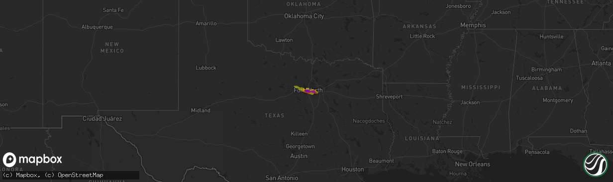
Hail Map on January 5, 1900
The weather event on January 5, 1900 includes Hail map. 1 state and 30 cities were impacted and suffered possible damage. The total estimated number of properties impacted is 354,676.
Want more than just the map?
Turn this storm into a full workflow.
- Owner + property data so you know who to knock
- OnDemand branded weather history reports to win the "did we even have hail?" argument
- RoofTrace estimate so reps stop guessing numbers at the door
Bought this map? Upgrade within 7 days and we'll credit the $230. (10-15 min setup call)
Hail
354,676
Estimated number of impacted properties by a 1.00" hail or larger228,204
Estimated number of impacted properties by a 1.75" hail or larger94,859
Estimated number of impacted properties by a 2.50" hail or largerStates Impacted by Hail Map on January 5, 1900
Storm reports
Cities Impacted by Hail Map on January 5, 1900
- Fort Worth, TX
- Haltom City, TX
- North Richland Hills, TX
- Hurst, TX
- Weatherford, TX
- Springtown, TX
- Azle, TX
- Flower Mound, TX
- Decatur, TX
- Denton, TX
- Justin, TX
- Newark, TX
- Rhome, TX
- Argyle, TX
- Lake Dallas, TX
- Krum, TX
- Roanoke, TX
- Boyd, TX
- Lewisville, TX
- Ponder, TX
- Aledo, TX
- Naval Air Station Jrb, TX
- Arlington, TX
- Grand Prairie, TX
- Dallas, TX
- Duncanville, TX
- Cedar Hill, TX
- Poolville, TX
- Mansfield, TX
- Kennedale, TX