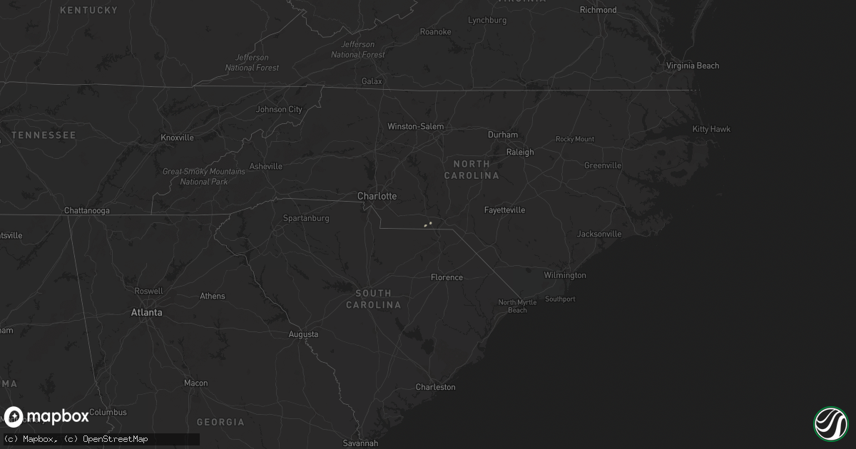
Hail Map on January 4, 2015
Get this storm
January 4 map
$229
one time, instant access
Download today. No call, no setup
Keep the $229
Bought the map and want the full workflow? Apply the entire $229 to a subscription within 7 days. None of it is wasted.
Every map, not just this one
This buys you this map. Subscription and you get every map we run, in the markets you choose from a few cities to whole states to nationwide. Plus real-time alerts the moment a storm fires.
Contact data
Name, contact info, occupancy, even credit band for addresses in the footprint. You go from where it hit to who to call.
Become the source they trust
Unlimited branding weather history reports on demand. You already have the documented answer ready for the property owner, and you are the one who showed up with it.
Property data and RoofTrace estimates
Pull up any address you have got, its value and the exact code rules for that jurisdiction, straight from One Click Code. Then RoofTrace estimates the squares, pitch, and roof value, priced the way you price.
States Impacted by Hail Map on January 4, 2015
Storm reports
South Carolina
| Date | Description |
|---|---|
| 01/04/20151:35 PM CST | Dispatch reported trees down in the camden up towards the bethune area. |
| 01/04/20151:17 PM CST | Electric company reports power outages in the dentsville and eastern ft jackson areas. |
North Carolina
| Date | Description |
|---|---|
| 01/04/20153:15 PM CST | One tree down on old raleigh road. |
| 01/04/20152:45 PM CST | Trees down in roadway near the intersection of hwy 42 and thanksgiving fire rd. |
| 01/04/20152:30 PM CST | Multiple trees down across road near the intersection of godwin road and old fairground rd. |
| 01/04/20151:57 PM CST | Multiple trees down in sanford one down on car |
Alabama
| Date | Description |
|---|---|
| 01/04/20157:52 AM CST | Tree down and pool enclosure ripped off on hwy 123n |
| 01/04/20157:34 AM CST | Tree and powelines down at county road 55 and county road 9. |
| 01/04/20157:10 AM CST | Trees down on county road 99. |
| 01/04/20156:30 AM CST | Damage to baseball fields at dale county high school. |
| 01/04/20156:30 AM CST | Trees down close to the fire department near pinckard. |
| 01/04/20156:28 AM CST | Damage to structures near county road 55 and county road 9. |
| 01/04/20156:28 AM CST | Damage to baseball fields at dale county high school. |
| 01/04/20156:28 AM CST | Damage to structures near county road 55 and county road 9. |
| 01/04/20156:28 AM CST | Tree down and pool enclosure ripped off on hwy 123n |
New Jersey
| Date | Description |
|---|---|
| 01/03/20158:21 PM CST | Traffic light knocked down on 29th street. Shingles blown off several roofs. |
| 01/03/20157:58 PM CST | Trees reported down in the millville area. |
Georgia
| Date | Description |
|---|---|
| 01/04/20152:12 PM CST | Numerous large limbs down. Time estimated by radar. |
| 01/04/20152:12 PM CST | Ham radio reports via port of savannah police that six containers blown over and a roof damaged at the ocean terminal. |
| 01/04/20152:10 PM CST | Power poles snapped at the base at cornell avenue and waters avenue. |
| 01/04/20152:08 PM CST | Chatham county emergency management reported two trees blown down and blocking traffic off of southern blvd and chatham parkway. Time estimated based on radar. |
| 01/04/20152:03 PM CST | Ef-1 tornado confirmed in parts of the savannah area. Tornado touched down in the stonebridge neighborhood and moved northeast. The tornado ripped shingles and vinyl si |
| 01/04/20152:03 PM CST | Trees down reported at fall avenue near gould elementary school. |
| 01/04/20152:01 PM CST | Broadcast media relayed a report of a tree blown down onto a house on salt creek road. Time was estimated from radar data. |
| 01/04/20151:59 PM CST | Chatham county emergency management reports 2 trees down and large limbs down on elk road in the silk hope area. Time estimated from radar. |
| 01/04/201512:05 PM CST | *** 2 inj *** possible tornado. Highway 32 east about 3 miles east of alma in the rockingham community. Mobile home destroyed...other structures damaged. Several trees |
| 01/04/201512:03 PM CST | *** 2 inj *** a national weather service storm survey determined that an ef1 tornado touched down 3 miles east southeast of alma. Two mobile homes were severely damaged |
| 01/04/201510:58 AM CST | Skywarn coordinator reported powerlines down and trees down and blocking the road near the intersection of log cabin road and antioch church road near eastman. |
| 01/04/201510:55 AM CST | A brief ef1 tornado touched down southwest of the intersection of log cabin road and antioch church road and traveled just 0.3 miles through the intersection. About 10 |
| 01/04/201510:48 AM CST | Ef1 tornado |
| 01/04/201510:45 AM CST | Roof of barn blown off on raleigh cobb rd. |
| 01/04/201510:44 AM CST | Another ef0 tornado touched down in eastern pulaski county on raliegh cobb rd and traveled east northeast for 2.2 miles. A tin covered barn with 4 inch loosely attached |
| 01/04/201510:40 AM CST | Damage to a church... Steeple blown off. |
| 01/04/201510:40 AM CST | Pine tree snapped along highway 82. |
| 01/04/201510:32 AM CST | A brief ef0 tornado touched down in far southern pulaski county at the 1600 block of pineview hwy. The tornado traveled just 0.2 miles. Approx 20 small and medium pine |
| 01/04/201510:28 AM CST | Ef1 tornado |
| 01/04/201510:28 AM CST | Several trees down on powell road. |
| 01/04/201510:05 AM CST | Powerline down on nw 3rd street. |
| 01/04/20159:56 AM CST | Several trees down at funston sale city rd and wilkes rd. |
| 01/04/20159:47 AM CST | Roof blown off a house and camper flipped over. |
| 01/04/20157:55 AM CST | Large tree uprooted near vilulah church near the randolph/clay county line. |
| 01/04/20157:39 AM CST | Tree down on highway 37 |