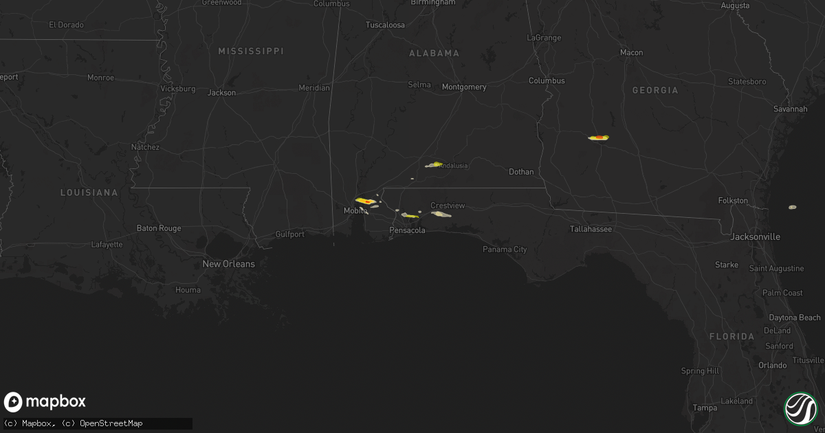
Hail Map on January 3, 2026
Get this storm
January 3 map
$229
one time, instant access
Download today. No call, no setup
Keep the $229
Bought the map and want the full workflow? Apply the entire $229 to a subscription within 7 days. None of it is wasted.
Every map, not just this one
This buys you this map. Subscription and you get every map we run, in the markets you choose from a few cities to whole states to nationwide. Plus real-time alerts the moment a storm fires.
Contact data
Name, contact info, occupancy, even credit band for addresses in the footprint. You go from where it hit to who to call.
Become the source they trust
Unlimited branding weather history reports on demand. You already have the documented answer ready for the property owner, and you are the one who showed up with it.
Property data and RoofTrace estimates
Pull up any address you have got, its value and the exact code rules for that jurisdiction, straight from One Click Code. Then RoofTrace estimates the squares, pitch, and roof value, priced the way you price.
Storm reports
California
| Date | Description |
|---|---|
| 01/03/20263:39 PM CST | Tree down on road blocking one lane oh highway 1 and rockport st. |
| 01/03/20262:39 PM CST | Roadway blocked by trees at garberville airport. |
| 01/03/20262:39 PM CST | Oak tree across road at branscomb road and ca-1. |
| 01/03/20261:50 PM CST | Trees blocking roadway in myers flat and ca 254. |
| 01/03/20261:48 PM CST | Trees down on power lines. |
Georgia
| Date | Description |
|---|---|
| 01/03/20263:55 PM CST | Golf ball size hail reported on graves springs road about 3 miles north of forrester pkwy. |
| 01/03/20263:37 PM CST | Reports of hail covering the ground up to 2 inches in diameter off lovers lane in lee county... Ga. |
Florida
| Date | Description |
|---|---|
| 01/03/20261:30 PM CST | A local report indicates 1.00 inch wind near 1 NNW Bagdad |
Alabama
| Date | Description |
|---|---|
| 01/03/20262:45 PM CST | Public reports quarter-sized hail in eastern conecuh county at around 2:45 pm cst. Location estimated via radar. |
| 01/03/20261:45 PM CST | Tree knocked down powerline. |
| 01/03/202612:18 PM CST | A local report indicates 1.75 inch wind near Whitehouse Forks |
| 01/03/202612:16 PM CST | Quarter sized hail near crossroads. |