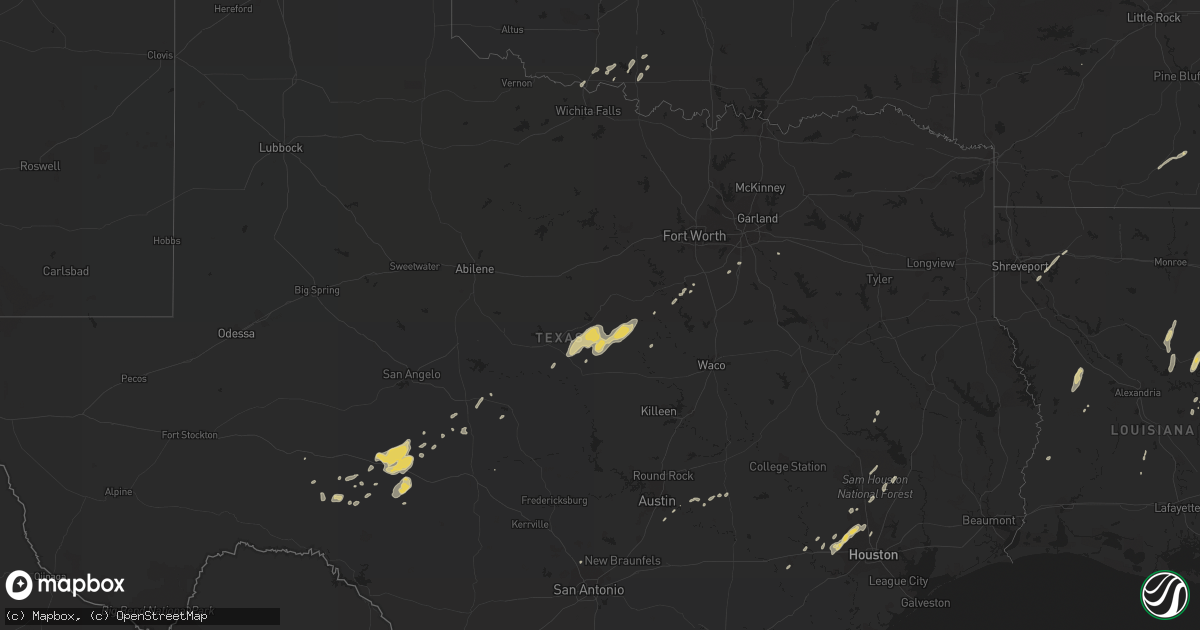
Hail Map on January 1, 2017
Get this storm
January 1 map
$229
one time, instant access
Download today. No call, no setup
Keep the $229
Bought the map and want the full workflow? Apply the entire $229 to a subscription within 7 days. None of it is wasted.
Every map, not just this one
This buys you this map. Subscription and you get every map we run, in the markets you choose from a few cities to whole states to nationwide. Plus real-time alerts the moment a storm fires.
Contact data
Name, contact info, occupancy, even credit band for addresses in the footprint. You go from where it hit to who to call.
Become the source they trust
Unlimited branding weather history reports on demand. You already have the documented answer ready for the property owner, and you are the one who showed up with it.
Property data and RoofTrace estimates
Pull up any address you have got, its value and the exact code rules for that jurisdiction, straight from One Click Code. Then RoofTrace estimates the squares, pitch, and roof value, priced the way you price.
States Impacted by Hail Map on January 1, 2017
Storm reports
New Mexico
| Date | Description |
|---|---|
| 12/31/20167:35 PM CST | Thunderstorm wind gust of 69mph reported at lea county regional airport |
| 12/31/20167:18 PM CST | Public reported powerlines blown down by thunderstorm winds and started a fire |
| 12/31/20166:40 PM CST | Public reported tree blown down on southeast side of carlsbad |
| 12/31/20166:17 PM CST | Thunderstorm wind gust of 60mph reported at carlsbad cavern city airport |
Texas
| Date | Description |
|---|---|
| 01/01/20175:52 PM CST | Thunderstorm wind gust of 58mph reported at the pinery raws |
| 01/01/20175:35 PM CST | Thunderstorm wind gust reported at guadalupe mountains national park mesonet site |
| 01/01/20175:58 AM CST | Delayed report - a small barn was blown across state hwy 75 near garland rd 5 miles sse of buffalo. |
| 01/01/20175:50 AM CST | Power poles blown down on highway 175 in seagoville. Estimated 65 mph wind gusts |
| 01/01/20175:45 AM CST | Roof blown off house. Numerous reports of straight-line winds across the county. Report relayed through navarro county oem. |
| 01/01/20175:45 AM CST | Roof blown off house. Numerous reports of straight-line winds across the county. |
| 01/01/20175:35 AM CST | Delayed report - the cottonwood community center's roof was blown off early this morning due to severe thunderstorm winds. Several trees along county roads were |
| 01/01/20175:35 AM CST | Twitter photo of a cell phone tower bent over in addison at beltline and midway. Time estimated based on radar data. |
| 01/01/20175:20 AM CST | Delayed report from social media---collapse of carport on sw side of corsicana. |
| 01/01/20175:15 AM CST | Trees blown down along mountain creek parkway and eagle ford. Estimated 60 mph. |
| 01/01/20174:50 AM CST | Delayed report - several reports of blown over trees in hillsboro due to high wind. |
| 01/01/20174:48 AM CST | Semi truck blown over by wind in grandview along interstate 35 and mm15. |
| 01/01/20174:32 AM CST | Delayed report - high winds blew the shingles off a house in waco. |
| 01/01/20174:31 AM CST | Measured 66 mph wind gust at waco airport |
| 01/01/20174:26 AM CST | Measured 64 mph wind gust in mcgregor |
| 01/01/20174:25 AM CST | Measured 64 mph wind gust in mcgregor |
| 01/01/20173:55 AM CST | Wind damage to heb grocery store sign. A few street lights were bent over at an intersection in gatesville. |
| 01/01/20173:29 AM CST | Measured 82 mph wind gust at hamilton municipal airport in hamilton |
| 12/31/20169:30 PM CST | Thunderstorm wind gust reported at lomax mesonet |
| 12/31/20169:30 PM CST | Multiple small rv trailers overturned and metal roof blown off of building. Winds estimated near 80mph. |
| 12/31/20168:50 PM CST | Powerlines down across some residential streets in brownfield. |
| 12/31/20167:55 PM CST | A local report indicates 64 MPH wind near 7 WNW DENVER CITY |
| 12/31/20167:50 PM CST | A local report indicates 58 MPH wind near 7 WNW DENVER CITY |
Louisiana
| Date | Description |
|---|---|
| 01/01/20173:00 AM CST | . |
Mississippi
| Date | Description |
|---|---|
| 01/01/20175:35 AM CST | A local report indicates 1.00 inch wind near TERRY |
| 01/01/20175:10 AM CST | Trees down with some across roads. |
Cities Impacted by Hail Map on January 1, 2017
- Sonora, TX
- Randlett, OK
- Olla, LA
- San Antonio, TX
- West, MS
- Gustine, TX
- Hamilton, TX
- Comanche, TX
- Doyline, LA
- Haughton, LA
- Lake Village, AR
- Utica, MS
- Terry, MS
- Port Gibson, MS
- Florence, MS
- Kelly, LA
- Jena, LA
- Trout, LA
- Eldorado, TX
- Wilmar, AR
- Provencal, LA
- Spring, TX
- Houston, TX
- Katy, TX
- Cypress, TX
- Melvin, TX
- Hico, TX
- Jonesville, LA
- Mullin, TX
- Zephyr, TX
- Dublin, TX
- Lincoln, TX
- Pottsville, TX
- Minden, LA
- Sibley, LA
- Vicksburg, MS
- Crystal Springs, MS
- Waurika, OK
- Devol, OK
- Burkburnett, TX
- Comanche, OK
- Conroe, TX
- Cleveland, TX
- Clifton, TX
- Jonesboro, TX
- Wilmot, AR
- Hermanville, MS
- Richland, MS
- Hazlehurst, MS
- Byram, MS
- Pearl, MS
- McDade, TX
- Paige, TX
- Lexington, TX
- Menard, TX
- Hermitage, AR
- Elm Grove, LA
- Moreauville, LA
- Marksville, LA
- Eunice, LA
- Jackson, MS
- Kopperl, TX
- Cleburne, TX
- Tallulah, LA
- Ozona, TX
- Carlton, TX
- Temple, OK
- Midlothian, TX
- Del Valle, TX
- Cedar Creek, TX
- Elgin, TX
- Rio Vista, TX
- Walnut Springs, TX
- Comstock, TX
- Sicily Island, LA
- Brookshire, TX
- Austin, TX
- Buda, TX
- Kaufman, TX
- Bastrop, TX
- Brady, TX
- Eden, TX
- Ferriday, LA
- Portland, AR
- Woodville, MS
- Leesville, LA
- Benton, MS
- Del Rio, TX
- Magnolia, TX
- Hockley, TX
- Shepherd, TX
- Satartia, MS
- Walters, OK
- New Waverly, TX
- Willis, TX
- Lovelady, TX
- Mer Rouge, LA
- Tomball, TX
- Waxahachie, TX
- Red Oak, TX
- Goldthwaite, TX
- Yazoo City, MS
- Sealy, TX
- Priddy, TX
- Rocksprings, TX
- Pickens, MS
- Ville Platte, LA
- Mamou, LA