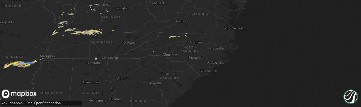
Hail Map in North Carolina on May 7, 2024
The weather event in North Carolina on May 7, 2024 includes Hail, Wind, and Tornado maps. 19 states and 876 cities were impacted and suffered possible damage. The total estimated number of properties impacted is 2,752.
Hail
Wind
Tornado
2,752
Estimated number of impacted properties by a 1.00" hail or larger0
Estimated number of impacted properties by a 1.75" hail or larger0
Estimated number of impacted properties by a 2.50" hail or largerStorm reports in North Carolina
North Carolina
| Date | Description |
|---|---|
| 05/07/20246:58 PM CDT | Tree downed by thunderstorm winds near the intersection of lakeview drive and fairway drive. |
| 05/07/20246:10 PM CDT | A business on denny road reported hail slightly larger than the size of a quarter. |
| 05/07/20246:06 PM CDT | Report of a couple trees blown down at scotts creek road near stevenson farm rd. Time estimated from radar. |
| 05/07/20245:59 PM CDT | Tree down blocking one lane of old winston road. |
| 05/07/20245:42 PM CDT | Tree down in the 290 block of siloam church road... North of the city of siloam. Time estimated from radar data. |
| 05/07/20245:37 PM CDT | Tree and power line down across both lanes of the roadway in the 6900 block of siloam road near siloam baptist church. |
| 05/07/20245:35 PM CDT | A local report indicates 1.75 inch wind near 1 SE Dobson |
| 05/07/20245:32 PM CDT | A local report indicates 1.75 inch wind near 2 ESE Fairview |
| 05/07/20245:11 PM CDT | Tree down in the 700 block of west mount herman church road... Northeast of elkin. Time estaimted from radar data. |
| 05/07/20244:56 PM CDT | A couple trees blown down on willie mcleod rd. Time estimated from radar. |
| 05/07/20244:40 PM CDT | One tree blown down by thunderstorm winds on u.s. Highway 421 south. |
| 05/07/20244:29 PM CDT | At least one tree blown down near n. Wilkesboro. |
| 05/07/20244:24 PM CDT | One tree blown down by thunderstorm winds north of moravian falls. |
| 05/07/20244:13 PM CDT | Large limbs down across yard. |
| 05/07/20244:11 PM CDT | A local report indicates 1.00 inch wind near 3 S Wentworth |
| 05/07/20244:08 PM CDT | A local report indicates 1.00 inch wind near 3 ESE Reidsville |
| 05/07/20243:54 PM CDT | Trees blown down on bethany church rd. Time estimated from radar. |
| 05/07/20243:48 PM CDT | Trees blown down on piney ridge rd. Time estimated from radar. |
| 05/07/20243:36 PM CDT | Trees blown down on clark rd. Time estimated from radar. |
| 05/07/20243:00 PM CDT | Tree down blocking both lanes at pat nixon road and adams ridge road. |
| 05/06/20247:37 PM CDT | Tree downed by thunderstorm winds near the intersection of rockingham lake road and competition court. |
All States Impacted by Hail Map on May 7, 2024
Cities Impacted by Hail Map on May 7, 2024
- Alma, AR
- Mulberry, AR
- Ozark, AR
- Melvin, TX
- Mount Washington, KY
- Prophetstown, IL
- Milledgeville, IL
- Polo, IL
- Sterling, IL
- Rock Falls, IL
- Lyndon, IL
- Dixon, IL
- Baileyville, IL
- Oregon, IL
- Mount Morris, IL
- Leaf River, IL
- Kinsman, IL
- Verona, IL
- Morris, IL
- Mazon, IL
- Winnebago, IL
- Byron, IL
- Channahon, IL
- Wilmington, IL
- Coal City, IL
- Minooka, IL
- Joliet, IL
- Rockford, IL
- Elwood, IL
- Shorewood, IL
- Forreston, IL
- Alsip, IL
- Homer Glen, IL
- Franklin Grove, IL
- Machesney Park, IL
- Roscoe, IL
- Loves Park, IL
- Clinton, WI
- Plainfield, IL
- Chicago, IL
- New Lenox, IL
- Manhattan, IL
- Mokena, IL
- Lockport, IL
- Evergreen Park, IL
- Orland Park, IL
- Lemont, IL
- Waukesha, WI
- Wales, WI
- Delafield, WI
- Oak Lawn, IL
- Caledonia, IL
- South Beloit, IL
- Poplar Grove, IL
- Tinley Park, IL
- Belvidere, IL
- Garden Prairie, IL
- Janesville, WI
- Romeoville, IL
- Beloit, WI
- Dousman, WI
- Capron, IL
- Harvard, IL
- Crest Hill, IL
- Morehead, KY
- Oak Forest, IL
- Palos Heights, IL
- Palos Park, IL
- Frankfort, IL
- Crestwood, IL
- Midlothian, IL
- Whitewater, WI
- Avalon, WI
- Delavan, WI
- Sharon, WI
- Darien, WI
- Pewaukee, WI
- Palos Hills, IL
- Worth, IL
- Chicago Ridge, IL
- Robbins, IL
- Blue Island, IL
- Riverdale, IL
- Verona, WI
- Owingsville, KY
- Salt Lick, KY
- Hickory Hills, IL
- Lyons, IL
- La Grange, IL
- Brookfield, IL
- Sussex, WI
- Hartland, WI
- Belleville, WI
- Walworth, WI
- Mount Horeb, WI
- Bridgeview, IL
- Willow Springs, IL
- Marengo, IL
- Cross Plains, WI
- Williams Bay, WI
- Cedar Lake, IN
- Elkhorn, WI
- Lake Geneva, WI
- Fontana, WI
- Hometown, IL
- La Grange Park, IL
- Burbank, IL
- Hobart, IN
- Portage, IN
- Merrillville, IN
- Menomonee Falls, WI
- Colgate, WI
- Valparaiso, IN
- Germantown, WI
- Richfield, WI
- Chesterton, IN
- Eagle, WI
- Martinsville, IL
- Panther, WV
- Casey, IL
- Burlington, WI
- Crown Point, IN
- Mohawk, WV
- Marshall, IL
- East Troy, WI
- Rochester, WI
- Waterford, WI
- Springfield, WI
- Hebron, IL
- Beverly Shores, IN
- Michigan City, IN
- Markham, IL
- Westville, IN
- Mukwonago, WI
- Mchenry, IL
- Iaeger, WV
- Ringwood, IL
- Spring Grove, IL
- Dennison, IL
- West Terre Haute, IN
- Franklin, WI
- Ingleside, IL
- Fox Lake, IL
- New Buffalo, MI
- Trevor, WI
- Salem, WI
- Round Lake, IL
- Antioch, IL
- Lake Villa, IL
- Franksville, WI
- Muskego, WI
- Oak Creek, WI
- Caledonia, WI
- Terre Haute, IN
- Union Pier, MI
- Dobson, NC
- Racine, WI
- South Milwaukee, WI
- Cudahy, WI
- Lakeside, MI
- Jesup, IA
- Clinton, IN
- La Porte, IN
- Bridgman, MI
- Baroda, MI
- Buchanan, MI
- Sawyer, MI
- Kenosha, WI
- Rutherfordton, NC
- Bristol, WI
- Gary, IN
- Sturtevant, WI
- Three Oaks, MI
- Downers Grove, IL
- Lisle, IL
- Woodridge, IL
- Union Grove, WI
- Berrien Springs, MI
- Brazil, IN
- Independence, IA
- Homewood, IL
- Country Club Hills, IL
- Harvey, IL
- Matteson, IL
- Hazel Crest, IL
- Flossmoor, IL
- New Troy, MI
- Staunton, IN
- Turtle Lake, WI
- Almena, WI
- Hillsdale, IN
- Darlington, IN
- Berrien Center, MI
- Eau Claire, MI
- Charleston, IL
- Reidsville, NC
- Harmony, IN
- Reelsville, IN
- Sodus, MI
- White Pigeon, MI
- Constantine, MI
- Dowagiac, MI
- Westfield, IL
- South Holland, IL
- Clarks Hill, IN
- Colfax, IN
- Frankfort, IN
- Dolton, IL
- Cumberland, WI
- Comstock, WI
- Calumet City, IL
- Knightsville, IN
- Saint Joseph, MI
- Benton Harbor, MI
- Union, MI
- Edwardsburg, MI
- Winthrop, IA
- Ferguson, NC
- Crawfordsville, IN
- Greencastle, IN
- Jones, MI
- Millers Creek, NC
- Wilkesboro, NC
- Decatur, MI
- Hartford, MI
- Lenoir, NC
- Boomer, NC
- Colfax, WI
- Wheeler, WI
- New Berlin, WI
- Michigantown, IN
- Vandalia, MI
- Cassopolis, MI
- Cloverdale, IN
- Osseo, WI
- Three Rivers, MI
- Mendon, MI
- Fillmore, IN
- North Wilkesboro, NC
- Hebron, IN
- Taylorsville, NC
- Highland, IN
- Hammond, IN
- Griffith, IN
- Masonville, IA
- Centreville, MI
- Tipton, IN
- Kempton, IN
- Forest, IN
- Paris, IL
- Carbon, IN
- Rosedale, IN
- Paw Paw, MI
- Lawton, MI
- Lake Station, IN
- Jamestown, IN
- Russiaville, IN
- Leonidas, MI
- Fulton, MI
- Putnamville, IN
- Coatesville, IN
- Colon, MI
- Athens, MI
- Sherwood, MI
- Union City, MI
- Kalamazoo, MI
- Jacksonville, NC
- Dundee, IA
- Whitestown, IN
- Lebanon, IN
- Mattawan, MI
- Calmar, IA
- Peru, IN
- Manchester, IA
- Stilesville, IN
- Sharpsville, IN
- Burlington, MI
- Portage, MI
- Tekonsha, MI
- North Manchester, IN
- Laketon, IN
- Camp Lejeune, NC
- Roann, IN
- Wabash, IN
- Denver, IN
- Westfield, IN
- Sheridan, IN
- Decorah, IA
- Tomah, WI
- Warrens, WI
- West Union, IL
- Harbert, MI
- Windfall, IN
- Greentown, IN
- Farmersburg, IN
- Shelburn, IN
- Elkin, NC
- Angola, IN
- Coldwater, MI
- Greenwood, IN
- Indianapolis, IN
- Mooresville, IN
- Ceresco, MI
- East Leroy, MI
- Liberty Mills, IN
- Claypool, IN
- South Whitley, IN
- State Road, NC
- Climax, MI
- Scotts, MI
- Galesburg, MI
- Marshall, MI
- Vicksburg, MI
- Pimento, IN
- Lewis, IN
- Martinsville, IN
- Stevensville, MI
- West Newton, IN
- Camby, IN
- Columbia City, IN
- Pierceton, IN
- Larwill, IN
- Jonesboro, IN
- Fairmount, IN
- Fairbanks, IN
- Whitehall, MI
- Montague, MI
- Battle Creek, MI
- Urbana, IN
- Lagro, IN
- Greeley, IA
- Edgewood, IA
- Churubusco, IN
- Albion, IN
- Huntington, IN
- Morgantown, IN
- Clay City, IN
- Trafalgar, IN
- Homer, MI
- Earlville, IA
- Dyersville, IA
- New Vienna, IA
- Poland, IN
- Cassville, WI
- Monrovia, IN
- Marion, IN
- Gas City, IN
- Upland, IN
- Avilla, IN
- Kendallville, IN
- Corunna, IN
- Waterloo, IN
- Hudson, IN
- Ashley, IN
- Siloam, NC
- Pinnacle, NC
- Watervliet, MI
- Laotto, IN
- Garrett, IN
- Albion, MI
- Franklin, IN
- Bargersville, IN
- Quincy, IN
- Beech Grove, IN
- Clayton, IN
- Cory, IN
- Coal City, IN
- Bowling Green, IN
- Durango, IA
- Dubuque, IA
- Peosta, IA
- Patricksburg, IN
- Plainfield, IN
- Shelbyville, IN
- Edinburgh, IN
- King, NC
- Pilot Mountain, NC
- Ronda, NC
- Silver Lake, IN
- Linden, WI
- Livingston, WI
- Montfort, WI
- Avon, IN
- Cascade, VA
- Axton, VA
- Danville, VA
- Brooklyn, IN
- Rice Lake, WI
- Stony Point, NC
- Ellettsville, IN
- Bloomington, IN
- Gosport, IN
- Sherrill, IA
- Spencer, IN
- Greenfield, IN
- Auburn, IN
- Dodgeville, WI
- Pleasant Lake, IN
- Hamilton, IN
- Wisconsin Dells, WI
- Guttenberg, IA
- Holy Cross, IA
- Manilla, IN
- Waldron, IN
- Germanton, NC
- Walnut Cove, NC
- New Market, AL
- Muncie, IN
- Montgomery, MI
- Fremont, IN
- Hazel Green, AL
- Warsaw, IN
- Whiteland, IN
- Milroy, IN
- Saint Paul, IN
- Schoolcraft, MI
- Cuba City, WI
- Oxford, WI
- Reading, MI
- Camden, MI
- Eden, NC
- Ararat, NC
- Boonville, NC
- Elora, TN
- Hillsdale, MI
- Needham, IN
- Homer, IN
- Boggstown, IN
- Fairland, IN
- Rushville, IN
- Richland, MI
- Augusta, MI
- Flintville, TN
- Edon, OH
- Osseo, MI
- North Adams, MI
- Jerome, MI
- Saint Meinrad, IN
- Ferdinand, IN
- Bristow, IN
- Evanston, IN
- Winchester, IN
- Farmland, IN
- Ruffin, NC
- Glenwood, IN
- Birdseye, IN
- Connersville, IN
- Wolcottville, IN
- Union City, IN
- Camp Douglas, WI
- Stockton, IL
- Laurel, IN
- Black River Falls, WI
- Rome City, IN
- Topeka, IN
- Nineveh, IN
- Greensburg, IN
- Coldwater, OH
- Fort Recovery, OH
- Dry Fork, VA
- Monroeville, IN
- Payne, OH
- Deforest, WI
- Waunakee, WI
- Madison, WI
- Lena, IL
- Lagrange, IN
- Flat Rock, IN
- Union City, OH
- Wawaka, IN
- Latty, OH
- Paulding, OH
- Haviland, OH
- Oakwood, OH
- Melrose, OH
- New Bremen, OH
- Saint Marys, OH
- New Knoxville, OH
- Wapakoneta, OH
- Sun Prairie, WI
- Windsor, WI
- Bronson, MI
- English, IN
- Stinesville, IN
- Metamora, IN
- Liberty, IN
- New Palestine, IN
- Westport, IN
- Fort Atkinson, WI
- Jefferson, WI
- Brookville, IN
- Milton, WI
- Edgerton, WI
- Oldenburg, IN
- Louisville, IL
- Cambridge, WI
- Depauw, IN
- Milltown, IN
- Leavenworth, IN
- Unionville, IN
- Columbus, IN
- Rio, WI
- Osgood, IN
- Sulphur, IN
- Johnson Creek, WI
- Helenville, WI
- Watertown, WI
- Sullivan, WI
- Deerfield, WI
- Columbus, WI
- Marshall, WI
- Waterloo, WI
- Ramsey, IN
- Oxford, OH
- Bath, IN
- Cedar Grove, IN
- Ingraham, IL
- Noble, IL
- Clay City, IL
- Palmyra, WI
- West Harrison, IN
- Okeana, OH
- Pittsford, MI
- Sunman, IN
- Batesville, IN
- Lake Mills, WI
- Waldron, MI
- North Prairie, WI
- Reeseville, WI
- Adams, WI
- Menlo, GA
- Concord, MI
- Hanover, MI
- Hope, IN
- Newton, IL
- Corydon, IN
- Big Bend, WI
- Hamilton, OH
- Trion, GA
- Summerville, GA
- Sainte Marie, IL
- Willow Hill, IL
- Oblong, IL
- Robinson, IL
- West Liberty, IL
- La Fayette, GA
- Milwaukee, WI
- Hutsonville, IL
- Sullivan, IN
- Stoy, IL
- West York, IL
- Guilford, IN
- Lawrenceburg, IN
- Elm Grove, WI
- Brookfield, WI
- Middletown, OH
- Fairfield, OH
- West Chester, OH
- Cable, OH
- Urbana, OH
- Trenton, OH
- Morrow, OH
- Lebanon, OH
- Oregonia, OH
- Cedarburg, WI
- Grafton, WI
- Greendale, WI
- Hales Corners, WI
- Cincinnati, OH
- Monroe, OH
- Woodstock, OH
- Mechanicsburg, OH
- Holton, IN
- Harrison, OH
- Kansasville, WI
- Cleves, OH
- South Lebanon, OH
- Clarksville, OH
- Roaring River, NC
- Loveland, OH
- Maineville, OH
- Butlerville, IN
- Mason, OH
- Jasonville, IN
- Ikes Fork, WV
- Lawrenceville, IL
- Irwin, OH
- Milford Center, OH
- Plain City, OH
- Marysville, OH
- Freedom, IN
- Worthington, IN
- Milan, IN
- Saukville, WI
- West Bend, WI
- Paragon, IN
- Riley, IN
- Centerpoint, IN
- Goshen, OH
- Clifford, IN
- Milford, OH
- Pleasant Plain, OH
- Solsberry, IN
- Bloomfield, IN
- Hartsville, IN
- Aurora, IN
- Moores Hill, IN
- Midland, OH
- Blanchester, OH
- Springville, IN
- Lynchburg, OH
- Martinsville, OH
- Jackson, MO
- Batavia, OH
- Fayetteville, OH
- Miamiville, OH
- Nashville, IN
- Makanda, IL
- Hillsboro, OH
- Amelia, OH
- Goreville, IL
- Marion, IL
- New Vienna, OH
- Williamsburg, OH
- Mount Orab, OH
- Bedford, IN
- Carbondale, IL
- Heltonville, IN
- Bridgeport, IL
- Norman, IN
- Creal Springs, IL
- Greenfield, OH
- Bainbridge, OH
- Seymour, IN
- Brownstown, IN
- Freetown, IN
- Pittsburg, IL
- Norris City, IL
- Waverly, OH
- Peebles, OH
- Stonefort, IL
- Carrier Mills, IL
- Mount Vernon, IN
- Chillicothe, OH
- Thompsonville, IL
- New Burnside, IL
- Harrisburg, IL
- Galatia, IL
- Junction, IL
- Equality, IL
- Ozark, IL
- Cairo, IL
- Hammondsville, OH
- Irondale, OH
- New Cumberland, WV
- Toronto, OH
- Chester, WV
- Georgetown, PA
- Weiner, AR
- Shawneetown, IL
- Wellsville, OH
- Eddyville, IL
- Amagon, AR
- Newport, AR
- Herod, IL
- Royal, AR
- Williamsville, MO
- Bonnerdale, AR
- Mound City, IL
- Beaver, PA
- Beaver Falls, PA
- McClure, IL
- Jonesboro, IL
- Jonesboro, AR
- Wappapello, MO
- Greenville, MO
- New Brighton, PA
- Mountain Pine, AR
- Hot Springs National Park, AR
- Sturgis, KY
- Anna, IL
- Pearcy, AR
- Buncombe, IL
- Morganfield, KY
- Advance, MO
- Mounds, IL
- Lewisport, KY
- Russellville, OH
- McGee, MO
- Barlow, KY
- La Center, KY
- Kevil, KY
- Tell City, IN
- Oran, MO
- Metropolis, IL
- Grand Chain, IL
- Stout, OH
- Bismarck, AR
- Hot Springs Village, AR
- Lonsdale, AR
- Burna, KY
- Olmsted, IL
- Golconda, IL
- Villa Ridge, IL
- Angola, NY
- Cannelton, IN
- Benton, AR
- Eden, NY
- Salem, KY
- Marion, KY
- Derby, NY
- Hamburg, NY
- Rome, IN
- Stephensport, KY
- Union Star, KY
- Hardinsburg, KY
- Elizabeth, IN
- Webster, KY
- Alexander, AR
- Penfield, NY
- Fairport, NY
- Macedon, NY
- Paron, AR
- Bryant, AR
- Little Rock, AR
- North Little Rock, AR
- Scott, AR
- Bardstown, KY
- Mabelvale, AR
- Clermont, KY
- Shepherdsville, KY
- Coxs Creek, KY
- Bauxite, AR
- Sherwood, AR
- Brookport, IL
- Cecilia, KY
- Elizabethtown, KY
- Boston, KY
- England, AR
- Rineyville, KY
- Hensley, AR
- Lexington, KY
- Lonoke, AR
- Keo, AR
- Bardwell, KY
- Wickliffe, KY
- Charleston, MO
- Orbisonia, PA
- Shade Gap, PA
- Carlisle, AR
- Humnoke, AR
- Blairs Mills, PA
- Cunningham, KY
- Redfield, AR
- Stuttgart, AR
- Hazen, AR
- Puryear, TN
- Hazel, KY
- Buchanan, TN
- West Paducah, KY
- Sheridan, AR
- Tucker, AR
- Ulm, AR
- New Concord, KY
- Murray, KY
- Cub Run, KY
- Munfordville, KY
- Bonnieville, KY
- Sonora, KY
- Upton, KY
- Magnolia, KY
- Hardin, KY
- Benton, KY
- Kirksey, KY
- Wabbaseka, AR
- Roe, AR
- De Valls Bluff, AR
- Humphrey, AR
- Dover, TN
- Mayfield, KY
- Paducah, KY
- Clarendon, AR
- Brinkley, AR
- Holly Grove, AR
- Almo, KY
- Hodgenville, KY
- Webster Springs, WV
- Big Rock, TN
- Indian Mound, TN
- Dexter, KY
- Cadiz, KY
- Bumpus Mills, TN
- Clarksville, TN
- Trenton, KY
- Woodlawn, TN
- Fort Campbell, KY
- La Fayette, KY
- Allensville, KY
- Guthrie, KY
- Herndon, KY
- Martin, TN
- Fountain Run, KY
- Scottsville, KY
- Oak Grove, KY
- Moro, AR
- Marianna, AR
- Dresden, TN
- Olmstead, KY
- Adairville, KY
- Aubrey, AR
- Russellville, KY
- Wingo, KY
- Adams, TN
- Cedar Hill, TN
- Springfield, TN
- Elkton, KY
- Franklin, KY
- Lebanon Junction, KY
- Greenbrier, TN
- Portageville, MO
- Orlinda, TN
- Cross Plains, TN
- Portland, TN
- Greeley, KS
- Parker, KS
- Lane, KS
- Garnett, KS
- Palmersville, TN
- Farmington, KY
- Paola, KS
- La Cygne, KS
- White House, TN
- Adolphus, KY
- Westmoreland, TN
- Osawatomie, KS
- Bethpage, TN
- Fontana, KS
- Hughes, AR
- Gallatin, TN
- Tiptonville, TN
- New Madrid, MO
- Louisburg, KS
- Drexel, MO
- Adrian, MO
- Amsterdam, MO
- Lilbourn, MO
- Marston, MO
- Hickman, KY
- Hendersonville, TN
- Cottontown, TN
- Sedalia, KY
- Burkesville, KY
- Lafayette, TN
- Albany, KY
- Scalf, KY
- Flat Lick, KY
- Walker, KY
- Harrisonville, MO
- Archie, MO
- Union City, TN
- Troy, TN
- Hornbeak, TN
- Manchester, KY
- Olathe, KS
- Garden City, MO
- Freeman, MO
- Overland Park, KS
- Hartsville, TN
- Ashland City, TN
- Gardner, KS
- Edgerton, KS
- Spring Hill, KS
- Elkhart, IN
- Borden, IN
- Memphis, IN
- Sellersburg, IN


