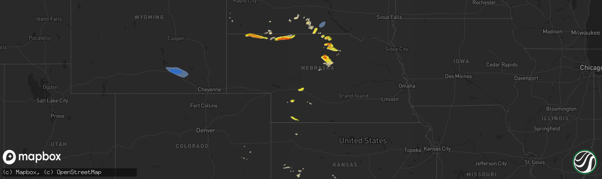
Hail Map on May 14, 2024
The weather event on May 14, 2024 includes Wind, Hail, and Tornado maps. 17 states and 206 cities were impacted and suffered possible damage. The total estimated number of properties impacted is 13,791.
Wind
Hail
Tornado
13,791
Estimated number of impacted properties by a 1.00" hail or larger155
Estimated number of impacted properties by a 1.75" hail or larger0
Estimated number of impacted properties by a 2.50" hail or largerStates Impacted by Hail Map on May 14, 2024
Storm reports
Indiana
| Date | Description |
|---|---|
| 05/14/20245:13 PM CDT | Several large tree limbs down at sharon road and kenwood drive. Time estimated from radar. |
| 05/13/20248:48 PM CDT | 2.93 inches cumulative rainfall from trained spotter on the southeast side of evansville produced local street and yard flooding. |
Mississippi
| Date | Description |
|---|---|
| 05/14/20244:10 PM CDT | A local report indicates 1.00 inch wind near 1 NNW Belmont |
| 05/14/20242:20 PM CDT | A local report indicates 1.00 inch wind near 6 WSW Abbeville |
| 05/14/20242:13 PM CDT | A local report indicates 1.00 inch wind near 7 ENE Walnut |
| 05/14/20242:10 PM CDT | A local report indicates 1.00 inch wind near 1 NNW Ripley |
South Carolina
| Date | Description |
|---|---|
| 05/14/20245:00 PM CDT | Windows blown out... Roofs collapsed and multiple trees down along and near main st by possible tornado. Time estimated by radar. |
| 05/14/20243:40 PM CDT | Long path of trees downed and snapped. Possible tornado. |
Florida
| Date | Description |
|---|---|
| 05/14/202410:40 AM CDT | Mesonet station 1829w fswn tampa international airport. |
| 05/14/202410:30 AM CDT | A mesonet site in palm harbor reported 64 mph wind gust. |
| 05/14/202410:20 AM CDT | Largo fire department and pinellas emergency management reported 15 buildings damaged... Of which 7 were uninhabitable... At pointe west mobile home park. Time estimate |
| 05/14/202410:15 AM CDT | A mesonet site reported 60 mph wind gust. |
| 05/14/20242:42 AM CDT | Power outage reported for south flagler beach. |
| 05/14/20241:52 AM CDT | Power outage mondex about 10 miles west of bunnell. |
Kentucky
| Date | Description |
|---|---|
| 05/14/20246:02 PM CDT | Delayed report. Several trees down near berea church road. |
| 05/14/20243:44 PM CDT | Quarter sized hail south of princeton. |
Alabama
| Date | Description |
|---|---|
| 05/14/20246:23 PM CDT | Social media photos of quarter size hail near haleyville. Location approximate. |
| 05/14/20246:20 PM CDT | Tree down on home. |
Tennessee
| Date | Description |
|---|---|
| 05/14/20245:37 PM CDT | Trees down on normandy road in normandy and along highway 269 south of normandy. |
| 05/14/20245:37 PM CDT | Trees down on normandy road in normandy and along highway 269 south |
| 05/14/20245:36 PM CDT | Tree down on cascade hollow road. |
| 05/14/20245:35 PM CDT | Tree down on hwy 269. |
| 05/14/20245:27 PM CDT | Report of a tree down across flat creek hwy from moore county ema. |
| 05/14/20245:25 PM CDT | Report from broadcast media of a tree down on tanyard hill rd in moore county... Tn. |
| 05/14/20245:23 PM CDT | A downed power line was reported by moore county ema at the intersection of shelbyville hwy and charity rd. |
| 05/14/20245:00 PM CDT | Tree down on snake creek road. |
| 05/14/20245:00 PM CDT | Tree down on webb road. |
| 05/14/20244:56 PM CDT | Tree on hwy. |
| 05/14/20244:20 PM CDT | House with roof damage. |
| 05/14/20244:19 PM CDT | Large tree uprooted on east edan road near ethridge. |
| 05/14/20244:19 PM CDT | Multiple large uprooted trees on jap lane. |
| 05/14/20244:14 PM CDT | Reports of multiple barns destroyed on east edan road... Northeast of ethridge. |
| 05/14/20244:09 PM CDT | Large tree blocking north bound lane of tn 242. 2535 buffalo road. |
| 05/14/20243:47 PM CDT | Report from mping: quarter |
| 05/14/20242:55 PM CDT | Quarter size hail in crump. |
North Carolina
| Date | Description |
|---|---|
| 05/14/20246:49 PM CDT | County em reported 4 houses damaged on red store rd near old lumberton rd from a possible tornado. Time estimated by radar. |
| 05/14/20245:57 PM CDT | Tree reported down and blocking carl freeman rd. Near the intersection of nc hwy 210. Time estimated by radar. |
| 05/14/20245:05 PM CDT | Roof damage and trees down from possible tornado. Time estimated from radar. |
| 05/14/20244:02 PM CDT | Duke energy outage caused by fallen trees or limbs damaging equipment. |
| 05/14/20244:01 PM CDT | Two trees down on longleaf dr. East. Time estimated from radar. |
| 05/13/20247:12 PM CDT | Tree down near the intersection of cabin museum rd. And old warsaw rd. |
Colorado
| Date | Description |
|---|---|
| 05/14/20244:55 PM CDT | [landspout] delayed report relayed via nws pub. Brief landspouts reported. Original reporter could not tell if they occurred in kiowa or cheyenne county. Landspouts we |
| 05/14/20244:37 PM CDT | [landspout] report and photo via social media. Photo was taken from the co/ks stateline and co rd 57... Looking south approx. 1 mile. |
Georgia
| Date | Description |
|---|---|
| 05/14/20248:40 AM CDT | Tree down at intersection of old tusculum rd and standard lane. |
| 05/14/20248:23 AM CDT | Lightning strike on commercial building. |
| 05/14/20248:21 AM CDT | Power line down at 411 whitaker st. |
| 05/14/20248:21 AM CDT | Tree down blocking access to a church. |
| 05/14/20248:20 AM CDT | Tree down on roadway. |
| 05/14/20248:19 AM CDT | Tree down blocking roadway. |
| 05/14/20248:15 AM CDT | Tree down on powerline. |
Wyoming
| Date | Description |
|---|---|
| 05/13/20248:02 PM CDT | From wy18 halleck ridge wind sensor. |
South Dakota
| Date | Description |
|---|---|
| 05/13/20247:35 PM CDT | A local report indicates 58 MPH wind near 4 NNE Colome |
Nebraska
| Date | Description |
|---|---|
| 05/14/20245:50 PM CDT | Report and photo via social media of half dollar size hail. Time estimated from radar. |
| 05/14/20245:49 PM CDT | Report and photo of 1 inch hail in trenton. |
| 05/14/20245:45 PM CDT | Report and photo via social media of 1 inch hail 1 mile west of trenton... Between 445-450 pm mdt. |
| 05/14/20245:37 PM CDT | Spotter reports hail started as pea size... Becoming nickel to quarter size. |
| 05/14/20245:37 PM CDT | Corrects previous hail report from 3 w trenton. Spotter reports hail started as pea size... Becoming nickel to quarter size. Hail lasted approx. 10-15 minutes. |
| 05/14/20245:25 PM CDT | Delayed report via social media. Time estimated via radar. |
| 05/14/20245:17 PM CDT | Public report of golf ball sized hail time estimated from radar. |
| 05/14/20245:15 PM CDT | Report and photo via social media of 1 inch hail. |
| 05/14/20245:05 PM CDT | Ground is white with hail... Largest stone approx. Quarter sized. |
| 05/14/20245:05 PM CDT | A local report indicates 1.25 inch wind near 6 S Eli |
| 05/14/20244:48 PM CDT | Spotter reported a few quarter sized hail stones. Time estimate from radar. |
| 05/14/20244:17 PM CDT | Public report of accumulating hail... With quarter sized being the largest. |
| 05/13/20249:23 PM CDT | Mostly nickel sized hail with quarters mixed in at the nws office. |
| 05/13/20249:21 PM CDT | A local report indicates 1.00 inch wind near 1 SE North Platte |
| 05/13/20249:17 PM CDT | Time estimated from radar. |
| 05/13/20249:13 PM CDT | Report from mping: quarter |
| 05/13/20248:40 PM CDT | Report via slack chat. Time estimated from radar. |
| 05/13/20248:19 PM CDT | Nickel to quarter sized hail... Heavy rain creating ponding and runoff on driveway. |
| 05/13/20248:15 PM CDT | Public report of quarter sized hail and smaller. Time estimated from radar. |
| 05/13/20248:05 PM CDT | Fire department reported hail ranging from quarter to golf ball sized. |
Cities Impacted by Hail Map on May 14, 2024
- Lake Panasoffkee, FL
- Wildwood, FL
- Palm Harbor, FL
- Crystal Beach, FL
- Tarpon Springs, FL
- Dade City, FL
- Tampa, FL
- Deland, FL
- Edgewater, FL
- Coldwater, MS
- Holly Springs, MS
- Lamar, MS
- Byhalia, MS
- Senatobia, MS
- Michigan City, MS
- Ashland, MS
- Stantonville, TN
- Adamsville, TN
- Hickory Flat, MS
- Blue Mountain, MS
- Ripley, MS
- Falkner, MS
- Middleton, TN
- Batesville, MS
- Sardis, MS
- Oxford, MS
- Walnut, MS
- Como, MS
- Pocahontas, TN
- Savannah, TN
- Crump, TN
- Tiplersville, MS
- Ramer, TN
- Corinth, MS
- Olivehill, TN
- Booneville, MS
- Michie, TN
- Shiloh, TN
- Myrtle, MS
- Dumas, MS
- Edgemont, SD
- Guys, TN
- Selmer, TN
- Clifton, TN
- Waynesboro, TN
- New Albany, MS
- Counce, TN
- Guntown, MS
- Baldwyn, MS
- Eddyville, KY
- Kuttawa, KY
- Blue Springs, MS
- Princeton, KY
- Hohenwald, TN
- Chadron, NE
- Dover, TN
- Marietta, MS
- New Site, MS
- Saltillo, MS
- Santa Fe, TN
- Williamsport, TN
- Primm Springs, TN
- Bumpus Mills, TN
- Stonefort, IL
- Ozark, IL
- Murray, KY
- Norris, SD
- Springville, TN
- Buchanan, TN
- Iron City, TN
- Tishomingo, MS
- Cadiz, KY
- Dennis, MS
- Hay Springs, NE
- Rushville, NE
- Hampshire, TN
- Duck River, TN
- Batesland, SD
- Franklin, TN
- Belmont, MS
- Big Rock, TN
- Herndon, KY
- Wanblee, SD
- Killen, AL
- Martin, SD
- La Fayette, KY
- Fort Campbell, KY
- Hopkinsville, KY
- Merriman, NE
- Milan, TN
- Eddyville, IL
- Ethridge, TN
- Henry, TN
- Paris, TN
- White River, SD
- Olmsted, IL
- Pembroke, KY
- La Center, KY
- Golden, MS
- Villa Ridge, IL
- Oak Grove, KY
- Peru, NY
- Cody, NE
- Bowling Green, KY
- Gordon, NE
- Karval, CO
- Stratton, NE
- Shelbyville, TN
- Nenzel, NE
- Kilgore, NE
- Trenton, NE
- Moorefield, NE
- Tullahoma, TN
- Estill Springs, TN
- Wood, SD
- Flintville, TN
- Hazel Green, AL
- Culbertson, NE
- Manchester, TN
- Farnam, NE
- Jackson, TN
- Mission, SD
- Okreek, SD
- Phil Campbell, AL
- Bear Creek, AL
- Haleyville, AL
- Owens Cross Roads, AL
- Huntsville, AL
- Brownsboro, AL
- Gurley, AL
- Winner, SD
- San Angelo, TX
- Taylor, NE
- Paint Rock, AL
- Springview, NE
- Clarkton, NC
- Atwood, KS
- Melbourne, FL
- Mills, NE
- Palm City, FL
- Merritt Island, FL
- Satellite Beach, FL
- Patrick Afb, FL
- Indialantic, FL
- Bassett, NE
- Wallace, NE
- Dickens, NE
- Newport, NE
- Stuart, NE
- Hanna, WY
- Long Pine, NE
- Burwell, NE
- Elk Mountain, WY
- Rock River, WY
- Bosler, WY
- Atkinson, NE
- Centerville, TN
- Evansville, IN
- Newburgh, IN
- Chandler, IN
- Lawrenceburg, TN
- Reed, KY
- Owensboro, KY
- Henderson, KY
- Colome, SD
- Dallas, SD
- Townley, AL
- Carbon Hill, AL
- Leoti, KS
- Dunning, NE
- North Platte, NE
- Brewster, NE
- Marienthal, KS
- Maxwell, NE
- Healy, KS
- Madison, GA
- Buckhead, GA
- Greensboro, GA
- Union Point, GA
- Garden City, KS
- Scott City, KS
- Crawfordville, GA
- Washington, GA
- Larned, KS
- Garfield, KS
- Pomona Park, FL
- Crescent City, FL
- Silver Springs, FL
- Bunnell, FL
- Oak Hill, FL
- Leesville, SC
- Batesburg, SC
- Gilbert, SC
- Lexington, SC
- Laredo, TX
- Realitos, TX
- Eustis, FL
- Umatilla, FL
- Paisley, FL
- Deltona, FL
- Lake Helen, FL
- New Smyrna Beach, FL
- Osteen, FL
- Red Bay, AL
- Rienzi, MS
- Potts Camp, MS