Hail Map in Lubbock, TX on May 1, 2024
The weather event in Lubbock, TX on May 1, 2024 includes Wind, Hail, and Tornado maps. 12 states and 454 cities were impacted and suffered possible damage. The total estimated number of properties impacted is 26,688.
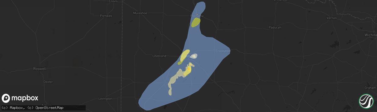
Wind
Hail
Tornado
26,688
Estimated number of impacted properties by a 1.00" hail or larger0
Estimated number of impacted properties by a 1.75" hail or larger0
Estimated number of impacted properties by a 2.50" hail or largerStorm reports in Lubbock, TX
Lubbock, TX
| Date | Description |
|---|---|
| 05/01/20246:58 PM CDT | Minor hail dents on automobile exterior. |
| 05/01/20246:56 PM CDT | A local report indicates 1.75 inch wind near 4 WSW Lubbock Int. Airp |
| 05/01/20246:49 PM CDT | Report from mping: quarter |
| 05/01/20246:46 PM CDT | Report from mping: quarter |
| 05/01/20246:44 PM CDT | Report from mping: quarter |
| 05/01/20246:43 PM CDT | Report from mping: ping pong ball |
| 05/01/20246:43 PM CDT | West texas mesonet. Additional gust to 61 mph measured at 644 pm. |
| 05/01/20246:43 PM CDT | West texas mesonet. |
| 05/01/20246:41 PM CDT | West texas mesonet. Additional gusts ranging from 58 to 60 mph measured from 638 pm through 642 pm. |
| 05/01/20246:35 PM CDT | Tree limbs several inches in diameter blown down in mackenzie park. Time estimated from radar. |
| 05/01/20246:17 PM CDT | A local report indicates 1.00 inch wind near Woodrow |
| 05/01/20246:16 PM CDT | Corrects time and location of previous hail report from woodrow. Fire dept reported mostly quarter size stones with a few slightly larger. |
| 04/30/20247:10 PM CDT | Lubbock int. Airport asos. Additional gusts ranging from 58 to 59 mph measured from 654 pm through 709 pm. |
| 04/30/20247:07 PM CDT | West texas mesonet. |
| 04/30/20247:05 PM CDT | A local report indicates 73 MPH wind near 4 E Lubbock |
| 04/30/20247:04 PM CDT | West texas mesonet. Additional gusts ranging from 58 to 67 mph measured from 657 pm through 706 pm. |
All States Impacted by Hail Map on May 1, 2024
All Cities Impacted by Hail Map on May 1, 2024
- Hollister, OK
- Frederick, OK
- Loveland, OK
- Valley Center, KS
- Tuttle, OK
- Atoka, OK
- Wapanucka, OK
- Coleman, OK
- Caddo, OK
- Caney, OK
- Tupelo, OK
- Coalgate, OK
- Centrahoma, OK
- Medford, OK
- Deer Creek, OK
- Braman, OK
- Nardin, OK
- Fort Stockton, TX
- Alpine, TX
- Belle Glade, FL
- Clarendon, TX
- Waverly, GA
- Brunswick, GA
- Marathon, TX
- Pampa, TX
- Arcadia, FL
- Stinnett, TX
- Spearman, TX
- Mclean, TX
- Prairie Hill, TX
- Miami, TX
- Perryton, TX
- Andrews, TX
- Milburn, OK
- Stonewall, OK
- Lelia Lake, TX
- Hedley, TX
- Coolidge, TX
- Groesbeck, TX
- Seminole, TX
- Floydada, TX
- Lehigh Acres, FL
- Idalou, TX
- Claude, TX
- Lockney, TX
- Turkey, TX
- Mexia, TX
- Seagraves, TX
- Quitaque, TX
- Kermit, TX
- Immokalee, FL
- Lorenzo, TX
- Naples, FL
- Grinnell, KS
- Healy, KS
- Brownfield, TX
- Waverly, KY
- Ralls, TX
- Clifton, TX
- Meridian, TX
- Valley Mills, TX
- Corydon, KY
- Lamesa, TX
- Welch, TX
- Ackerly, TX
- Denver City, TX
- Wilson, TX
- Lubbock, TX
- Tahoka, TX
- Gove, KS
- Evansville, IN
- Henderson, KY
- Silverton, TX
- Blanco, TX
- Reed, KY
- Spottsville, KY
- Walnut Springs, TX
- Iredell, TX
- Kendalia, TX
- Boerne, TX
- Newburgh, IN
- Normangee, TX
- Meadow, TX
- Morgan, TX
- Akron, CO
- Scott City, KS
- Jewett, TX
- Centerville, TX
- Oakley, KS
- Gruver, TX
- Teague, TX
- Wolfforth, TX
- Ropesville, TX
- Marquez, TX
- Glen Rose, TX
- Shallowater, TX
- Yuma, CO
- Johnson City, TX
- Buffalo, TX
- Leona, TX
- Richland, IN
- Rockport, IN
- Quinter, KS
- Slaton, TX
- Jasper, TX
- Donie, TX
- Park, KS
- Anton, CO
- Gail, TX
- Dripping Springs, TX
- Joes, CO
- Eckley, CO
- Williamsville, MO
- Greenville, MO
- Lakeview, TX
- Loop, TX
- Odonnell, TX
- Abernathy, TX
- Crosbyton, TX
- New Deal, TX
- Post, TX
- Ransom Canyon, TX
- Spur, TX
- Justiceburg, TX
- Canadian, TX
- Oakwood, TX
- Midway, TX
- Petersburg, TX
- Austin, TX
- Buda, TX
- Vernon, CO
- Wray, CO
- Kirk, CO
- Plainview, TX
- Hale Center, TX
- Collyer, KS
- Crockett, TX
- Thornton, TX
- Kress, TX
- Higgins, TX
- Haigler, NE
- Saint Francis, KS
- Cope, CO
- Seibert, CO
- Snyder, TX
- Flagler, CO
- Prairie Du Rocher, IL
- Bloomsdale, MO
- Vona, CO
- Childress, TX
- Valmeyer, IL
- Dighton, KS
- Waterloo, IL
- Wakeeney, KS
- Parks, NE
- Lovelady, TX
- Evansville, IL
- Red Bud, IL
- Tulia, TX
- Fults, IL
- Stratton, CO
- Fluvanna, TX
- Matador, TX
- Booker, TX
- Benkelman, NE
- Ozona, TX
- Idalia, CO
- Burlington, CO
- Trinity, TX
- Jayton, TX
- Max, NE
- Palisade, NE
- Stratton, NE
- Sonora, TX
- Paint Rock, TX
- Bird City, KS
- Aspermont, TX
- Utica, KS
- Taylor, TX
- Girard, TX
- Old Glory, TX
- Memphis, TX
- McDonald, KS
- Kanorado, KS
- Goodland, KS
- Trenton, NE
- Ballinger, TX
- Rowena, TX
- Paducah, TX
- Eldorado, TX
- Thrall, TX
- Culbertson, NE
- Voss, TX
- Eden, TX
- Thorndale, TX
- Fredericksburg, TX
- Haskell, TX
- Quanah, TX
- Throckmorton, TX
- Rexford, KS
- Ransom, KS
- Willow City, TX
- McCook, NE
- Madisonville, TX
- Rule, TX
- London, TX
- Winters, TX
- Llano, TX
- Selden, KS
- Hoxie, KS
- Ogallah, KS
- Crowell, TX
- Hawley, TX
- Junction, TX
- Rotan, TX
- Millersview, TX
- Groom, TX
- Wellington, TX
- Quail, TX
- Shamrock, TX
- Edson, KS
- Colby, KS
- Atwood, KS
- Rockdale, TX
- Groveton, TX
- Seymour, TX
- Lexington, TX
- Doole, TX
- Ellis, KS
- Huntsville, TX
- Tribune, KS
- Melvin, TX
- Lohn, TX
- Milano, TX
- Caldwell, TX
- Mason, TX
- Bedias, TX
- Coupland, TX
- Sharon Springs, KS
- Pointblank, TX
- Morland, KS
- Hill City, KS
- Penokee, KS
- Jennings, KS
- Lenora, KS
- Clayton, KS
- Richards, TX
- Altus, OK
- Anson, TX
- Oakhurst, TX
- Rockwood, TX
- Dresden, KS
- Norton, KS
- Grainfield, KS
- Eldorado, OK
- Mangum, OK
- Gould, OK
- Duke, OK
- Blair, OK
- Olustee, OK
- Altus Afb, OK
- Mountain Park, OK
- Headrick, OK
- Elmer, OK
- Snyder, OK
- Tipton, OK
- Davidson, OK
- Odell, TX
- Vernon, TX
- Chillicothe, TX
- Livingston, TX
- Onalaska, TX
- Leoti, KS
- Miles, TX
- Electra, TX
- Bogue, KS
- Stockton, KS
- Phillipsburg, KS
- Harper, TX
- Doss, TX
- Palco, KS
- Damar, KS
- Newcastle, TX
- Coldspring, TX
- Hearne, TX
- Kensington, KS
- Winona, KS
- Anderson, TX
- New Waverly, TX
- Almena, KS
- Stamford, NE
- Orleans, NE
- Beaver City, NE
- Alma, NE
- Prairie View, KS
- Long Island, KS
- Logan, KS
- Republican City, NE
- Bloomington, NE
- Agra, KS
- Naponee, NE
- Riverton, NE
- Franklin, NE
- Glade, KS
- Smith Center, KS
- Kirwin, KS
- Hays, KS
- Woodston, KS
- Gaylord, KS
- Athol, KS
- Natoma, KS
- Plainville, KS
- Cedar, KS
- Portis, KS
- Lebanon, KS
- Osborne, KS
- Esbon, KS
- Catharine, KS
- Alton, KS
- Victoria, KS
- Montgomery, TX
- Lawton, OK
- Chattanooga, OK
- Faxon, OK
- Indiahoma, OK
- Cache, OK
- Walters, OK
- Geronimo, OK
- Grandfield, OK
- Elgin, OK
- Fletcher, OK
- Rush Springs, OK
- Marlow, OK
- Duncan, OK
- Devol, OK
- Comanche, OK
- Randlett, OK
- Temple, OK
- Ninnekah, OK
- Chickasha, OK
- Blanchard, OK
- Alex, OK
- Bradley, OK
- Burnet, TX
- Marble Falls, TX
- Beeler, KS
- Kingsland, TX
- Gorham, KS
- Burr Oak, KS
- Downs, KS
- Paradise, KS
- Mankato, KS
- Luray, KS
- Formoso, KS
- Tipton, KS
- Waldo, KS
- Beloit, KS
- Cawker City, KS
- Randall, KS
- Jewell, KS
- Glen Elder, KS
- Sylvan Grove, KS
- Russell, KS
- Lucas, KS
- Hunter, KS
- Walker, KS
- Bunker Hill, KS
- Willis, TX
- Belleville, KS
- Webber, KS
- Scandia, KS
- Republic, KS
- Courtland, KS
- Hardy, NE
- Byron, NE
- Deshler, NE
- Chester, NE
- Cleveland, TX
- Conroe, TX
- Shepherd, TX
- Goodrich, TX
- Talpa, TX
- Warren, TX
- Shenandoah, IA
- Saratoga, TX
- Woodville, TX
- Kountze, TX
- Essex, IA
- Clarinda, IA
- Dayton, TX
- Sainte Genevieve, MO
- Huffman, TX
- Crosby, TX
- Gatesville, TX
- Moody, TX
- Liberty, TX
- Gravity, IA
- New Market, IA
- McGregor, TX
- Lenox, IA
- Bedford, IA
- Oglesby, TX
- Sharpsburg, IA
- Hull, TX
- Troy, TX
- Eddy, TX
- Lorena, TX
- Bruceville, TX
- Devers, TX
- Sour Lake, TX
- Batson, TX
- Oak, NE
- Davenport, NE
- Edgar, NE
- Ong, NE
- Shickley, NE
- Geneva, NE
- Belvidere, NE
- Strang, NE
- Bruning, NE
- Carleton, NE
- Ohiowa, NE
- Milford, NE
- Crete, NE
- Milligan, NE
- Lincoln, NE
- Dorchester, NE
- Western, NE
- Pleasant Dale, NE
- Friend, NE
- Tobias, NE
- Exeter, NE
- Denton, NE
- Daykin, NE
- De Witt, NE
- Cortland, NE
- Wilber, NE
- Martell, NE
- Hallam, NE
- Alexandria, NE
- Swanton, NE
- Clatonia, NE
- Beaumont, TX
- Navasota, TX
- Washington, TX
- Chilton, TX
- Sprague, NE
- Firth, NE
- Hickman, NE
- Roca, NE
- Bennet, NE
- Crawford, TX
- Waller, TX
- Hempstead, TX


