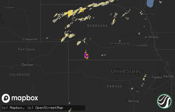
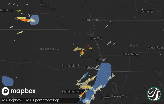
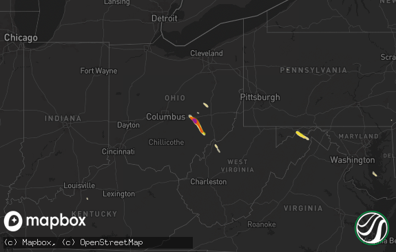
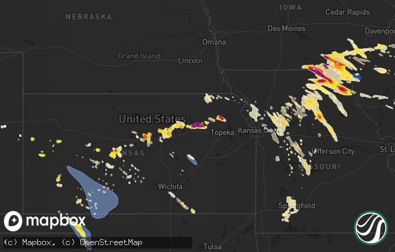
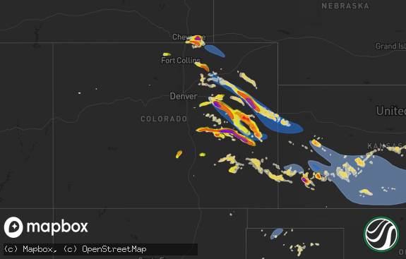
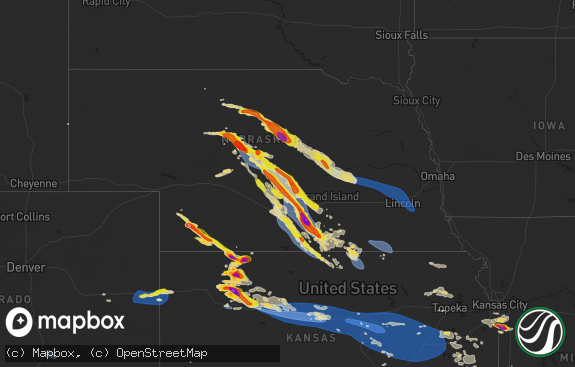
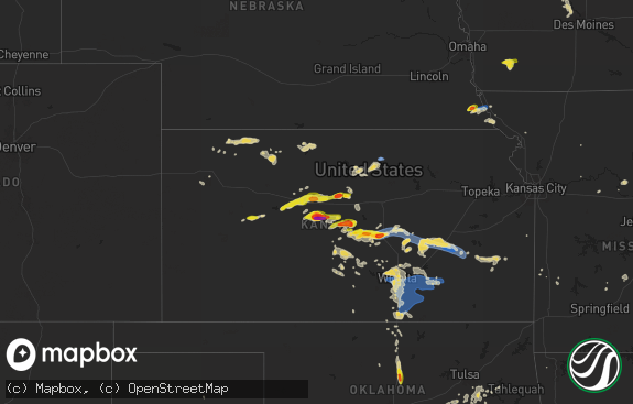
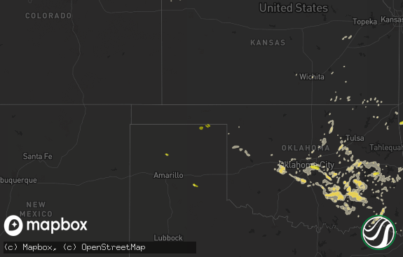
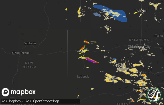
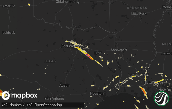
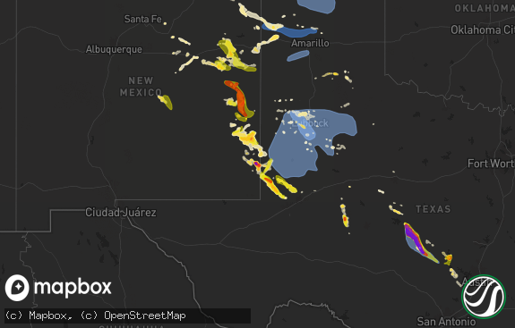
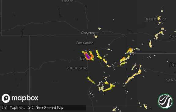
Hail Map in Kansas on October 3, 2023
The weather event in Kansas on October 3, 2023 includes Wind and Hail maps. 9 states and 550 cities were impacted and suffered possible damage. The total estimated number of properties impacted is 9,961.

Wind
Hail
9,961
Estimated number of impacted properties by a 1.00" hail or larger7,211
Estimated number of impacted properties by a 1.75" hail or larger8,455
Estimated number of impacted properties by a 2.50" hail or largerStorm reports in Kansas
Kansas
| Date | Description |
|---|---|
| 10/03/20236:30 PM CDT | 1.5 to 1.75 hail. |
| 10/03/20236:25 PM CDT | Report from mping: tennis ball |
| 10/03/20236:24 PM CDT | 2.5-3 inch hail caused extensive damage to vehicles and pontoon boat. |
| 10/03/20236:18 PM CDT | A local report indicates 2.50 inch wind near Larned |
| 10/03/20236:18 PM CDT | A tree was reported down in larned due to thunderstorm winds. |
| 10/03/20236:17 PM CDT | Report from mping: baseball |
| 10/03/20236:14 PM CDT | Mesonet reports a gust to 59 mph. |
| 10/03/20236:10 PM CDT | A local report indicates 2.75 inch wind near 3 S Garfield |
| 10/03/20236:10 PM CDT | A local report indicates 1.00 inch wind near Greensburg |
| 10/03/20236:03 PM CDT | A local report indicates 2.75 inch wind near Lewis |
| 10/03/20236:00 PM CDT | Report was received via social media with picture. |
| 10/03/20235:59 PM CDT | A local report indicates 1.50 inch wind near 1 S Centerview |
| 10/03/20235:58 PM CDT | A local report indicates 2.50 inch wind near 1 S Centerview |
| 10/03/20235:58 PM CDT | Mesonet reports a gust to 80 mph. |
| 10/03/20235:58 PM CDT | Emergency management reported at least 8 power poles were damaged in the area. Tree damage in osborne. A building was damaged in unincorporated bloomington... Which is |
| 10/03/20235:55 PM CDT | The emergency manager reported that up to 70 percent of homes in lewis sustained broken windows and/or damaged siding due to wind driven hail. South side of structures |
| 10/03/20235:53 PM CDT | Large wood and metal machine shed destroyed two miles west and one mile south of bloomington. Tree damage in the general area. Nearby ksu mesonet gusted to 80 mph. |
| 10/03/20235:49 PM CDT | Mesonet reports a gust to 65 mph. |
| 10/03/20235:45 PM CDT | Storm chaser noted via live stream along highway 183 near the kiowa edwards county line. |
| 10/03/20235:40 PM CDT | A local report indicates 1.50 inch wind near 9 NNE Mullinville |
| 10/03/20235:34 PM CDT | A local report indicates 1.75 inch wind near 2 SSE Mullinville |
| 10/03/20235:33 PM CDT | A local report indicates 1.75 inch wind near Mullinville |
| 10/03/20235:28 PM CDT | Mesonet reports a 59 mph gust. |
| 10/03/20235:28 PM CDT | Quarter sized hail reported. |
| 10/03/20235:26 PM CDT | Mesonet reports a 62 mph gust. |
| 10/03/20234:29 PM CDT | Relayed report with picture of hail up to two inches in diameter at the keith sebelius reservoir. |
| 10/03/20234:25 PM CDT | Caller reported two inch hail on the west side of norton. |
| 10/03/20234:25 PM CDT | Trained spotter reports hail mostly pea to dime size with largest up to 1.25 inch. Time estimated. |
| 10/03/20234:24 PM CDT | Trained spotter estimated 65 mph gusts with storm. |
| 10/03/20234:24 PM CDT | Corrects previous hail report from norton. Spotter reported one to one and a half inches initially with two inch hail by 4:32 pm cdt. |
| 10/03/20234:24 PM CDT | Follow up report to previous report at the reservoir. One hailstone was found and measured to be three inches. |
| 10/03/20234:14 PM CDT | Site kksnorca2 reports 65 mph wind gust. |
| 10/03/20234:14 PM CDT | Social media report with pictures of healthy tree uprooted. |
| 10/03/20234:07 PM CDT | Hail ranged from pea to quarter in size. |
| 10/03/20234:03 PM CDT | Emergency manager reports golf ball size hail on the north edge of phillipsburg. |
| 10/03/20234:00 PM CDT | Trained spotter estimates thunderstorm winds 40-60 mph. |
| 10/03/20233:58 PM CDT | Measured via vehicle mounted anemometer. Report via fb. Time estimated from radar. |
| 10/03/20233:51 PM CDT | Mesonet report of 58 mph winds. |
| 10/03/20233:24 PM CDT | Spotter reported one to one and a half inches initially with two inch hail by 3:32 pm cdt. |
| 10/03/20233:13 PM CDT | Coop observer reports hail up to quarters in size. Most hail was smaller in size. |
| 10/03/20233:06 PM CDT | Emergency manager reports hail up to half dollar in size though only a few of the larger stones. Some blowing dust and heavy rain is also occurring. |
| 10/03/20233:00 PM CDT | Public report of hail with a few up to the size of golf balls... Mostly smaller around quarter size. Time estimated from radar. |
| 10/03/20232:41 PM CDT | Possible brief tornado reported by a storm chaser. |
| 10/03/20232:23 PM CDT | Delayed social media report of dime to half dollar size with the largest hail at the beginning of the storm and lasting only a minute. Time estimated from radar. |
| 10/03/20232:17 PM CDT | [landspout] ag camera facing west of goodland show circulation that could have been a landspout. |
| 10/02/20239:49 PM CDT | Mesonet station up430 1.8 w wellsford |
| 10/02/20239:49 PM CDT | Meson |
All States Impacted by Hail Map on October 3, 2023
Cities Impacted by Hail Map on October 3, 2023
- Chadron, NE
- Hay Springs, NE
- Rushville, NE
- Pine Ridge, SD
- Plains, TX
- Levelland, TX
- Whiteface, TX
- Sundown, TX
- Boise City, OK
- Dalhart, TX
- Keyes, OK
- Texhoma, OK
- Goodwell, OK
- Elkhart, KS
- Rolla, KS
- Richfield, KS
- Johnson, KS
- Hugoton, KS
- Guymon, OK
- Walsh, CO
- Moscow, KS
- Ulysses, KS
- Dickens, TX
- Sheridan Lake, CO
- Tribune, KS
- Weskan, KS
- Sharon Springs, KS
- Wallace, KS
- Winona, KS
- Lebanon, NE
- Wilsonville, NE
- Holbrook, NE
- Cambridge, NE
- Monument, KS
- Brady, NE
- Gothenburg, NE
- Arapahoe, NE
- Stockville, NE
- Oakley, KS
- Elwood, NE
- Rexford, KS
- Colby, KS
- Burlington, CO
- Bethune, CO
- Cozad, NE
- Smithfield, NE
- Bertrand, NE
- Logan, KS
- Phillipsburg, KS
- Kanorado, KS
- Lexington, NE
- Overton, NE
- Glade, KS
- Goodland, KS
- Elm Creek, NE
- Amherst, NE
- Alma, NE
- Kensington, KS
- Agra, KS
- Naponee, NE
- Republican City, NE
- Miller, NE
- Holdrege, NE
- Funk, NE
- Crane, TX
- Norton, KS
- Lenora, KS
- Almena, KS
- Bloomington, NE
- Franklin, NE
- Riverton, NE
- Tulia, TX
- Hale Center, TX
- Sublette, KS
- Lubbock, TX
- Healy, KS
- Park, KS
- Norcatur, KS
- Midland, TX
- Garden City, KS
- Gove, KS
- Tahoka, TX
- Liberal, KS
- Jennings, KS
- Plainview, TX
- Odessa, TX
- Spearman, TX
- Kismet, KS
- Broken Bow, NE
- Borger, TX
- Hardesty, OK
- Abernathy, TX
- Gardendale, TX
- Welch, TX
- Wayside, TX
- Hazard, NE
- Pleasanton, NE
- Ravenna, NE
- Edson, KS
- Rockville, NE
- Loup City, NE
- Orleans, NE
- Campbell, NE
- Lamesa, TX
- Ackerly, TX
- Ashton, NE
- Quinter, KS
- Collyer, KS
- Holstein, NE
- Selden, KS
- Dresden, KS
- Oberlin, KS
- Clayton, KS
- Hays, KS
- Ellis, KS
- Plainville, KS
- Farwell, NE
- Elba, NE
- Beaver City, NE
- Hendley, NE
- Oxford, NE
- Edison, NE
- Bladen, NE
- Fort Stockton, TX
- Roseland, NE
- Gail, TX
- Ayr, NE
- Minneola, KS
- Mullinville, KS
- Natoma, KS
- Stanton, TX
- Glenvil, NE
- Hastings, NE
- Wolbach, NE
- Scotia, NE
- Greensburg, KS
- Dryden, TX
- Inavale, NE
- Blue Hill, NE
- Paradise, KS
- Kinsley, KS
- Harvard, NE
- Inland, NE
- Lewis, KS
- Waldo, KS
- Osborne, KS
- Long Island, KS
- Stamford, NE
- Loomis, NE
- Atlanta, NE
- Wilcox, NE
- Axtell, NE
- Kearney, NE
- Alton, KS
- Big Spring, TX
- Trumbull, NE
- Burwell, NE
- Prairie View, KS
- Culbertson, NE
- Mason City, NE
- Bird City, KS
- Hoxie, KS
- McDonald, KS
- Stratton, CO
- Scott City, KS
- Wellfleet, NE
- Levant, KS
- Oconto, NE
- Leoti, KS
- Syracuse, KS
- McCook, NE
- Maywood, NE
- Ansley, NE
- Litchfield, NE
- Comstock, NE
- Elyria, NE
- Minden, NE
- Gaylord, KS
- Riverdale, NE
- Hildreth, NE
- Westerville, NE
- Farnam, NE
- Moorefield, NE
- Curtis, NE
- Imperial, TX
- Gem, KS
- Amelia, NE
- Ord, NE
- McCamey, TX
- Bogue, KS
- Stockton, KS
- Callaway, NE
- Arnold, NE
- Heartwell, NE
- Eustis, NE
- North Loup, NE
- Hill City, KS
- Trenton, NE
- Stratton, NE
- Atwood, KS
- Cedar, KS
- Athol, KS
- Morland, KS
- Upland, NE
- Kenesaw, NE
- Portis, KS
- Fairfield, NE
- Belpre, KS
- Garfield, KS
- Larned, KS
- Downs, KS
- Gibbon, NE
- Shelton, NE
- Juniata, NE
- Fluvanna, TX
- Smith Center, KS
- Clay Center, NE
- Wood River, NE
- Edgar, NE
- Sutton, NE
- Deweese, NE
- Geneva, NE
- Saronville, NE
- Lawrence, NE
- Doniphan, NE
- Giltner, NE
- Aurora, NE
- Grand Island, NE
- Alda, NE
- Phillips, NE
- Marquette, NE
- Hampton, NE
- Henderson, NE
- Pawnee Rock, KS
- Great Bend, KS
- Red Cloud, NE
- Guide Rock, NE
- Shickley, NE
- Nelson, NE
- Ong, NE
- Grafton, NE
- Bradshaw, NE
- Polk, NE
- Hordville, NE
- York, NE
- Clarks, NE
- Central City, NE
- Chapman, NE
- Oak, NE
- Davenport, NE
- Fairmont, NE
- McCool Junction, NE
- Stromsburg, NE
- Benedict, NE
- Snyder, TX
- Osceola, NE
- Waco, NE
- Gresham, NE
- Shelby, NE
- Silver Creek, NE
- Columbus, NE
- Duncan, NE
- Monroe, NE
- Rising City, NE
- Bellwood, NE
- Surprise, NE
- Ulysses, NE
- Utica, NE
- Beaver Crossing, NE
- David City, NE
- Platte Center, NE
- Colorado City, TX
- Staplehurst, NE
- Loraine, TX
- Creston, NE
- Schuyler, NE
- Leigh, NE
- Seward, NE
- Dwight, NE
- Humphrey, NE
- Clarkson, NE
- Bruno, NE
- Brainard, NE
- Ozona, TX
- Linwood, NE
- Rogers, NE
- Bee, NE
- Carleton, NE
- Strang, NE
- Exeter, NE
- Ohiowa, NE
- Milligan, NE
- Friend, NE
- Cordova, NE
- Dodge, NE
- North Bend, NE
- Howells, NE
- Morse Bluff, NE
- Abie, NE
- Prague, NE
- Roscoe, TX
- Sheyenne, ND
- Maddock, ND
- Oberon, ND
- Saint Michael, ND
- Bruning, NE
- Goehner, NE
- Dorchester, NE
- Milford, NE
- Garland, NE
- Weston, NE
- Valparaiso, NE
- Scribner, NE
- Devils Lake, ND
- Pleasant Dale, NE
- Raymond, NE
- Malcolm, NE
- Malmo, NE
- Cedar Bluffs, NE
- Ames, NE
- Hooper, NE
- West Point, NE
- Snyder, NE
- Lincoln, NE
- Denton, NE
- Ceresco, NE
- Colon, NE
- Wahoo, NE
- Fremont, NE
- Davey, NE
- Wisner, NE
- Oakland, NE
- Uehling, NE
- Mead, NE
- Valley, NE
- Yutan, NE
- Nickerson, NE
- Winslow, NE
- Craig, NE
- Ashland, NE
- Stanton, NE
- Beemer, NE
- Bancroft, NE
- Lyons, NE
- Rosalie, NE
- Walthill, NE
- Herman, NE
- Arlington, NE
- Sweetwater, TX
- Crary, ND
- Tekamah, NE
- Decatur, NE
- Macy, NE
- Superior, NE
- Republic, KS
- Ruskin, NE
- Deshler, NE
- Hardy, NE
- Chester, NE
- Byron, NE
- Narka, KS
- Munden, KS
- Hebron, NE
- Hubbell, NE
- Belleville, KS
- Mahaska, KS
- Fairbury, NE
- Reynolds, NE
- Webber, KS
- Belvidere, NE
- Gilead, NE
- Endicott, NE
- Alexandria, NE
- Daykin, NE
- Tobias, NE
- Western, NE
- Jansen, NE
- Plymouth, NE
- Wilber, NE
- Swanton, NE
- Crete, NE
- Morrowville, KS
- Maryneal, TX
- Diller, NE
- De Witt, NE
- Steele City, NE
- Beatrice, NE
- Sergeant Bluff, IA
- Salix, IA
- Sloan, IA
- Onawa, IA
- Whiting, IA
- Blencoe, IA
- Little Sioux, IA
- Blair, NE
- Kennard, NE
- Hallam, NE
- Clatonia, NE
- Pickrell, NE
- Martell, NE
- Roca, NE
- Waverly, NE
- Ithaca, NE
- Greenwood, NE
- Memphis, NE
- Waterloo, NE
- Bennington, NE
- Hornick, IA
- Mondamin, IA
- Modale, IA
- Washington, NE
- Elkhorn, NE
- Cortland, NE
- Hickman, NE
- Sprague, NE
- Firth, NE
- Bennet, NE
- Walton, NE
- Gretna, NE
- Omaha, NE
- Missouri Valley, IA
- Fort Calhoun, NE
- Pisgah, IA
- Moorhead, IA
- Castana, IA
- Smithland, IA
- Rodney, IA
- Anthon, IA
- Oto, IA
- Adams, NE
- Filley, NE
- Eagle, NE
- Alvo, NE
- Boys Town, NE
- Mapleton, IA
- Soldier, IA
- Danbury, IA
- Climbing Hill, IA
- Moville, IA
- Winnebago, NE
- Odell, NE
- Blue Springs, NE
- Wymore, NE
- Crescent, IA
- Logan, IA
- Magnolia, IA
- Ute, IA
- Woodbine, IA
- Virginia, NE
- Panama, NE
- Palmyra, NE
- Tecumseh, NE
- Crab Orchard, NE
- Lewiston, NE
- Sterling, NE
- Douglas, NE
- Pampa, TX
- Miami, TX
- Clarendon, TX
- Hedley, TX
- Haviland, KS
- Pratt, KS
- St John, KS
- Iuka, KS
- Turon, KS
- Stafford, KS
- Sylvia, KS
- Anselmo, NE
- Utica, KS
- Sylvan Grove, KS
- Hunter, KS
- Protection, KS
- Ashland, KS
- Lenorah, TX
- Sheffield, TX
- Olmitz, KS
- Hoisington, KS
- Harvey, ND
- Knott, TX
- Wakeeney, KS
- Bucklin, KS
- Albert, KS
- Tyndall, SD
- Bison, KS
- Otis, KS
- Pfeifer, KS
- Victoria, KS
- Mankato, KS
- Courtland, KS
- Ira, TX
- Coahoma, TX
- Meade, KS
- Dighton, KS
- Fowler, KS
- Englewood, KS
- Coldwater, KS
- Westbrook, TX
- Luray, KS
- Lucas, KS
- Macksville, KS
- Greeley, NE
- Glen Elder, KS
- Bunker Hill, KS
- Russell, KS
- Arnold, KS
- Ransom, KS
- Catharine, KS
- Scotland, SD
- Jewell, KS
- Formoso, KS
- Gorham, KS
- Rotan, TX
- Lincoln, KS
- Woodston, KS
- Walker, KS
- La Crosse, KS
- Dorrance, KS
- Claflin, KS
- Grinnell, KS
- Waldron, KS
- Burlington, OK
- Amorita, OK
- Hazelton, KS
- Kiowa, KS
- Perryton, TX
- Booker, TX
- Follett, TX
- Forgan, OK
- Sawyer, KS
- Coats, KS
- Plevna, KS
- Arcadia, NE
- Mott, ND
- Gate, OK
- Lamont, OK
- Deer Creek, OK
- Arapahoe, CO
- Medford, OK
- Manchester, OK
- Anthony, KS
- Miami, OK
- Granby, MO
- Diamond, MO
- Rush Center, KS
- Fargo, OK
- Stinnett, TX
- Shattuck, OK
- Gage, OK
- Ellsworth, KS
- Wilmore, KS
