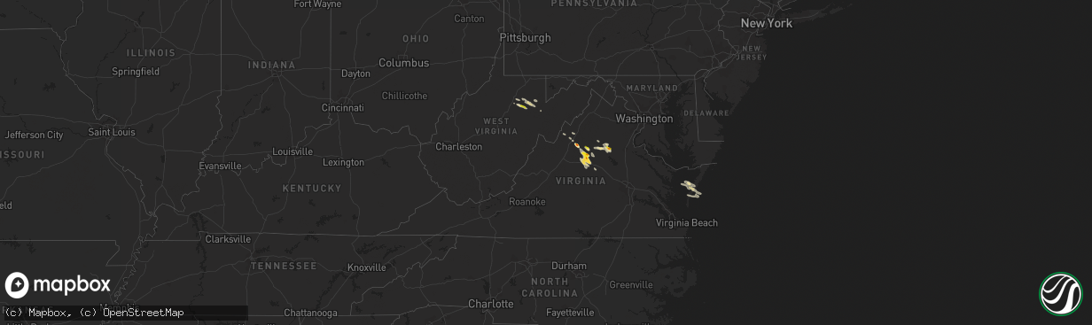
Hail Map in Virginia on September 28, 2021
The weather event in Virginia on September 28, 2021 includes Hail map. 8 states and 194 cities were impacted and suffered possible damage. The total estimated number of properties impacted is 1,400.
Hail
1,400
Estimated number of impacted properties by a 1.00" hail or larger96
Estimated number of impacted properties by a 1.75" hail or larger0
Estimated number of impacted properties by a 2.50" hail or largerStorm reports in Virginia
Virginia
| Date | Description |
|---|---|
| 09/28/20216:15 PM CDT | A local report indicates 1.00 inch wind near 1 SSW BARRACKS |
| 09/28/20215:17 PM CDT | A local report indicates 1.75 inch wind near 1 N CARRSBROOK |
| 09/28/20215:15 PM CDT | A local report indicates 1.00 inch wind near 1 NE CARRSBROOK |
| 09/28/20215:11 PM CDT | A local report indicates 1.00 inch wind near 1 SSE HOLLYMEAD |
| 09/28/20214:45 PM CDT | A local report indicates 1.25 inch wind near 1 NNE FIVE FORKS |
| 09/28/20214:40 PM CDT | A local report indicates 1.50 inch wind near 3 N EARLYSVILLE |
| 09/28/20214:36 PM CDT | A local report indicates 1.00 inch wind near 3 N EARLYSVILLE |
| 09/28/20214:05 PM CDT | A local report indicates 1.00 inch wind near 1 SSE MCMULLEN |
| 09/28/20214:00 PM CDT | A local report indicates 1.00 inch wind near 2 SW SWIFT RUN |
| 09/28/20213:58 PM CDT | Golfball hail size at 2000 block of shady acres drive in elkton. |
| 09/28/20213:51 PM CDT | A local report indicates 1.00 inch wind near 2 SE MASSANUTTEN |
| 09/28/20213:50 PM CDT | A local report indicates 1.00 inch wind near 1 SE MASSANUTTEN |
| 09/28/20212:02 AM CDT | At 702 PM EDT, a severe thunderstorm was located near Free Union, or near Charlottesville, moving southeast at 20 mph. HAZARD...Quarter size hail. SOURCE...Radar indicated. IMPACT...Some hail damage to agriculture is expected. Locations impacted include... Charlottesville, Free Union, Campbell, Westmoreland, Hollymead, Ivy, Cobham, Cismont, Newcomb Hall, Boyd Tavern, Monticello, Keswick, Stony Point, Flordon, Carrsbrook, Shadwell, Barracks, Overton and Scott Stadium. |
| 09/28/20211:08 AM CDT | At 607 PM EDT, a severe thunderstorm with a history of producing large hail was located near Charlottesville, moving southeast at 20 mph. HAZARD...Quarter size hail. SOURCE...Radar indicated. IMPACT...Some hail damage to agriculture is expected. Locations impacted include... Campbell, Westmoreland, Hollymead, Cobham, Cismont, Boyd Tavern, Keswick, Stony Point, Advance Mills, Carrsbrook and Earlysville. |
| 09/28/20211:02 AM CDT | At 602 PM EDT, a severe thunderstorm with a history of producing large hail was located 13 miles east of Orange, moving southeast at 20 mph. HAZARD...60 mph wind gusts and half dollar size hail. SOURCE...Radar indicated. IMPACT...Damaging winds will cause some trees and large branches to fall. This could injure those outdoors, as well as damage homes and vehicles. Roadways may become blocked by downed trees. Localized power outages are possible. Unsecured light objects may become projectiles. Locations impacted include... Massaponax, Spotsylvania, Brokenburg, Parker, Snell, Alsop, Gatewood, Logan, Partlow, Glenora, Post Oak, Thornburg and Cookstown. |
| 09/28/202112:40 AM CDT | At 540 PM EDT, a severe thunderstorm was located near Madison, moving east at 25 mph. HAZARD...Quarter size hail. SOURCE...Radar indicated. IMPACT...Some hail damage to agriculture is expected. Locations impacted include... Orange, Rhoadesville, Rapidan, Oakpark, Everona, Verdiersville, Pratts, Rochelle, Nasons, Aroda, Madison Mills, Montford, Lahore, Twymans Mill, Unionville and Locust Dale. |
| 09/28/202112:32 AM CDT | At 532 PM EDT, a severe thunderstorm was located near Culpeper, moving southeast at 15 mph. HAZARD...Quarter size hail. SOURCE...Radar indicated. IMPACT...Some hail damage to agriculture is expected. Locations impacted include... Gold Dale, Raccoon Ford, Mine Run, Winston, Mitchells, Lake Of The Woods, Burr Hill, Locust Grove and Flat Run. |
| 09/28/202112:27 AM CDT | At 527 PM EDT, a severe thunderstorm with a history of producing large hail was located near Stanardsville, or 14 miles north of Charlottesville, moving southeast at 20 mph. HAZARD...Quarter size hail. SOURCE...Trained weather spotters. IMPACT...Some hail damage to agriculture is expected. Locations impacted include... Hollymead, Ruckersville, Quinque, Boonesville, Eheart, Amicus, Barboursville, Stony Point, Advance Mills, Saint George, Earlysville and Shady Grove. |
| 09/27/202111:43 PM CDT | At 443 PM EDT, a severe thunderstorm was located over Massanutten, or 10 miles east of Harrisonburg, moving southeast at 25 mph. HAZARD...60 mph wind gusts and quarter size hail. SOURCE...Radar indicated. IMPACT...Damaging winds will cause some trees and large branches to fall. This could injure those outdoors, as well as damage homes and vehicles. Roadways may become blocked by downed trees. Localized power outages are possible. Unsecured light objects may become projectiles. Locations impacted include... Massanutten, Stanardsville, Elkton, Ruckersville, Mcmullen, Rocky Bar, Quinque, Lydia, Haneytown, Mission Home, Swift Run, Amicus, Mcgaheysville, Saint George, Shady Grove and Montevideo. |
| 09/27/20218:02 PM CDT | At 101 PM EDT, a severe thunderstorm was located 9 miles north of Dale Enterprise, or 12 miles northwest of Harrisonburg, moving southeast at 30 mph. HAZARD...60 mph wind gusts and quarter size hail. SOURCE...Radar indicated. IMPACT...Damaging winds will cause some trees and large branches to fall. This could injure those outdoors, as well as damage homes and vehicles. Roadways may become blocked by downed trees. Localized power outages are possible. Unsecured light objects may become projectiles. Locations impacted include... Harrisonburg, Shenandoah, Massanutten, Dale Enterprise, Dayton, Penn Laird, Cherry Grove, Lacey Spring, Singers Glen, Linville, Keezletown, Hinton, Montevideo and Sparkling Springs. |
All States Impacted by Hail Map on September 28, 2021
Cities Impacted by Hail Map on September 28, 2021
- Belle Haven, VA
- Graford, TX
- Junction, TX
- Fredericksburg, TX
- Llano, TX
- Mason, TX
- Doss, TX
- Harper, TX
- Ruckersville, VA
- Stanardsville, VA
- Brady, TX
- Rochelle, TX
- Mullin, TX
- Weatherford, TX
- Lipan, TX
- Olney, TX
- Throckmorton, TX
- Newcastle, TX
- Evant, TX
- Bandera, TX
- Charlottesville, VA
- Scottsville, VA
- Dyke, VA
- Earlysville, VA
- Elkton, VA
- McGaheysville, VA
- Eagle Pass, TX
- La Pryor, TX
- Quemado, TX
- Crystal City, TX
- Sunset, TX
- Chico, TX
- Lometa, TX
- Philippi, WV
- Saint Jo, TX
- Nocona, TX
- Star, TX
- Hamilton, TX
- Goldthwaite, TX
- Overbrook, OK
- San Saba, TX
- Fredonia, TX
- Keswick, VA
- Granbury, TX
- Ranger, TX
- Burnet, TX
- Jacksboro, TX
- Strawn, TX
- Barboursville, VA
- Free Union, VA
- Ryan, OK
- Bluff Dale, TX
- Sweetwater, TX
- Roby, TX
- Sylvester, TX
- Wilson, OK
- Ringling, OK
- Bowie, TX
- Eldorado, TX
- Christoval, TX
- Henrietta, TX
- Windthorst, TX
- Quanah, TX
- Perrin, TX
- San Marcos, TX
- Wimberley, TX
- Fischer, TX
- Driftwood, TX
- Comanche, OK
- Odem, TX
- Terral, OK
- Moran, TX
- Cisco, TX
- Breckenridge, TX
- Woonsocket, RI
- Manville, RI
- North Smithfield, RI
- Plainville, MA
- Cumberland, RI
- Indiahoma, OK
- Cache, OK
- Bellevue, TX
- Foxboro, MA
- Mansfield, MA
- Montrose, WV
- Parsons, WV
- Grafton, WV
- Moatsville, WV
- Menard, TX
- North Windham, CT
- Canyon Lake, TX
- Spring Branch, TX
- Burneyville, OK
- Leon, OK
- Crozet, VA
- Sinton, TX
- Volga, WV
- Belington, WV
- San Antonio, TX
- Helotes, TX
- Graham, TX
- Tolar, TX
- Stephenville, TX
- Gustine, TX
- Dublin, TX
- Exmore, VA
- Rapidan, VA
- Radiant, VA
- Orange, VA
- Locust Dale, VA
- Duncan, OK
- Culpeper, VA
- Rhoadesville, VA
- Unionville, VA
- Hanksville, UT
- San Angelo, TX
- Baird, TX
- Cross Plains, TX
- Painter, VA
- Dilley, TX
- Colorado City, TX
- Kerrville, TX
- Taft, TX
- Mathis, TX
- Caddo, TX
- Boerne, TX
- Holliday, TX
- Coleman, TX
- North Attleboro, MA
- Wrentham, MA
- Lincoln, RI
- Snyder, OK
- Frederick, OK
- Palmyra, VA
- Troy, VA
- Muenster, TX
- Gordonsville, VA
- South Bend, TX
- Lampasas, TX
- Mitchells, VA
- Ardmore, OK
- Lawton, OK
- Brookesmith, TX
- Brownwood, TX
- Medina, TX
- Jermyn, TX
- Bryson, TX
- Bridgeport, TX
- Bronte, TX
- Harrisonburg, VA
- Vernon, TX
- Crowell, TX
- Richland Springs, TX
- Yorktown, TX
- Hunt, TX
- Hico, TX
- Salado, TX
- Gainesville, TX
- Marietta, OK
- Forestburg, TX
- Fulks Run, VA
- Lohn, TX
- Ringgold, TX
- Spicewood, TX
- Marble Falls, TX
- Leander, TX
- Loving, TX
- New Braunfels, TX
- Keezletown, VA
- Hacksneck, VA
- Leon, VA
- Reva, VA
- Brightwood, VA
- Aroda, VA
- Rochelle, VA
- Mount Clare, WV
- Ferron, UT
- Pontotoc, TX
- Voca, TX
- Robstown, TX
- Corpus Christi, TX
- Hockley, TX
- Broadway, VA
- Woodson, TX
- Bertram, TX
- Hendricks, WV
- Cape Charles, VA
- Machipongo, VA
- Locust Grove, VA
- Madison, VA
- Harrisville, RI
- Flemington, WV
- Bridgeport, WV
- Cedar Park, TX


