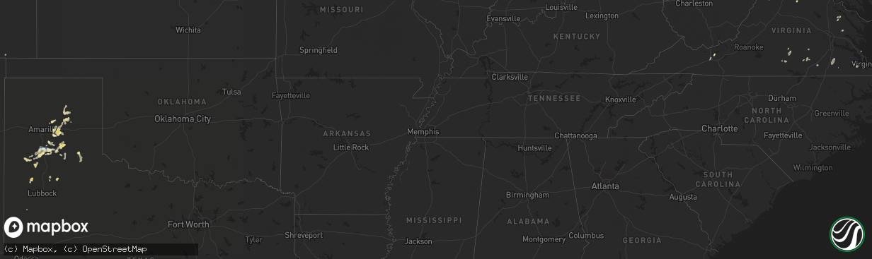
Hail Map in Pennsylvania on August 4, 2022
The weather event in Pennsylvania on August 4, 2022 includes Hail, Wind, and Tornado maps. 23 states and 417 cities were impacted and suffered possible damage. The total estimated number of properties impacted is 0.
Hail
Wind
Tornado
0
Estimated number of impacted properties by a 1.00" hail or larger0
Estimated number of impacted properties by a 1.75" hail or larger0
Estimated number of impacted properties by a 2.50" hail or largerStorm reports in Pennsylvania
Pennsylvania
| Date | Description |
|---|---|
| 08/04/20226:45 PM CDT | Em reports trees down on wires. Time estimated via radar. |
| 08/04/20226:41 PM CDT | Corrects time on previous tstm wnd dmg report from trappe. Meant 2341z rather than 2241z. Large limbs and branches down. Report via social media. Time estimated via rad |
| 08/04/20226:38 PM CDT | Reports of trees down on wires in limerick... Pa. Time estimated via radar. |
| 08/04/20226:30 PM CDT | Reports of trees and wires down around phoenixville. Time estimated via radar. |
| 08/04/20225:55 PM CDT | Reports of trees and wires down around wallace twp. Time estimated via radar. |
| 08/04/20225:41 PM CDT | Large limbs and branches down. Report via social media. Time estimated via radar. |
| 08/04/20225:40 PM CDT | Trees and wires down around west brandywine... Twp. Time estimated via radar. |
| 08/04/20225:30 PM CDT | Tree down on a car and a tree down on a propane tank between w main st and n market st. |
| 08/04/20225:07 PM CDT | Trees down near muddy creek forks rd and good rd. |
| 08/04/20224:00 PM CDT | Trees down. |
| 08/04/20223:45 PM CDT | Trees down. |
| 08/04/20223:30 PM CDT | Several reports of trees down. Trees on wires. |
| 08/04/20223:15 PM CDT | Power line down at cumberland dr and wayne rd. |
| 08/04/20222:36 PM CDT | Trees and wires down |
| 08/04/20222:26 PM CDT | Tree down |
| 08/04/20221:40 PM CDT | Trees down. Also hail up to quarter size. |
| 08/04/202212:57 PM CDT | Tree down at the intersection of sr36 and dory carson road. |
| 08/04/202212:51 PM CDT | Multiple trees and power poles down along sr108 ne of slippery rock. |
| 08/04/202212:35 PM CDT | Trees blown down on wires. |
| 08/04/202212:27 PM CDT | Tree down at leslie road and wampum mt air road. |
| 08/04/202212:23 PM CDT | Trees and wires down. |
| 08/04/202212:21 PM CDT | Multiple trees down |
| 08/04/202212:16 PM CDT | A couple of trees down across rockland cranberry road. |
| 08/04/20222:24 AM CDT | At 724 PM EDT, a severe thunderstorm was located near Royersford, or 17 miles north of West Chester, moving northeast at 35 mph. HAZARD...60 mph wind gusts and penny size hail. SOURCE...Radar indicated. IMPACT...Damage to roofs, siding, trees, and power lines is possible. Locations impacted include... Pottstown, Phoenixville, Lansdale, Quakertown, Perkasie, Doylestown, Souderton, Collegeville, Royersford, Chalfont, Trappe, Hatfield, Dublin, Schwenksville, Green Lane, Fricks, Pughtown, Spring Mount, Gilbertsville and Cedarville.This includes Northeast Extension between mile markers 28 and 44. |
| 08/04/202212:05 AM CDT | At 505 PM EDT, a severe thunderstorm was located over Chester Hill, moving east at 35 mph. HAZARD...60 mph wind gusts and penny size hail. SOURCE...Radar indicated. IMPACT...Expect damage to roofs, siding, and trees. Locations impacted include... Bellefonte, Park Forest Village, Pleasant Gap, Philipsburg, Woodland, Lemont, Houserville, Osceola Mills, Milesburg, Chester Hill, Houtzdale and Snow Shoe.For those driving on Interstate 80, this includes areas between theWoodland and Bellefonte exits, specifically from mile markers 124 to160.This includes Interstate 99 from mile markers 64 to 85. |
| 08/03/202211:10 PM CDT | At 410 PM EDT, a severe thunderstorm was located over Drums, or near Hazleton, moving east at 15 mph. HAZARD...60 mph wind gusts and quarter size hail. SOURCE...Radar indicated. IMPACT...Hail damage to vehicles is expected. Expect wind damage to roofs, siding, and trees. Locations impacted include... Hazleton, West Hazleton, Freeland, Bear Creek, Dorrance, Conyngham, Slocum, White Haven, Sugar Notch and Nuangola. |
| 08/03/202210:18 PM CDT | At 318 PM EDT, a cluster of severe thunderstorms was located near Plum, or near Penn Hills, and near Saltsburg moving east at 15 mph. HAZARD...60 mph wind gusts and quarter size hail. SOURCE...Radar indicated. IMPACT...Minor hail damage to vehicles is possible. Expect wind damage to trees and power lines, resulting in some power outages. Locations impacted include... Penn Hills, Monroeville, Indiana, Vandergrift, Homer City, Apollo, Plum, Murrysville, Wilkinsburg, New Kensington, Lower Burrell, and Harrison Township. |
| 08/03/20228:51 PM CDT | At 151 PM EDT, a severe thunderstorm was located over Slippery Rock, or near Grove City, moving east at 20 mph. HAZARD...60 mph wind gusts. SOURCE...Radar indicated. IMPACT...Expect damage to trees and power lines, resulting in some power outages. Locations impacted include... Grove City, Slippery Rock, Harrisville, Plain Grove Township, Bruin, Clintonville, West Liberty, Eau Claire, Petrolia, Karns City, Fairview, and West Sunbury. |
| 08/03/20228:48 PM CDT | At 147 PM EDT, a severe thunderstorm was located over Franklinville, moving northeast at 35 mph. HAZARD...60 mph wind gusts and half dollar size hail. SOURCE...Radar indicated. IMPACT...Hail damage to vehicles is expected. Expect wind damage to roofs, siding, and trees. Locations impacted include... State College, Bellefonte, Boalsburg, Pleasant Gap, Lemont, Zion, Houserville, Pine Grove Mills, Milroy, Centre Hall, Ramblewood and Reedsville.For those driving on Interstate 80, this includes areas between theBellefonte and Lamar exits, specifically near mile marker 162.This includes Interstate 99 from mile markers 74 to 83. |
| 08/03/20228:40 PM CDT | At 140 PM EDT, a severe thunderstorm was located near Oil City, moving east at 25 mph. HAZARD...60 mph wind gusts. SOURCE...Radar indicated. IMPACT...Expect damage to trees and power lines, resulting in some power outages. Locations impacted include... Oil City, Sugarcreek, Tionesta, Hasson Heights, Seneca, Rouseville, Woodland Heights, Fryburg, Kellettville, West Hickory, Leeper, and Starr. |
| 08/03/20228:29 PM CDT | At 127 PM EDT, a severe thunderstorm was located near Shinglehouse, or 12 miles southwest of Wellsville, moving northeast at 35 mph. HAZARD...60 mph wind gusts and quarter size hail. SOURCE...Radar indicated. IMPACT...Minor damage to vehicles is possible. Expect wind damage to trees and power lines. Locations impacted include... Wellsville, Whitesville, Andover, Alma, Stannards and Paynesville. |
| 08/03/20228:26 PM CDT | At 126 PM EDT, a severe thunderstorm was located over Bald Eagle State Park, moving east at 35 mph. HAZARD...60 mph wind gusts and quarter size hail. SOURCE...Radar indicated. IMPACT...Hail damage to vehicles is expected. Expect wind damage to roofs, siding, and trees. Locations impacted include... Lock Haven, Carroll, Lamar, Zion, Mill Hall, Avis, Dunnstown, Flemington, Castanea, Blanchard, McElhattan and Monument.For those driving on Interstate 80, this includes areas between theBellefonte and Mile Run exits, specifically from mile markers 161 to195. |
| 08/03/20228:18 PM CDT | At 118 PM EDT, a severe thunderstorm was located over Trough Creek State Park, moving east at 35 mph. HAZARD...60 mph wind gusts and nickel size hail. SOURCE...Radar indicated. IMPACT...Expect damage to roofs, siding, and trees. Locations impacted include... Mount Union, Rockhill Furnace, Dudley, Raystown Dam, Shy Beaver, Trough Creek State Park, Entriken, Broad Top City, Mapleton, Orbisonia, Saltillo and Mill Creek. |
All States Impacted by Hail Map on August 4, 2022
Cities Impacted by Hail Map on August 4, 2022
- Berkeley Springs, WV
- Campton, NH
- Holderness, NH
- Jefferson, NY
- Stamford, NY
- Melrose, NY
- Troy, NY
- Holtwood, PA
- Arlington, VT
- Wysox, PA
- Wyalusing, PA
- Mechanicville, NY
- Winner, SD
- Ravena, NY
- Slingerlands, NY
- Coeymans Hollow, NY
- Alcove, NY
- Feura Bush, NY
- Selkirk, NY
- Delmar, NY
- Bainbridge, NY
- Oxford, NY
- Greene, NY
- Schaghticoke, NY
- Stillwater, NY
- Schuylerville, NY
- Eldred, PA
- Turtlepoint, PA
- Smethport, PA
- Monongahela, PA
- Elizabeth, PA
- Sykesville, MD
- Woodbine, MD
- Gambrills, MD
- Millersville, MD
- Crownsville, MD
- Panhandle, TX
- Hart, TX
- Cohoes, NY
- Windsor, VA
- Suffolk, VA
- Mount Gilead, OH
- Cardington, OH
- New Park, PA
- Fawn Grove, PA
- Airville, PA
- Stewartstown, PA
- Pylesville, MD
- Ijamsville, MD
- Monrovia, MD
- New Market, MD
- Essex, MD
- Sparrows Point, MD
- Charlotte Court House, VA
- Cullen, VA
- Dimmitt, TX
- Petersburg, TX
- Long Valley, SD
- Mission, SD
- Martin, SD
- Kilgore, NE
- Tuthill, SD
- Cody, NE
- Saint Francis, SD
- Nenzel, NE
- Norris, SD
- Parmelee, SD
- Crookston, NE
- Valentine, NE
- Somerset, OH
- Beech Creek, PA
- Laurel Bloomery, TN
- Lake City, SC
- Kingstree, SC
- New Zion, SC
- Clio, SC
- Manchester Center, VT
- Gregory, SD
- Whiteford, MD
- Street, MD
- Patton, PA
- Martinsburg, PA
- Oil City, PA
- Bessemer, PA
- Hillsville, PA
- New Castle, PA
- Edinburg, PA
- Ashville, PA
- Loretto, PA
- Danby, VT
- Wallingford, VT
- Gifford, PA
- Lutherville Timonium, MD
- Rosedale, MD
- Parkville, MD
- Halethorpe, MD
- Baltimore, MD
- Catonsville, MD
- Cockeysville, MD
- Curtis Bay, MD
- Towson, MD
- Gwynn Oak, MD
- Brooklyn, MD
- Severn, MD
- Dundalk, MD
- Phoenix, MD
- Glen Burnie, MD
- Linthicum Heights, MD
- Nottingham, MD
- Summerhill, PA
- Portage, PA
- Cropseyville, NY
- White Post, VA
- Stephens City, VA
- Floydada, TX
- Owego, NY
- Candor, NY
- Anton, TX
- Littlefield, TX
- Needmore, PA
- Warfordsburg, PA
- Mardela Springs, MD
- Kim, CO
- Pleasantville, PA
- Turbeville, SC
- Howard, PA
- Northern Cambria, PA
- Nicktown, PA
- Silverton, TX
- Pampa, TX
- Kenbridge, VA
- Dundas, VA
- Stevensville, MD
- Easton, MD
- Claiborne, MD
- Saint Michaels, MD
- Mcdaniel, MD
- Spartanburg, SC
- Pauline, SC
- Groom, TX
- White Deer, TX
- Ballston Spa, NY
- Greenwich, NY
- Saratoga Springs, NY
- Fort Edward, NY
- Ulster, PA
- Rome, PA
- Guilford, NY
- Rockwood, PA
- Saxton, PA
- James Creek, PA
- Claremont, NH
- Charlestown, NH
- Amity, PA
- Royersford, PA
- Collegeville, PA
- Schwenksville, PA
- Carrollton, OH
- Nathalie, VA
- Burke, VA
- Fairfax Station, VA
- Wytheville, VA
- Fonda, NY
- Sprakers, NY
- Canajoharie, NY
- Palatine Bridge, NY
- Oldtown, MD
- Milan, PA
- Athens, PA
- Stanardsville, VA
- Elmira, NY
- Hedgesville, WV
- Shinglehouse, PA
- Port Allegany, PA
- Bellefonte, PA
- Julian, PA
- Huntingdon, PA
- Finleyville, PA
- Mountain Top, PA
- Freeland, PA
- White Haven, PA
- Drums, PA
- Ballston Lake, NY
- Burnt Hills, NY
- Schenectady, NY
- Punxsutawney, PA
- Milford, VA
- Hustle, VA
- Champlain, VA
- Claude, TX
- Campbell, NY
- Addison, NY
- Johnsonville, NY
- Buskirk, NY
- Valley Falls, NY
- Commodore, PA
- Cherry Tree, PA
- Wilkes Barre, PA
- Gouldsboro, PA
- Dysart, PA
- Divide, CO
- Florissant, CO
- Woodland Park, CO
- Horseheads, NY
- Wye Mills, MD
- Queen Anne, MD
- Centreville, MD
- Queenstown, MD
- Clifton Park, NY
- Tyrone, PA
- Spruce Creek, PA
- Peyton, CO
- Blairsville, PA
- Rougemont, NC
- Timberlake, NC
- Cloudcroft, NM
- Fairfax, VA
- Annandale, VA
- Falls Church, VA
- Florence, SC
- Brandywine, MD
- Mount Upton, NY
- North Bennington, VT
- Eagle Bridge, NY
- Bennington, VT
- Hoosick Falls, NY
- Tulia, TX
- Quitaque, TX
- Mill Hall, PA
- Greensboro, MD
- Ridgely, MD
- Cordova, MD
- Goldsboro, MD
- Denton, MD
- Felton, DE
- Hillsboro, MD
- Harrington, DE
- Royal Oak, MD
- Big Prairie, OH
- Glenmont, OH
- Brinkhaven, OH
- Alexandria, VA
- Monroeton, PA
- Towanda, PA
- Elida, NM
- Byron, GA
- Sussex, VA
- Yale, VA
- Stony Creek, VA
- Waverly, VA
- Donnybrook, ND
- Summit, NY
- Fultonham, NY
- Richmondville, NY
- West Fulton, NY
- Warnerville, NY
- Harleysville, PA
- Damascus, MD
- Brookeville, MD
- Gaithersburg, MD
- Mount Airy, MD
- Nichols, NY
- Waverly, NY
- Barton, NY
- Hancock, MD
- Kearneysville, WV
- Clear Brook, VA
- Bunker Hill, WV
- Berryville, VA
- Summit Point, WV
- Springfield, WV
- Cumberland, MD
- Newtown, VA
- Grasonville, MD
- Fallston, MD
- Monkton, MD
- Baldwin, MD
- Forest Hill, MD
- Jarrettsville, MD
- Lunenburg, VA
- Victoria, VA
- Bowie, MD
- Edgewater, MD
- Riva, MD
- Harwood, MD
- Annapolis, MD
- Galesville, MD
- Davidsonville, MD
- Upper Marlboro, MD
- West River, MD
- Lothian, MD
- Shady Side, MD
- New Waterford, OH
- East Palestine, OH
- Enon Valley, PA
- Petersburg, OH
- New Springfield, OH
- Pamplin, VA
- Allen, SD
- Schenevus, NY
- Worcester, NY
- Harpersfield, NY
- Charlotteville, NY
- Davenport, NY
- Hollis, OK
- Barney, GA
- Quitman, GA
- Morven, GA
- Henderson, NC
- Windsor, NY
- Alexandria, PA
- Petersburg, PA
- Pennsylvania Furnace, PA
- Port Crane, NY
- Linden, VA
- Flint Hill, VA
- Huntly, VA
- Hume, VA
- Belleville, PA
- Reedsville, PA
- Milroy, PA
- Dunkirk, MD
- Cripple Creek, CO
- White River, SD
- Wood, SD
- Okreek, SD
- Sayre, PA
- Ebensburg, PA
- Middletown, VA
- Strasburg, VA
- Odenton, MD
- Glenn Dale, MD
- Greenbelt, MD
- Lanham, MD
- Fort George G Meade, MD
- Laurel, MD
- Beltsville, MD
- Martinsburg, WV
- Olton, TX
- Plainview, TX
- Kress, TX
- Saint Johns, AZ
- Lakeland, GA
- Trappe, MD
- Canyon, TX
- Hudson, FL
- Brandon, MS
- Pelahatchie, MS
- King William, VA
- West Point, VA
- Saltsburg, PA
- Avonmore, PA
- Lakeview, TX
- Dorset, VT
- Childress, TX
- Yorktown, VA
- Happy, TX
- Wayside, TX
- Courtland, VA
- Tampa, FL
- Dublin, VA
- Voorheesville, NY
- Fort Hancock, TX
- New Port Richey, FL
- Skellytown, TX
- Trinidad, CO
- Nazareth, TX
- Chapel Hill, NC
- Hillsborough, NC
- Borger, TX
- Sierra Blanca, TX
- Shelby, NC
- Pittsboro, NC
- Easley, SC
- Bokeelia, FL
- West Rupert, VT
- Pawlet, VT
- Clover, VA
- Woodville, VA
- Washington, VA
- Sperryville, VA
- Lawrenceville, VA
- Dolphin, VA
- Webster Springs, WV
- Brownfield, TX
- Pritchett, CO
- Raleigh, NC
- Odessa, FL
- Graham, NC
- Efland, NC
- Shonto, AZ
- Randolph, VA
- Murrysville, PA
- Export, PA
- Slickville, PA
- Bryans Road, MD
- Accokeek, MD
- Effingham, SC
- Pamplico, SC
- Crewe, VA
- Turkey, TX
- Carrizozo, NM
- Woodbridge, VA
- Spring Hill, FL
- Land O'Lakes, FL
- Winburne, PA
- Lanse, PA
- Allport, PA
- Munson, PA
- Philipsburg, PA
- Hawk Run, PA
- West Decatur, PA
- Morrisdale, PA
- Gansevoort, NY
- Middleburgh, NY
- Flintstone, MD
- Ewell, MD


