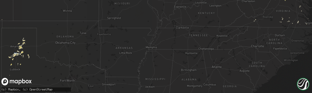
Hail Map in Delaware on August 4, 2022
The weather event in Delaware on August 4, 2022 includes Hail, Wind, and Tornado maps. 23 states and 417 cities were impacted and suffered possible damage. The total estimated number of properties impacted is 0.
Hail
Wind
Tornado
0
Estimated number of impacted properties by a 1.00" hail or larger0
Estimated number of impacted properties by a 1.75" hail or larger0
Estimated number of impacted properties by a 2.50" hail or largerStorm reports in Delaware
Delaware
| Date | Description |
|---|---|
| 08/04/20226:51 PM CDT | Dedot gauge at us 1 at appoquinimink river measured 58 mph gust. |
| 08/04/20223:06 AM CDT | At 805 PM EDT, severe thunderstorms were located along a line extending from near Goldsboro to Ridgely to near University Of Maryland Center For Environmental Studies, moving east at 30 mph. HAZARD...70 mph wind gusts and penny size hail. SOURCE...Radar indicated. IMPACT...Expect considerable tree damage. Damage is likely to mobile homes, roofs, and outbuildings. Locations impacted include... Dover, Easton, Milford, Denton, Harrington, Camden, Federalsburg, Bridgeville, Greensboro, Oakland, Ridgely, Trappe, Preston, Bowers, Goldsboro, Queen Anne, Woodside, Viola, Smithville and Hazlettville. |
| 08/04/20222:37 AM CDT | At 737 PM EDT, severe thunderstorms were located along a line extending from Kennedyville to Grasonville to near Chesapeake Beach, moving east at 25 mph. HAZARD...60 mph wind gusts and penny size hail. SOURCE...Radar indicated. IMPACT...Damage to roofs, siding, trees, and power lines is possible. Locations impacted include... Easton, Centerville, Talbot, Chestertown, Centreville, Romancoke, Oakland, Ridgely, St. Michaels, Church Hill, Oxford, Millington, Sudlersville, Queen Anne, Old Town, Grasonville, Starr, Copperville, Jumptown and Morgnec. |
| 08/04/20221:35 AM CDT | At 634 PM EDT, a severe thunderstorm was located near Bowleys Quarters, or near Back River, moving east at 40 mph. HAZARD...60 mph wind gusts and penny size hail. SOURCE...Radar indicated. IMPACT...Damage to roofs, siding, trees, and power lines is possible. Locations impacted include... Chestertown, Rock Hall, Millington, Betterton, Sassafras, Old Town, Langford, Newtown, Morgnec, Massey, Crumpton, Kennedyville, Galena and Kingstown. |
| 08/03/20228:21 PM CDT | Multiple areas in bethany beach... De with wires down. Time estimated via radar. |
| 08/03/20227:54 PM CDT | *** 1 inj *** tree fell into camper at trap pond state park. 1 minor injury reported. Time estimated via radar. |
| 08/03/20227:49 PM CDT | Reports of wires down in georgetown. Time estimated via radar. |
| 08/03/20227:46 PM CDT | Numerous trees and wires down across laurel... De. Time estimated via radar. |
| 08/03/20227:25 PM CDT | Reports of trees and wires down in greenwood... De. Time estimated via radar. |
All States Impacted by Hail Map on August 4, 2022
Cities Impacted by Hail Map on August 4, 2022
- Berkeley Springs, WV
- Campton, NH
- Holderness, NH
- Jefferson, NY
- Stamford, NY
- Melrose, NY
- Troy, NY
- Holtwood, PA
- Arlington, VT
- Wysox, PA
- Wyalusing, PA
- Mechanicville, NY
- Winner, SD
- Ravena, NY
- Slingerlands, NY
- Coeymans Hollow, NY
- Alcove, NY
- Feura Bush, NY
- Selkirk, NY
- Delmar, NY
- Bainbridge, NY
- Oxford, NY
- Greene, NY
- Schaghticoke, NY
- Stillwater, NY
- Schuylerville, NY
- Eldred, PA
- Turtlepoint, PA
- Smethport, PA
- Monongahela, PA
- Elizabeth, PA
- Sykesville, MD
- Woodbine, MD
- Gambrills, MD
- Millersville, MD
- Crownsville, MD
- Panhandle, TX
- Hart, TX
- Cohoes, NY
- Windsor, VA
- Suffolk, VA
- Mount Gilead, OH
- Cardington, OH
- New Park, PA
- Fawn Grove, PA
- Airville, PA
- Stewartstown, PA
- Pylesville, MD
- Ijamsville, MD
- Monrovia, MD
- New Market, MD
- Essex, MD
- Sparrows Point, MD
- Charlotte Court House, VA
- Cullen, VA
- Dimmitt, TX
- Petersburg, TX
- Long Valley, SD
- Mission, SD
- Martin, SD
- Kilgore, NE
- Tuthill, SD
- Cody, NE
- Saint Francis, SD
- Nenzel, NE
- Norris, SD
- Parmelee, SD
- Crookston, NE
- Valentine, NE
- Somerset, OH
- Beech Creek, PA
- Laurel Bloomery, TN
- Lake City, SC
- Kingstree, SC
- New Zion, SC
- Clio, SC
- Manchester Center, VT
- Gregory, SD
- Whiteford, MD
- Street, MD
- Patton, PA
- Martinsburg, PA
- Oil City, PA
- Bessemer, PA
- Hillsville, PA
- New Castle, PA
- Edinburg, PA
- Ashville, PA
- Loretto, PA
- Danby, VT
- Wallingford, VT
- Gifford, PA
- Lutherville Timonium, MD
- Rosedale, MD
- Parkville, MD
- Halethorpe, MD
- Baltimore, MD
- Catonsville, MD
- Cockeysville, MD
- Curtis Bay, MD
- Towson, MD
- Gwynn Oak, MD
- Brooklyn, MD
- Severn, MD
- Dundalk, MD
- Phoenix, MD
- Glen Burnie, MD
- Linthicum Heights, MD
- Nottingham, MD
- Summerhill, PA
- Portage, PA
- Cropseyville, NY
- White Post, VA
- Stephens City, VA
- Floydada, TX
- Owego, NY
- Candor, NY
- Anton, TX
- Littlefield, TX
- Needmore, PA
- Warfordsburg, PA
- Mardela Springs, MD
- Kim, CO
- Pleasantville, PA
- Turbeville, SC
- Howard, PA
- Northern Cambria, PA
- Nicktown, PA
- Silverton, TX
- Pampa, TX
- Kenbridge, VA
- Dundas, VA
- Stevensville, MD
- Easton, MD
- Claiborne, MD
- Saint Michaels, MD
- Mcdaniel, MD
- Spartanburg, SC
- Pauline, SC
- Groom, TX
- White Deer, TX
- Ballston Spa, NY
- Greenwich, NY
- Saratoga Springs, NY
- Fort Edward, NY
- Ulster, PA
- Rome, PA
- Guilford, NY
- Rockwood, PA
- Saxton, PA
- James Creek, PA
- Claremont, NH
- Charlestown, NH
- Amity, PA
- Royersford, PA
- Collegeville, PA
- Schwenksville, PA
- Carrollton, OH
- Nathalie, VA
- Burke, VA
- Fairfax Station, VA
- Wytheville, VA
- Fonda, NY
- Sprakers, NY
- Canajoharie, NY
- Palatine Bridge, NY
- Oldtown, MD
- Milan, PA
- Athens, PA
- Stanardsville, VA
- Elmira, NY
- Hedgesville, WV
- Shinglehouse, PA
- Port Allegany, PA
- Bellefonte, PA
- Julian, PA
- Huntingdon, PA
- Finleyville, PA
- Mountain Top, PA
- Freeland, PA
- White Haven, PA
- Drums, PA
- Ballston Lake, NY
- Burnt Hills, NY
- Schenectady, NY
- Punxsutawney, PA
- Milford, VA
- Hustle, VA
- Champlain, VA
- Claude, TX
- Campbell, NY
- Addison, NY
- Johnsonville, NY
- Buskirk, NY
- Valley Falls, NY
- Commodore, PA
- Cherry Tree, PA
- Wilkes Barre, PA
- Gouldsboro, PA
- Dysart, PA
- Divide, CO
- Florissant, CO
- Woodland Park, CO
- Horseheads, NY
- Wye Mills, MD
- Queen Anne, MD
- Centreville, MD
- Queenstown, MD
- Clifton Park, NY
- Tyrone, PA
- Spruce Creek, PA
- Peyton, CO
- Blairsville, PA
- Rougemont, NC
- Timberlake, NC
- Cloudcroft, NM
- Fairfax, VA
- Annandale, VA
- Falls Church, VA
- Florence, SC
- Brandywine, MD
- Mount Upton, NY
- North Bennington, VT
- Eagle Bridge, NY
- Bennington, VT
- Hoosick Falls, NY
- Tulia, TX
- Quitaque, TX
- Mill Hall, PA
- Greensboro, MD
- Ridgely, MD
- Cordova, MD
- Goldsboro, MD
- Denton, MD
- Felton, DE
- Hillsboro, MD
- Harrington, DE
- Royal Oak, MD
- Big Prairie, OH
- Glenmont, OH
- Brinkhaven, OH
- Alexandria, VA
- Monroeton, PA
- Towanda, PA
- Elida, NM
- Byron, GA
- Sussex, VA
- Yale, VA
- Stony Creek, VA
- Waverly, VA
- Donnybrook, ND
- Summit, NY
- Fultonham, NY
- Richmondville, NY
- West Fulton, NY
- Warnerville, NY
- Harleysville, PA
- Damascus, MD
- Brookeville, MD
- Gaithersburg, MD
- Mount Airy, MD
- Nichols, NY
- Waverly, NY
- Barton, NY
- Hancock, MD
- Kearneysville, WV
- Clear Brook, VA
- Bunker Hill, WV
- Berryville, VA
- Summit Point, WV
- Springfield, WV
- Cumberland, MD
- Newtown, VA
- Grasonville, MD
- Fallston, MD
- Monkton, MD
- Baldwin, MD
- Forest Hill, MD
- Jarrettsville, MD
- Lunenburg, VA
- Victoria, VA
- Bowie, MD
- Edgewater, MD
- Riva, MD
- Harwood, MD
- Annapolis, MD
- Galesville, MD
- Davidsonville, MD
- Upper Marlboro, MD
- West River, MD
- Lothian, MD
- Shady Side, MD
- New Waterford, OH
- East Palestine, OH
- Enon Valley, PA
- Petersburg, OH
- New Springfield, OH
- Pamplin, VA
- Allen, SD
- Schenevus, NY
- Worcester, NY
- Harpersfield, NY
- Charlotteville, NY
- Davenport, NY
- Hollis, OK
- Barney, GA
- Quitman, GA
- Morven, GA
- Henderson, NC
- Windsor, NY
- Alexandria, PA
- Petersburg, PA
- Pennsylvania Furnace, PA
- Port Crane, NY
- Linden, VA
- Flint Hill, VA
- Huntly, VA
- Hume, VA
- Belleville, PA
- Reedsville, PA
- Milroy, PA
- Dunkirk, MD
- Cripple Creek, CO
- White River, SD
- Wood, SD
- Okreek, SD
- Sayre, PA
- Ebensburg, PA
- Middletown, VA
- Strasburg, VA
- Odenton, MD
- Glenn Dale, MD
- Greenbelt, MD
- Lanham, MD
- Fort George G Meade, MD
- Laurel, MD
- Beltsville, MD
- Martinsburg, WV
- Olton, TX
- Plainview, TX
- Kress, TX
- Saint Johns, AZ
- Lakeland, GA
- Trappe, MD
- Canyon, TX
- Hudson, FL
- Brandon, MS
- Pelahatchie, MS
- King William, VA
- West Point, VA
- Saltsburg, PA
- Avonmore, PA
- Lakeview, TX
- Dorset, VT
- Childress, TX
- Yorktown, VA
- Happy, TX
- Wayside, TX
- Courtland, VA
- Tampa, FL
- Dublin, VA
- Voorheesville, NY
- Fort Hancock, TX
- New Port Richey, FL
- Skellytown, TX
- Trinidad, CO
- Nazareth, TX
- Chapel Hill, NC
- Hillsborough, NC
- Borger, TX
- Sierra Blanca, TX
- Shelby, NC
- Pittsboro, NC
- Easley, SC
- Bokeelia, FL
- West Rupert, VT
- Pawlet, VT
- Clover, VA
- Woodville, VA
- Washington, VA
- Sperryville, VA
- Lawrenceville, VA
- Dolphin, VA
- Webster Springs, WV
- Brownfield, TX
- Pritchett, CO
- Raleigh, NC
- Odessa, FL
- Graham, NC
- Efland, NC
- Shonto, AZ
- Randolph, VA
- Murrysville, PA
- Export, PA
- Slickville, PA
- Bryans Road, MD
- Accokeek, MD
- Effingham, SC
- Pamplico, SC
- Crewe, VA
- Turkey, TX
- Carrizozo, NM
- Woodbridge, VA
- Spring Hill, FL
- Land O'Lakes, FL
- Winburne, PA
- Lanse, PA
- Allport, PA
- Munson, PA
- Philipsburg, PA
- Hawk Run, PA
- West Decatur, PA
- Morrisdale, PA
- Gansevoort, NY
- Middleburgh, NY
- Flintstone, MD
- Ewell, MD


