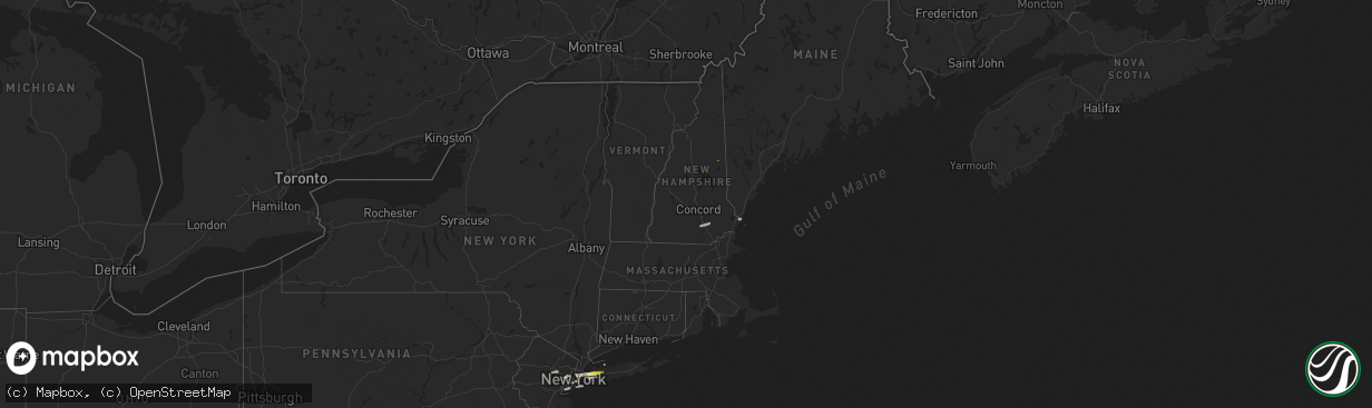
Hail Map in New Hampshire on July 25, 2022
The weather event in New Hampshire on July 25, 2022 includes Hail and Wind maps. 24 states and 180 cities were impacted and suffered possible damage. The total estimated number of properties impacted is 23.
Hail
Wind
23
Estimated number of impacted properties by a 1.00" hail or larger0
Estimated number of impacted properties by a 1.75" hail or larger0
Estimated number of impacted properties by a 2.50" hail or largerStorm reports in New Hampshire
New Hampshire
| Date | Description |
|---|---|
| 07/25/20223:49 PM CDT | Trained spotter observing 1 inch hail currently falling in madison on highway 113/conway rd near rock farm lane. |
| 07/25/20221:13 PM CDT | Tree down on wires on crowley rd. |
| 07/25/202212:52 PM CDT | Tree down on cottage ave. |
| 07/25/202212:48 PM CDT | Multiple utility poles reported down along the londonderry turnpike... Closing part of the road. Time estimated from radar. |
| 07/25/202212:42 PM CDT | Corrects previous tstm wnd dmg report from 2 n manchester. Three trees down on wires on bruce rd... Including one on a vehicle. |
| 07/25/202210:22 AM CDT | Thunderstorms brought down trees and large branches. Time estimated by radar. |
| 07/25/20226:06 AM CDT | At 1105 AM EDT, a severe thunderstorm was located over Rindge, or 8 miles south of Jaffrey, moving northeast at 55 mph. HAZARD...60 mph wind gusts and quarter size hail. SOURCE...Radar indicated. IMPACT...Hail damage to vehicles is expected. Expect wind damage to roofs, siding, and trees. Locations impacted include... Manchester, Nashua, Derry, Jaffrey, Merrimack, Salem, Bedford, Milford, Hooksett, Amherst, Litchfield, Hollis, Peterborough, New Boston, Mont Vernon, Fitzwilliam, Greenfield, Lyndeborough, Rindge and New Ipswich.This includes the following highways... Interstate 293 between mile markers 1 and 11. Interstate 93 between mile markers 7 and 29. |
| 07/25/20226:04 AM CDT | At 1103 AM EDT, a severe thunderstorm was located over Winchendon, or 10 miles south of Jaffrey, moving northeast at 50 mph. HAZARD...60 mph wind gusts and quarter size hail. SOURCE...Radar indicated. IMPACT...Expect wind damage to trees and power lines. Minor hail damage to vehicles is possible. Locations impacted include... Gardner, Winchendon, Townsend, Templeton, Ashburnham, Ashby and Royalston. |
All States Impacted by Hail Map on July 25, 2022
Cities Impacted by Hail Map on July 25, 2022
- Kimball, NE
- Bushnell, NE
- Bethesda, MD
- Catlett, VA
- Inglis, FL
- Willow City, ND
- Rugby, ND
- Guthrie, KY
- Allensville, KY
- Locust Grove, VA
- Spotsylvania, VA
- Unionville, VA
- Rhoadesville, VA
- New Athens, IL
- Freeburg, IL
- Mascoutah, IL
- Crookston, NE
- Portland, TN
- Tremont, MS
- Land O'Lakes, FL
- Charlottesville, VA
- Valentine, NE
- East Saint Louis, IL
- Elmont, NY
- Floral Park, NY
- Franklin Square, NY
- West Hempstead, NY
- Garden City, NY
- New Hyde Park, NY
- Savage, MT
- Kilgore, NE
- Kim, CO
- Far Rockaway, NY
- Brooklyn, NY
- Hayes, SD
- Fort Pierre, SD
- East Hanover, NJ
- Livingston, NJ
- Whippany, NJ
- Roseland, NJ
- Colorado Springs, CO
- Ravenden Springs, AR
- Ravenden, AR
- Hardy, AR
- Salt Flat, TX
- Dunnellon, FL
- Crystal River, FL
- Appomattox, VA
- Red House, VA
- Midland, VA
- Bealeton, VA
- McEwen, TN
- Tompkinsville, KY
- Charlotte Court House, VA
- Cullen, VA
- Roslyn Heights, NY
- Roslyn, NY
- Manhasset, NY
- Old Westbury, NY
- Albertson, NY
- Barboursville, VA
- Oldsmar, FL
- Tampa, FL
- Murdo, SD
- Draper, SD
- Las Animas, CO
- Franklin, KY
- Lynchburg, VA
- Evington, VA
- Forest, VA
- Selma, AL
- Dickson, TN
- Orange, VA
- Mineral, VA
- Adairville, KY
- Springfield, TN
- Harrison, NJ
- Kearny, NJ
- Secaucus, NJ
- Jersey City, NJ
- Newark, NJ
- Dickinson, ND
- Belfield, ND
- Palmyra, VA
- Troy, VA
- Keswick, VA
- Great Neck, NY
- Chiefland, FL
- Trenton, FL
- Rienzi, MS
- California, MD
- Hollywood, MD
- Whitman, NE
- Culpeper, VA
- Jeffersonton, VA
- Warrenton, VA
- Olmstead, KY
- Rye, NH
- Kittery Point, ME
- Portsmouth, NH
- New Castle, NH
- Lobelville, TN
- Waverly, TN
- Hurricane Mills, TN
- Parrish, FL
- Cedar Hill, TN
- Dupo, IL
- Saint Louis, MO
- Millstadt, IL
- East Carondelet, IL
- Wood Lake, NE
- Merriman, NE
- Cody, NE
- Bluemont, VA
- Paeonian Springs, VA
- Hamilton, VA
- Purcellville, VA
- Harpers Ferry, WV
- Waterford, VA
- Round Hill, VA
- Roseglen, ND
- Glen Head, NY
- Little Neck, NY
- Jericho, NY
- Primm Springs, TN
- Franklin, TN
- Clarksville, TN
- Centerville, TN
- Santa Fe, TN
- Columbia, TN
- Hudson, FL
- Nantucket, MA
- Syosset, NY
- Bethpage, TN
- Willow Beach, AZ
- Cedar Key, FL
- Cottontown, TN
- Hicksville, NY
- Long Island City, NY
- Westbury, NY
- Woodbury, NY
- Plainview, NY
- Whitestone, NY
- East Elmhurst, NY
- Oakland Gardens, NY
- New York, NY
- Sunnyside, NY
- Greenvale, NY
- Flushing, NY
- College Point, NY
- Williston Park, NY
- Woodside, NY
- Corona, NY
- Bayside, NY
- Astoria, NY
- Jackson Heights, NY
- Bedford, NH
- Auburn, NH
- Manchester, NH
- Staten Island, NY
- Martin, SD
- Tuthill, SD
- Northport, NY
- Carrizozo, NM
- Madison, NH
- Saint Inigoes, MD
- Ridge, MD
- Dameron, MD
- Eden, MD
- Princess Anne, MD
- Deal Island, MD
- Westover, MD
- Crisfield, MD
- Huntington Station, NY
- Huntington, NY
- Melville, NY
- Branson, CO
- Richardton, ND
- Gladstone, ND
- Taylor, ND


