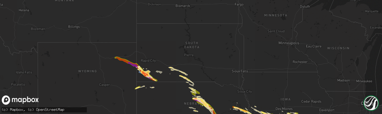
Hail Map in South Dakota on July 17, 2023
The weather event in South Dakota on July 17, 2023 includes Hail, Wind, and Tornado maps. 24 states and 1,163 cities were impacted and suffered possible damage. The total estimated number of properties impacted is 5,968.
Hail
Wind
Tornado
5,968
Estimated number of impacted properties by a 1.00" hail or larger4,976
Estimated number of impacted properties by a 1.75" hail or larger4,723
Estimated number of impacted properties by a 2.50" hail or largerStorm reports in South Dakota
South Dakota
| Date | Description |
|---|---|
| 07/17/20234:55 AM CDT | A local report indicates 1.00 inch wind near 2 N Rosebud |
| 07/16/202311:15 PM CDT | A local report indicates 59 MPH wind near Wasta |
| 07/16/202310:59 PM CDT | A local report indicates 60 MPH wind near 3 NW Wasta |
| 07/16/202310:53 PM CDT | Estimated 50 to 60 mph winds... Small branches down |
| 07/16/202310:36 PM CDT | A local report indicates 63 MPH wind near Rapid City Arpt |
| 07/16/202310:30 PM CDT | A local report indicates 2.50 inch wind near Oral |
| 07/16/202310:20 PM CDT | A local report indicates 2.50 inch wind near 9 W Smithwick |
| 07/16/202310:20 PM CDT | Mping report |
| 07/16/202310:17 PM CDT | A local report indicates 2.75 inch wind near 7 SSE Hot Springs |
| 07/16/202310:03 PM CDT | A local report indicates 2.50 inch wind near 1 W Hot Springs |
| 07/16/20239:58 PM CDT | A local report indicates 2.25 inch wind near 5 WNW Hot Springs |
| 07/16/20239:56 PM CDT | A local report indicates 1.75 inch wind near 5 W Hot Springs |
| 07/16/20239:54 PM CDT | A local report indicates 2.50 inch wind near 4 W Hot Springs |
| 07/16/20239:49 PM CDT | A local report indicates 66 MPH wind near 11 W Hot Springs |
| 07/16/20239:46 PM CDT | A local report indicates 1.25 inch wind near Argyle |
| 07/16/20239:15 PM CDT | Time estimated from radar. |
| 07/16/20239:12 PM CDT | A local report indicates 61 MPH wind near 10 W Jewel Cave |
All States Impacted by Hail Map on July 17, 2023
Cities Impacted by Hail Map on July 17, 2023
- Eddyville, IA
- Oskaloosa, IA
- Leigh, NE
- Clarkson, NE
- Cedar, IA
- Kirkville, IA
- Ottumwa, IA
- Fremont, IA
- Hedrick, IA
- Batavia, IA
- Howells, NE
- Schuyler, NE
- Dodge, NE
- Rogers, NE
- Scribner, NE
- North Bend, NE
- Fairfield, IA
- Eagleville, MO
- Hatfield, MO
- Ridgeway, MO
- Bethany, MO
- Fremont, NE
- Nickerson, NE
- Arlington, NE
- Hooper, NE
- Ames, NE
- Kennard, NE
- Blair, NE
- Valley, NE
- Washington, NE
- Bennington, NE
- Omaha, NE
- Carter Lake, IA
- Council Bluffs, IA
- Crescent, IA
- Gilman City, MO
- Trenton, MO
- Chillicothe, MO
- Jamesport, MO
- Chula, MO
- Knoxville, IA
- Milo, IA
- Pleasantville, IA
- Melcher Dallas, IA
- Lacona, IA
- Ackworth, IA
- Harvey, IA
- Tracy, IA
- Leighton, IA
- Pella, IA
- New Sharon, IA
- Chariton, IA
- Humeston, IA
- Williamson, IA
- Walnut, IA
- Atlantic, IA
- Lewis, IA
- Massena, IA
- Cumberland, IA
- Wiota, IA
- Bridgewater, IA
- Fontanelle, IA
- Greenfield, IA
- Orient, IA
- Glenwood, IA
- Silver City, IA
- Hastings, IA
- Imogene, IA
- Emerson, IA
- Essex, IA
- Malvern, IA
- Randolph, IA
- Shenandoah, IA
- Griswold, IA
- Elliott, IA
- Henderson, IA
- Red Oak, IA
- Centerville, MO
- Black, MO
- Braddyville, IA
- Blanchard, IA
- Elmo, MO
- Coin, IA
- Clearmont, MO
- College Springs, IA
- Clarinda, IA
- Burlington Junction, MO
- Skidmore, MO
- Maryville, MO
- Macksburg, IA
- Winterset, IA
- Osceola, IA
- Murray, IA
- Lorimor, IA
- Creston, IA
- Afton, IA
- Truro, IA
- Peru, IA
- Bunker, MO
- Lesterville, MO
- Barnard, MO
- Bolckow, MO
- Guilford, MO
- Florence, KS
- Burns, KS
- Leon, KS
- Ellington, MO
- Redford, MO
- Atlanta, KS
- Latham, KS
- Piedmont, MO
- El Dorado, KS
- Cambridge, KS
- Burden, KS
- Rosalia, KS
- Beaumont, KS
- Piedmont, KS
- Moline, KS
- Howard, KS
- Grenola, KS
- Mill Spring, MO
- Elk Falls, KS
- Elk City, KS
- Longton, KS
- Dexter, KS
- Cedar Vale, KS
- Winfield, KS
- Sedan, KS
- Peru, KS
- Niotaze, KS
- Maple City, KS
- Shidler, OK
- Newkirk, OK
- Chautauqua, KS
- Copan, OK
- Pawhuska, OK
- Havana, KS
- Dewey, OK
- Caney, KS
- Burbank, OK
- Bartlesville, OK
- Fairfax, OK
- Ochelata, OK
- Ramona, OK
- Nowata, OK
- Talala, OK
- Oologah, OK
- Claremore, OK
- Cassoday, KS
- Wisner, NE
- Beemer, NE
- Marion, KS
- Steelville, MO
- New Athens, IL
- Portsmouth, IA
- Logan, IA
- Woodbine, IA
- Albia, IA
- Cuba, MO
- Missouri Valley, IA
- Modale, IA
- Cedar Bluffs, NE
- Bourbon, MO
- Leasburg, MO
- Eldon, IA
- Libertyville, IA
- Douds, IA
- Selma, IA
- Anita, IA
- Hancock, IA
- Russell, IA
- Belleview, MO
- Bixby, MO
- Hillsboro, KS
- Minden, IA
- Persia, IA
- Neola, IA
- Shelby, IA
- Mineola, IA
- Platte Center, NE
- Columbus, NE
- Raymondville, MO
- Licking, MO
- Houston, MO
- Cedar Point, KS
- Herman, NE
- Beacon, IA
- Severy, KS
- Marissa, IL
- Lenzburg, IL
- New Virginia, IA
- Hugo, CO
- Avoca, IA
- Indianola, IA
- Hamilton, IA
- Bussey, IA
- Lucas, IA
- Birmingham, IA
- Potosi, MO
- Lovilia, IA
- Melrose, IA
- Independence, KS
- Coffeyville, KS
- Norwalk, IA
- Prole, IA
- Shannon City, IA
- Westboro, MO
- Rea, MO
- Union Star, MO
- Agency, IA
- Stockport, IA
- Elkhorn, NE
- Peabody, KS
- Walton, KS
- Hope, KS
- Abilene, KS
- Whitewater, KS
- Eureka, KS
- Potwin, KS
- Augusta, KS
- Keosauqua, IA
- Hillsboro, IA
- Bonaparte, IA
- Floris, IA
- Blakesburg, IA
- Bloomfield, IA
- Liberty Center, IA
- Saint Charles, IA
- Columbia, IA
- Chillicothe, IA
- University Park, IA
- Boss, MO
- Newton, KS
- Coulterville, IL
- Gypsum, KS
- Oakland, IA
- Cole Camp, MO
- Versailles, MO
- Stover, MO
- Lebanon, MO
- Osceola, MO
- Quincy, MO
- Weaubleau, MO
- Wheatland, MO
- Portage Des Sioux, MO
- Saint Charles, MO
- Florissant, MO
- Hazelwood, MO
- Saint Louis, MO
- Granite City, IL
- Venice, IL
- Madison, IL
- East Saint Louis, IL
- Lovejoy, IL
- Belleville, IL
- Stoutland, MO
- Richland, MO
- Waynesville, MO
- Saint Robert, MO
- Half Way, MO
- Bolivar, MO
- Polk, MO
- Buffalo, MO
- Rozel, KS
- Larned, KS
- Potomac, IL
- Danville, IL
- Bismarck, IL
- Covington, IN
- State Line, IN
- Pompano Beach, FL
- Coral Springs, FL
- Williamsport, IN
- Veedersburg, IN
- Hillsboro, IN
- Kinsley, KS
- Garfield, KS
- Lewis, KS
- Fair Grove, MO
- Pleasant Hope, MO
- Flemington, MO
- Strafford, MO
- Springfield, MO
- Rogersville, MO
- Marshfield, MO
- Fordland, MO
- Sparta, MO
- Bruner, MO
- Duke, MO
- Worden, IL
- Livingston, IL
- Seymour, MO
- Eureka, MO
- Fairmount, IL
- Sorento, IL
- Shelbyville, IL
- Catawissa, MO
- Hartville, MO
- Longview, IL
- Findlay, IL
- East Alton, IL
- Saint Clair, MO
- Pacific, MO
- Mountain Grove, MO
- Villa Grove, IL
- Saint James, MO
- Robertsville, MO
- Falcon, MO
- Witt, IL
- Oconee, IL
- Ballwin, MO
- Tower Hill, IL
- Lonedell, MO
- Staunton, IL
- Roby, MO
- Valley Park, MO
- Pana, IL
- Irving, IL
- Arcola, IL
- Taylor Springs, IL
- Hillsboro, IL
- Alhambra, IL
- Tuscola, IL
- Plato, MO
- Mansfield, MO
- Edwardsville, IL
- Walshville, IL
- High Ridge, MO
- Mount Olive, IL
- Sullivan, MO
- Homer, IL
- Lynchburg, MO
- South Roxana, IL
- Rolla, MO
- Roxana, IL
- Broadlands, IL
- Hartford, IL
- Grovespring, MO
- Newburg, MO
- Nokomis, IL
- Sullivan, IL
- Fenton, MO
- Edgar Springs, MO
- Cook Sta, MO
- Arthur, IL
- New Douglas, IL
- Rosamond, IL
- Philo, IL
- Ohlman, IL
- Lovington, IL
- Bethalto, IL
- Fithian, IL
- Atwood, IL
- Sidney, IL
- Union, MO
- Litchfield, IL
- Wood River, IL
- Pesotum, IL
- Tolono, IL
- Bethany, IL
- Moro, IL
- Butler, IL
- Assumption, IL
- Oakwood, IL
- Wildwood, MO
- Arcadia, IN
- Atlanta, IN
- Cicero, IN
- Noblesville, IN
- Westfield, IN
- Sheridan, IN
- Whitestown, IN
- Zionsville, IN
- Carmel, IN
- North Salem, IN
- Danville, IN
- Lizton, IN
- Pittsboro, IN
- Offerle, KS
- Oldfield, MO
- Ava, MO
- Garrison, MO
- Bradleyville, MO
- Chadwick, MO
- Greensburg, KS
- Thornfield, MO
- Theodosia, MO
- Rueter, MO
- Protem, MO
- Gainesville, MO
- Zanoni, MO
- Dora, MO
- Tecumseh, MO
- Caulfield, MO
- Bucklin, KS
- Avon, IN
- Indianapolis, IN
- Spearville, KS
- Ford, KS
- Mullinville, KS
- Pontiac, MO
- Peel, AR
- Isabella, MO
- Oakland, AR
- Yellville, AR
- Flippin, AR
- Bull Shoals, AR
- Mountain Home, AR
- Lakeview, AR
- Gassville, AR
- Cotter, AR
- Poplar Bluff, MO
- Fisk, MO
- Puxico, MO
- Brownsburg, IN
- Beech Grove, IN
- Raymore, MO
- Farmland, IN
- Winchester, IN
- Parker City, IN
- Pleasant Hill, MO
- Gravois Mills, MO
- Sunrise Beach, MO
- Camdenton, MO
- Climax Springs, MO
- Edwards, MO
- Roach, MO
- Harrisonville, MO
- Macks Creek, MO
- Eldridge, MO
- Tunas, MO
- Sturdivant, MO
- Zalma, MO
- Plainfield, IN
- Morristown, IN
- Shelbyville, IN
- Advance, MO
- Manilla, IN
- Homer, IN
- Rushville, IN
- Arlington, IN
- Bell City, MO
- Oran, MO
- Garden City, MO
- Liberty, IN
- College Corner, OH
- West College Corner, IN
- Camden, OH
- Harriet, AR
- Big Flat, AR
- Hollansburg, OH
- Fountain City, IN
- New Paris, OH
- New Madison, OH
- Eldorado, OH
- Arcanum, OH
- Minneola, KS
- Smithton, MO
- Sedalia, MO
- Edna, KS
- Bluejacket, OK
- Welch, OK
- Romney, IN
- Winchester, IL
- Godfrey, IL
- Dow, IL
- Elsah, IL
- Grafton, IL
- Lebanon, IN
- Thorntown, IN
- Collinsville, OK
- Rockville, IN
- Mora, MO
- Lowry City, MO
- Pittsburg, MO
- Hermitage, MO
- Fort Leonard Wood, MO
- Alton, IL
- Kaiser, MO
- Brumley, MO
- Tuscumbia, MO
- Ulman, MO
- Moweaqua, IL
- Dalton City, IL
- Cross Timbers, MO
- Warsaw, MO
- Laquey, MO
- Devils Elbow, MO
- Dixon, MO
- Palestine, WV
- Wappapello, MO
- Gillette, WY
- Winifrede, WV
- Eskdale, WV
- Hernshaw, WV
- Amesville, OH
- Athens, OH
- Patagonia, AZ
- Waynetown, IN
- New Market, IN
- Crawfordsville, IN
- Ladoga, IN
- New Ross, IN
- Eldon, MO
- Niangua, MO
- Bland, MO
- Owensville, MO
- Waycross, GA
- Jamestown, IN
- Belle, MO
- Clarksburg, OH
- Rosebud, MO
- Gerald, MO
- Brighton, MO
- Delaware, OK
- McGee, MO
- Charleston, WV
- Beulah, MO
- Vienna, MO
- Jefferson City, MO
- Linn, MO
- Westphalia, MO
- Freeburg, MO
- Koeltztown, MO
- Colfax, IN
- Clarks Hill, IN
- Armstrong, IL
- Frankfort, OH
- Washington Court House, OH
- Gainesville, FL
- Elkview, WV
- Tilton, IL
- Ogden, IL
- Rossville, IL
- Gifford, IL
- Penfield, IL
- Alvin, IL
- Henning, IL
- Collison, IL
- Fall River, KS
- Havre, MT
- Millstadt, IL
- Miami, WV
- Drybranch, WV
- Oberlin, LA
- Reeves, LA
- Kinder, LA
- Dry Creek, LA
- Afton, OK
- South West City, MO
- Fairland, OK
- Jay, OK
- Grove, OK
- Gravette, AR
- Sulphur Springs, AR
- Ragley, LA
- Linn Creek, MO
- Martinsville, MO
- Grant City, MO
- Crocker, MO
- Salem, MO
- Fairview Heights, IL
- Montreal, MO
- Singer, LA
- Taylorville, IL
- Osage Beach, MO
- Squires, MO
- Caseyville, IL
- Upper Tract, WV
- Petersburg, WV
- Jerome, MO
- Vinton, OH
- Modoc, IN
- Losantville, IN
- Chouteau, OK
- Pryor, OK
- Needham, AL
- Owasso, OK
- Wagoner, OK
- Inola, OK
- Catoosa, OK
- Wynona, OK
- Montezuma, IN
- Mecca, IN
- Lafayette, IN
- Frankfort, IN
- Bloomfield, MO
- Brixey, MO
- Nogales, AZ
- Sonoita, AZ
- Richmond Hill, GA
- Conway, MO
- South Charleston, WV
- Dunbar, WV
- Hartford City, IN
- Dunkirk, IN
- Deridder, LA
- Barnett, MO
- Dequincy, LA
- Vichy, MO
- Deepwater, MO
- Collins, MO
- Welch, WV
- Kimball, WV
- Williamsville, MO
- Linden, IN
- Ravenswood, WV
- Long Lane, MO
- Phillipsburg, MO
- Oakdale, LA
- Tipton, IN
- Carbon, IN
- Vail, AZ
- Portland, OH
- Saint Johns, FL
- Westpoint, IN
- Stonington, IL
- Collinsville, IL
- Marshall, AR
- Timbo, AR
- Onia, AR
- Fox, AR
- Leslie, AR
- Mountain View, AR
- Hardenville, MO
- Udall, MO
- Windyville, MO
- Marble Hill, MO
- Waverly, IL
- Auburn, IL
- Tucson, AZ
- Pawnee, IL
- Morrisonville, IL
- Kincaid, IL
- Palmer, IL
- Eaton, OH
- Oxford, OH
- Somerville, OH
- Mount Lemmon, AZ
- West Manchester, OH
- Lewisburg, OH
- Protection, KS
- Coldwater, KS
- Milroy, IN
- Laurel, IN
- Glenwood, IN
- Connersville, IN
- Metamora, IN
- Brookville, IN
- Quincy, IN
- Cloverdale, IN
- Gosport, IN
- Paragon, IN
- Hamilton, OH
- Peculiar, MO
- Spencer, IN
- Haviland, KS
- Creighton, MO
- Urich, MO
- Butler, MO
- Archie, MO
- Middletown, OH
- Franklin, OH
- Macomb, MO
- Rozet, WY
- Upton, WY
- Moorcroft, WY
- Branson, MO
- Dayton, OH
- Bellbrook, OH
- Waynesville, OH
- Spring Valley, OH
- Oregonia, OH
- Hollister, MO
- Omaha, AR
- Kirbyville, MO
- Lead Hill, AR
- Jackson, MO
- Oak Ridge, MO
- Cedarcreek, MO
- Cape Girardeau, MO
- Whitewater, MO
- Chaffee, MO
- Ashland, KS
- Norwood, MO
- Montrose, MO
- Appleton City, MO
- Harveysburg, OH
- Wilmington, OH
- Bloomington, IN
- Unionville, IN
- Chilhowee, MO
- Blairstown, MO
- Clinton, MO
- Leeton, MO
- Calhoun, MO
- Windsor, MO
- Lincoln, MO
- Harrison, AR
- Preston, MO
- Urbana, MO
- Everton, AR
- Valley Springs, AR
- Saint Joe, AR
- Wickliffe, KY
- Barlow, KY
- La Center, KY
- Kevil, KY
- Brookport, IL
- Smithland, KY
- Grand Rivers, KY
- Newcastle, WY
- Osage, WY
- Nashville, IN
- Gilbert, AR
- Harrison, NE
- Van Tassell, WY
- Lusk, WY
- Eddyville, KY
- Fredonia, KY
- Kuttawa, KY
- Marion, KY
- Tiline, KY
- Hill City, SD
- Edgemont, SD
- Custer, SD
- Hot Springs, SD
- Pringle, SD
- Buffalo Gap, SD
- Oral, SD
- Smithwick, SD
- Oelrichs, SD
- Springville, IN
- Bedford, IN
- Heltonville, IN
- Pine Ridge, SD
- Oglala, SD
- Medora, IN
- Campbellsburg, IN
- Vallonia, IN
- Norman, IN
- Scottsburg, IN
- Salem, IN
- Princeton, KY
- Greenville, MO
- Fairburn, SD
- Clinton, KY
- Brownstown, IN
- Elizabethtown, IN
- Columbus, IN
- Grammer, IN
- Newport, PA
- New Bloomfield, PA
- Garita, NM
- Maysville, KY
- Germantown, KY
- Freetown, IN
- Seymour, IN
- Farmersville, IL
- Chadron, NE
- Douglas, WY
- Henderson, NV
- Gonzales, LA
- Benton, KY
- Symsonia, KY
- Florence, MO
- New Straitsville, OH
- San Manuel, AZ
- Oracle, AZ
- Mammoth, AZ
- North Vernon, IN
- Commiskey, IN
- Olmsted, IL
- De Soto, MO
- Dittmer, MO
- Festus, MO
- Grubville, MO
- Luebbering, MO
- Hillsboro, MO
- Fillmore, IN
- Greencastle, IN
- New Palestine, IN
- Dawson Springs, KY
- West Paducah, KY
- Ledbetter, KY
- Bardwell, KY
- Boaz, KY
- Arlington, KY
- Charleston, MO
- Paducah, KY
- Calvert City, KY
- Cunningham, KY
- South Salem, OH
- Fortuna, MO
- Saint Augustine, FL
- Westport, IN
- Greensburg, IN
- Amado, AZ
- Trenton, OH
- Fishers, IN
- Milton, KY
- Madison, IN
- Kyle, SD
- Deputy, IN
- Patterson, MO
- Racine, OH
- Peridot, AZ
- Owaneco, IL
- Ellettsville, IN
- Lynn, IN
- Richmond, IN
- Crawford, NE
- Chestnutridge, MO
- Kissee Mills, MO
- Taneyville, MO
- Walnut Shade, MO
- Rockaway Beach, MO
- Forsyth, MO
- Russellville, MO
- Catlin, IL
- Perrysville, IN
- Westville, IL
- Martinsville, IN
- Poland, IN
- Coatesville, IN
- Fountaintown, IN
- Fifty Six, AR
- Kansas City, MO
- Scott City, MO
- Butlerville, IN
- East Lynne, MO
- Grandview, MO
- Lees Summit, MO
- Greenwood, MO
- Reeds Spring, MO
- Vevay, IN
- Carrollton, KY
- Paris Crossing, IN
- Solsberry, IN
- Letart, WV
- Mount Alto, WV
- Cottageville, WV
- Millwood, WV
- New Holland, OH
- Holden, MO
- Lake Charles, LA
- Nineveh, IN
- Trafalgar, IN
- East Prairie, MO
- New Madrid, MO
- Sulphur, LA
- Bridgeton, IN
- Rosedale, IN
- Brazil, IN
- Sells, AZ
- Divernon, IL
- Thayer, IL
- Virden, IL
- Clayton, IN
- Stilesville, IN
- Monrovia, IN
- Westlake, LA
- Vinton, LA
- Galion, OH
- Caledonia, OH
- Ashville, OH
- Circleville, OH
- Liverpool, PA
- Halifax, PA
- Millersburg, PA
- Sorrento, LA
- Saint Amant, LA
- Sabina, OH
- New Vienna, OH
- Clarksville, OH
- Brookville, OH
- West Alexandria, OH
- New Lebanon, OH
- Reelsville, IN
- Glendo, WY
- Huggins, MO
- Graff, MO
- Cabool, MO
- Freeburg, PA
- Selinsgrove, PA
- Middleburg, PA
- Mount Pleasant Mills, PA
- Lebanon, OH
- Springboro, OH
- Metropolis, IL
- Franklin, IN
- Freedom, IN
- Centerpoint, IN
- Stinesville, IN
- Morgantown, IN
- Scipio, IN
- Pulaski, IL
- Villa Ridge, IL
- Annapolis, MO
- Needham, IN
- Boggstown, IN
- Mount Olivet, KY
- Columbus, KY
- Waveland, IN
- Marshall, IN
- Spokane, MO
- Bloomfield, IN
- Flat Rock, IN
- Edinburgh, IN
- New Iberia, LA
- Brownsville, TN
- Ripley, WV
- Sandyville, WV
- West Columbia, WV
- Vulcan, MO
- Bainbridge, IN
- Russellville, IN
- Roachdale, IN
- Maurepas, LA
- Eugene, MO
- Henley, MO
- Greenfield, IN
- Mooresville, IN
- Vanduser, MO
- Brownwood, MO
- Sikeston, MO
- Glenallen, MO
- Gipsy, MO
- Mayslick, KY
- Seven Mile, OH
- Wilkinson, IN
- New Castle, IN
- Hagerstown, IN
- Chrisman, IL
- Bargersville, IN
- Middletown, IN
- Springport, IN
- Kingsville, MO
- Cedar Grove, TN
- Las Vegas, NM
- Waldron, IN
- Saint Paul, IN
- Story, AR
- Brooksville, KY
- Green Ridge, MO
- Milan, TN
- Medina, TN
- Camby, IN
- Cottonwood, AZ
- Cynthiana, KY
- Norfork, AR
- Drury, MO
- Gilbertsville, KY
- Fortville, IN
- Fairland, IN
- Pendleton, IN
- Ingalls, IN
- Greenwood, IN
- Whiteland, IN
- Knightstown, IN
- Shirley, IN
- Edinburg, IL
- Everett, PA
- Bedford, PA
- Attica, KS
- Jamestown, OH
- Xenia, OH
- Louisville, KY
- Finchville, KY
- Fisherville, KY
- Simpsonville, KY
- Shelbyville, KY
- Sellersburg, IN
- Jeffersonville, IN
- Prospect, KY
- Glenview, KY
- Pewee Valley, KY
- Crestwood, KY
- Bardstown, KY
- New Haven, KY
- Loretto, KY
- Springfield, KY
- Lebanon, KY
- Heartwell, NE
- Juniata, NE
- Kenesaw, NE
- Hastings, NE
- Holstein, NE
- Roseland, NE
- Ayr, NE
- Parksville, KY
- Gravel Switch, KY
- Brighton, IL
- Richland, MT
- Opheim, MT
- Stapleton, NE
- Wood, SD
- Wanblee, SD
- Duryea, PA
- Pittston, PA
- Wyoming, PA
- Clarks Summit, PA
- White River, SD
- Humboldt, TN
- Parmelee, SD
- Mission, SD
- Saint Francis, SD
- Boston, KY
- Elm Creek, NE
- Nicholasville, KY
- Long Valley, SD
- Kadoka, SD
- Croton, OH
- Johnstown, OH
- Trumbull, NE
- Harvard, NE
- Floyds Knobs, IN
- Pekin, IN
- Borden, IN
- Palmyra, IN
- Fredericksburg, IN
- Brady, NE
- Bedford, KY
- Worthville, KY
- Turners Station, KY
- Sanders, KY
- Norris, SD
- Sutton, NE
- Crothersville, IN
- Lexington, IN
- Austin, IN
- Elizabeth, IN
- Shepherdsville, KY
- Lebanon Junction, KY
- West Point, KY
- Anselmo, NE
- Maricopa, AZ
- Whitewater, MT
- Merna, NE
- Callaway, NE
- Arnold, NE
- Broken Bow, NE
- Versailles, KY
- Kearney, NE
- Shelton, NE
- Wood River, NE
- Gibbon, NE
- Kinmundy, IL
- Amherst, NE
- Riverdale, NE
- Salvisa, KY
- Laconia, IN
- Tunnelton, IN
- Orleans, IN
- Mitchell, IN
- Comfort, WV
- Cabin Creek, WV
- Point Pleasant, WV
- New Haven, WV
- Mason, WV
- Morrow, OH
- Central City, NE
- Wilber, NE
- Chillicothe, OH
- Friend, NE
- Harrodsburg, KY
- Lawrenceburg, KY
- Wilmore, KY
- Clarksville, IN
- Campbellsburg, KY
- Owenton, KY
- New Liberty, KY
- Hanover, IN
- Oolitic, IN
- Alma, IL
- Taylorsville, KY
- New Albany, IN
- Perryville, KY
- Bradfordsville, KY
- Atkinson, NE
- Shawnee, OH
- Taylor, NE
- Burwell, NE
- Ord, NE
- Ericson, NE
- Scotia, NE
- Elyria, NE
- North Loup, NE
- Brewster, NE
- Greeley, NE
- Wolbach, NE
- Saint Paul, NE
- Elba, NE
- Lame Deer, MT
- Birney, MT
- Crow Agency, MT
- Hardin, MT
- Rogersville, TN
- Sargent, NE
- Rutledge, TN
- Jefferson City, TN
- New Market, TN
- Hulett, WY
- Rosebud, SD
- Winner, SD
- Springview, NE
- Valentine, NE
- Hustonville, KY
- Dandridge, TN
- Sevierville, TN
- Columbia, KY
- Aladdin, WY
- Alva, WY
- Ainsworth, NE
- Bassett, NE
- Ballantine, MT
- Johnstown, NE
- Wood Lake, NE
- Long Pine, NE
- Weston, WY
- Ashton, NE
- Williamsburg, KY
- Parkers Lake, KY
- Whitley City, KY
- Elk Horn, KY
- Liberty, KY
- Dunnville, KY
- Firth, NE
- Adams, NE
- Middleburg, KY
- New Hope, KY
- Busby, MT
- Burnside, KY
- Huntley, MT
- Waynesburg, KY
- Eubank, KY
- Kings Mountain, KY
- Douglas, NE
- Windsor, KY
- Knifley, KY
- Nancy, KY
- Somerset, KY
- Sparks, NE
- Talbott, TN
- White Pine, TN
- Powder Springs, TN
- Blaine, TN
- Washburn, TN
- Morrill, KS
- Hiawatha, KS
- Farwell, NE
- Otter, MT
- Kearney, MO
- Lawson, MO
- Edgerton, MO
- Fair Play, MO
- Lone Jack, MO
- Oak Grove, MO
- Sneedville, TN
- Liberty, MO
- Holt, MO
- Excelsior Springs, MO
- Purdum, NE


