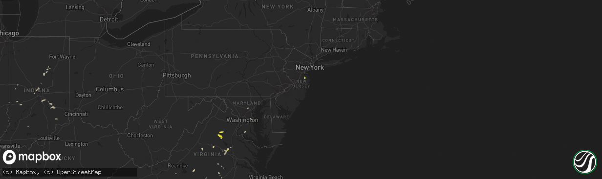
Hail Map in New Jersey on July 16, 2022
The weather event in New Jersey on July 16, 2022 includes Wind and Hail maps. 19 states and 312 cities were impacted and suffered possible damage. The total estimated number of properties impacted is 1,638.
Wind
Hail
1,638
Estimated number of impacted properties by a 1.00" hail or larger0
Estimated number of impacted properties by a 1.75" hail or larger0
Estimated number of impacted properties by a 2.50" hail or largerStorm reports in New Jersey
New Jersey
| Date | Description |
|---|---|
| 07/16/20223:23 PM CDT | Wires down reported in colts neck... Nj. Time estimated via radar. |
| 07/16/20223:20 PM CDT | Tree down through a deck left some damage via social media. Time estimated via radar. |
| 07/16/20223:01 PM CDT | Wires down in marlboro... Nj. Time estimated via radar. |
| 07/16/20223:00 PM CDT | Social media video of hail and strong winds. Quarter size hail was estimated from the person who sent report in. Time estimated via radar. |
| 07/16/20222:59 PM CDT | Trees on wires near mccampbell road in holmdel. Time estimated via radar. |
| 07/15/202210:57 PM CDT | At 357 PM EDT, a severe thunderstorm was located over Holmdel, or 10 miles west of Long Branch, moving southeast at 10 mph. HAZARD...60 mph wind gusts and quarter size hail. SOURCE...Radar indicated. IMPACT...Minor damage to vehicles is possible. Wind damage to roofs, siding, trees, and power lines is possible. Locations impacted include... Long Branch, Asbury Park, Middletown, Howell, Marlboro, Tinton Falls, Holmdel, Red Bank, Farmingdale, East Freehold, Elberon, Collingwood Park, Lincroft, Morganville, Navesink, Eatontown, Freehold, West Long Branch, Rumson and Little Silver.This includes Garden State Parkway between mile markers 100 and 117. |
All States Impacted by Hail Map on July 16, 2022
Cities Impacted by Hail Map on July 16, 2022
- Burwell, NE
- Hugo, CO
- Atkinson, NE
- Stuart, NE
- Ellendale, ND
- Loup City, NE
- North Loup, NE
- Ord, NE
- Ashton, NE
- Buffalo Gap, SD
- Hot Springs, SD
- Farnam, NE
- Edgeley, ND
- Verona, ND
- Hazard, NE
- Ravenna, NE
- Rockville, NE
- Oran, MO
- Fredericktown, MO
- Glenallen, MO
- Zalma, MO
- Marble Hill, MO
- Advance, MO
- Greenville, MO
- Marquand, MO
- Montpelier, ND
- Louisburg, NC
- Edgewater, MD
- Davidsonville, MD
- Harwood, MD
- Cozad, NE
- Lexington, NE
- Eddyville, NE
- Fullerton, ND
- Battle Lake, MN
- Clitherall, MN
- Callaway, NE
- Gothenburg, NE
- Morganville, NJ
- Colts Neck, NJ
- Marlboro, NJ
- Holmdel, NJ
- Greensburg, IN
- Hendley, NE
- Beaver City, NE
- Shelbyville, IN
- Wilsons, VA
- Blackstone, VA
- Purdum, NE
- Buffalo Junction, VA
- Clarksville, VA
- Mason City, NE
- Kingman, IN
- Nelson, VA
- Virgilina, VA
- Broken Bow, NE
- Sumner, NE
- Oconto, NE
- Wild Horse, CO
- Karval, CO
- Kit Carson, CO
- Saint Francis, KS
- Bowling Green, IN
- Centerpoint, IN
- Poland, IN
- Overton, NE
- Peridot, AZ
- Colorado Springs, CO
- Brownsburg, IN
- Indianapolis, IN
- Avon, IN
- Sells, AZ
- Clearwater, NE
- La Fontaine, IN
- Wabash, IN
- Vona, CO
- Inman, NE
- Naper, NE
- Oneill, NE
- Page, NE
- Mills, NE
- Ewing, NE
- Carmel, IN
- Zionsville, IN
- Nogales, AZ
- Rio Rico, AZ
- Tumacacori, AZ
- Oxford, NE
- Cambridge, NE
- Holbrook, NE
- Arapahoe, NE
- Stamford, NE
- Eustis, NE
- Edison, NE
- Catonsville, MD
- Ellicott City, MD
- Whiteland, IN
- Needham, IN
- Boggstown, IN
- Franklin, IN
- Fairland, IN
- Westfield, IN
- Greentown, IN
- Windfall, IN
- Sargent, NE
- Eads, CO
- Ramah, CO
- Rush, CO
- Oral, SD
- Lamoure, ND
- Robbins, NC
- Eagle Springs, NC
- Georgetown, MS
- Hazlehurst, MS
- Tonopah, AZ
- Vail, AZ
- Tucson, AZ
- Marion, IN
- Boonville, NC
- Yadkinville, NC
- Hillsboro, IN
- State Road, NC
- Elkin, NC
- Brodnax, VA
- Miami, AZ
- Concord, NC
- Greensboro, NC
- Globe, AZ
- Faber, VA
- Lovingston, VA
- Pleasanton, NE
- Shelton, NE
- Riverdale, NE
- Gibbon, NE
- Kearney, NE
- Boelus, NE
- Farwell, NE
- Elba, NE
- Saint Paul, NE
- Miller, NE
- Cairo, NE
- Dannebrog, NE
- Scotia, NE
- Grand Island, NE
- Wolbach, NE
- Sheridan Lake, CO
- Merna, NE
- Wood River, NE
- Sonoita, AZ
- Henning, MN
- Oxford, NC
- Kenesaw, NE
- Juniata, NE
- Amherst, NE
- Rothsay, MN
- Trinidad, CO
- Green Valley, AZ
- Amado, AZ
- Culpeper, VA
- Litchfield, NE
- Oilville, VA
- Crozier, VA
- Syracuse, KS
- Troy, VA
- Palmyra, VA
- Stuart, VA
- Ansley, NE
- Young, AZ
- San Manuel, AZ
- West Baden Springs, IN
- Shipman, VA
- Nellysford, VA
- Vass, NC
- Dunning, NE
- Saint Libory, NE
- Kenbridge, VA
- Long Island, VA
- Hurt, VA
- Gladys, VA
- Lowry, MN
- Glenwood, MN
- Cicero, IN
- Madison, IN
- Lisbon, ND
- Faison, NC
- Red Oak, VA
- Rougemont, NC
- Westerville, NE
- Alda, NE
- Lakeland, FL
- Mulberry, FL
- Milton, NC
- Alton, VA
- West Terre Haute, IN
- Wilsonville, NE
- Enfield, NC
- Whitakers, NC
- Anselmo, NE
- Rye, CO
- Bumpass, VA
- Manakin Sabot, VA
- Montpelier, VA
- Beaverdam, VA
- Maidens, VA
- Rockville, VA
- Rapidan, VA
- Unionville, VA
- Locust Dale, VA
- Orange, VA
- Moorefield, NE
- Marienthal, KS
- Salisbury, NC
- Spencer, NC
- Lakin, KS
- Doswell, VA
- Ruther Glen, VA
- Arnold, NE
- Brazil, IN
- Corning, KS
- Centralia, KS
- Pelican Rapids, MN
- Chesterfield, SC
- Patrick, SC
- Danville, VA
- Eden, NC
- Thibodaux, LA
- Elm Creek, NE
- Converse, IN
- Chambers, AZ
- Doniphan, NE
- Greeley, NE
- Elyria, NE
- Swayzee, IN
- La Plata, MD
- Charlotte Hall, MD
- Milroy, IN
- Waldron, IN
- Saint Paul, IN
- Des Allemands, LA
- Paradis, LA
- Holly, CO
- Fort Mcdowell, AZ
- Seagrove, NC
- Raeford, NC
- Eure, NC
- Gates, NC
- Mineral, VA
- Gum Spring, VA
- Sandy Hook, VA
- Brandy Station, VA
- Elkwood, VA
- Stevensburg, VA
- Dennison, IL
- Amelia Court House, VA
- Snow Camp, NC
- Burlington, NC
- Jetersville, VA
- Deerfield, KS
- Brady, NE
- Joes, CO
- Clinton, NC
- Spring Grove, PA
- York, PA
- Seven Valleys, PA
- Mitchells, VA
- Rhoadesville, VA
- Greenup, IL
- Casey, IL
- Callaway, VA
- Dundas, VA
- Roxboro, NC
- Roseland, NE
- Heartwell, NE
- Minden, NE
- Holstein, NE
- Ong, NE
- Hastings, NE
- Belleville, KS
- Harvard, NE
- Inland, NE
- Byron, NE
- Deshler, NE
- Superior, NE
- Red Cloud, NE
- Oak, NE
- Fairfield, NE
- Deweese, NE
- Guide Rock, NE
- Trumbull, NE
- Edgar, NE
- Nelson, NE
- Lawrence, NE
- Glenvil, NE
- Davenport, NE
- Ruskin, NE
- Hebron, NE
- Clay Center, NE
- Republic, KS
- Giltner, NE
- Hardy, NE
- Blue Hill, NE
- Ayr, NE
- Saronville, NE
- Chester, NE
- Bladen, NE
- Leopold, MO
- Whitewater, MO
- Sahuarita, AZ
- Saint Hilaire, MN
- Red Lake Falls, MN
- Orchard, NE
- Ericson, NE


