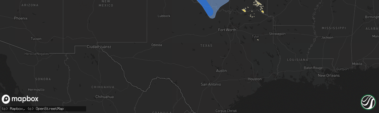
Hail Map in Texas on July 8, 2023
The weather event in Texas on July 8, 2023 includes Hail, Wind, and Tornado maps. 28 states and 589 cities were impacted and suffered possible damage. The total estimated number of properties impacted is 0.
Hail
Wind
Tornado
0
Estimated number of impacted properties by a 1.00" hail or larger0
Estimated number of impacted properties by a 1.75" hail or larger0
Estimated number of impacted properties by a 2.50" hail or largerStorm reports in Texas
Texas
| Date | Description |
|---|---|
| 07/08/20234:52 AM CDT | A local report indicates 59 MPH wind near 2 SSE Wichita Falls |
| 07/08/20234:49 AM CDT | A local report indicates 64 MPH wind near 1 W Petrolia |
| 07/08/20234:45 AM CDT | A local report indicates 76 MPH wind near 3 NW Lakeside City |
| 07/08/20231:29 AM CDT | Severe gusts occurred from 129 am cdt through 141 am cdt with a peak gust of 59 mph at 129 am cdt. |
| 07/08/20231:25 AM CDT | Severe gusts occurred from 125 am cdt to 140 am cdt with a peak gust of 69 mph at 131 am cdt. |
| 07/08/20231:22 AM CDT | Severe gusts occurred from 122 am cdt through 132 am cdt with a peak of 63 mph at 122 am cdt. |
| 07/08/202312:53 AM CDT | Wt mesonet site had severe gusts from 1253 am cdt to 1255 am cdt... With a peak of 61 mph at 1255 am cdt. |
| 07/08/202312:31 AM CDT | A local report indicates 58 MPH wind near 9 NNE Sunray |
| 07/08/202312:24 AM CDT | A local report indicates 60 MPH wind near 4 E Perryton |
| 07/07/202311:50 PM CDT | West texas mesonet. Severe gust along leading edge of thunderstorm outflow. |
| 07/07/202310:47 PM CDT | West texas mesonet report. |
| 07/07/20239:58 PM CDT | Wtm station gusted to 61 mph at 9:58 pm... Then dropped before hitting 58 mph at 10:03 pm. |
| 07/07/20239:47 PM CDT | A local report indicates 60 MPH wind near 3 NNE Umbarger |
| 07/07/20238:48 PM CDT | A local report indicates 61 MPH wind near 11 WNW Bootleg |
All States Impacted by Hail Map on July 8, 2023
Cities Impacted by Hail Map on July 8, 2023
- Idabel, OK
- Valliant, OK
- Winthrop, AR
- Foreman, AR
- Heavener, OK
- Howe, OK
- Haworth, OK
- Broken Bow, OK
- Gwinn, MI
- Hodgen, OK
- Wister, OK
- Rattan, OK
- Snow, OK
- Nashoba, OK
- Vernon, AL
- Sulligent, AL
- Poteau, OK
- Robinson, IL
- Willow Hill, IL
- Flat Rock, IL
- Oblong, IL
- Hot Springs National Park, AR
- West Liberty, IL
- Sardis, MS
- Red Oak, OK
- Claremont, IL
- Little Rock, AR
- Lake Cormorant, MS
- Charlotte, NC
- Heth, AR
- Earle, AR
- Fulton, MS
- Kinta, OK
- Rapid City, SD
- Scottsbluff, NE
- Harrison, NE
- Rock, MI
- Rapid River, MI
- Minatare, NE
- Bayard, NE
- Melbeta, NE
- Gering, NE
- Mcgrew, NE
- Buffalo, WY
- Kaycee, WY
- Harrisburg, NE
- Platteville, CO
- Fort Lupton, CO
- Bridgeport, NE
- Greenbrier, TN
- Springfield, TN
- Goodlettsville, TN
- Haxtun, CO
- Hudson, CO
- Lusk, WY
- Keenesburg, CO
- Hendersonville, TN
- Whites Creek, TN
- Joelton, TN
- Madison, TN
- Holyoke, CO
- Old Hickory, TN
- Nashville, TN
- Yuma, CO
- Wray, CO
- Jay Em, WY
- Morrison, CO
- Littleton, CO
- Denver, CO
- Torrington, WY
- Haigler, NE
- Lone Tree, CO
- Castle Rock, CO
- Parker, CO
- Englewood, CO
- Saint Francis, KS
- Kimball, NE
- Colorado Springs, CO
- Peyton, CO
- Hermitage, TN
- Mount Juliet, TN
- Dix, NE
- Dalton, NE
- Gurley, NE
- Sidney, NE
- Newcastle, WY
- Lance Creek, WY
- Douglas, WY
- Gillette, WY
- Yoder, CO
- Calhan, CO
- Sedgwick, CO
- Fleming, CO
- Paoli, CO
- Rush, CO
- Goodland, KS
- Edson, KS
- Brewster, KS
- Ramah, CO
- Shannon, NC
- Hartford, KY
- Olaton, KY
- Beaver Dam, KY
- Midwest, WY
- Briggsdale, CO
- Carney, MI
- Deatsville, AL
- Marbury, AL
- Hamlet, NC
- Bennett, CO
- Strasburg, CO
- Mitchell, NE
- Wright City, OK
- Snyder, CO
- Escanaba, MI
- Louisville, MS
- Crenshaw, MS
- Powderly, TX
- Arthur City, TX
- Underwood, IN
- Henryville, IN
- Lexington, IN
- Nabb, IN
- Portland, TN
- Golden, CO
- Evergreen, CO
- Idledale, CO
- Indian Hills, CO
- Milan, TN
- Velva, ND
- Upton, WY
- Greeley, CO
- Eaton, CO
- Lucerne, CO
- Galeton, CO
- Ferdinand, IN
- Red Springs, NC
- Santa Rosa, NM
- Pontotoc, MS
- Randolph, MS
- Blue Mountain, MS
- Ripley, MS
- Prattville, AL
- Verbena, AL
- Paris, TX
- Brookston, TX
- Bark River, MI
- Gibbstown, NJ
- Mickleton, NJ
- Berwyn, PA
- Newtown Square, PA
- Malvern, PA
- Abita Springs, LA
- Bush, LA
- Covington, LA
- Madisonville, LA
- Lodgepole, NE
- Chappell, NE
- Bennington, OK
- Bokchito, OK
- Telephone, TX
- Durant, OK
- Ivanhoe, TX
- Columbus, NJ
- Trenton, NJ
- Robbinsville, NJ
- Chesterfield, NJ
- Marks, MS
- Adolphus, KY
- Bowling Green, KY
- Scottsville, KY
- Alvaton, KY
- Champion, NE
- Carriere, MS
- Picayune, MS
- Garvin, OK
- Ringold, OK
- Evanston, IN
- Grandview, IN
- Lamar, IN
- Faunsdale, AL
- Linden, AL
- Perkins, MI
- Cuervo, NM
- Arlington, AL
- Thomaston, AL
- Catherine, AL
- Crook, CO
- Iliff, CO
- Hopkinsville, KY
- Crofton, KY
- Media, PA
- Glen Mills, PA
- Flourtown, PA
- Fort Washington, PA
- Lafayette Hill, PA
- Saint Meinrad, IN
- Santa Claus, IN
- Coosada, AL
- Wetumpka, AL
- Bethpage, TN
- Westmoreland, TN
- Opp, AL
- Ruidoso, NM
- Byers, CO
- Lonoke, AR
- Defuniak Springs, FL
- Nichols, SC
- Boswell, OK
- Atoka, OK
- Pembroke, KY
- Elkton, KY
- Trenton, KY
- Watford City, ND
- Corona, NM
- Live Oak, FL
- Mayo, FL
- Marianna, AR
- Palestine, AR
- Samson, AL
- Coffee Springs, AL
- Deport, TX
- Pattonville, TX
- Charleston, SC
- Clanton, AL
- Elba, AL
- Jack, AL
- English, IN
- Galivants Ferry, SC
- Kinston, AL
- Elmore, AL
- Moro, AR
- Cottontown, TN
- Trenton, TN
- South Hadley, MA
- Granby, MA
- Blossom, TX
- Saginaw, MI
- Batesville, MS
- Olney Springs, CO
- Boone, CO
- Ordway, CO
- Manville, WY
- Lost Springs, WY
- Cheyenne, WY
- Carpenter, WY
- Grover, CO
- Nunn, CO
- Sugar City, CO
- Manzanola, CO
- Rocky Ford, CO
- Swink, CO
- La Junta, CO
- Shawnee, WY
- Glendo, WY
- Orchard, CO
- Las Animas, CO
- Kim, CO
- Weldona, CO
- Karval, CO
- Pritchett, CO
- Canyon, TX
- Wildorado, TX
- Amarillo, TX
- Happy, TX
- Andalusia, AL
- Wing, AL
- Elgin, AZ
- Tucumcari, NM
- Marlborough, NH
- Nelson, NH
- Harrisville, NH
- Voltaire, ND
- Hereford, AZ
- Bisbee, AZ
- New Madrid, MO
- Martinsdale, MT
- Ronda, NC
- Birch Tree, MO
- Alton, MO
- Trementina, NM
- Aynor, SC
- Elizabeth, CO
- Winona, KS
- Monument, KS
- Otis, CO
- Akron, CO
- Lilbourn, MO
- Maxton, NC
- Brush, CO
- Hugo, CO
- Grafton, NH
- Kiowa, CO
- Elbert, CO
- Pueblo, CO
- Conchas Dam, NM
- Evergreen, AL
- Castleberry, AL
- Dayton, TN
- Fountain, CO
- Hartford, AL
- Chancellor, AL
- Enterprise, AL
- Daleville, AL
- Burns, WY
- Hillsdale, WY
- Eckley, CO
- Couch, MO
- Deer Trail, CO
- Franktown, CO
- Oakley, KS
- Rumney, NH
- Wagon Mound, NM
- Myrtle, MO
- Matheson, CO
- Ridgeway, SC
- Troup, TX
- Bosler, WY
- Colby, KS
- Bristol, NH
- Scott City, KS
- Healy, KS
- Newport, NH
- Wheatland, WY
- Garrett, WY
- Gould City, MI
- San Jon, NM
- Grinnell, KS
- Ackerman, MS
- Geneva, AL
- Roxton, TX
- Granada, CO
- Springfield, NH
- Lamar, CO
- Canaan, NH
- Thayer, MO
- Roswell, NM
- Paoli, PA
- Goodwell, OK
- Keyes, OK
- Texhoma, OK
- Elkhart, KS
- Meade, KS
- Canadian, TX
- Mobeetie, TX
- Gruver, TX
- Forgan, OK
- Hugoton, KS
- Hooker, OK
- Kismet, KS
- Turpin, OK
- Laverne, OK
- Hardesty, OK
- Miami, TX
- Arnett, OK
- Tyrone, OK
- Crawford, OK
- Durham, OK
- Cheyenne, OK
- Reydon, OK
- Higgins, TX
- Guymon, OK
- Pampa, TX
- Plains, KS
- Briscoe, TX
- Beaver, OK
- Darrouzett, TX
- Perryton, TX
- Liberal, KS
- Spearman, TX
- Follett, TX
- Stinnett, TX
- Lipscomb, TX
- Gate, OK
- Shattuck, OK
- Balko, OK
- Booker, TX
- Wheeler, TX
- Leedey, OK
- Hammon, OK
- Butler, OK
- Taloga, OK
- Oakwood, OK
- Fay, OK
- Watonga, OK
- Putnam, OK
- Gage, OK
- Camargo, OK
- Vici, OK
- Canton, OK
- Shamrock, TX
- Sweetwater, OK
- Sayre, OK
- Elk City, OK
- Custer City, OK
- Thomas, OK
- Clinton, OK
- Norman, OK
- Noble, OK
- Texola, OK
- Erick, OK
- Canute, OK
- Carter, OK
- Willow, OK
- Weatherford, OK
- Geary, OK
- Yukon, OK
- Oklahoma City, OK
- Bethany, OK
- Wheatland, OK
- Hydro, OK
- Lookeba, OK
- Hinton, OK
- Cordell, OK
- Rocky, OK
- Gotebo, OK
- Corn, OK
- Sentinel, OK
- Bessie, OK
- Foss, OK
- Granite, OK
- Hobart, OK
- Arapaho, OK
- Lone Wolf, OK
- Roosevelt, OK
- Colony, OK
- Mountain View, OK
- Dill City, OK
- Carnegie, OK
- Gracemont, OK
- Fort Cobb, OK
- Lawton, OK
- Medicine Park, OK
- Greenfield, OK
- Calumet, OK
- Apache, OK
- Binger, OK
- Elgin, OK
- Anadarko, OK
- Tuttle, OK
- Chickasha, OK
- Union City, OK
- Okarche, OK
- Piedmont, OK
- Minco, OK
- El Reno, OK
- Verden, OK
- Cyril, OK
- Mustang, OK
- Amber, OK
- Pocasset, OK
- Mangum, OK
- Blair, OK
- Olustee, OK
- Headrick, OK
- Altus, OK
- Mountain Park, OK
- Altus Afb, OK
- Vinson, OK
- Hollis, OK
- Gould, OK
- Duke, OK
- Eldorado, OK
- Vernon, TX
- Elmer, OK
- Odell, TX
- Snyder, OK
- Frederick, OK
- Tipton, OK
- Chattanooga, OK
- Marlow, OK
- Loveland, OK
- Cache, OK
- Fletcher, OK
- Geronimo, OK
- Fort Sill, OK
- Hollister, OK
- Indiahoma, OK
- Ninnekah, OK
- Rush Springs, OK
- Walters, OK
- Faxon, OK
- Cement, OK
- Newcastle, OK
- Alex, OK
- Blanchard, OK
- Lindsay, OK
- Duncan, OK
- Bradley, OK
- Washington, OK
- Davidson, OK
- Grandfield, OK
- Randlett, OK
- Devol, OK
- Stratford, TX
- Texhoma, TX
- Byers, TX
- Celina, TX
- Temple, OK
- Saint Jo, TX
- Muenster, TX
- Waurika, OK
- Mckinney, TX
- Ryan, OK
- Nocona, TX
- Pilot Point, TX
- Gainesville, TX
- Hastings, OK
- Lindsay, TX
- Valley View, TX
- Maysville, OK
- Purcell, OK
- Wayne, OK
- Lexington, OK
- Macomb, OK
- Tecumseh, OK
- Wanette, OK
- Newalla, OK
- Iowa Park, TX
- Harrold, TX
- Holliday, TX
- Wichita Falls, TX
- Oklaunion, TX
- Burkburnett, TX
- Electra, TX
- Sheppard Afb, TX
- Scotland, TX
- Petrolia, TX
- Archer City, TX
- Henrietta, TX
- Windthorst, TX
- Comanche, OK
- Loco, OK
- Ringling, OK
- Pauls Valley, OK
- Elmore City, OK
- Hennepin, OK
- Healdton, OK
- Foster, OK
- Ratliff City, OK
- Graham, OK
- Tussy, OK
- Byars, OK
- Asher, OK
- Paoli, OK
- Bryson, TX
- Perrin, TX
- Olney, TX
- Bellevue, TX
- Ringgold, TX
- Bowie, TX
- Terral, OK
- Jacksboro, TX
- Springer, OK
- Stratford, OK
- Wynnewood, OK
- Davis, OK
- Wilson, OK
- Boise City, OK
- Mooreland, OK
- Amherst, MA
- Walsh, CO
- Ault, CO
- Ulysses, KS
- Quitaque, TX
- Allen, OK
- Harrah, OK
- Mcloud, OK
- Calvin, OK
- Moscow, KS
- Fort Towson, OK
- Ada, OK
- Tupelo, OK
- Stonewall, OK
- Kingfisher, OK
- Holly, CO
- Atwood, OK
- Omega, OK
- Manter, KS
- Konawa, OK
- Kiowa, OK
- Choctaw, OK
- Sasakwa, OK
- Stuart, OK
- Mcalester, OK
- Seiling, OK
- Meeker, OK
- Wardville, OK
- Holdenville, OK


