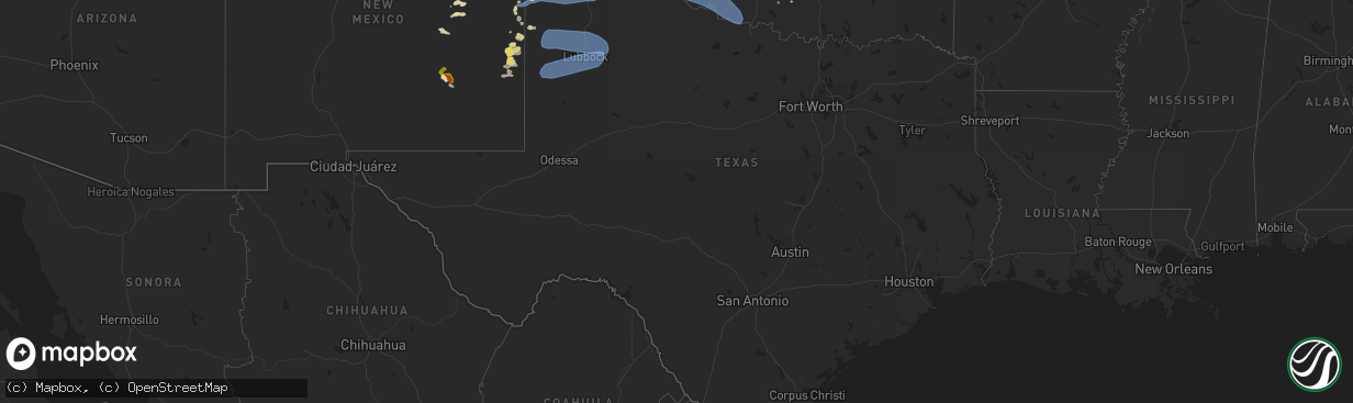
Hail Map in Texas on July 7, 2023
The weather event in Texas on July 7, 2023 includes Wind and Hail maps. 26 states and 533 cities were impacted and suffered possible damage. The total estimated number of properties impacted is 70.
Wind
Hail
70
Estimated number of impacted properties by a 1.00" hail or larger0
Estimated number of impacted properties by a 1.75" hail or larger0
Estimated number of impacted properties by a 2.50" hail or largerStorm reports in Texas
Texas
| Date | Description |
|---|---|
| 07/07/20236:55 PM CDT | A local report indicates 64 MPH wind near 2 SSW Levelland |
| 07/07/20236:54 PM CDT | West texas mesonet report. |
| 07/07/20236:40 PM CDT | A local report indicates 75 MPH wind near 3 SE Pantex |
| 07/07/20236:40 PM CDT | West texas mesonet report. |
| 07/07/20236:40 PM CDT | First severe wind gust of 59 mph was at 1840cdt. Peak wind gust of 61 mph was at 1852cdt. Last 60 mph wind gust was at 1857cdt. |
| 07/07/20236:39 PM CDT | First gust of 61 mph at 1839cdt... Gust picked back up to 61 at 1848cdt. Peak gust of 65 mph was at 1849cdt and last 61 mph wind gust was at 1850cdt. |
| 07/07/20236:35 PM CDT | A local report indicates 60 MPH wind near 2 N Spearman |
| 07/07/20236:32 PM CDT | West texas mesonet report. Additional severe gust at 6:13p. |
| 07/07/20236:26 PM CDT | West texas mesonet report. Additional severe gust to 61 mph at 6:27p. |
| 07/07/20236:18 PM CDT | Multiple wind gusts in excess of 58 mph measured by the mesonet located 9 nne of amarillo. |
| 07/07/20236:15 PM CDT | Large tree branches down by intersection near sam houston park. |
| 07/07/20236:13 PM CDT | A local report indicates 75 MPH wind near 2 N Borger |
| 07/07/20236:11 PM CDT | A local report indicates 65 MPH wind near 7 E Borger |
| 07/07/20236:11 PM CDT | Metal fence blown out into roadway. |
| 07/07/20236:10 PM CDT | A local report indicates 74 MPH wind near 10 ESE Valley de Oro |
| 07/07/20236:10 PM CDT | Report sent in by emergency manager with pictures of large trees limbs snapped... Large signs blown over... And metal shingles ripped off roof of house in the town of f |
| 07/07/20236:04 PM CDT | Mesonet measured 66 mph wind gust at 1804cdt and peaked at 69 mph at 1806cdt. Still gusting upwards of 64 mph at 1810cdt. |
| 07/07/20235:57 PM CDT | West texas mesonet report. |
| 07/07/20235:49 PM CDT | A local report indicates 58 MPH wind near 1 NW Boys Ranch |
| 07/07/20235:47 PM CDT | West texas mesonet report. |
| 07/07/20235:38 PM CDT | Mesonet station near sunray measured multiple wind gusts between 58 and 61 mph between 1738cdt and 1747cdt. |
| 07/07/20235:36 PM CDT | West texas mesonet report. Multiple severe wind gusts from 5:35p to 5:40p. |
| 07/07/20235:34 PM CDT | West texas mesonet report. Multiple severe gusts from 5:25p to 5:38p. |
| 07/07/20235:25 PM CDT | Video of tornado looking west from a few miles southeast of stratford. Tornado was intermittently on the ground for about 2 minutes. |
| 07/07/20234:55 PM CDT | West texas mesonet report |
| 07/07/20234:35 PM CDT | Corrects previous tstm wnd gst report from 3 sw dalhart. From 1635cdt through 1650cdt the asos in dalhart gusted 58 to 64 mph from a line of thunderstorms moving throug |
| 07/07/20233:35 PM CDT | From 1535cdt through 1550cdt the asos in dalhart gusted 58 to 64 mph from a line of thunderstorms moving through. |
| 07/07/202312:05 AM CDT | A local report indicates 60 MPH wind near 6 SSW Lubbock |
| 07/06/202311:57 PM CDT | A local report indicates 58 MPH wind near Reese Center |
| 07/06/202311:57 PM CDT | A local report indicates 64 MPH wind near 2 WNW Burris |
| 07/06/202311:48 PM CDT | A local report indicates 59 MPH wind near 6 SSW Wolfforth |
| 07/06/202311:46 PM CDT | A local report indicates 60 MPH wind near Reese Center |
| 07/06/202310:51 PM CDT | A local report indicates 66 MPH wind near 8 WSW Sundown |
| 07/06/20239:55 PM CDT | Wilbarger county airport. |
| 07/06/20238:24 PM CDT | 59 mph wind gusts were reported at 824 and 827 pm cdt at the post west texas mesonet site. |
| 07/06/20238:16 PM CDT | First wind gust was 66 mph at 2016cdt. A gust of 73 mph was measured at 2018cdt. The mesonet measured an even higher wind gust of 76 mph at 2025cdt and continued to gus |
| 07/06/20238:10 PM CDT | Multiple reports of tree damage across wellington. Branches ranges from 1 inch to greater than 3 inches. Time estimated from radar. |
| 07/06/20238:06 PM CDT | A local report indicates 60 MPH wind near 1 ENE Mclean |
| 07/06/20237:27 PM CDT | Mesonet gusted to 76 mph at 1927cdt... And quickly measured a 95 and 96 mph gust over the next two minute. Last gust of 61 mph was at 1935cdt. |
| 07/06/20237:27 PM CDT | Mesonet gusted to 76 mph at 1927cdt... And quickly measured a 95 and 96 mph gust over the next two minute. Last gust of 61 mph was at |
| 07/06/20237:22 PM CDT | A local report indicates 66 MPH wind near 6 ESE Lora |
| 07/06/20237:11 PM CDT | A local report indicates 60 MPH wind near Goodnight |
| 07/06/20237:10 PM CDT | A local report indicates 60 MPH wind near 2 WNW Lake Mcclellan |
| 07/06/20237:09 PM CDT | A local report indicates 60 MPH wind near 5 S Wolfforth |
All States Impacted by Hail Map on July 7, 2023
Cities Impacted by Hail Map on July 7, 2023
- Liberal, KS
- Kismet, KS
- Plains, KS
- Meade, KS
- Forgan, OK
- Beaver, OK
- Gate, OK
- Laverne, OK
- Johnson, KS
- Richfield, KS
- Rolla, KS
- Hugoton, KS
- El Reno, OK
- Okarche, OK
- Calumet, OK
- Yukon, OK
- Piedmont, OK
- Bethany, OK
- Oklahoma City, OK
- Spencer, OK
- Edmond, OK
- Choctaw, OK
- Jones, OK
- Lawton, OK
- Taloga, OK
- Geary, OK
- Greenfield, OK
- Oakwood, OK
- Watonga, OK
- Seiling, OK
- Canton, OK
- Thomas, OK
- Fay, OK
- Kingfisher, OK
- Duncan, OK
- Ratliff City, OK
- Tussy, OK
- Danville, VT
- West Danville, VT
- Bennet, NE
- Osceola, NE
- Fort Sill, OK
- Morrisville, VT
- Hyde Park, VT
- Palmyra, NE
- Weleetka, OK
- New Ringgold, PA
- Fallston, MD
- Jarrettsville, MD
- Forest Hill, MD
- Elgin, OK
- Essex, NY
- Westport, NY
- Elizabethtown, NY
- Laurel, MD
- Walton, NE
- Lincoln, NE
- Sheffield, VT
- Lyndonville, VT
- Montpelier, VT
- Worcester, VT
- Wolcott, VT
- Dupree, SD
- Kulm, ND
- Ashley, ND
- Forbes, ND
- Moorhead, MN
- Sabin, MN
- Grenville, NM
- Folsom, NM
- Roswell, NM
- Dexter, NM
- Schenevus, NY
- Worcester, NY
- Hagerman, NM
- Clayton, NM
- Colorado Springs, CO
- Branson, CO
- Peyton, CO
- Trinidad, CO
- Cascade, CO
- Walsenburg, CO
- Texico, NM
- Clovis, NM
- Farwell, TX
- Bovina, TX
- Eureka, SD
- Calhan, CO
- Hartley, TX
- Channing, TX
- Dalhart, TX
- Adrian, TX
- Friona, TX
- Stratford, TX
- Dumas, TX
- Cactus, TX
- Sunray, TX
- Model, CO
- Vega, TX
- Masterson, TX
- Dimmitt, TX
- Hereford, TX
- Trinchera, CO
- Amarillo, TX
- Gruver, TX
- Morse, TX
- Stinnett, TX
- Nazareth, TX
- Fritch, TX
- Hart, TX
- Pep, TX
- Morton, TX
- Levelland, TX
- Amherst, TX
- Sudan, TX
- Whiteface, TX
- Enochs, TX
- Ropesville, TX
- Littlefield, TX
- Borger, TX
- Spearman, TX
- Panhandle, TX
- Wildorado, TX
- Tulia, TX
- Happy, TX
- Anton, TX
- Shallowater, TX
- Lubbock, TX
- Hale Center, TX
- Abernathy, TX
- Skellytown, TX
- Cripple Creek, CO
- Florissant, CO
- Miami, TX
- Perryton, TX
- Pampa, TX
- Smyer, TX
- Fuquay Varina, NC
- Victor, CO
- Groom, TX
- White Deer, TX
- Idalou, TX
- Petersburg, TX
- Lorenzo, TX
- Floydada, TX
- New Deal, TX
- Ralls, TX
- Claude, TX
- Mclean, TX
- Clarendon, TX
- Canadian, TX
- Mobeetie, TX
- Pueblo, CO
- Fountain, CO
- Wahpeton, ND
- Kent, MN
- Plainview, AR
- Perham, MN
- Angier, NC
- Vergas, MN
- Dent, MN
- Milnesand, NM
- Pep, NM
- Causey, NM
- Peru, VT
- Weston, VT
- Londonderry, VT
- Alachua, FL
- Livermore, CO
- New Effington, SD
- Hankinson, ND
- Rogers, NM
- Jamesville, NY
- Fayetteville, NY
- Syracuse, NY
- Manlius, NY
- Milner, GA
- Barnesville, GA
- Johnson, NE
- Crossroads, NM
- Tatum, NM
- Bryceville, FL
- Jacksonville, FL
- Kenansville, FL
- Saint Cloud, FL
- Tecumseh, NE
- Sterling, NE
- Warsaw, VA
- Fort Sumner, NM
- Portales, NM
- Enderlin, ND
- Jet, OK
- Cherokee, OK
- Edgeley, ND
- Manitou Springs, CO
- Des Moines, NM
- Richfield Springs, NY
- Springfield Center, NY
- Cooperstown, NY
- Mud Butte, SD
- Louisburg, NC
- Spring Hope, NC
- Broadview, NM
- Manchester, OK
- Medford, OK
- Brooktondale, NY
- Willseyville, NY
- Spencer, NY
- Ithaca, NY
- Auburn, NE
- Elk Creek, NE
- Crab Orchard, NE
- Verona, ND
- Litchville, ND
- Yellville, AR
- Selby, SD
- Nelson, NE
- Ruskin, NE
- Oak, NE
- Deshler, NE
- Burlington Flats, NY
- Hartwick, NY
- Crawfordville, FL
- Fort Lauderdale, FL
- Dania, FL
- Jennings, FL
- Long Lake, SD
- Eagle Butte, SD
- Mahaska, KS
- Harpursville, NY
- Chipley, FL
- Mosquero, NM
- Bluff City, KS
- Fly Creek, NY
- Port Crane, NY
- Mena, AR
- La Grange, NC
- Goldsboro, NC
- West Forks, ME
- Waubun, MN
- Clio, SC
- Leola, SD
- Mechanicsburg, PA
- Woodruff, UT
- Trail City, SD
- Burlington, OK
- Mahnomen, MN
- Unadilla, GA
- Caldwell, KS
- Tallahassee, FL
- Lisbon, ND
- Sheldon, ND
- Nome, ND
- Hatfield, AR
- Deridder, LA
- Pittston, PA
- Anthony, KS
- Waldron, KS
- Dillon, SC
- Patten, ME
- Hubbell, NE
- Chester, NE
- Bingham, ME
- Caratunk, ME
- Susquehanna, PA
- Deposit, NY
- Courtland, KS
- Webber, KS
- Scandia, KS
- Belleville, KS
- Madison, FL
- Honesdale, PA
- Ridgeway, SC
- Fleetwood, PA
- Kutztown, PA
- Afton, NY
- Chenango Forks, NY
- Enola, PA
- Java, SD
- San Mateo, FL
- Attica, KS
- Amistad, NM
- Canajoharie, NY
- Sharon Springs, NY
- Midland, SD
- Benson, NC
- Vredenburgh, AL
- Monroeville, AL
- McColl, SC
- Hawley, PA
- Lakeville, PA
- Willow Spring, NC
- Garner, NC
- Raleigh, NC
- Maryland, NY
- Shamrock, TX
- Wheeler, TX
- Briscoe, TX
- Boone, CO
- Hedley, TX
- Lelia Lake, TX
- Quail, TX
- Wellington, TX
- Texola, OK
- Reydon, OK
- Sweetwater, OK
- Durham, OK
- Erick, OK
- Arnett, OK
- Higgins, TX
- Crawford, OK
- Lipscomb, TX
- Shattuck, OK
- Follett, TX
- Booker, TX
- Fargo, OK
- Gage, OK
- Memphis, TX
- Sharon, OK
- Leedey, OK
- Hammon, OK
- Sayre, OK
- Cheyenne, OK
- Mangum, OK
- Dodson, TX
- Willow, OK
- Hollis, OK
- Elk City, OK
- Vinson, OK
- Gould, OK
- Childress, TX
- Quanah, TX
- Eldorado, OK
- Duke, OK
- Carter, OK
- Granite, OK
- Butler, OK
- Vici, OK
- Camargo, OK
- Dill City, OK
- Canute, OK
- Lone Wolf, OK
- Sentinel, OK
- Hobart, OK
- Foss, OK
- Ellington, MO
- Altus, OK
- Blair, OK
- Olustee, OK
- Elmer, OK
- Cordell, OK
- Arapaho, OK
- Custer City, OK
- Bessie, OK
- Corn, OK
- Clinton, OK
- Weatherford, OK
- Putnam, OK
- Winona, MO
- Van Buren, MO
- Altus Afb, OK
- Odell, TX
- Snyder, OK
- Tipton, OK
- Headrick, OK
- Vernon, TX
- Frederick, OK
- Davidson, OK
- Loveland, OK
- Grandfield, OK
- Electra, TX
- Hollister, OK
- Rocky, OK
- Gotebo, OK
- Mountain View, OK
- Fort Cobb, OK
- Carnegie, OK
- Apache, OK
- Fletcher, OK
- Anadarko, OK
- Cyril, OK
- Cement, OK
- Mutual, OK
- Harrold, TX
- Grandin, MO
- Plains, TX
- Sundown, TX
- Brownfield, TX
- Tokio, TX
- Meadow, TX
- Wilson, TX
- Slaton, TX
- Tahoka, TX
- Wolfforth, TX
- Ransom Canyon, TX
- Ola, AR
- Sawyer, KS
- Springfield, MO
- Turpin, OK
- Kingman, KS
- Onaka, SD
- Burchard, NE
- Waymart, PA
- Breckenridge, MN
- New York Mills, MN
- Rosholt, SD
- Salem, MO
- Yoder, CO
- Sisseton, SD
- Lidgerwood, ND
- Veblen, SD
- Ellsinore, MO
- Round O, SC
- Cottageville, SC
- Pollocksville, NC
- New Bern, NC
- Hooker, OK
- Bunker, MO
- Tie Siding, WY
- Vale, SD
- Sturgis, SD
- Millersburg, PA
- Elizabethville, PA
- Hardesty, OK
- Mount Ida, AR
- Eminence, MO
- Cayuga, ND
- Timmonsville, SC
- Muleshoe, TX
- Lake Arthur, NM
- Texline, TX
- Cook Sta, MO
- Hosmer, SD
- Bowdle, SD
- Roscoe, SD
- Ashland, KS
- Murdock, KS
- Beulah, CO
- Wheaton, MN
- Story, AR
- Morrowville, KS
- Dawson, NE
- Coats, NC
- Raymondville, MO
- Licking, MO
- Lenox, MO
- Dumont, MN
- Cumberland, VA
- Campbell, MN
- Tintah, MN
- Pritchett, CO
- Fowler, KS
- Nara Visa, NM
- Logan, NM
- Baldwin, MD
- Clarkton, NC
- Council, NC
- Elizabethtown, NC
- Hanceville, AL
- Elgin, SC
- Blythewood, SC
- Columbia, SC
- Tyrone, OK
- Penrose, CO
- Valley Center, KS
- Savannah, GA
- Nichols, SC
- Mound City, SD
- Hartshorn, MO
- Edgar Springs, MO
- Fergus Falls, MN
- Wichita, KS
- Ashburn, GA
- Beulah, MO
- Hardeeville, SC
- Saint James, MO
- Dillwyn, VA
- Birch Tree, MO
- Huntsville, AL
- Owens Cross Roads, AL
- New Hope, AL
- Haviland, KS
- Coats, KS
- Lesterville, MO
- Black, MO
- Englewood, KS
- King And Queen Court House, VA
- West Point, VA
- Baileyville, KS
- Beattie, KS
- Axtell, KS
- Tabor City, NC
- Green Sea, SC
- Cerro Gordo, NC
- Ozark, MO
- Rogersville, MO
- Rawlins, WY
- Lamar, CO
- Hasty, CO
- Carlisle, PA
- Isabel, KS
- Medicine Lodge, KS
- Dalmatia, PA
- Fremont, MO
- Doniphan, MO
- Alton, MO
- Hanna, WY
- Westville, OK
- Mullins, SC
- Sharon, KS
- Zenda, KS
- Lincoln, IL
- Pryor, OK
- Rocky Ford, CO
- Pocahontas, AR
- Maynard, AR
- Tahlequah, OK
- Hulbert, OK
- Bixby, OK
- Mounds, OK
- Gatewood, MO
- Unionville, VA
- Chouteau, OK
- Sun City, KS
- Orange, VA
- Couch, MO
- Carlyle, IL
- Quinton, OK
- Adair, OK
- Chelsea, OK
- Eufaula, OK
- Florence, KS
- Mullinville, KS


