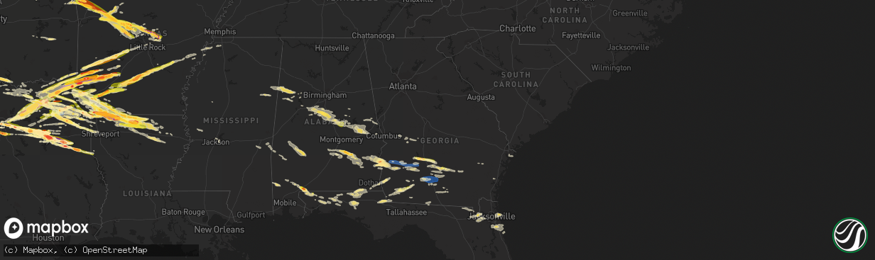
Hail Map in Georgia on June 13, 2023
The weather event in Georgia on June 13, 2023 includes Hail, Wind, and Tornado maps. 16 states and 797 cities were impacted and suffered possible damage. The total estimated number of properties impacted is 3,424.
Hail
Wind
Tornado
3,424
Estimated number of impacted properties by a 1.00" hail or larger927
Estimated number of impacted properties by a 1.75" hail or larger0
Estimated number of impacted properties by a 2.50" hail or largerStorm reports in Georgia
Georgia
| Date | Description |
|---|---|
| 06/13/20236:40 PM CDT | Asos station kssi brunswick. |
| 06/13/20236:31 PM CDT | A 911 call center reported numerous trees down in the richmond hill area. Time was estimated via radar data. |
| 06/13/20236:30 PM CDT | Downed power line due to strong winds on hwy 40 on the camden/ charlton line. |
| 06/13/20236:00 PM CDT | Downed trees at the cross section of hwy 17 and burnt fort rd. |
| 06/13/20235:40 PM CDT | Tree down on jess allen road. Time estimated by radar. |
| 06/13/20235:30 PM CDT | Trees down in the area of blackshear towards waycross. |
| 06/13/20235:25 PM CDT | Em shared photos of damage to a store in waycross... Including part of a roof blown off. Time estimated by radar. |
| 06/13/20235:25 PM CDT | Steeple was knocked down at a church in western blackshear. Time estimated by radar. |
| 06/13/20235:25 PM CDT | Snapped power supply pole by the cross section of stanton ave and woodrow ave due to strong winds. |
| 06/13/20235:21 PM CDT | A 911 call center relayed a report of a downed tree on power lines which caused live wires to fall onto a residential home along the 300 block of screven fork rd. Time |
| 06/13/20235:20 PM CDT | Downed trees all throughout the area of waresboro due to strong winds. |
| 06/13/20235:18 PM CDT | Emergency management reports a tree down on a mobile home in spring creek. No injuries. |
| 06/13/20235:15 PM CDT | A 911 call center reported numerous downed power lines in and around the town of walthourville. |
| 06/13/20235:13 PM CDT | A 911 call center relayed a report of a large tree branch down on a car on talmadge rd near busbee rd. There were no injuries. Time was estimated via radar data. |
| 06/13/20235:12 PM CDT | A 911 call center relayed a report of tree down on a car along e b cooper hwy. No injuries were reported. Time was estimated via radar data. |
| 06/13/20235:10 PM CDT | Downed trees... Power lines and power line poles due to strong winds in the town of millwood. |
| 06/13/20235:09 PM CDT | Emergency manager reported a tree down on lanier rd. |
| 06/13/20235:07 PM CDT | Tree down near adams road and knights ferry road. |
| 06/13/20235:05 PM CDT | Trees and power lines down in homerville near april rd. Time estimated from radar. |
| 06/13/20235:04 PM CDT | A 911 call center reported a downed tree across the roadway along beards creek church rd. Time was estimated via radar data. |
| 06/13/20234:55 PM CDT | Spotter reports trees down near nichols st and pine st in dupont. Time estimated by radar. |
| 06/13/20234:51 PM CDT | A 911 call center reported a downed tree across power lines on kicklighter st. Time was estimated via radar data. |
| 06/13/20234:50 PM CDT | Trees reported down along south hwy 221. |
| 06/13/20234:50 PM CDT | Downed trees by stokes way off of hwy 64. |
| 06/13/20234:45 PM CDT | A carport collapsed with trees down. |
| 06/13/20234:45 PM CDT | Trees reported down along south hwy 135. |
| 06/13/20234:45 PM CDT | Photos shared on social media of a large tree down on e austin ave area. Time estimated from radar. |
| 06/13/20234:30 PM CDT | Numerous trees and powerlines down throughout berrien county. |
| 06/13/20234:30 PM CDT | Multiple trees and powerlines down across bacon county as reported by both social media and 911 dispatch. Time estimated by radar. |
| 06/13/20234:27 PM CDT | Report from mping: 3-inch tree limbs broken; power poles broken. |
| 06/13/20234:25 PM CDT | Multiple trees reported down throughout the southeast portion of the county. |
| 06/13/20234:18 PM CDT | Portable anemometer measures 70 mile an hour wind gusts. |
| 06/13/20234:18 PM CDT | Trees down in lenox. North union road... Highway 41... And barneyville road. |
| 06/13/20234:13 PM CDT | Trees were blown down in tift county. |
| 06/13/20234:10 PM CDT | Corrects previous tstm wnd dmg report from 7 ese douglas. Downed trees in the area east off of highway 158 east of chatterton church rd due to winds. |
| 06/13/20234:10 PM CDT | Downed trees in the area of ford ln and nicholls rd 1/2 mile off of highway 32. |
| 06/13/20234:03 PM CDT | Part of an awning blew off in norman park. |
| 06/13/20233:57 PM CDT | Spotter reports 60 mph wind gust measured on roof top anemometer. |
| 06/13/20233:50 PM CDT | Worth 911 reported a tree down blocking sands dr... Also limbs down on elm st in poulan. |
| 06/13/20233:50 PM CDT | Multiple trees down near new elm... Doerun normanpark rd at sumner rd. |
| 06/13/20233:45 PM CDT | Worth 911 reporting a church steeple in the roadway on hwy 32 1 mile west of doles. |
| 06/13/20233:45 PM CDT | Worth 911 reports hwy 313 multiple pine tree down just north of hwy 32. |
| 06/13/20233:45 PM CDT | Hay barn |
| 06/13/20233:40 PM CDT | Mitchell county ga e911 reports multiple trees down over roads southwest of pelham. State route 262... 112... County line road... And harmony road east of pelham. Also. |
| 06/13/20233:40 PM CDT | A car in baconton was damaged by a fallen tree. |
| 06/13/20233:36 PM CDT | Large tree limbs fell on sr 97 at branchville road blocking all lanes. |
| 06/13/20233:30 PM CDT | Numerous trees down... County wide. |
| 06/13/20233:28 PM CDT | A tree was blown down at radium springs road and putney ave. |
| 06/13/20233:25 PM CDT | Photo of snapped tree from the leesburg area. |
| 06/13/20233:23 PM CDT | A tree was blown down at lily pond road and newton road. |
| 06/13/20233:15 PM CDT | Pictures of hail around quarter size from northern grady county. |
| 06/13/20233:10 PM CDT | A tree was down at 1000 tallahassee road in dougherty county. |
| 06/13/20233:06 PM CDT | Report of several trees down on andrew avery road near the county border. |
| 06/13/20233:05 PM CDT | Numerous trees and powerlines down throughout terrell county... Mainly from dawson east. |
| 06/13/20232:58 PM CDT | Mesonet station tt665 bainbridge. |
| 06/13/20232:52 PM CDT | Tree reported down near miller ave and lake dr. |
| 06/13/20232:52 PM CDT | Tree reported down near copeland st and martin st. |
| 06/13/20232:40 PM CDT | Corrects time of previous hail report from rebecca. Social media photo of hail around quarter size. |
| 06/13/20232:37 PM CDT | Trees reported down throughout randolph county. |
| 06/13/20232:30 PM CDT | Social media photo of hail around quarter size. |
| 06/13/20232:30 PM CDT | Social media photo of hail around quarter size. |
| 06/13/20232:20 PM CDT | Em via law enforcement reported 1 inch hail in arabi and surrounding locations. Spotters also reported 1 inch hail just east along i-75. |
| 06/13/20236:57 AM CDT | Tree down on dr. Deryl hart road between harold harris road and barwick road. |
All States Impacted by Hail Map on June 13, 2023
Cities Impacted by Hail Map on June 13, 2023
- Mount Vernon, TX
- Winnsboro, TX
- Scroggins, TX
- Mount Pleasant, TX
- Pittsburg, TX
- Leesburg, TX
- Gilmer, TX
- De Kalb, TX
- New Boston, TX
- Foreman, AR
- Hooks, TX
- Ashdown, AR
- Texarkana, TX
- Ogden, AR
- Marietta, OK
- Lebanon, OK
- Kingston, OK
- Whitesboro, TX
- Cartwright, OK
- Calera, OK
- Pottsboro, TX
- Denison, TX
- Colbert, OK
- Bonham, TX
- Ladonia, TX
- Windom, TX
- Honey Grove, TX
- Roxton, TX
- Pecan Gap, TX
- Cooper, TX
- Sulphur Springs, TX
- Saltillo, TX
- Sulphur Bluff, TX
- Dike, TX
- Ore City, TX
- Lone Star, TX
- Avinger, TX
- Jefferson, TX
- Diana, TX
- Marshall, TX
- Karnack, TX
- Mooringsport, LA
- Ramer, AL
- Pattonville, TX
- Blossom, TX
- Deport, TX
- Detroit, TX
- Bogata, TX
- Clarksville, TX
- Annona, TX
- Avery, TX
- Grady, AL
- Troy, AL
- Shreveport, LA
- Ivanhoe, TX
- Telephone, TX
- Satartia, MS
- Bentonia, MS
- Valley Park, MS
- Hughes Springs, TX
- Daingerfield, TX
- Gainesville, TX
- Sadler, TX
- Lapine, AL
- Cruger, MS
- Sherman, TX
- Howe, TX
- Pine Hill, AL
- Paris, TX
- Savoy, TX
- Como, TX
- Pickton, TX
- Petty, TX
- Camden, AL
- Catherine, AL
- Arlington, AL
- Whitewright, TX
- Ector, TX
- Tom Bean, TX
- Commerce, TX
- Klondike, TX
- Emerson, AR
- Dodd City, TX
- Hope Hull, AL
- Highland Home, AL
- Letohatchee, AL
- Brookston, TX
- Toxey, AL
- Butler, AL
- Omaha, TX
- Harleton, TX
- Naples, TX
- Thomaston, AL
- Magnolia, AL
- Thomasville, AL
- Lake Creek, TX
- Talco, TX
- Meridian, MS
- Needham, AL
- Quitman, MS
- Enterprise, MS
- Stonewall, MS
- Winfield, TX
- Ravenna, TX
- Linden, AL
- Dixons Mills, AL
- Demopolis, AL
- Sweet Water, AL
- Leonard, TX
- Randolph, TX
- Wolfe City, TX
- Bells, TX
- Trenton, TX
- Banks, AL
- Kaufman, TX
- Terrell, TX
- Wills Point, TX
- Irving, TX
- Grand Prairie, TX
- Dallas, TX
- Simms, TX
- Abbeville, AL
- Fort Worth, TX
- Kennedale, TX
- Leesburg, GA
- De Soto, GA
- Cordele, GA
- Warwick, GA
- Arlington, TX
- Mansfield, TX
- Arabi, GA
- Balch Springs, TX
- Cedar Hill, TX
- Mesquite, TX
- Fort Gaines, GA
- Coleman, GA
- Ashburn, GA
- Canton, TX
- Edgewood, TX
- Grand Saline, TX
- Van, TX
- Pueblo, CO
- Forney, TX
- Midlothian, TX
- Desoto, TX
- Red Oak, TX
- Rebecca, GA
- Sunnyvale, TX
- Crandall, TX
- Rockwall, TX
- Royse City, TX
- Lindale, TX
- Lancaster, TX
- Ferris, TX
- Palmer, TX
- Quinlan, TX
- Caddo Mills, TX
- Greenville, TX
- Fort Lauderdale, FL
- Ennis, TX
- Lone Oak, TX
- Garland, TX
- Waxahachie, TX
- Campbell, TX
- Ocilla, GA
- Wray, GA
- Boone, CO
- Cumby, TX
- Brashear, TX
- Pritchett, CO
- Las Animas, CO
- Grenville, NM
- Kenton, OK
- Ben Wheeler, TX
- Atmore, AL
- Tyler, TX
- Linden, TX
- Cuthbert, GA
- Shellman, GA
- Dawson, GA
- Oakfield, GA
- Albany, GA
- Ambrose, GA
- Sylvester, GA
- Boise City, OK
- Felt, OK
- Moultrie, GA
- Norman Park, GA
- Omega, GA
- Tifton, GA
- Sumner, GA
- Lenox, GA
- Sparks, GA
- Nashville, GA
- Enigma, GA
- Alapaha, GA
- Jay, FL
- Arp, TX
- Overton, TX
- Dalhart, TX
- Sheridan Lake, CO
- Henderson, TX
- Tribune, KS
- Idabel, OK
- Haworth, OK
- Winthrop, AR
- Bagwell, TX
- Garvin, OK
- Lockesburg, AR
- Stratford, TX
- Menard, TX
- Eden, TX
- Horatio, AR
- Mineral Springs, AR
- Nashville, AR
- Brady, TX
- De Queen, AR
- Eagletown, OK
- Melvin, TX
- Troup, TX
- Dumas, TX
- Sunray, TX
- Carthage, TX
- Cactus, TX
- Dierks, AR
- Gruver, TX
- Lakin, KS
- Murfreesboro, AR
- Delight, AR
- Antoine, AR
- Okolona, AR
- Arkadelphia, AR
- Hext, TX
- Hartsfield, GA
- Crestview, FL
- Goshen, AL
- Walsenburg, CO
- McCaskill, AR
- Slocomb, AL
- Westville, FL
- Hartford, AL
- Black, AL
- Bonifay, FL
- Odum, GA
- Ozan, AR
- Douglas, GA
- Chattahoochee, FL
- Grand Ridge, FL
- Sneads, FL
- Marianna, FL
- Bainbridge, GA
- Rowlett, TX
- Bryceville, FL
- Vivian, LA
- Oil City, LA
- Whigham, GA
- Climax, GA
- Little River, AL
- Eads, CO
- Mineola, TX
- Quitman, TX
- Big Sandy, TX
- Hawkins, TX
- Morgan, GA
- Selman City, TX
- Clayton, NM
- Adel, GA
- Bossier City, LA
- Fitzgerald, GA
- Rochelle, GA
- Laurel Hill, FL
- Eufaula, AL
- Georgetown, GA
- Morris, GA
- Macclenny, FL
- Jacksonville, FL
- Clewiston, FL
- Clayton, AL
- Downs, KS
- Cottonwood, AL
- Donalsonville, GA
- Kim, CO
- Milton, FL
- Bronwood, GA
- Doerun, GA
- Century, FL
- Flomaton, AL
- Holt, FL
- Citronelle, AL
- McDavid, FL
- Blakely, GA
- Kilgore, TX
- Pelham, GA
- Meigs, GA
- Brinson, GA
- Beloit, KS
- Glen Elder, KS
- Honoraville, AL
- Greenville, AL
- Luverne, AL
- Fort Deposit, AL
- Brundidge, AL
- Deer Park, AL
- Camilla, GA
- Glen Saint Mary, FL
- Saint George, GA
- Sanderson, FL
- Caryville, FL
- Ponce De Leon, FL
- Alma, GA
- Point, TX
- Hollywood, FL
- Naylor, GA
- Moody Afb, GA
- Hahira, GA
- Lakeland, GA
- Valdosta, GA
- Model, CO
- Vinegar Bend, AL
- Blevins, AR
- Okeechobee, FL
- Pansey, AL
- Ashford, AL
- Gordon, AL
- Dothan, AL
- Jakin, GA
- Damascus, GA
- Clio, AL
- Ariton, AL
- Louisville, AL
- Hayneville, AL
- Chula, GA
- Pompano Beach, FL
- Cookville, TX
- Shorterville, AL
- Nicholls, GA
- Sandpoint, ID
- Lorida, FL
- Flowood, MS
- Pearl, MS
- Umpire, AR
- Tatum, TX
- McIntosh, AL
- Jackson, AL
- Labelle, FL
- Coffeeville, AL
- Ione, WA
- Cusick, WA
- Quitman, GA
- Leary, GA
- Edison, GA
- La Junta, CO
- Gladewater, TX
- Winona, TX
- Scurry, TX
- Texarkana, AR
- Mabank, TX
- Sycamore, GA
- Broxton, GA
- Hutchins, TX
- Duncanville, TX
- Defuniak Springs, FL
- Jupiter, FL
- Stockton, AL
- Willacoochee, GA
- Seagoville, TX
- Geneva, AL
- Graceville, FL
- Baker, FL
- Chandler, TX
- Jackson, MS
- Vernon, FL
- Brownsboro, TX
- Iron City, GA
- Colquitt, GA
- Cairo, GA
- Atlantic Beach, FL
- Ponte Vedra, FL
- Saint Johns, FL
- Whitehouse, TX
- Bivins, TX
- Kemp, TX
- Long Branch, TX
- Gary, TX
- Douglassville, TX
- Marietta, TX
- Stinnett, TX
- Morse, TX
- Borger, TX
- Yantis, TX
- Atlanta, TX
- Doddridge, AR
- Ida, LA
- Rodessa, LA
- Plain Dealing, LA
- Miami, TX
- Pampa, TX
- Skellytown, TX
- White Deer, TX
- Groom, TX
- Mclean, TX
- Mobeetie, TX
- Shamrock, TX
- Fruitvale, TX
- Wellington, TX
- Wheeler, TX
- Joaquin, TX
- Tenaha, TX
- Logansport, LA
- Fulton, AR
- Lewisville, AR
- Hope, AR
- Emmet, AR
- Rosston, AR
- Homer, LA
- Arcadia, LA
- Bradley, AR
- Erick, OK
- Mangum, OK
- Willow, OK
- Hollis, OK
- Vinson, OK
- Dubach, LA
- Taylor, AR
- Shongaloo, LA
- Springhill, LA
- Haynesville, LA
- Sarepta, LA
- Prescott, AR
- Bluff City, AR
- Chidester, AR
- Altus, OK
- Blair, OK
- Altus Afb, OK
- Broken Bow, OK
- Bernice, LA
- Farmerville, LA
- Choudrant, LA
- Downsville, LA
- Maud, TX
- Queen City, TX
- Olustee, OK
- Lisbon, LA
- Fouke, AR
- Garland City, AR
- Grannis, AR
- Gillham, AR
- Summerfield, LA
- Minden, LA
- Cotton Valley, LA
- Headrick, OK
- Tipton, OK
- Frederick, OK
- Jesup, GA
- Sylvan Grove, KS
- Barnard, KS
- Lincoln, KS
- Smith Center, KS
- Athol, KS
- Langley, AR
- Newhope, AR
- Deerfield, KS
- Hunter, KS
- Tipton, KS
- Osborne, KS
- Tescott, KS
- Healy, KS
- Jordan Valley, OR
- Eglin Afb, FL
- Magnolia, AR
- Monroe, LA
- Delphos, KS
- Salina, KS
- New Cambria, KS
- Holly, CO
- Granada, CO
- Lamar, CO
- Adrian, OR
- Syracuse, KS
- Burley, ID
- Saint Augustine, FL
- Stockton, KS
- Lebanon, KS
- West Monroe, LA
- Lake City, FL
- Grinnell, KS
- Savannah, GA
- Powderly, TX
- Gurdon, AR
- Valliant, OK
- Hosston, LA
- Athens, LA
- Stockton, GA
- Ponte Vedra Beach, FL
- Oakley, ID
- Beverly, KS
- Bayview, ID
- Glenns Ferry, ID
- Leoti, KS
- Cawker City, KS
- Benton, LA
- Athol, ID
- Hayden, ID
- Emory, TX
- Collyer, KS
- Bloomburg, TX
- Neptune Beach, FL
- Jacksonville Beach, FL
- Flint, TX
- Buckner, AR
- Stamps, AR
- Greenville, FL
- Garden City, KS
- Scott City, KS
- Sale City, GA
- Lake Placid, FL
- Thomasville, GA
- Pembroke Pines, FL
- Alba, TX
- Brunswick, GA
- Nash, TX
- Sparkman, AR
- Camden, AR
- Glenwood, AR
- Caddo Gap, AR
- Bonnerdale, AR
- Royal, AR
- Hot Springs National Park, AR
- Pearcy, AR
- Carthage, AR
- Fordyce, AR
- Rison, AR
- Bearden, AR
- Ivan, AR
- Hot Springs Village, AR
- Lonsdale, AR
- Grapevine, AR
- Kingsland, AR
- Pine Bluff, AR
- Altheimer, AR
- Grady, AR
- Humphrey, AR
- Wabbaseka, AR
- Stuttgart, AR
- Almyra, AR
- Junction City, AR
- Spearsville, LA
- Lillie, LA
- Fairfax, OK
- Wynona, OK
- Pawhuska, OK
- Tulsa, OK
- Marion, LA
- Broken Arrow, OK
- Haskell, OK
- Weiser, ID
- Lexa, AR
- Benton, AR
- Alexander, AR
- Little Rock, AR
- Paron, AR
- Walters, OK
- Temple, OK
- Kaw City, OK
- Newkirk, OK
- Ponca City, OK
- Shidler, OK
- Big Timber, MT
- Greycliff, MT
- Alberta, AL
- Dundee, MS
- West Fork, AR
- Mountain Pine, AR
- Norman, AR
- Sand Springs, OK
- Burbank, OK
- Ruston, LA
- Argonia, KS
- Wilburton, OK
- Red Oak, OK
- Coweta, OK
- Bixby, OK
- Rayville, LA
- Prairie Grove, AR
- Stilwell, OK
- Lincoln, AR
- Morrow, AR
- Evansville, AR
- Winslow, AR
- Canehill, AR
- Bartlesville, OK
- Barnsdall, OK
- Caldwell, KS
- Wellington, KS
- Wagoner, OK
- Chouteau, OK
- Mcalester, OK
- Kirby, AR
- Amity, AR
- Coy, AL
- Arkansas City, KS
- Geuda Springs, KS
- Clarendon, TX
- Bismarck, AR
- Tunica, MS
- Oxford, KS
- Marvell, AR
- Mayfield, KS
- Mount Vernon, AL
- Loveland, OK
- Snyder, OK
- Randlett, OK
- Chattanooga, OK
- Poplar Grove, AR
- Holly Grove, AR
- West Helena, AR
- Eagle, ID
- Garden City, ID
- Brierfield, AL
- Montevallo, AL
- Calera, AL
- Jemison, AL
- Milan, KS
- Conway Springs, KS
- Clearwater, KS
- Belcher, LA
- Perdido, AL
- De Witt, AR
- Simsboro, LA
- Mountainburg, AR
- Ozark, AR
- Elkins, AR
- Oark, AR
- Clarksville, AR
- Altus, AR
- Coal Hill, AR
- Hartman, AR
- Lamar, AR
- Dover, AR
- London, AR
- Titus, AL
- Rockford, AL
- Equality, AL
- Marbury, AL
- Deatsville, AL
- Hector, AR
- Russellville, AR
- Fayetteville, AR
- Combs, AR
- Ozone, AR
- Atkins, AR
- Jerusalem, AR
- Hattieville, AR
- Solgohachia, AR
- Springfield, AR
- Greenbrier, AR
- Conway, AR
- Vilonia, AR
- Pottsville, AR
- Dardanelle, AR
- Ochelata, OK
- Ramona, OK
- Morrilton, AR
- Casa, AR
- Adona, AR
- Plumerville, AR
- El Paso, AR
- Cabot, AR
- Austin, AR
- Beebe, AR
- Talala, OK
- Oologah, OK
- Ward, AR
- Perryville, AR
- Perry, AR
- Houston, AR
- Bigelow, AR
- Claremore, OK
- Chelsea, OK
- Lonoke, AR
- Pryor, OK
- Westville, OK
- Siloam Springs, AR
- Summers, AR
- Watts, OK
- Mount Judea, AR
- Nowata, OK
- North Little Rock, AR
- Welling, OK
- Danville, KS
- Marianna, AR
- Cypress Inn, TN
- Lutts, TN
- Collinwood, TN
- Lanett, AL
- Valley, AL
- Cusseta, AL
- Winfield, KS
- Northport, AL
- Sherwood, AR
- Mayflower, AR
- Hernando, MS
- Reynolds, GA
- Rupert, GA
- Ellaville, GA
- Ideal, GA
- Oglethorpe, GA
- Montezuma, GA
- Kansas, OK
- Skiatook, OK
- Collinston, LA
- Bastrop, LA
- Pelsor, AR
- Catoosa, OK
- Auburn, AL
- Deer, AR
- Hagarville, AR
- Vera, OK
- Collinsville, OK
- Oak Ridge, LA
- Sherrill, AR
- Damascus, AR
- Sterlington, LA
- Millport, AL
- Euless, TX
- London, TX
- Columbus, MS
- West Point, MS
- Starkville, MS
- Searcy, AR
- Romance, AR
- Woodstock, AL
- West Blocton, AL
- Salem, AL
- Phenix City, AL
- Gordo, AL
- Mauk, GA
- Buena Vista, GA
- Tallassee, AL
- Calhoun, LA
- Eros, LA
- Baskin, LA
- Mangham, LA
- Wooster, AR
- Knoxville, AR
- Scranton, AR
- New Blaine, AR
- Delaware, AR
- Dadeville, AL
- Camp Hill, AL
- Notasulga, AL
- Thorsby, AL
- Clanton, AL
- Verbena, AL
- Goodwater, AL
- Kennedy, AL
- Fayette, AL
- Vernon, AL
- Sulligent, AL
- Tuscaloosa, AL
- Centreville, AL
- Brent, AL
- Berry, AL
- Lafayette, AL
- Center Ridge, AR
- Cleveland, AR
- Jacksonville, AR
- Tahlequah, OK
- Proctor, OK
- Caledonia, MS
- Randolph, AL
- Vance, AL
- Coldwater, MS
- Elrod, AL
- Reform, AL
- Mount Vernon, AR
- Alexander City, AL
- Weogufka, AL
- Wetumpka, AL
- Maplesville, AL
- Cottondale, AL
- Opelika, AL
- Helena, AL
- Shelby, AL
- Sylacauga, AL
- Kellyton, AL
- Alabaster, AL
- Eclectic, AL
- Waverly, AL
- Tuskegee, AL
- Bankston, AL
- Steens, MS
- Hamilton, MS
- Delhi, LA
- Inola, OK
- Echola, AL
- Brandon, MS


