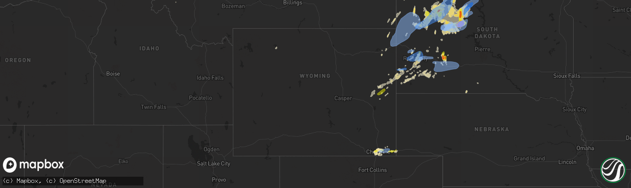
Hail Map in Wyoming on June 8, 2021
The weather event in Wyoming on June 8, 2021 includes Hail, Wind, and Tornado maps. 27 states and 374 cities were impacted and suffered possible damage. The total estimated number of properties impacted is 2,189.
Hail
Wind
Tornado
2,189
Estimated number of impacted properties by a 1.00" hail or larger0
Estimated number of impacted properties by a 1.75" hail or larger0
Estimated number of impacted properties by a 2.50" hail or largerStorm reports in Wyoming
Wyoming
| Date | Description |
|---|---|
| 06/08/20215:11 PM CDT | No rain detected at asos... But weak convective showers likely caused a dry microburst... Which was amplified by a passing mesoscale frontal feature. One camper was tip |
| 06/08/20216:15 AM CDT | At 1115 PM MDT, severe thunderstorms were located along a line extending from 10 miles east of Albin to 6 miles southeast of Burns, moving east at 25 mph. HAZARD...60 mph wind gusts and quarter size hail. SOURCE...Radar indicated. IMPACT...Hail damage to vehicles is expected. Expect wind damage to roofs, siding, and trees. Severe thunderstorms will be near... Pine Bluffs around 1145 PM MDT. Oliver Campground and Oliver Reservoir around 1200 AM MDT.Other locations impacted by these severe thunderstorms includeBushnell.This includes the following highways... Interstate 80 in Wyoming between mile markers 389 and 402. Interstate 80 in Nebraska between mile markers 1 and 25. |
| 06/08/20214:03 AM CDT | At 903 PM MDT, severe thunderstorms were located along a line extending from 6 miles southeast of La Grange to 6 miles southeast of Albin to Pine Bluffs, moving east at 30 mph. HAZARD...70 mph wind gusts and penny size hail. SOURCE...Radar indicated. IMPACT...Expect considerable tree damage. Damage is likely to mobile homes, roofs, and outbuildings. Locations impacted include... Kimball, Pine Bluffs, La Grange, Dix, Albin, Oliver Campground, Wildcat Hills State Recreation Area, Wildcat Hills Campground, Oliver Reservoir, Hubbard Hill, Kimball Airport, Harrisburg and Bushnell.This includes the following highways... Interstate 80 in Wyoming between mile markers 396 and 402. Interstate 80 in Nebraska between mile markers 1 and 34. |
| 06/08/20213:35 AM CDT | At 835 PM MDT, severe thunderstorms were located along a line extending from Morrisey to near Manville, moving east at 20 mph. HAZARD...60 mph wind gusts and quarter size hail. SOURCE...Radar indicated. IMPACT...Hail damage to vehicles is expected. Expect wind damage to roofs, siding, and trees. Severe thunderstorms will be near... Lusk around 900 PM MDT. |
| 06/08/20212:27 AM CDT | At 726 PM MDT, a severe thunderstorm was located over Cheyenne, moving east at 10 mph. HAZARD...Quarter size hail. SOURCE...Radar indicated. IMPACT...Damage to vehicles is expected. Locations impacted include... Cheyenne, South Greeley, Ranchettes, Warren AFB, Frontier Park, North Cheyenne, Warren Af Base, Fox Farm-College and South Greeley High.This includes the following highways... Interstate 25 in Wyoming between mile markers 5 and 20. Interstate 80 in Wyoming between mile markers 351 and 380.This replaces the Severe Thunderstorm Warning which was previously in effect for the warned area. |
| 06/08/20211:45 AM CDT | At 645 PM MDT, a severe thunderstorm was located over Warren AFB, or near Cheyenne, moving northeast at 5 mph. HAZARD...60 mph wind gusts and half dollar size hail. SOURCE...Radar indicated. IMPACT...Hail damage to vehicles is expected. Expect wind damage to roofs, siding, and trees. Locations impacted include... Cheyenne, Ranchettes, Warren AFB, Frontier Park, North Cheyenne, Warren Af Base, South Greeley, Fox Farm-College and South Greeley High.This includes the following highways... Interstate 25 in Wyoming between mile markers 8 and 23. Interstate 80 in Wyoming between mile markers 352 and 373. |
| 06/07/202111:26 PM CDT | A local report indicates 1.00 inch wind near PINE BLUFFS |
| 06/07/20219:35 PM CDT | A local report indicates 1.00 inch wind near 1 NE LANCE CREEK |
| 06/07/20219:10 PM CDT | Pea to quarter size hail along with 60 mph wind gusts. 3-4 inches of hail covered ground. Greenhouse destroyed. Livestock lost including a goat and chickens. Flash floo |
| 06/07/20218:42 PM CDT | A local report indicates 60 MPH wind near 8 SW HILLSDALE |
| 06/07/20218:40 PM CDT | A local report indicates 1.00 inch wind near 5 ENE CHEYENNE |
| 06/07/20218:40 PM CDT | Report received via facebook. Delayed report. |
| 06/07/20218:39 PM CDT | 51-53 mph winds. |
| 06/07/20218:36 PM CDT | A local report indicates 62 MPH wind near BEULAH |
| 06/07/20218:36 PM CDT | Corrects previous non-tstm wnd gst report from 8 wsw hillsdale. Mesonet station wy46 9.7 e cheyenne |
| 06/07/20218:15 PM CDT | Report received via facebook. Delayed report. I25 and vandehei. |
| 06/07/20217:49 PM CDT | A local report indicates 1.00 inch wind near 2 SE WARREN AF BASE |
| 06/07/20217:16 PM CDT | A local report indicates 62 MPH wind near 13 NNE WRIGHT |
| 06/07/20217:02 PM CDT | A local report indicates 69 MPH wind near 13 NNE WRIGHT |
All States Impacted by Hail Map on June 8, 2021
Cities Impacted by Hail Map on June 8, 2021
- Merrill, WI
- Fe Warren Afb, WY
- Cheyenne, WY
- Winsted, CT
- Pine Bluffs, WY
- Bushnell, NE
- Pelican Lake, WI
- New England, ND
- Timber Lake, SD
- Forsyth, MT
- Rosebud, MT
- Flasher, ND
- McIntosh, SD
- Hettinger, ND
- Lemmon, SD
- Regent, ND
- Fort Peck, MT
- Brockton, MT
- Glendive, MT
- Foster City, MI
- Sturgis, SD
- Piedmont, SD
- Kadoka, SD
- Seney, MI
- Hermosa, SD
- Rapid City, SD
- Caputa, SD
- Paradise, MI
- Lantry, SD
- Dupree, SD
- Bison, SD
- Prairie City, SD
- Frazer, MT
- Wolf Point, MT
- Bowman, ND
- Goshen, AL
- Coffeeville, AL
- Jackson, AL
- Fairview, MT
- Wibaux, MT
- Cartwright, ND
- Beach, ND
- Bloomfield, MT
- Savage, MT
- Froid, MT
- Culbertson, MT
- Richey, MT
- Lambert, MT
- Jamestown, ND
- Carson, ND
- Center, ND
- Keystone, SD
- Ellsworth Afb, SD
- Custer, SD
- Box Elder, SD
- Tappen, ND
- Cohagen, MT
- Brockway, MT
- Circle, MT
- Gleason, WI
- Dickinson, ND
- Lefor, ND
- Gladstone, ND
- Meadow, SD
- Malta, MT
- Elgin, ND
- Glen Ullin, ND
- Long Lake, WI
- Fairfield, ND
- Cleveland, ND
- Medina, ND
- Isabel, SD
- Woodstown, NJ
- Salem, NJ
- Palmer, MI
- Negaunee, MI
- Thief River Falls, MN
- Braddock, ND
- Hazelton, ND
- Rice Lake, WI
- Deerbrook, WI
- Oakfield, GA
- Sagola, MI
- Belle Fourche, SD
- Norway, MI
- Niagara, WI
- Dunbar, WI
- Quinnesec, MI
- Pembine, WI
- Alzada, MT
- Viking, MN
- Argyle, MN
- Barron, WI
- Jordan, MT
- McLaughlin, SD
- Newell, SD
- Mud Butte, SD
- Watauga, SD
- Reva, SD
- Eagle Butte, SD
- Trail City, SD
- Selfridge, ND
- Faith, SD
- Keldron, SD
- Morristown, SD
- Buffalo Gap, SD
- Fairburn, SD
- Dawson, ND
- Kintyre, ND
- Steele, ND
- Linton, ND
- Driscoll, ND
- Moffit, ND
- Wing, ND
- Raleigh, ND
- Hot Springs, SD
- Germfask, MI
- Hinsdale, MT
- Buffalo, SD
- Camp Crook, SD
- Wall, SD
- Wausau, WI
- Phillips, WI
- Valentine, NE
- Westboro, WI
- Medford, WI
- Laona, WI
- Cameron, WI
- Shields, ND
- Big Springs, NE
- Brinson, GA
- Colquitt, GA
- Bainbridge, GA
- Edgemont, SD
- Carbon Hill, AL
- Belfield, ND
- Mott, ND
- Gwinn, MI
- Republic, MI
- Channing, MI
- Champion, MI
- New Underwood, SD
- Butler, AL
- Needham, AL
- Ripon, WI
- Saco, MT
- Pine Ridge, SD
- Enning, SD
- Andersonville, GA
- Americus, GA
- Leary, GA
- Fort Yates, ND
- Cannon Ball, ND
- Solen, ND
- Leesburg, GA
- Smithville, GA
- Antigo, WI
- Ishpeming, MI
- New Leipzig, ND
- Quinn, SD
- Skandia, MI
- Felch, MI
- Elmer, NJ
- Monroeville, NJ
- Nashua, MT
- Sidney, MT
- Armstrong Creek, WI
- Winter, WI
- Three Lakes, WI
- Eagle River, WI
- Chappell, NE
- Staten Island, NY
- Marquette, MI
- Lance Creek, WY
- Tuckerton, NJ
- Egg Harbor City, NJ
- Chatsworth, NJ
- Vincentown, NJ
- Ojibwa, WI
- Lodgepole, NE
- Saugerties, NY
- Catskill, NY
- Montgomery, AL
- Hope Hull, AL
- Rhinelander, WI
- Iron River, MI
- Colebrook, CT
- Norfolk, CT
- Hogansville, GA
- Phelps, WI
- Damascus, GA
- Clifford, MI
- Burns, WY
- Upton, WY
- Elcho, WI
- Iron Mountain, MI
- Tripoli, WI
- Brilliant, AL
- Winfield, AL
- Guin, AL
- Ladysmith, WI
- West Chester, PA
- Kennett Square, PA
- Prentice, WI
- Woodcliff Lake, NJ
- Hillsdale, NJ
- Westwood, NJ
- Dawson, GA
- Howes, SD
- Summit Lake, WI
- Argonne, WI
- Crookston, MN
- Red Lake Falls, MN
- Aladdin, WY
- Alva, WY
- Hulett, WY
- Black Hawk, SD
- Dorchester, WI
- Abbotsford, WI
- Newberry, MI
- Marshall, VA
- Hume, VA
- Park Falls, WI
- Ellaville, GA
- Township Of Washington, NJ
- Park Ridge, NJ
- Harrington Park, NJ
- Emerson, NJ
- Tony, WI
- Cody, WY
- Philip, SD
- Reynolds, GA
- Medora, ND
- Regan, ND
- Baldwin, ND
- Florida, NY
- Chester, NY
- Goshen, NY
- Amidon, ND
- East Orange, NJ
- Newark, NJ
- New Salem, ND
- Stanton, ND
- Crystal Falls, MI
- Poplar, MT
- Terry, MT
- Hawkins, WI
- Mission, SD
- Lusk, WY
- Angela, MT
- Kinsey, MT
- Bronwood, GA
- Plains, GA
- Elko, GA
- Warren, MN
- Fort Monmouth, NJ
- Eatontown, NJ
- Otisville, MI
- Olivebridge, NY
- Ackerman, MS
- Weir, MS
- Newcastle, WY
- Belmar, NJ
- Spring Lake, NJ
- Sundance, WY
- Thorp, WI
- McMillan, MI
- Birmingham, MI
- Vulcan, MI
- Saint Francis, SD
- Marianna, FL
- Cottondale, FL
- Athelstane, WI
- Conowingo, MD
- Hysham, MT
- Sanders, MT
- Glen Flora, WI
- Bloomfield Hills, MI
- Pontiac, MI
- McGehee, AR
- Tillar, AR
- Carpenter, WY
- Irma, WI
- Franklin, AL
- Ainsworth, NE
- Brantwood, WI
- Wanblee, SD
- Millville, MA
- Oglethorpe, GA
- Lac Du Flambeau, WI
- Woodworth, ND
- Pettibone, ND
- Demopolis, AL
- Wabeno, WI
- Manville, WY
- Hammonton, NJ
- Yale, MI
- Melvin, MI
- Columbiaville, MI
- Macon, MS
- Newport, TN
- Franklin, GA
- Tifton, GA
- Ty Ty, GA
- Omega, GA
- New Brockton, AL
- Kyle, SD
- Ogema, WI
- Moorcroft, WY
- Bloomer, WI
- Williamstown, NJ
- Franklinville, NJ
- Brokaw, WI
- Warwick, NY
- Glenwood, NJ
- Vernon, NJ
- Hawkinsville, GA
- Ocilla, GA
- Fitzgerald, GA
- Kingsford, MI
- Douglas, MA
- Middletown, NY
- Montgomery, NY
- Shreve, OH
- Wisdom, MT
- Swiftwater, PA
- Mount Pocono, PA
- Carteret, NJ
- Irvington, NJ
- Vauxhall, NJ
- Springfield, NJ
- Elizabeth, NJ
- Maplewood, NJ
- Millburn, NJ
- Hillside, NJ
- Union, NJ
- Hazen, ND
- Beulah, ND
- Shawnee, WY
- Tuttle, ND
- Douglas, WY
- Livermore, CO
- Alvarado, MN
- Meridian, MS
- Collinston, LA
- West Monroe, LA
- Columbia, LA
- Monroe, LA
- Mangham, LA
- Rayville, LA
- Oak Ridge, LA
- Williston, ND
- Bainville, MT
- Trenton, ND
- Lost Springs, WY
- Hillsdale, WY
- Patoka, IN
- Little Eagle, SD
- Wakpala, SD
- Glencross, SD
- Spearfish, SD
- Nisland, SD
- Saint Onge, SD
- Beulah, WY
- Deadwood, SD
- Nemo, SD
- Owanka, SD
- Wasta, SD
- Scenic, SD
- Belvidere, SD
- Interior, SD
- Tyler, TX
- Reklaw, TX
- Whitewater, MT