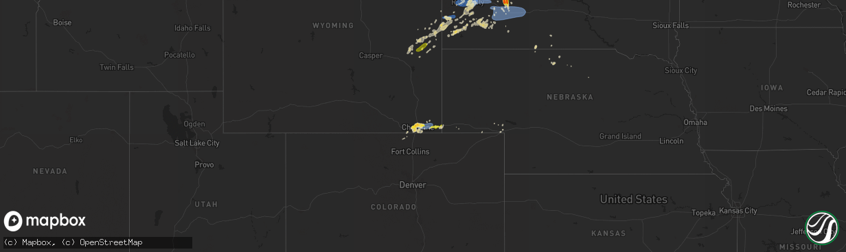
Hail Map on June 8, 2021
The weather event on June 8, 2021 includes Hail, Wind, and Tornado maps. 27 states and 374 cities were impacted and suffered possible damage. The total estimated number of properties impacted is 9,597.
Hail
Wind
Tornado
9,597
Estimated number of impacted properties by a 1.00" hail or larger2,448
Estimated number of impacted properties by a 1.75" hail or larger815
Estimated number of impacted properties by a 2.50" hail or largerStates Impacted by Hail Map on June 8, 2021
Storm reports
Texas
| Date | Description |
|---|---|
| 06/08/202111:42 AM CDT | Tree down on hwy 96 between center and tenaha. |
| 06/08/202111:37 AM CDT | Several large trees down on appleby sand road between cr 2041 and sl 224. |
| 06/08/202111:05 AM CDT | Tree down on fm 782. |
| 06/08/202110:23 AM CDT | An ef0 tornado briefly touched down at ramey plant farm where it collapsed the metal lining structure of a couple greenhouses and snapped off several large limbs from a |
| 06/08/202110:10 AM CDT | Touchdown along hwy 84 west of reklaw. |
| 06/08/202110:02 AM CDT | An ef0 tornado briefly touched down as it crossed us highway 84 just northeast of rusk. A few trees sustained minor limb damage and two wooden utility poles were also l |
| 06/08/20219:55 AM CDT | Public report: 3-inch tree limbs broken; power poles broken. |
| 06/08/20219:20 AM CDT | Large tree uprooted in lindsey park. |
| 06/08/20219:11 AM CDT | An ef0 tornado with maximum winds of 80 mph occurred along tx-364 spur at lindsey park on the southwest side of tyler. A large oak tree was uprooted in lindsey park wit |
| 06/08/20218:50 AM CDT | Several trees down and utility poles down on e carthage st. Reported by mexia fire and police dept. |
| 06/08/20216:43 AM CDT | At 1143 AM CDT, severe thunderstorms were located along a line extending from 6 miles northwest of Elysian Fields to 7 miles west of Center, moving northeast at 40 mph. HAZARD...60 mph wind gusts. SOURCE...Radar indicated. IMPACT...Expect damage to roofs, siding, and trees. Locations impacted include... Shreveport, Center, Greenwood, Stonewall, Logansport, Joaquin, Deberry, Elysian Fields, Keachi, Longstreet, Stanley, Gloster, Keat Chie, James, Front, Spring Ridge, Cross Lake, Midyett, Kickapoo and Keithville. |
| 06/08/20216:15 AM CDT | At 1114 AM CDT, severe thunderstorms were located along a line extending from Pinehill to near Garrison to Nacogdoches, moving east at 35 mph. HAZARD...60 mph wind gusts. SOURCE...Radar indicated. IMPACT...Expect damage to roofs, siding, and trees. Locations impacted include... Nacogdoches, Carthage, Center, Tenaha, Timpson, Garrison, Melrose, Pinehill, Martinsville, Minden, Trawick, Appleby, Mount Enterprise, Gary City, Chapman, Jericho, Stockman, Lawsonville, Fairplay and Arcadia. |
| 06/08/20215:51 AM CDT | At 1051 AM CDT, severe thunderstorms were located along a line extending from near Clarksville City to near Henderson, moving east at 35 mph. HAZARD...60 mph wind gusts. SOURCE...Radar indicated. IMPACT...Expect damage to roofs, siding, and trees. Locations impacted include... Longview, Henderson, Kilgore, White Oak, Gladewater, Hallsville, Overton, Tatum, New London, Clarksville City, Beckville, Liberty City, Joinerville, Turnertown, Lakeport, Easton, Warren City, Rolling Meadows, Fairplay and Stewart. |
| 06/08/20215:30 AM CDT | At 1029 AM CDT, severe thunderstorms were located along a line extending from near Troup to near Rusk to 7 miles southwest of Morrill, moving east at 45 mph. HAZARD...60 mph wind gusts and penny size hail. SOURCE...Radar indicated. IMPACT...Expect damage to roofs, siding, and trees. Locations impacted include... Nacogdoches, Rusk, Alto, Morrill, Ponta, Pinehill, New Salem, Trawick, Sacul, Douglass, Minden, New Summerfield, Cushing, Appleby, Mount Enterprise, Gallatin, Reklaw, Linwood, Lilbert and Dotson. |
Rhode Island
| Date | Description |
|---|---|
| 06/08/202112:17 AM CDT | At 517 PM EDT, a severe thunderstorm was located over Millville, or near Woonsocket, moving east at 20 mph. HAZARD...60 mph wind gusts and quarter size hail. SOURCE...Radar indicated. IMPACT...Expect wind damage to trees and power lines. Minor hail damage to vehicles is possible. Locations impacted include... Woonsocket, Cumberland, Franklin, North Attleborough, Milford, Walpole, Mansfield, Norton, Sharon, Foxborough, Bellingham, Burrillville, Northbridge, Westwood, Holliston, Uxbridge, Medway, Medfield, North Smithfield and Norfolk. |
Indiana
| Date | Description |
|---|---|
| 06/08/20216:15 PM CDT | Observed tornado near the intersection of interstate 69 and highway 356 near alford. |
| 06/08/20215:25 PM CDT | *** 1 inj *** barn roof and side walls torn off and part of a residence damaged. One male was injured by debris lofted while occupying building. Several trees damaged a |
| 06/08/20211:42 PM CDT | Observer was looking north from agricultural cooperative and noted the tornado formed twice. A brief touchdown occurred... But no damage reported. Estimated ef0 with wi |
Louisiana
| Date | Description |
|---|---|
| 06/08/20214:10 PM CDT | The roof was blown off an apartment and some power lines were blown down in the lake providence area. Time estimated from radar. Possible significant severe wind report |
| 06/08/20213:20 PM CDT | Report from mping of wind damage similar to 1 inch tree limbs broken or roofing shingles blown off. Adjusted time of report based on radar. |
| 06/08/20212:52 PM CDT | Tree limbs snapped off at knoe station - around 3 inches in diameter. |
| 06/08/20211:39 PM CDT | Trees down on hwy 501 between saline and jonesboro. |
| 06/08/202112:32 PM CDT | Tree reported down with power lines in logansport. |
| 06/08/20217:17 AM CDT | At 1217 PM CDT, severe thunderstorms were located along a line extending from near Greenwood to near Stonewall to 8 miles east of Logansport, moving east at 50 mph. HAZARD...60 mph wind gusts. SOURCE...Radar indicated. IMPACT...Expect damage to roofs, siding, and trees. Locations impacted include... Shreveport, Bossier City, Mansfield, Coushatta, Stonewall, Ringgold, Heflin, Martin, South Mansfield, Hall Summit, Keachi, Grand Cane, Edgefield, Jamestown, Carmel, Curtis, Grand Bayou, Kingston, Plum Orchard Landing and Hanna. |
| 06/07/202111:08 PM CDT | At 407 PM CDT, severe thunderstorms were located along a line extending from near Lake Providence to near Eagle Bend to near Afton, moving east at 50 mph. HAZARD...60 mph wind gusts. SOURCE...Radar indicated. IMPACT...Expect damage to roofs, siding, and trees. Severe thunderstorms will be near... Eagle Bend around 410 PM CDT. Fitler around 415 PM CDT. Vicksburg, Valley Park, Redwood, Onward and Le Tourneau around 425 PM CDT. Oak Ridge around 435 PM CDT. Bovina and Holly Bluff around 440 PM CDT. Phoenix, Flowers and Newman around 445 PM CDT. Edwards and Youngton around 450 PM CDT. Tinsley around 500 PM CDT.Other locations impacted by these severe thunderstorms include Mound,Satartia, Cary and Delta. |
| 06/07/202110:37 PM CDT | At 336 PM CDT, severe thunderstorms were located along a line extending from near Goodwill to near Warden to near Crowville, moving east at 35 mph. HAZARD...60 mph wind gusts. SOURCE...Radar indicated. IMPACT...Expect damage to roofs, siding, and trees. Severe thunderstorms will be near... Delhi around 340 PM CDT. Waverly around 345 PM CDT. Monticello, Darnell and Tendal around 350 PM CDT. Oak Grove around 400 PM CDT. Sondheimer and Alsatia around 410 PM CDT. Transylvania and Omega around 415 PM CDT. Lake Providence, Afton and Shelburn around 420 PM CDT. Tallulah around 425 PM CDT.Other locations impacted by these severe thunderstorms includePioneer, Forest and Richmond. |
| 06/07/20219:05 PM CDT | At 204 PM CDT, severe thunderstorms were located along a line extending from near Ruston to 10 miles east of Jonesboro to 9 miles north of Winnfield, moving east at 45 mph. HAZARD...60 mph wind gusts. SOURCE...Radar indicated. IMPACT...Expect damage to roofs, siding, and trees. Locations impacted include... Monroe, Ruston, Claiborne, West Monroe, Grambling, Columbia, Swartz, Brownsville-Bawcom, Brownsville-Bawcomville, Richwood, Sterlington, Clarks, Grayson, Choudrant, Chatham, Vienna, Dodson, Eros, Downsville and Sikes. |
| 06/07/20218:29 PM CDT | At 128 PM CDT, severe thunderstorms were located along a line extending from 13 miles south of Gibsland to 13 miles west of Jonesboro to 14 miles northeast of Campti, moving east at 35 mph. HAZARD...60 mph wind gusts. SOURCE...Radar indicated. IMPACT...Expect damage to roofs, siding, and trees. Locations impacted include... Jonesboro, Chatham, Hodge, North Hodge, Dodson, East Hodge, Saline, Lucky, Bienville, Quitman, Eros, Sikes, Brice, Friendship and Liberty Hill. |
Michigan
| Date | Description |
|---|---|
| 06/08/20216:06 PM CDT | Report via facebook of winds taking off the tops of at least 3 very tall pines. Picture provided. |
| 06/08/20216:04 PM CDT | Multiple trees down... Approximately 14 to 16 inches in diameter. Spotter estimated 70 mph winds. Power is out. |
| 06/08/20215:36 PM CDT | Dispatcher reports multiple reports of downed trees... Power lines... And power outages across dickinson county. We energies outage map indicating outages stretching fr |
| 06/08/20215:29 PM CDT | Report relayed of multiple trees down in the felch area... With one large... Healthy tree blocking the road. |
| 06/08/20214:54 PM CDT | Also tree down on powerline. |
| 06/08/20214:40 PM CDT | Quarter size hail reported along hwy m-95 via wjmn-tv broadcast media. |
| 06/08/20214:36 PM CDT | Numerous power outages reported in the little shag lake area as well as additional multiple outages in the princeton and areas west in forsyth township. |
| 06/08/20214:12 PM CDT | Also... Large branches down and tree on powerline. |
| 06/08/20214:10 PM CDT | Via facebook. |
| 06/08/20213:57 PM CDT | 1 inch to slightly larger size hail reported via social media in the palmer area. |
| 06/08/20213:48 PM CDT | A local report indicates 1.75 inch wind near 5 SSE PALMER |
| 06/08/20211:38 AM CDT | At 637 PM CDT, severe thunderstorms were located along a line extending from 9 miles southeast of Norway to near Pembine to near Goodman, moving south at 30 mph. HAZARD...60 mph wind gusts and quarter size hail. SOURCE...Radar indicated. IMPACT...Hail damage to vehicles is expected. Expect wind damage to roofs, siding, and trees. Locations impacted include... Pembine, Goodman, Wausaukee, Niagara, Dunbar, Amberg, Beecher, Athelstane, Silver Cliff and Caldron Falls Rese. |
| 06/08/202112:46 AM CDT | At 546 PM EDT/446 PM CDT/, severe thunderstorms were located along a line extending from near Witch Lake to 9 miles southwest of Gwinn, moving southeast at 10 mph. HAZARD...60 mph wind gusts and quarter size hail. SOURCE...Radar indicated. IMPACT...Hail damage to vehicles is expected. Expect wind damage to roofs, siding, and trees. Locations impacted include... Witch Lake and Silver Lake near Channing. |
| 06/08/202112:16 AM CDT | At 515 PM EDT, a severe thunderstorm was located near Gwinn, or 14 miles southeast of Ishpeming, moving southeast at 10 mph. HAZARD...60 mph wind gusts and quarter size hail. SOURCE...Radar indicated. IMPACT...Hail damage to vehicles is expected. Expect wind damage to roofs, siding, and trees. Locations impacted include... Gwinn, K. I. Sawyer Airport, Anderson Lake and Little Lake. |
| 06/08/202112:14 AM CDT | At 514 PM CDT, a severe thunderstorm was located near Kentuck Lake Campground, or 15 miles west of Iron River, moving south at 5 mph. HAZARD...Quarter size hail. SOURCE...Radar indicated. IMPACT...Damage to vehicles is expected. Locations impacted include... Kentuck Lake Campground. |
| 06/08/202112:09 AM CDT | At 509 PM CDT, severe thunderstorms were located along a line extending from near Channing to 11 miles northwest of Watson, moving south at 10 mph. HAZARD...60 mph wind gusts and quarter size hail. SOURCE...Radar indicated. IMPACT...Hail damage to vehicles is expected. Expect wind damage to roofs, siding, and trees. Locations impacted include... Felch, Foster City, Channing, Sagola, Randville, Ralph, Hardwood and Silver Lake near Channing. |
| 06/07/202111:44 PM CDT | At 443 PM EDT, a severe thunderstorm was located 7 miles northwest of Gwinn, or 10 miles southeast of Ishpeming, moving east at 5 mph. HAZARD...60 mph wind gusts and quarter size hail. SOURCE...Radar indicated. IMPACT...Hail damage to vehicles is expected. Expect wind damage to roofs, siding, and trees. This severe thunderstorm will be near... K. I. Sawyer Airport and Gwinn around 515 PM EDT.Other locations impacted by this severe thunderstorm include Palmer. |
South Dakota
| Date | Description |
|---|---|
| 06/08/20216:58 PM CDT | A local report indicates 62 MPH wind near 1 N BUFFALO |
| 06/08/20216:46 PM CDT | A local report indicates 67 MPH wind near 4 N LUDLOW |
| 06/08/20216:18 PM CDT | A local report indicates 1.75 inch wind near 2 N FIRESTEEL |
| 06/08/20216:06 PM CDT | A local report indicates 63 MPH wind near 7 S SHADEHILL |
| 06/08/20215:56 PM CDT | At least ping pong ball at largest. Hail for 30 minutes... Just ended. |
| 06/08/20215:55 PM CDT | A local report indicates 59 MPH wind near 7 SSE MEADOW |
| 06/08/20215:05 PM CDT | Mesonet station mcts2 mcintosh |
| 06/08/20213:38 PM CDT | A local report indicates 1.50 inch wind near 7 NE QUINN |
| 06/08/20216:58 AM CDT | At 1157 PM CDT/1057 PM MDT/, a severe thunderstorm was located 6 miles southwest of Thunder Hawk, or 7 miles southeast of Lemmon, moving north at 50 mph. HAZARD...60 mph wind gusts. SOURCE...Radar indicated. IMPACT...Expect damage to roofs, siding, and trees. Locations impacted include... New Leipzig. |
| 06/08/20215:54 AM CDT | At 1054 PM MDT, severe thunderstorms were located along a line extending from near Shadehill to 7 miles north of Iron Lightning to near Intersection of Cherry Creek and Sunnybrook Roads to near Bridger, moving northeast at 40 mph. HAZARD...60 mph wind gusts and penny size hail. SOURCE...Radar indicated. IMPACT...Expect damage to roofs, siding, and trees. Severe thunderstorms will be near... Thunder Hawk around 1110 PM MDT.Other locations in the path of these severe thunderstorms includeLantry, Bear Creek, Keldron, Green Grass, Klein Ranch, Black Horse,Eagle Butte, Timber Lake, Little Moreau Rec Area and Parade. |
| 06/08/20215:50 AM CDT | At 1049 PM MDT, severe thunderstorms were located along a line extending from 8 miles southwest of Shambo Ranch to 5 miles south of Red Elm to near Bridger, moving east at 30 mph. HAZARD...60 mph wind gusts and penny size hail. SOURCE...Radar indicated. IMPACT...Expect damage to roofs, siding, and trees. Severe thunderstorms will be near... Red Elm around 1055 PM MDT.Other locations in the path of these severe thunderstorms includeDupree, Glad Valley, Cherry Creek, South Eagle Butte and Kirley. |
| 06/08/20214:12 AM CDT | At 912 PM MDT, a severe thunderstorm was located near Green Grass, or 12 miles north of Eagle Butte, moving northeast at 25 mph. HAZARD...Two inch hail and 70 mph wind gusts. SOURCE...Radar indicated. IMPACT...People and animals outdoors will be injured. Expect hail damage to roofs, siding, windows, and vehicles. Expect considerable tree damage. Wind damage is also likely to mobile homes, roofs, and outbuildings. Locations impacted include... White Horse. |
| 06/08/20214:10 AM CDT | At 909 PM MDT, a severe thunderstorm was located 6 miles northeast of Date, or 38 miles south of Hettinger, moving north at 10 mph. HAZARD...Quarter size hail. SOURCE...Radar indicated. IMPACT...Damage to vehicles is expected. Locations impacted include... Bison. |
| 06/08/20213:44 AM CDT | At 844 PM MDT, severe thunderstorms were located along a line extending from 3 miles north of Newell Lake to 7 miles northeast of Bear Butte State Park to 5 miles east of Black Hawk, moving northeast at 35 mph. HAZARD...60 mph wind gusts and penny size hail. SOURCE...Radar indicated. IMPACT...Expect damage to roofs, siding, and trees. Severe thunderstorms will be near... Castle Rock around 850 PM MDT.Other locations in the path of these severe thunderstorms includeDears Ears Butte, Viewfield, Hereford, Curlew Lake, Mud Butte andFairpoint.This includes Interstate 90 in South Dakota between Mile Markers 23and 53. |
| 06/08/20213:41 AM CDT | At 840 PM MDT, severe thunderstorms were located along a line extending from Rapid City to 3 miles south of Hayward to 2 miles south of Pringle, moving east at 25 mph. HAZARD...60 mph wind gusts and penny size hail. SOURCE...Radar indicated. IMPACT...Expect damage to roofs, siding, and trees. Severe thunderstorms will be near... Rapid City, Rapid Valley, Black Hawk and Hayward around 845 PM MDT. Southern Ellsworth Air Force Base, Box Elder and Hermosa around 855 PM MDT. Rapid City Airport around 900 PM MDT.Other locations in the path of these severe thunderstorms includeBuffalo Corrals, Thompson Butte, New Underwood, Fairburn, Folsom andRailroad Buttes.This includes Interstate 90 in South Dakota between Mile Markers 54and 84. |
| 06/08/20213:28 AM CDT | At 827 PM MDT, a severe thunderstorm was located near Bear Creek, or near Dupree, moving east at 15 mph. HAZARD...70 mph wind gusts and quarter size hail. SOURCE...Radar indicated. IMPACT...Hail damage to vehicles is expected. Expect considerable tree damage. Wind damage is also likely to mobile homes, roofs, and outbuildings. This severe thunderstorm will be near... Bear Creek around 840 PM MDT.Other locations in the path of this severe thunderstorm include GreenGrass. |
| 06/08/20213:20 AM CDT | At 820 PM MDT, a severe thunderstorm was located 8 miles southwest of Owen Lake, or 31 miles northwest of Faith, moving east at 20 mph. HAZARD...60 mph wind gusts and quarter size hail. SOURCE...Radar indicated. IMPACT...Hail damage to vehicles is expected. Expect wind damage to roofs, siding, and trees. This severe thunderstorm will be near... Owen Lake around 840 PM MDT.Other locations in the path of this severe thunderstorm includeChance and Meadow. |
| 06/08/20212:59 AM CDT | At 759 PM MDT, a severe thunderstorm was located near Red Elm, or 9 miles west of Dupree, moving east at 25 mph. HAZARD...60 mph wind gusts and quarter size hail. SOURCE...Radar indicated. IMPACT...Hail damage to vehicles is expected. Expect wind damage to roofs, siding, and trees. Locations impacted include... Dupree. |
| 06/08/20212:46 AM CDT | At 745 PM MDT, severe thunderstorms were located along a line extending from near Crooks Tower to 8 miles south of Moon to near Dewey, moving east at 30 mph. HAZARD...60 mph wind gusts and penny size hail. SOURCE...Radar indicated. IMPACT...Expect damage to roofs, siding, and trees. Severe thunderstorms will be near... Flag Mountain and Deerfield around 750 PM MDT. Jewel Cave National Monument around 755 PM MDT. Rochford and Bear Mountain Lookout around 805 PM MDT.Other locations in the path of these severe thunderstorms includeMystic, Medicine Mountain, Crazy Horse Memorial, Custer, Silver City,Custer State Park, Pactola Reservoir, Hill City, Argyle, Black ElkPeak, Sylvan Lake, Palmer Gulch Resort, Stockade Lake, JohnsonSiding, Pringle, Horse Thief Lake, Sheridan Lake, Cottonwood SpringsDam and Legion Lake.This includes Interstate 90 in South Dakota between Mile Markers 54and 57. |
| 06/08/20212:25 AM CDT | At 725 PM MDT, a severe thunderstorm was located near Timber Lake, or 29 miles north of Eagle Butte, moving northeast at 20 mph. HAZARD...60 mph wind gusts and quarter size hail. SOURCE...Radar indicated. IMPACT...Hail damage to vehicles is expected. Expect wind damage to roofs, siding, and trees. This severe thunderstorm will be near... Timber Lake around 735 PM MDT.Other locations in the path of this severe thunderstorm includeGlencross and Spring Lake. |
| 06/08/20212:11 AM CDT | At 711 PM MDT, a severe thunderstorm was located near Spring Lake, or 21 miles south of Mclaughlin, moving east at 15 mph. HAZARD...60 mph wind gusts and quarter size hail. SOURCE...Radar indicated. IMPACT...Hail damage to vehicles is expected. Expect wind damage to roofs, siding, and trees. This severe thunderstorm will be near... Glencross around 720 PM MDT. Spring Lake around 725 PM MDT.Other locations in the path of this severe thunderstorm include TrailCity. |
| 06/08/20211:17 AM CDT | At 616 PM MDT, severe thunderstorms were located along a line extending from 11 miles east of Klein Ranch to Firesteel, moving southeast at 25 mph. HAZARD...60 mph wind gusts and quarter size hail. SOURCE...Radar indicated. IMPACT...Hail damage to vehicles is expected. Expect wind damage to roofs, siding, and trees. Locations impacted include... Little Moreau Rec Area, Timber Lake, Spring Lake and Glencross. |
| 06/08/202112:54 AM CDT | At 553 PM MDT, a severe thunderstorm was located 11 miles northwest of Shambo Ranch, or 21 miles south of Lemmon, moving east at 25 mph. HAZARD...60 mph wind gusts and quarter size hail. SOURCE...Radar indicated. IMPACT...Hail damage to vehicles is expected. Expect wind damage to roofs, siding, and trees. This severe thunderstorm will remain over mainly rural areas of northwestern Corson County. |
| 06/08/202112:34 AM CDT | A local report indicates 62 MPH wind near 4 E CACTUS FLAT |
| 06/08/202112:24 AM CDT | A local report indicates 58 MPH wind near 4 E CACTUS FLAT |
| 06/08/202112:23 AM CDT | At 523 PM MDT, a severe thunderstorm was located 8 miles east of Shambo Ranch, or 34 miles north of Dupree, moving east at 30 mph. HAZARD...60 mph wind gusts and quarter size hail. SOURCE...Radar indicated. IMPACT...Hail damage to vehicles is expected. Expect wind damage to roofs, siding, and trees. Locations impacted include... Klein Ranch. |
| 06/08/202112:20 AM CDT | A local report indicates 59 MPH wind near 8 S WALL |
| 06/07/202111:54 PM CDT | A local report indicates 64 MPH wind near 1 WSW RED ELM |
| 06/07/202111:54 PM CDT | A local report indicates 64 MPH wind near 7 SSE MEADOW |
| 06/07/202111:46 PM CDT | At 446 PM MDT, a severe thunderstorm was located near Green Grass, or 18 miles north of Eagle Butte, moving north at 15 mph. HAZARD...60 mph wind gusts and quarter size hail. SOURCE...Radar indicated. IMPACT...Hail damage to vehicles is expected. Expect wind damage to roofs, siding, and trees. Locations impacted include... Firesteel and Timber Lake. |
| 06/07/202111:45 PM CDT | A local report indicates 59 MPH wind near 8 S WALL |
| 06/07/202111:44 PM CDT | A local report indicates 62 MPH wind near 3 NW WASTA |
| 06/07/202111:39 PM CDT | A local report indicates 59 MPH wind near 3 NW WASTA |
| 06/07/202111:19 PM CDT | A local report indicates 60 MPH wind near 7 SSE MEADOW |
| 06/07/202111:19 PM CDT | A local report indicates 61 MPH wind near 3 NW WASTA |
| 06/07/202111:09 PM CDT | A local report indicates 61 MPH wind near 5 WNW NEW UNDERWOOD |
| 06/07/202111:00 PM CDT | A local report indicates 1.00 inch wind near 6 W HERMOSA |
| 06/07/202110:51 PM CDT | A local report indicates 68 MPH wind near 4 N LUDLOW |
| 06/07/202110:45 PM CDT | At 345 PM MDT, a severe thunderstorm was located near Watauga, or 26 miles east of Lemmon, moving northeast at 10 mph. HAZARD...60 mph wind gusts and half dollar size hail. SOURCE...Radar indicated. IMPACT...Hail damage to vehicles is expected. Expect wind damage to roofs, siding, and trees. This severe thunderstorm will be near... Watauga around 405 PM MDT. |
| 06/07/202110:36 PM CDT | A local report indicates 59 MPH wind near 10 W EDGEMONT |
| 06/07/202110:04 PM CDT | A local report indicates 1.00 inch wind near 7 NNE ELLSWORTH AFB |
| 06/07/20219:55 PM CDT | A local report indicates 63 MPH wind near 7 NNE ELLSWORTH AFB |
| 06/07/20219:45 PM CDT | A local report indicates 68 MPH wind near 12 WSW CASTLE ROCK |
| 06/07/20219:45 PM CDT | Also pea to nickel size hail. |
| 06/07/20219:39 PM CDT | Mesonet station lans2 lantry 3 nw. Time estimated by radar. Gust occurred between 852 pm and 952 pm cdt. |
| 06/07/20219:37 PM CDT | Damage to branches and rain gauge. |
| 06/07/20219:30 PM CDT | A local report indicates 59 MPH wind near 1 WSW RED ELM |
| 06/07/20219:25 PM CDT | A local report indicates 58 MPH wind near 13 NW BELLE FOURCHE |
| 06/07/20219:20 PM CDT | At 220 PM MDT, a severe thunderstorm was located over Grindstone, or 14 miles west of Philip, moving north at 20 mph. HAZARD...60 mph wind gusts and half dollar size hail. SOURCE...Radar indicated. IMPACT...Hail damage to vehicles is expected. Expect wind damage to roofs, siding, and trees. This severe thunderstorm will be near... Grindstone around 225 PM MDT. |
| 06/07/20219:15 PM CDT | Also had pea to marble size hail. |
| 06/07/20219:06 PM CDT | A local report indicates 86 MPH wind near 1 WSW RED ELM |
| 06/07/20219:05 PM CDT | A local report indicates 62 MPH wind near 13 NW BELLE FOURCHE |
| 06/07/20219:00 PM CDT | Some door and roof damage to a barn. A semi trailer was blown over. |
| 06/07/20218:54 PM CDT | Mesonet station 293 timber lake |
| 06/07/20218:49 PM CDT | A local report indicates 1.00 inch wind near TIMBER LAKE |
| 06/07/20218:44 PM CDT | A local report indicates 64 MPH wind near 1 WSW RED ELM |
| 06/07/20218:42 PM CDT | A local report indicates 64 MPH wind near 1 NNE FAITH |
| 06/07/20218:39 PM CDT | Mesonet station 293 timber lake |
| 06/07/20218:30 PM CDT | 70-80 mph wind gusts |
| 06/07/20218:19 PM CDT | Mesonet station 293 timber lake |
| 06/07/20218:18 PM CDT | Preliminary info. Time and location approximated and based on radar/reports. Spotter reported a tornado. |
| 06/07/20217:40 PM CDT | Mesonet station grrs2 bullhead 10 s. Time estimated. |
| 06/07/20217:20 PM CDT | Small tree limbs down. |
| 06/07/20217:06 PM CDT | A local report indicates 58 MPH wind near 4 N LUDLOW |
| 06/07/20217:00 PM CDT | A local report indicates 1.00 inch wind near 2 N FIRESTEEL |
North Carolina
| Date | Description |
|---|---|
| 06/08/20215:15 PM CDT | Trees and utility lines downed along with power outages along highway 16. |
| 06/08/20211:03 AM CDT | At 603 PM EDT, a severe thunderstorm was located over Taylorsville, moving northeast at 15 mph. HAZARD...60 mph wind gusts and quarter size hail. SOURCE...Radar indicated. IMPACT...Minor hail damage to vehicles is expected. Expect wind damage to trees and power lines. Locations impacted include... Taylorsville, Love Valley, Hiddenite, Vashti, Millersville, Ellendale and Union Grove. |
Maryland
| Date | Description |
|---|---|
| 06/08/20214:59 PM CDT | A tree blew down in a yard in capitol heights. |
| 06/07/202110:48 PM CDT | At 348 PM EDT, a severe thunderstorm was located over Rock Springs, or 10 miles north of Havre De Grace, moving east at 5 mph. HAZARD...60 mph wind gusts. SOURCE...Radar indicated. IMPACT...Damaging winds will cause some trees and large branches to fall. This could injure those outdoors, as well as damage homes and vehicles. Roadways may become blocked by downed trees. Localized power outages are possible. Unsecured light objects may become projectiles. Locations impacted include... Calvert, Rising Sun, West Nottingham, Octoraro, Blake, Conowingo, Rock Springs, Lombard, Richardsmere and Farmington. |
Wyoming
| Date | Description |
|---|---|
| 06/08/20215:11 PM CDT | No rain detected at asos... But weak convective showers likely caused a dry microburst... Which was amplified by a passing mesoscale frontal feature. One camper was tip |
| 06/08/20216:15 AM CDT | At 1115 PM MDT, severe thunderstorms were located along a line extending from 10 miles east of Albin to 6 miles southeast of Burns, moving east at 25 mph. HAZARD...60 mph wind gusts and quarter size hail. SOURCE...Radar indicated. IMPACT...Hail damage to vehicles is expected. Expect wind damage to roofs, siding, and trees. Severe thunderstorms will be near... Pine Bluffs around 1145 PM MDT. Oliver Campground and Oliver Reservoir around 1200 AM MDT.Other locations impacted by these severe thunderstorms includeBushnell.This includes the following highways... Interstate 80 in Wyoming between mile markers 389 and 402. Interstate 80 in Nebraska between mile markers 1 and 25. |
| 06/08/20214:03 AM CDT | At 903 PM MDT, severe thunderstorms were located along a line extending from 6 miles southeast of La Grange to 6 miles southeast of Albin to Pine Bluffs, moving east at 30 mph. HAZARD...70 mph wind gusts and penny size hail. SOURCE...Radar indicated. IMPACT...Expect considerable tree damage. Damage is likely to mobile homes, roofs, and outbuildings. Locations impacted include... Kimball, Pine Bluffs, La Grange, Dix, Albin, Oliver Campground, Wildcat Hills State Recreation Area, Wildcat Hills Campground, Oliver Reservoir, Hubbard Hill, Kimball Airport, Harrisburg and Bushnell.This includes the following highways... Interstate 80 in Wyoming between mile markers 396 and 402. Interstate 80 in Nebraska between mile markers 1 and 34. |
| 06/08/20213:35 AM CDT | At 835 PM MDT, severe thunderstorms were located along a line extending from Morrisey to near Manville, moving east at 20 mph. HAZARD...60 mph wind gusts and quarter size hail. SOURCE...Radar indicated. IMPACT...Hail damage to vehicles is expected. Expect wind damage to roofs, siding, and trees. Severe thunderstorms will be near... Lusk around 900 PM MDT. |
| 06/08/20212:27 AM CDT | At 726 PM MDT, a severe thunderstorm was located over Cheyenne, moving east at 10 mph. HAZARD...Quarter size hail. SOURCE...Radar indicated. IMPACT...Damage to vehicles is expected. Locations impacted include... Cheyenne, South Greeley, Ranchettes, Warren AFB, Frontier Park, North Cheyenne, Warren Af Base, Fox Farm-College and South Greeley High.This includes the following highways... Interstate 25 in Wyoming between mile markers 5 and 20. Interstate 80 in Wyoming between mile markers 351 and 380.This replaces the Severe Thunderstorm Warning which was previously in effect for the warned area. |
| 06/08/20211:45 AM CDT | At 645 PM MDT, a severe thunderstorm was located over Warren AFB, or near Cheyenne, moving northeast at 5 mph. HAZARD...60 mph wind gusts and half dollar size hail. SOURCE...Radar indicated. IMPACT...Hail damage to vehicles is expected. Expect wind damage to roofs, siding, and trees. Locations impacted include... Cheyenne, Ranchettes, Warren AFB, Frontier Park, North Cheyenne, Warren Af Base, South Greeley, Fox Farm-College and South Greeley High.This includes the following highways... Interstate 25 in Wyoming between mile markers 8 and 23. Interstate 80 in Wyoming between mile markers 352 and 373. |
| 06/07/202111:26 PM CDT | A local report indicates 1.00 inch wind near PINE BLUFFS |
| 06/07/20219:35 PM CDT | A local report indicates 1.00 inch wind near 1 NE LANCE CREEK |
| 06/07/20219:10 PM CDT | Pea to quarter size hail along with 60 mph wind gusts. 3-4 inches of hail covered ground. Greenhouse destroyed. Livestock lost including a goat and chickens. Flash floo |
| 06/07/20218:42 PM CDT | A local report indicates 60 MPH wind near 8 SW HILLSDALE |
| 06/07/20218:40 PM CDT | A local report indicates 1.00 inch wind near 5 ENE CHEYENNE |
| 06/07/20218:40 PM CDT | Report received via facebook. Delayed report. |
| 06/07/20218:39 PM CDT | 51-53 mph winds. |
| 06/07/20218:36 PM CDT | A local report indicates 62 MPH wind near BEULAH |
| 06/07/20218:36 PM CDT | Corrects previous non-tstm wnd gst report from 8 wsw hillsdale. Mesonet station wy46 9.7 e cheyenne |
| 06/07/20218:15 PM CDT | Report received via facebook. Delayed report. I25 and vandehei. |
| 06/07/20217:49 PM CDT | A local report indicates 1.00 inch wind near 2 SE WARREN AF BASE |
| 06/07/20217:16 PM CDT | A local report indicates 62 MPH wind near 13 NNE WRIGHT |
| 06/07/20217:02 PM CDT | A local report indicates 69 MPH wind near 13 NNE WRIGHT |
Montana
| Date | Description |
|---|---|
| 06/08/20216:35 PM CDT | A local report indicates 2.75 inch wind near 15 N WIBAUX |
| 06/08/20216:00 PM CDT | Corrects previous hail report from 9 e glendive. Facebook photo of various hailstones and a measurement of 4 inches. |
| 06/08/20215:57 PM CDT | Mesonet station mtbvr 3.8 ne hodges |
| 06/08/20215:50 PM CDT | Still occurring... Estimating quarter size hail bouncing off ground. Some wind but not too bad. |
| 06/08/20215:49 PM CDT | Facebook comment with hail measurement. |
| 06/08/20215:49 PM CDT | Facebook comment. |
| 06/08/20215:26 PM CDT | Facebook photo of various hailstones and a measurement of 4 inches. |
| 06/08/20213:46 PM CDT | A local report indicates 2.00 inch wind near 10 SW CULBERTSON |
| 06/08/20211:30 PM CDT | Measured 1.3 inches. |
| 06/08/20214:53 AM CDT | At 952 PM MDT, severe thunderstorms were located along a line extending from 12 miles southwest of Culbertson to Lambert to 11 miles northwest of West Glendive, moving east at 45 mph. HAZARD...60 mph wind gusts and quarter size hail. SOURCE...Radar indicated. IMPACT...Hail damage to vehicles is expected. Expect wind damage to roofs, siding, and trees. Locations impacted include... Sidney, Fairview, Bainville, Bloomfield, Savage, Lambert, Intake, Snowden, Enid, Nohly, Wooley, Crane, Midway and Burns. |
| 06/08/20213:57 AM CDT | At 856 PM MDT, severe thunderstorms were located along a line extending from 20 miles east of Lustre to near Bredette to 24 miles south of Flaxville to 14 miles north of Brockton, moving northeast at 40 mph. HAZARD...60 mph wind gusts and quarter size hail. SOURCE...Radar indicated. IMPACT...Hail damage to vehicles is expected. Expect wind damage to roofs, siding, and trees. Locations impacted include... Plentywood, Scobey, Flaxville, Archer, Port Of Whitetail, Port Of Raymond, Madoc, Bredette, Redstone, Whitetail, Outlook, Raymond, Dooley, Daleview, Navajo and Antelope. |
| 06/08/20213:20 AM CDT | At 819 PM MDT, severe thunderstorms were located along a line extending from 10 miles southeast of Frazer to near Vida to 8 miles north of Brockway to 12 miles north of Miles City, moving east at 70 mph. HAZARD...60 mph wind gusts and quarter size hail. SOURCE...Radar indicated. IMPACT...Hail damage to vehicles is expected. Expect wind damage to roofs, siding, and trees. Locations impacted include... Glendive, Circle, Terry, Fallon, Richey, Savage, West Glendive, Brockway, Flowing Wells Rest Area, Intake, Bloomfield, Lambert, Vida, Lindsay, Enid, Crane, Mildred, Calypso, Midway and Hoyt. |
| 06/08/20213:07 AM CDT | At 806 PM MDT, severe thunderstorms were located along a line extending from 14 miles east of Lustre to 6 miles east of Wolf Point, moving north at 40 mph. HAZARD...60 mph wind gusts and quarter size hail. SOURCE...Radar indicated. IMPACT...Hail damage to vehicles is expected. Expect wind damage to roofs, siding, and trees. Locations impacted include... Wolf Point, Scobey, Bredette and Volt. |
| 06/08/20212:52 AM CDT | At 752 PM MDT, severe thunderstorms were located along a line extending from near Hillside to 16 miles west of Miles City, moving east at 35 mph. HAZARD...60 mph wind gusts and half dollar size hail. SOURCE...Radar indicated. IMPACT...Hail damage to vehicles is expected. Expect wind damage to roofs, siding, and trees. Locations impacted include... Rock Springs, Angela and Matthews Recreation Area. This replaces the warning previously in effect for this area. |
| 06/08/20212:48 AM CDT | At 748 PM MDT, severe thunderstorms were located along a line extending from 5 miles southeast of Colony to 4 miles southwest of Belle Fourche to 5 miles north of Black Fox Campground, moving east at 35 mph. HAZARD...60 mph wind gusts. SOURCE...Radar indicated. IMPACT...Expect damage to roofs, siding, and trees. Severe thunderstorms will be near... Belle Fourche around 755 PM MDT. Saint Onge, Brownsville and Roubaix Lake around 800 PM MDT. Fruitdale and Galena around 805 PM MDT.Other locations in the path of these severe thunderstorms includeNemo, Belle Fourche Reservoir, Nisland, Dalton Lake, Piedmont,Tilford, Arpan, Fort Meade, Summerset, Two Top Butte, Newell andVale.This includes... Interstate 90 in South Dakota between Mile Markers 1 and 53. Interstate 90 in Wyoming between Mile Markers 200 and 207. |
| 06/08/20212:45 AM CDT | At 744 PM MDT, severe thunderstorms were located along a line extending from 6 miles south of Flowing Wells Rest Area to 9 miles east of Hillside to 27 miles northeast of Forsyth, moving east at 50 mph. HAZARD...60 mph wind gusts and quarter size hail. SOURCE...Radar indicated. IMPACT...Hail damage to vehicles is expected. Expect wind damage to roofs, siding, and trees. Locations impacted include... Hillside, Mccloud and Crow Rock. |
| 06/08/20212:31 AM CDT | At 731 PM MDT, severe thunderstorms were located along a line extending from St. Marie to near Nashua to near Fort Peck to 6 miles northeast of Nelson Creek Rec Area to 6 miles southwest of Flowing Wells Rest Area, moving east at 25 mph. HAZARD...60 mph wind gusts and quarter size hail. SOURCE...Radar indicated. IMPACT...Hail damage to vehicles is expected. Expect wind damage to roofs, siding, and trees. Locations impacted include... Circle, Nashua, Fort Peck, The Pines Rec Area, Duck Creek Rec Area, Lustre, Brockway, Fort Peck Marina, Frazer, Flowing Wells Rest Area, Nelson Creek Rec Area, St. Marie, Rock Creek Rec Area, Oswego, Park Grove, Van Norman, Haxby, Weldon, Watkins and Whatley. |
| 06/08/20212:25 AM CDT | At 725 PM CDT/625 PM MDT/, a severe thunderstorm was located over Trotters, or 27 miles southeast of Sidney, moving northeast at 25 mph. This is a very dangerous storm. HAZARD...Baseball size hail and 60 mph wind gusts. SOURCE...Public. IMPACT...People and animals outdoors will be severely injured. Expect shattered windows, extensive damage to roofs, siding, and vehicles. This severe thunderstorm will remain over mainly rural areas of northern Golden Valley and southwestern McKenzie Counties, including the following locations... Sather Dam. |
| 06/08/20212:20 AM CDT | At 720 PM MDT, a severe thunderstorm was located near Wolf Point, moving northeast at 40 mph. HAZARD...60 mph wind gusts and half dollar size hail. SOURCE...Radar indicated. IMPACT...Hail damage to vehicles is expected. Expect wind damage to roofs, siding, and trees. Locations impacted include... Wolf Point, Bredette, Frazer and Oswego. |
| 06/08/20212:12 AM CDT | At 712 PM MDT, a severe thunderstorm was located 10 miles west of Flowing Wells Rest Area, or 24 miles east of Jordan, moving northeast at 30 mph. HAZARD...60 mph wind gusts and quarter size hail. SOURCE...Radar indicated. IMPACT...Hail damage to vehicles is expected. Expect wind damage to roofs, siding, and trees. Locations impacted include... Nelson Creek Rec Area, Rock Creek Rec Area, Flowing Wells Rest Area, Van Norman, Haxby and Weldon. |
| 06/08/20212:06 AM CDT | At 705 PM MDT, a severe thunderstorm was located 10 miles east of Whitewater, moving north at 50 mph. HAZARD...60 mph wind gusts and quarter size hail. SOURCE...Radar indicated. IMPACT...Hail damage to vehicles is expected. Expect wind damage to roofs, siding, and trees. Locations impacted include... Whitewater and Frenchman Reservoir. |
| 06/08/20212:02 AM CDT | At 702 PM MDT, severe thunderstorms were located along a line extending from 24 miles southwest of Cohagen to near Forsyth, moving northeast at 40 mph. HAZARD...60 mph wind gusts and half dollar size hail. SOURCE...Radar indicated. IMPACT...Hail damage to vehicles is expected. Expect wind damage to roofs, siding, and trees. Locations impacted include... Forsyth, Rosebud, Hathaway, Vananda, Rock Springs, Angela and Cartersville. |
| 06/08/20211:58 AM CDT | At 657 PM MDT, severe thunderstorms were located along a line extending from near Skaar to 9 miles southwest of Carlyle, moving northeast at 30 mph. HAZARD...Ping pong ball size hail and 60 mph wind gusts. SOURCE...Radar indicated. IMPACT...People and animals outdoors will be injured. Expect hail damage to roofs, siding, windows, and vehicles. Expect wind damage to roofs, siding, and trees. Locations impacted include... Wibaux, Carlyle, Saint Phillip and Yates. |
| 06/08/20211:53 AM CDT | At 652 PM MDT, a severe thunderstorm was located near Froid, or 14 miles north of Culbertson, moving north at 45 mph. HAZARD...Ping pong ball size hail and 60 mph wind gusts. SOURCE...Radar indicated. IMPACT...People and animals outdoors will be injured. Expect hail damage to roofs, siding, windows, and vehicles. Expect wind damage to roofs, siding, and trees. Locations impacted include... Plentywood, Medicine Lake, Froid, Archer, Outlook, Reserve, Raymond, Homestead, Dooley, Antelope and Comertown. |
| 06/08/20211:50 AM CDT | At 650 PM MDT, severe thunderstorms were located along a line extending from 9 miles northwest of Duck Creek Rec Area to near Hell Creek Rec Area, moving northeast at 45 mph. HAZARD...60 mph wind gusts and quarter size hail. SOURCE...Radar indicated. IMPACT...Hail damage to vehicles is expected. Expect wind damage to roofs, siding, and trees. Locations impacted include... Glasgow, The Pines Rec Area, Fort Peck Marina, Hell Creek Rec Area, Tampico, Duck Creek Rec Area, St. Marie and Whatley. |
| 06/08/20211:38 AM CDT | At 637 PM MDT, a severe thunderstorm was located near Frazer, or 21 miles west of Wolf Point, moving northeast at 35 mph. HAZARD...60 mph wind gusts and half dollar size hail. SOURCE...Radar indicated. IMPACT...Hail damage to vehicles is expected. Expect wind damage to roofs, siding, and trees. Locations impacted include... Lustre, Frazer, Volt and Oswego. |
| 06/08/20211:34 AM CDT | At 633 PM MDT, severe thunderstorms were located along a line extending from 6 miles southwest of Skaar to 10 miles west of Carlyle, moving northeast at 45 mph. HAZARD...Ping pong ball size hail and 60 mph wind gusts. SOURCE...Radar indicated. IMPACT...People and animals outdoors will be injured. Expect hail damage to roofs, siding, windows, and vehicles. Expect wind damage to roofs, siding, and trees. Locations impacted include... Wibaux, Carlyle, Saint Phillip and Yates. |
| 06/08/20211:24 AM CDT | At 624 PM MDT, a severe thunderstorm was located 13 miles north of Fourchette, or 26 miles east of Zortman, moving north at 30 mph. HAZARD...60 mph wind gusts and quarter size hail. SOURCE...Radar indicated. IMPACT...Hail damage to vehicles is expected. Expect wind damage to roofs, siding, and trees. This severe thunderstorm will remain over mainly rural areas of central Phillips County. |
| 06/08/20211:19 AM CDT | At 619 PM MDT, a severe thunderstorm was located near Hell Creek Rec Area, or 17 miles north of Jordan, moving north at 35 mph. HAZARD...60 mph wind gusts and half dollar size hail. SOURCE...Radar indicated. IMPACT...Hail damage to vehicles is expected. Expect wind damage to roofs, siding, and trees. Locations impacted include... Hell Creek Rec Area. |
| 06/08/20211:16 AM CDT | At 615 PM MDT, a severe thunderstorm was located 13 miles southwest of Hinsdale, or 28 miles west of Glasgow, moving north at 45 mph. HAZARD...60 mph wind gusts and quarter size hail. SOURCE...Radar indicated. IMPACT...Hail damage to vehicles is expected. Expect wind damage to roofs, siding, and trees. Locations impacted include... Whitewater, Saco, Loring, Hinsdale, Vandalia, Sleeping Buffalo, The Bentonite Plant, Frenchman Reservoir and Bowdoin. |
| 06/08/20211:00 AM CDT | At 559 PM MDT, a severe thunderstorm was located 7 miles east of The Pines Rec Area, or 28 miles south of Glasgow, moving northeast at 20 mph. HAZARD...60 mph wind gusts and quarter size hail. SOURCE...Radar indicated. IMPACT...Hail damage to vehicles is expected. Expect wind damage to roofs, siding, and trees. Locations impacted include... Nashua, Fort Peck, The Pines Rec Area, Fort Peck Marina, Duck Creek Rec Area, Rock Creek Rec Area, Haxby and Park Grove. |
| 06/08/202112:57 AM CDT | At 556 PM MDT, a severe thunderstorm was located 8 miles north of Lambert, or 23 miles west of Sidney, moving north at 45 mph. HAZARD...Ping pong ball size hail and 60 mph wind gusts. SOURCE...Radar indicated. IMPACT...People and animals outdoors will be injured. Expect hail damage to roofs, siding, windows, and vehicles. Expect wind damage to roofs, siding, and trees. Locations impacted include... Culbertson, Froid, Lambert, Mccabe, Fort Kipp and Enid. |
| 06/08/202112:32 AM CDT | At 531 PM MDT, a severe thunderstorm was located 10 miles southwest of Skaar, or 18 miles north of Wibaux, moving northeast at 30 mph. HAZARD...Ping pong ball size hail and 60 mph wind gusts. SOURCE...Radar indicated. IMPACT...People and animals outdoors will be injured. Expect hail damage to roofs, siding, windows, and vehicles. Expect wind damage to roofs, siding, and trees. Locations impacted include... Skaar. |
| 06/08/202112:11 AM CDT | At 511 PM MDT, a severe thunderstorm was located 8 miles southwest of The Pines Rec Area, or 30 miles north of Jordan, moving north at 40 mph. HAZARD...60 mph wind gusts and quarter size hail. SOURCE...Radar indicated. IMPACT...Hail damage to vehicles is expected. Expect wind damage to roofs, siding, and trees. Locations impacted include... Glasgow, Fort Peck, The Pines Rec Area, Fort Peck Marina, Hell Creek Rec Area, Tampico, Duck Creek Rec Area, Park Grove and Whatley. |
| 06/08/202112:10 AM CDT | Measure 84 mph gust on home weather station. |
| 06/07/202111:30 PM CDT | Trained spotter reported a measured wind gust of 60 mph 3 miles south of bainville. No wind damage reported. Time estimated. |
| 06/07/202111:17 PM CDT | Awos station ksdy sidney airport. Gust of 62 mph measured with 47 sustained. Two minutes earlier at 10:15pm... 53 mph sustained with gusts to 61. |
| 06/07/202111:17 PM CDT | Ndawn mesonet site has measured a 77 mph wind gust. |
| 06/07/202111:15 PM CDT | Straight line winds hit in the town of fairview. Photos include large spruce and cottonwood trees uprooted... A metal building caved in and large tree branches down. Ri |
| 06/07/202111:15 PM CDT | Corrects previous tstm wnd gst report from 2 wsw sidney. Awos station ksdy sidney airport. |
| 06/07/202111:10 PM CDT | Corrects previous tstm wnd gst report from 3 n sidney. Measure 84 mph gust on home weather station. |
| 06/07/202110:44 PM CDT | Mesonet station blum8 thoeny 1wsw/bluff creek. Time estimated. |
| 06/07/202110:10 PM CDT | Corrects previous hail report from 7 ne wolf point. 60 mph winds as well. |
| 06/07/20219:55 PM CDT | Spotter report 1.12 inches of rainfall... No hail. Wind damage observed to a few shingles and the soffit broke loose. No major tree or crop damage observed so far. Time |
| 06/07/20219:25 PM CDT | Some flash flooding of lowlands. Severe winds and heavy rain lasted from 7:55 to 8:40 pm. |
| 06/07/20219:20 PM CDT | Mesonet station 07mt 1.0 ne saint marie |
| 06/07/20219:15 PM CDT | With nickle-sized hail. |
| 06/07/20219:00 PM CDT | Nickle to quarter size hail. |
| 06/07/20219:00 PM CDT | A local report indicates 1.75 inch wind near 9 SE VAN NORMAN |
| 06/07/20218:56 PM CDT | Asos station kolf wolf point airport. Recorded at 7:48pm... 7:53pm and 7:56pm. Sustained winds up to 49 mph with all but one observation in the last 15 minutes over 40 |
| 06/07/20218:54 PM CDT | Wolf point airport. |
| 06/07/20218:53 PM CDT | Asos station kggw glasgow airport |
| 06/07/20218:30 PM CDT | Facebook photos from in town- at least golf ball size hail. |
| 06/07/20218:23 PM CDT | Awos station ksdy sidney airport. |
| 06/07/20218:16 PM CDT | A local report indicates 1.75 inch wind near OSWEGO |
| 06/07/20218:15 PM CDT | No hail 0.6 to 0.7 inches rain. |
| 06/07/20218:15 PM CDT | A local report indicates 1.75 inch wind near HELL CREEK REC AREA |
| 06/07/20218:00 PM CDT | Pea sized hail as well. |
| 06/07/20217:50 PM CDT | Facebook message with photo. Size of hail estimated to be 1.5 inches. |
| 06/07/20217:35 PM CDT | Corrects previous hail report from fort kipp. Occurred 1 hour earlier than previously reported. Facebook photos from in town- at least golf ball size hail. |
| 06/07/20217:30 PM CDT | Golfball to tennis ball hail off and on from 630-715 pm. |
| 06/07/20217:23 PM CDT | Outflow from cluster of storms to east. |
| 06/07/20217:18 PM CDT | A local report indicates 1.75 inch wind near 8 SSE FORT KIPP |
| 06/07/20217:05 PM CDT | Twitter photo with measurement of baseball size hail. |
| 06/07/20217:00 PM CDT | A local report indicates 2.00 inch wind near 10 SW CULBERTSON |
Mississippi
| Date | Description |
|---|---|
| 06/08/20214:13 PM CDT | A few trees down and a power line along hwy 465. |
| 06/08/20214:10 PM CDT | Recorded by cbm asos. |
| 06/08/20213:33 PM CDT | Tree across 363 north of friendship baptist church. |
| 06/08/20213:25 PM CDT | Tree down across highway 25 in front of fairview school. |
| 06/08/20212:47 PM CDT | Trees and power lines down in mooreville. |
| 06/08/20212:45 PM CDT | At highway 45 and pontotoc pkwy large drainage pipes thrown across the highway and a fence knocked down around a business in verona. |
| 06/08/20212:43 PM CDT | A 53 foot trailer was flipped over near the intersection of highway 45 and us 278 northeast of veronna. |
| 06/08/20212:30 PM CDT | Several trees down in palmetto and verona areas and a large tree down on house in verona. |
| 06/08/20212:28 PM CDT | Video of a weak tornado near highway 45 and highway 278. Time estimated from radar. |
| 06/08/20214:58 AM CDT | At 958 PM CDT, a severe thunderstorm was located near Chester, or 17 miles northwest of Louisville, moving northeast at 35 mph. HAZARD...60 mph wind gusts and quarter size hail. SOURCE...Radar indicated. IMPACT...Hail damage to vehicles is expected. Expect wind damage to roofs, siding, and trees. This severe thunderstorm will be near... Ackerman around 1005 PM CDT. Reform around 1015 PM CDT. Sherwood around 1020 PM CDT. Longview around 1035 PM CDT. Starkville around 1045 PM CDT.Other locations impacted by this severe thunderstorm include Sturgisand Weir. |
| 06/08/202112:05 AM CDT | At 503 PM CDT, severe thunderstorms were located along a line extending from near Tinsley to near Oak Ridge, moving east at 40 mph. HAZARD...60 mph wind gusts and quarter size hail. SOURCE...Radar indicated. IMPACT...Hail damage to vehicles is expected. Expect wind damage to roofs, siding, and trees. Severe thunderstorms will be near... Tinsley around 510 PM CDT. Little Yazoo around 515 PM CDT. Myrleville and Phoenix around 520 PM CDT. Brownsville around 530 PM CDT. Flora and Pocahontas around 540 PM CDT.Other locations impacted by these severe thunderstorms includeSatartia and Bentonia. |
| 06/07/20219:26 PM CDT | At 226 PM CDT, a severe thunderstorm was located near Trace State Park, moving east at 20 mph. HAZARD...60 mph wind gusts. SOURCE...Radar indicated. IMPACT...Expect damage to roofs, siding, and trees. Locations impacted include... Tupelo, Verona, Trace State Park, Tombigbee State Park, Saltillo, Guntown, Plantersville, Mantachie, Pratts Friendship, Furrs, Sherman, Abney, Endville, Mooreville, Eggville, Ballardsville, Kirkville, Flowerdale, Beech Springs and Skyline. |
| 06/07/20219:18 PM CDT | At 218 PM CDT, a severe thunderstorm was located 7 miles southwest of Lisman, or 9 miles west of Butler, moving north at 35 mph. HAZARD...60 mph wind gusts and penny size hail. SOURCE...Radar indicated. IMPACT...Expect damage to roofs, siding, and trees. Locations impacted include... Lisman. |
| 06/07/20219:07 PM CDT | At 207 PM CDT, a severe thunderstorm was located near Trace State Park, moving east at 20 mph. HAZARD...60 mph wind gusts. SOURCE...Radar indicated. IMPACT...Expect damage to roofs, siding, and trees. Locations impacted include... Tupelo, Pontotoc, Baldwyn, Verona, Trace State Park, Tombigbee State Park, Saltillo, Guntown, Plantersville, Ecru, New Harmony, Blair, Furrs, Sherman, Blue Springs, Endville, Cherry Creek, Branyan, Chiwapa and Mooreville. |
Tennessee
| Date | Description |
|---|---|
| 06/08/20214:07 PM CDT | Several trees were blown down on 1st butler creek road blocking the roadway and tree tops were blown off trees on a nearby ridge. Two outbuildings at a nearby home were |
| 06/08/20213:00 PM CDT | Tree down. Several large limbs down. Damage to siding and porch posts on home. |
| 06/08/202112:04 AM CDT | At 504 PM CDT, a severe thunderstorm was located near Mount Pleasant, or 13 miles southwest of Columbia, moving northeast at 30 mph. HAZARD...60 mph wind gusts. SOURCE...Radar indicated. IMPACT...Expect damage to roofs, siding, and trees. Locations impacted include... Columbia, Mount Pleasant and Culleoka. This includes Interstate 65 between mile markers 35 and 38. |
West Virginia
| Date | Description |
|---|---|
| 06/08/20215:07 PM CDT | One tree down along 16th street... Route 10. There was also some high waster... But no streets were closed. |
Arkansas
| Date | Description |
|---|---|
| 06/08/20217:03 AM CDT | At 1202 PM CDT, a severe thunderstorm was located over Brandon, or 10 miles northwest of Monticello, moving northeast at 35 mph. HAZARD...60 mph wind gusts and penny size hail. SOURCE...Radar indicated. IMPACT...Expect damage to roofs, siding, and trees. Locations impacted include... Brandon... Plantersville... Cane Creek State Park... Garrett Bridge... Gourd... Calhoun... Cornerville... Tyro... Rose Hill... Crigler... Fresno... Garnett... Montongo... Rock Springs... Coleman... Avery... Relfs Bluff... Rye... Florence... |
| 06/08/20215:57 AM CDT | At 1056 AM CDT, a severe thunderstorm was located near Winchester, or near Dumas, moving northeast at 30 mph. HAZARD...60 mph wind gusts. SOURCE...Radar indicated. IMPACT...Expect damage to roofs, siding, and trees. Locations impacted include... Dumas... Mitchellville... Tillar... Watson... Winchester... Yancopin... Omega... Merrisach Lake... Trusten Holder WMA... Kelso... Pendleton... Gourd... Selma... Morgan Point Recreation Area... Yukon... Pickens in Desha County... |
| 06/08/202112:26 AM CDT | At 526 PM CDT, a severe thunderstorm was located 8 miles northwest of Bearden, or 17 miles north of Camden, moving northeast at 15 mph. HAZARD...60 mph wind gusts and quarter size hail. SOURCE...Radar indicated. IMPACT...Hail damage to vehicles is expected. Expect wind damage to roofs, siding, and trees. Locations impacted include... Holly Springs... |
| 06/07/202110:16 PM CDT | At 315 PM CDT, severe thunderstorms were located along a line extending from Trusten Holder WMA to near Yancopin to 6 miles southwest of Rosedale to near Arkansas City, moving northeast at 45 mph. HAZARD...60 mph wind gusts and quarter size hail. SOURCE...Radar indicated. IMPACT...Hail damage to vehicles is expected. Expect wind damage to roofs, siding, and trees. Locations impacted include... Rohwer... Arkansas City... Watson... Lucca Landing... Yancopin... Jersey Point... Trusten Holder WMA... Kelso... Halley... |
| 06/07/202110:12 PM CDT | At 312 PM CDT, a severe thunderstorm was located over Arkansas City, or 10 miles south of Rohwer, moving northeast at 40 mph. HAZARD...60 mph wind gusts and quarter size hail. SOURCE...Radar indicated. IMPACT...Hail damage to vehicles is expected. Expect wind damage to roofs, siding, and trees. This severe thunderstorm will be near... Scott around 320 PM CDT. Benoit around 330 PM CDT. Rosedale around 340 PM CDT. Renova around 355 PM CDT. Mound Bayou around 400 PM CDT. Shelby around 405 PM CDT.Other locations impacted by this severe thunderstorm includeAlligator, Winstonville, Beulah, Duncan, Pace and Merigold. |
| 06/07/20219:33 PM CDT | At 230 PM CDT, severe thunderstorms were located along a line extending from 6 miles northwest of Claiborne to 10 miles southwest of Brownsville-Bawcom to 11 miles northwest of Clarks, moving east at 45 mph. HAZARD...70 mph wind gusts and penny size hail. SOURCE...Emergency management. At 139 PM, wind damage was reported 7 miles east northeast of Saline, LA. IMPACT...Expect considerable tree damage. Damage is likely to mobile homes, roofs, and outbuildings. Severe thunderstorms will be near... Alto around 300 PM CDT. Bastrop, Start and Buckner around 305 PM CDT. Rayville and Liddieville around 310 PM CDT. Winnsboro around 315 PM CDT. Mangham and Archibald around 320 PM CDT. Holly Ridge around 325 PM CDT. Crowville around 330 PM CDT. Delhi, Warden and Goodwill around 335 PM CDT.Other locations impacted by these severe thunderstorms includeBaskin, Collinston, Mer Rouge, Pioneer, Gilbert, Bonita, Oak Ridgeand Epps. |
| 06/07/20219:00 PM CDT | At 159 PM CDT, severe thunderstorms were located along a line extending from 6 miles north of Richardson to Whitefield to Plantersville, moving east at 30 mph. HAZARD...60 mph wind gusts. SOURCE...Radar indicated. IMPACT...Expect damage to roofs, siding, and trees. Locations impacted include... Dumas... Star City... Gould... Gillett... Humphrey... Grady... Mitchellville... Almyra... Tillar... Winchester... Whitefield... Plantersville... Little Bayou Meto Park... Woodville... Douglas... Nebo... Omega... Linwood... Cane Creek State Park... Mills... |
| 06/07/20218:19 PM CDT | At 119 PM CDT, severe thunderstorms were located along a line extending from near Kedron to Mt Elba, moving northeast at 40 mph. HAZARD...60 mph wind gusts. SOURCE...Radar indicated. IMPACT...Expect damage to roofs, siding, and trees. Locations impacted include... Pine Bluff... Star City... Rison... Grady... Nebo... Feenyville... Cottondale... Whitefield... Linwood... Cane Creek State Park... Hebron... Madding... Kedron... Woodville... Mt Elba... Richardson... Toledo... Herbine... Sulphur Springs... Tarry...This includes Interstate 530 between mile markers 36 and 46. |
New York
| Date | Description |
|---|---|
| 06/08/20214:52 PM CDT | Tree down on road near exit 84 ny17. |
| 06/08/20213:57 PM CDT | Large tree limb fell down onto suv causing damage on atlantic ave in oceanside. |
| 06/08/20213:43 PM CDT | Trees reported down across queens with tree service requested. |
| 06/08/20213:20 PM CDT | Downed trees reported across the bronx with tree service requested with time estimated by radar. |
| 06/08/20213:14 PM CDT | A tree snapped and fell on a car... Taking down wires on 31st drive. |
| 06/08/20212:26 PM CDT | Tree reported down on ny 303 northbound between campbell avenue and oak tree road in orangetown with partial blockage of one lane. |
| 06/08/20212:09 PM CDT | Large branches reported down. |
| 06/08/20211:02 PM CDT | Multiple trees down along camby road. |
| 06/08/202112:50 PM CDT | Tree down |
| 06/08/202112:32 PM CDT | Trees reported down on a house in chester. |
| 06/08/202112:28 PM CDT | Tree down. |
| 06/08/202112:19 PM CDT | Downed tree on 17a... Just past greenwich ave and us6. |
| 06/08/202112:00 PM CDT | Numerous trees down into wires... Almost entire city without power. |
| 06/08/202111:30 AM CDT | Large tree down in front of the port jervis fire department. |
| 06/07/20219:58 PM CDT | At 258 PM EDT, a severe thunderstorm was located over Teterboro, or over Ridgefield, moving northeast at 15 mph. HAZARD...60 mph wind gusts. SOURCE...Radar indicated. IMPACT...Expect damage to trees and power lines. Locations impacted include... Hackensack, Bergenfield, Paramus, Ridgefield, Fort Lee, Englewood, Oradell, Teterboro, Teaneck, Garfield, Lodi, Palisades Park, Elmwood Park, Dumont and New Milford. |
| 06/07/20219:07 PM CDT | At 207 PM EDT, a severe thunderstorm was located near Peekskill, moving northeast at 20 mph. HAZARD...60 mph wind gusts and quarter size hail. SOURCE...Radar indicated. IMPACT...Minor hail damage to vehicles is possible. Expect wind damage to trees and power lines. Locations impacted include... Peekskill, Mahopac, Lake Carmel, Brewster, Carmel, Fahnestock State Park, Jefferson Valley and Putnam Valley. |
Delaware
| Date | Description |
|---|---|
| 06/07/202111:47 PM CDT | At 447 PM EDT, a severe thunderstorm was located near Woodstown, or 8 miles southeast of Wilmington, moving east at 15 mph. HAZARD...60 mph wind gusts and quarter size hail. SOURCE...Radar indicated. IMPACT...Minor damage to vehicles is possible. Wind damage to roofs, siding, trees, and power lines is possible. Locations impacted include... Wilmington, Deptford, West Deptford, Glassboro, Pennsville, Woodbury, Pitman, Clayton, Carneys Point, Paulsboro, Penns Grove, Salem, Woodstown, Alloway, Woodbury Heights, National Park, Quinton, Swedesboro, Elmer and Franklinville.This includes the following highways... New Jersey Turnpike between exits 1 and 2. Interstate 295 in New Jersey between mile markers 0 and 23. |
New Jersey
| Date | Description |
|---|---|
| 06/08/20215:00 PM CDT | Power lines downed. Time estimated from radar. |
| 06/08/20214:50 PM CDT | Downed tree on the atlantic city expressway wb entrance ramp. Time estimated from radar. |
| 06/08/20214:25 PM CDT | Tree limbs down in monroe. Time estimated from radar. |
| 06/08/20214:21 PM CDT | An mping report of quarter size hail. |
| 06/08/20214:16 PM CDT | Dime to quarter size hail. |
| 06/08/20214:12 PM CDT | Tree limbs down in harrison twp. Time estimated from radar. |
| 06/08/20214:00 PM CDT | Power lines downed. Time estimated from radar. |
| 06/08/20212:14 PM CDT | Trees and wires down on soldier hill road at gettysburg place with soldier hill road shut down from gettysburg place to pascack road with wires on fire with time estima |
| 06/08/20212:02 PM CDT | Tree branches and power lines down on lincoln and magnolia road. Time estimated by radar. |
| 06/08/20211:01 AM CDT | At 600 PM EDT, severe thunderstorms were located along a line extending from near Wading River to Shamong, moving east at 20 mph. HAZARD...60 mph wind gusts and quarter size hail. SOURCE...Radar indicated. IMPACT...Minor damage to vehicles is possible. Wind damage to roofs, siding, trees, and power lines is possible. Locations impacted include... Barnegat, Hammonton, Shamong, Egg Harbor City, Tuckerton, Surf City, Port Republic, Wharton State Forest, Atsion, Wading River, Brookville, Warren Grove, Bass River State Forest, Batsto, Chatsworth, Old Halfway, New Gretna, Penn State Forest, Beach Haven West and Mystic Island.This includes Garden State Parkway between mile markers 46 and 71. |
| 06/08/202112:30 AM CDT | At 530 PM EDT, severe thunderstorms were located along a line extending from Batsto to near Hammonton to near Elmer, moving east at 20 mph. This storm has a history of producing quarter sized hail. HAZARD...60 mph wind gusts and quarter size hail. SOURCE...Public. IMPACT...Minor damage to vehicles is possible. Wind damage to roofs, siding, trees, and power lines is possible. Locations impacted include... Vineland, Millville, Bridgeton, Glassboro, Lindenwold, Hammonton, Pitman, Clayton, Berlin, Tabernacle, Shamong, Buena, Chesilhurst, Newfield, Elmer, Franklinville, Sicklerville, Elwood-Magnolia, Atsion and Atco.This includes Atlantic City Expressway between mile markers 22 and44. |
| 06/07/202111:58 PM CDT | At 458 PM EDT, severe thunderstorms were located along a line extending from Manasquan to Dover Beaches North to Brookville, moving east at 15 mph. HAZARD...60 mph wind gusts and quarter size hail. SOURCE...Radar indicated. IMPACT...Minor damage to vehicles is possible. Wind damage to roofs, siding, trees, and power lines is possible. Locations impacted include... Toms River, Barnegat, Beachwood, Manasquan, Point Pleasant Beach, Seaside Heights, Mantoloking, Brick Township, Dover Beaches North, Dover Beaches South, Holiday City South, Point Pleasant, Brielle, South Toms River, Spring Lake, Sea Girt, Island Heights, Bay Head, Gilford Park and Waretown.This includes Garden State Parkway between mile markers 68 and 82. |
| 06/07/202111:56 PM CDT | At 456 PM EDT, a severe thunderstorm was located over Victory Lakes, or 11 miles north of Vineland, moving east at 15 mph. HAZARD...60 mph wind gusts and quarter size hail. SOURCE...Radar indicated. IMPACT...Minor damage to vehicles is possible. Wind damage to roofs, siding, trees, and power lines is possible. Locations impacted include... Glassboro, Hammonton, Clayton, Berlin, Chesilhurst, Newfield, Atco, Franklinville, Victory Lakes, Sicklerville, Williamstown, Malaga, Monroe Township, Folsom and Collings Lakes.This includes Atlantic City Expressway between mile markers 26 and41. |
| 06/07/202111:15 PM CDT | At 414 PM EDT, severe thunderstorms were located along a line extending from East Tremont to Sandy Hook, moving northeast at 20 mph. HAZARD...65 mph wind gusts and quarter size hail. SOURCE...Radar indicated. IMPACT...Minor hail damage to vehicles is possible. Expect wind damage to trees and power lines. Severe thunderstorms will be near... Flushing and Mott Haven around 420 PM EDT. Throgs Neck Bridge and Bayside around 425 PM EDT. Great Neck and City Island around 430 PM EDT. Manhasset around 435 PM EDT. Port Washington and Sands Point around 440 PM EDT. Glen Cove and Rockaway Beach around 450 PM EDT. Oyster Bay and Kennedy Airport around 500 PM EDT. Long Beach and Woodmere around 505 PM EDT. Valley Stream around 510 PM EDT. Freeport and Garden City around 515 PM EDT.This includes the following New York State COVID tent sites Bay Plaza...New Rochelle...Aqueduct Racetrack...Staten Island OMH...and Beverly Road in Brooklyn. |
| 06/07/202111:12 PM CDT | At 411 PM EDT, severe thunderstorms were located along a line extending from Navesink to Allenwood, moving east at 10 mph. HAZARD...60 mph wind gusts and quarter size hail. SOURCE...Radar indicated. IMPACT...Minor damage to vehicles is possible. Wind damage to roofs, siding, trees, and power lines is possible. Locations impacted include... Long Branch, Asbury Park, Sandy Hook, Middletown, Tinton Falls, Red Bank, Manasquan, Highlands, Point Pleasant Beach, Allenwood, Elberon, Ramtown, Navesink, Collingwood Park, Lincroft, Point Pleasant, Eatontown, West Long Branch, Rumson and Little Silver.This includes the following highways... Interstate 195 in New Jersey between mile markers 32 and 34. Garden State Parkway between mile markers 95 and 112. |
| 06/07/202110:29 PM CDT | At 327 PM EDT, severe thunderstorms were located along a line extending from Teterboro to Edison, moving east at 25 mph. HAZARD...60 mph wind gusts and quarter size hail. SOURCE...Radar indicated. IMPACT...Minor hail damage to vehicles is possible. Expect wind damage to trees and power lines. Severe thunderstorms will be near... Hoboken and Lyndhurst around 335 PM EDT. Midtown Manhattan and Upper West Side around 340 PM EDT. Harlem and Long Island City around 345 PM EDT. Mott Haven and RFK Bridge around 350 PM EDT. Huguenot and Laguardia Airport around 355 PM EDT. Flushing and Throgs Neck Bridge around 400 PM EDT. Bayside around 405 PM EDT. Coney Island around 415 PM EDT.This includes the following New York State COVID tent sites Staten Island OMH...and Beverly Road in Brooklyn. |
| 06/07/202110:10 PM CDT | At 310 PM EDT, severe thunderstorms were located along a line extending from Pearl River to Bergenfield, moving east at 15 mph. HAZARD...60 mph wind gusts and quarter size hail. SOURCE...Radar indicated. IMPACT...Minor hail damage to vehicles is possible. Expect wind damage to trees and power lines. Severe thunderstorms will be near... Tappan and Orangeburg around 315 PM EDT. Norwood around 320 PM EDT. Nyack and Riverdale around 325 PM EDT. Dobbs Ferry around 330 PM EDT. Yonkers and Tarrytown around 335 PM EDT. Bronxville around 340 PM EDT. Hawthorne around 345 PM EDT. New Rochelle and White Plains around 350 PM EDT. Harrison around 355 PM EDT. Port Chester and Rye around 400 PM EDT. |
| 06/07/20219:40 PM CDT | At 236 PM EDT, an area of severe thunderstorms was located in the area, moving northeast at 15 mph. HAZARD...60 mph wind gusts and penny size hail. SOURCE...Radar indicated. IMPACT...Expect damage to trees and power lines. Locations impacted include... Ossining, Haverstraw, Tarrytown, Dobbs Ferry, Nyack, Tappan, Pearl River, Norwood, Hawthorne, Orangeburg, Upper Nyack, Yorktown Heights, Westwood, Hillsdale and River Vale. |
| 06/07/20218:28 PM CDT | At 127 PM EDT, an area of severe thunderstorms were located over central Orange County, moving northeast at 15 mph. HAZARD...60 mph wind gusts and penny size hail. SOURCE...Radar indicated. IMPACT...Expect damage to trees and power lines. Locations impacted include... Newburgh, Monroe, Walden, Warwick, Goshen, New Windsor, Gardnertown, Chester, Montgomery, Greenwood Lake, Florida, Harriman, Kiryas Joel, Woodbury and Scotchtown. |
Pennsylvania
| Date | Description |
|---|---|
| 06/08/20214:50 PM CDT | *** 1 inj *** tree down on occupied car on chestnut street. One female received minor cuts and abrasions from broken glass. |
| 06/08/20212:00 PM CDT | Tree down in wires on beverly hills rd at church view rd. Time estimated from radar. |
| 06/08/202112:56 PM CDT | A downed tree blocked bethlehem rd. Time estimated from radar. |
| 06/08/202111:30 AM CDT | Three trees fell on a vacant vehicle on dowlin forge rd... Pulling live wires down on the vehicle. Time estimated from radar. |
| 06/08/202111:21 AM CDT | Tree down on wires. |
| 06/08/202110:10 AM CDT | Trees down on powerlines. |
Nebraska
| Date | Description |
|---|---|
| 06/07/202110:32 PM CDT | Power outages reported in this area. Utility company believes damage to power poles was caused by straight line winds or a microburst. Location estimated by outage clus |
Virginia
| Date | Description |
|---|---|
| 06/08/20214:30 PM CDT | Large limbs down on paint bank rd... Blocking road. Time estimate from radar. |
| 06/08/20214:13 PM CDT | Report of 6 inch healthy tree down halfway up echo hills road. Time estimated by radar. |
| 06/08/20214:06 PM CDT | Volunteer fire department reports downed power lines in ironto. Time estimated from radar. |
| 06/08/20213:51 PM CDT | Thunderstorm winds blew several tops of trees down and also blew over metal lawn furniture along summer road. |
| 06/08/20214:06 AM CDT | At 906 PM EDT, a severe thunderstorm was located near Harrisonburg, moving east at 5 mph. HAZARD...60 mph wind gusts. SOURCE...Radar indicated. IMPACT...Damaging winds will cause some trees and large branches to fall. This could injure those outdoors, as well as damage homes and vehicles. Roadways may become blocked by downed trees. Localized power outages are possible. Unsecured light objects may become projectiles. Locations impacted include... Harrisonburg, Bridgewater, Grottoes, Massanutten, Weyers Cave, Dayton, Mount Crawford, Rocky Bar, Penn Laird, Port Republic, Pleasant Valley, Keezletown, Mcgaheysville, Montevideo and Staunton Airport. |
| 06/08/20213:02 AM CDT | At 802 PM EDT, a severe thunderstorm was located near Hume, or 9 miles northwest of Warrenton, moving east at 15 mph. HAZARD...60 mph wind gusts. SOURCE...Radar indicated. IMPACT...Damaging winds will cause some trees and large branches to fall. This could injure those outdoors, as well as damage homes and vehicles. Roadways may become blocked by downed trees. Localized power outages are possible. Unsecured light objects may become projectiles. Locations impacted include... Warrenton, The Plains, Hume, New Baltimore, Marshall, Meadowville, Airlie, Broken Hill, Auburn, Ashville, Orlean and Ada. |
| 06/08/202112:08 AM CDT | At 508 PM EDT, a severe thunderstorm was located over Elliston-Lafayette, or near Shawsville, moving east at 25 mph. HAZARD...60 mph wind gusts. SOURCE...Radar indicated. IMPACT...Expect damage to roofs, siding, and trees. Locations impacted include... Roanoke... Salem... Vinton... Catawba... Shawsville... Mc Donalds Mill... and Hollins.This includes The following Locations The Salem Fairgrounds andRoanoke Regional Airport. |
| 06/07/20218:16 PM CDT | Wires down in the 2000 block of va-682 friedens church road. |
| 06/07/20217:22 PM CDT | A tree blew down near the intersection of va-688 leeds manor road and braemont lane. |
| 06/07/20217:22 PM CDT | At least half a dozen trees and large limbs blew down on va-721 free state road near and south of i-66. |
Minnesota
| Date | Description |
|---|---|
| 06/08/20217:17 AM CDT | At 1216 AM CDT, severe thunderstorms were located along a line extending from near Butler to near Ottertail to near Ashby, moving east at 55 mph. HAZARD...60 mph wind gusts. SOURCE...Radar indicated. IMPACT...Expect damage to roofs, siding, and trees. Locations impacted include... Wadena, New York Mills, Parkers Prairie, Battle Lake, Henning, Verndale and Ottertail. |
| 06/08/20211:25 AM CDT | Several large 3 to 5 inch branches broken down. |
| 06/07/20219:32 PM CDT | At 231 AM CDT, severe thunderstorms were located along a line extending from near Nett Lake, to 10 miles west of Togo, to near Marcell, moving east at 40 mph. HAZARD...60 mph wind gusts and quarter size hail. SOURCE...Radar indicated. IMPACT...Hail damage to vehicles is expected. Expect wind damage to roofs, siding, and trees. Severe thunderstorms will be near... Orr, Togo and Pelican Lake around 250 AM CDT.Other locations in the path of these severe thunderstorms includeGheen and Meadow Brook. |
| 06/07/20218:25 PM CDT | Updates previous report. Leaves were covering dunkirk ln near weaver lake park... With a section of fence at a nearby home blown over. Several large branches were also |
| 06/07/20218:16 PM CDT | A tree and numerous large branches were downed between maple grove hospital and rice lake per city officials. This was from a microburst. |
Wisconsin
| Date | Description |
|---|---|
| 06/08/20216:54 PM CDT | 4 trees down and 1 power line down. Time estimated via radar. |
| 06/08/20216:42 PM CDT | Several trees over county road o. Time estimated via radar. |
| 06/08/20216:35 PM CDT | Couple trees down in the town. Time estimated by radar. |
| 06/08/20215:28 PM CDT | Couple trees down. Time estimated via radar. |
| 06/08/20211:47 AM CDT | At 647 PM CDT, a severe thunderstorm was located 10 miles north of Veterans Memorial County Park, or 14 miles southwest of Crandon, moving south at 10 mph. HAZARD...60 mph wind gusts and quarter size hail. SOURCE...Radar indicated. IMPACT...Hail damage to vehicles is expected. Expect wind damage to roofs, siding, and trees. Locations impacted include... Pearson, Veterans Memorial County Park, Ma Ka Ja Wan Scout Reservation, Elcho, Enterprise, Lennox, Summit Lake, Post Lake, Pelican Lake and Pickerel. |
| 06/08/202112:47 AM CDT | At 546 PM CDT, a severe thunderstorm was located near Prentice, or 24 miles southeast of Park Falls, moving southeast at 5 mph. HAZARD...Quarter size hail. SOURCE...Radar indicated. IMPACT...Damage to vehicles is expected. This severe thunderstorm will be near... Prentice around 605 PM CDT. |
| 06/08/202112:36 AM CDT | At 535 PM CDT, a severe thunderstorm was located over Felch, or 14 miles northeast of Iron Mountain, moving south at 15 mph. HAZARD...60 mph wind gusts and quarter size hail. SOURCE...Radar indicated. IMPACT...Hail damage to vehicles is expected. Expect wind damage to roofs, siding, and trees. Locations impacted include... Iron Mountain, Kingsford, Norway, Felch, Foster City, Niagara, Waucedah, Quinnesec, Loretto, Vulcan and Hardwood. |
| 06/07/20219:08 PM CDT | Tree or large branch reported down over part of roadway. |
| 06/07/20217:35 PM CDT | Report and video via weau-tv. Stock tank lifted up and thrown a few hundred feet into another field. Cattle gate blown away. Video suggests a downburst. Time estimated |
| 06/07/20217:10 PM CDT | Updates previous report from bloomer. Pictures sent to wqow forwarded to the nws showed several trees down in bloomer. Wind damage was due to a microburst. Most down tr |
Alabama
| Date | Description |
|---|---|
| 06/08/20216:32 PM CDT | Single-wide mobile home shifted off foundation. A couple of awnings/metal roofs blown off nearby structures. Time reported by em. |
| 06/08/20215:28 PM CDT | Several trees uprooted along highway 233. |
| 06/08/20214:25 PM CDT | A tree was knocked down into the roadway at roller coaster road at cr 130. Time estimated by radar. |
| 06/08/20214:24 PM CDT | A tree was knocked down at vanderbilt avenue and university street. Time estimated by radar. |
| 06/08/20214:18 PM CDT | A tree was knocked down onto power lines near happy hollow market at cr 47/cr 94. Time estimated by radar. |
| 06/08/20214:15 PM CDT | A tree was knocked down into the roadway at 691 cr 130. Time estimated by radar. |
| 06/08/20214:06 PM CDT | A tree was knocked down partially blocking cr 8 at highway 17. Time estimated by radar. |
| 06/08/20214:02 PM CDT | Report from algo of trees down in roadway with lane blockage on al 157 at cr 265 in cloverdale. |
| 06/08/20214:00 PM CDT | Broadcast media shared damage photos with us by twitter showing a steel open barn with the roof collapsed as well as a large tree uprooted and additional tree debris on |
| 06/08/20213:58 PM CDT | A tree was knocked down on highway 157 at cr 265. Time estimated by radar. |
| 06/08/20213:56 PM CDT | Multiple trees were knocked down on cr 15 near cr 8. Time estimated by radar. |
| 06/08/20213:55 PM CDT | Multiple trees were knocked down onto houses at 16326 cr 8. Time estimated by radar. |
| 06/08/20213:54 PM CDT | Trees were knocked down on cr 154 near the intersection of cr 15... Blocking all lanes. Time estimated by radar. |
| 06/08/20213:53 PM CDT | A tree was knocked down near 16410 cr 8 and blocking westbound lane. Time estimated by radar. |
| 06/08/20213:44 PM CDT | A tree was knocked down on cr 14 near natchez trace turnoff blocking all lanes. Time estimated by radar. |
| 06/08/20213:12 PM CDT | A tree was knocked down on cr 1 south of second creek recreation area. Time estimated by radar. |
| 06/08/20213:10 PM CDT | A tree was knocked down at cr 8 off of cr 14. Time estimated by radar. |
| 06/08/20217:36 AM CDT | At 1236 PM CDT, a severe thunderstorm was located 4 miles north of Frisco City, moving north at 15 mph. HAZARD...60 mph wind gusts. SOURCE...Radar indicated. IMPACT...Expect damage to roofs, siding, and trees. Locations impacted include... Monroeville, Frisco City, Peterman, Excel and Beatrice. |
| 06/08/202112:33 AM CDT | At 533 PM CDT, a severe thunderstorm was located near Eldridge, or near Lynn, moving east at 45 mph. HAZARD...60 mph wind gusts. SOURCE...Radar indicated. IMPACT...Expect damage to roofs, siding, and trees. Locations impacted include... Lynn, Nauvoo, Eldridge, Curry, Camp McDowell, Ashbank, Poplar Springs, Corinth Rec Area, Smith Lake, Hullett Branch, Clear Creek, Yellow Creek, Coon Creek, Rockhouse Creek, Lupton, Battle Branch, Black Pond, Devils Branch, Seymour Branch and Duncan Bridge. |
| 06/07/202111:50 PM CDT | At 450 PM CDT, a severe thunderstorm was located near Waverly, or near Camp Hill, moving northeast at 30 mph. HAZARD...60 mph wind gusts. SOURCE...Radar indicated. IMPACT...Expect damage to roofs, siding, and trees. Locations impacted include... Lafayette, La Fayette, Waverly, Sturkie, Ridge Grove and West Chambers. |
| 06/07/202110:12 PM CDT | At 311 PM CDT, a severe thunderstorm was located near Mantachie, or near Fulton, moving northeast at 25 mph. HAZARD...60 mph wind gusts. SOURCE...Radar indicated. IMPACT...Expect damage to roofs, siding, and trees. Locations impacted include... Fulton, Red Bay, Belmont, Mantachie, Sandy Springs, Fairview, Golden, Eastman, Dennis, Moores Mill, Bloody Springs, Ballardsville, Bounds Crossroads and Dorsey. |
| 06/07/20219:46 PM CDT | At 245 PM CDT, a severe thunderstorm was located 7 miles northeast of Coffeeville, or 13 miles northwest of Grove Hill, moving north at 30 mph. HAZARD...60 mph wind gusts and nickel size hail. SOURCE...Radar indicated. IMPACT...Expect damage to roofs, siding, and trees. This severe thunderstorm will remain over mainly rural areas of northwestern Clarke County. |
| 06/07/20219:32 PM CDT | At 232 PM CDT, a severe thunderstorm was located over Saint Stephens, or 8 miles west of Jackson, moving northeast at 15 mph. HAZARD...60 mph wind gusts and nickel size hail. SOURCE...Radar indicated. IMPACT...Expect damage to roofs, siding, and trees. Locations impacted include... Saint Stephens and Leroy. |
| 06/07/20219:16 PM CDT | At 215 PM CDT, a severe thunderstorm was located 4 miles north of Leroy, or 6 miles northwest of Jackson, moving northeast at 5 mph. HAZARD...60 mph wind gusts and penny size hail. SOURCE...Radar indicated. IMPACT...Expect damage to roofs, siding, and trees. Locations impacted include... Jackson. |
| 06/07/20218:15 PM CDT | At 115 PM CDT, a severe thunderstorm was located 11 miles northeast of Whatley, or 13 miles east of Grove Hill, moving north at 25 mph. HAZARD...60 mph wind gusts and penny size hail. SOURCE...Radar indicated. IMPACT...Expect damage to roofs, siding, and trees. Locations impacted include... Pine Hill and Yellow Bluff. |
| 06/07/20217:48 PM CDT | Tree down across roadway on hodge road in section... Al. |
Massachusetts
| Date | Description |
|---|---|
| 06/08/20215:30 PM CDT | Trees down on wires at lakewood drive by bay road |
| 06/08/20215:10 PM CDT | Tree and wires down on brook st |
| 06/08/20215:05 PM CDT | Tree down at norwood st by avalon drive |
| 06/08/20214:45 PM CDT | Power line down on lincoln st |
| 06/08/20214:40 PM CDT | Tree down on two cars at north st |
| 06/08/20213:15 PM CDT | Large tree down on 2-story house on salem street. Picture confirmed on twitter and reported by various media outlets. |
| 06/08/20212:58 PM CDT | Trees down on power line on ayer st near riverview boulevard |
| 06/08/202112:59 AM CDT | At 558 PM EDT, a severe thunderstorm was located over Walpole, or near Norwood, moving east at 30 mph. HAZARD...60 mph wind gusts and quarter size hail. SOURCE...Radar indicated. This storm has a history of producing tree and power line damage. IMPACT...Expect wind damage to trees and power lines. Minor hail damage to vehicles is possible. Locations impacted include... Boston, Brockton, Quincy, Weymouth, Braintree, Randolph, Norwood, Milton, Stoughton, Dedham, Walpole, Easton, Hingham, Canton, Scituate, Pembroke, Sharon, Rockland, Foxborough and Abington. |
| 06/07/20219:59 PM CDT | At 259 PM EDT, a severe thunderstorm was located over Winsted, or 8 miles north of Torrington, moving northeast at 5 mph. HAZARD...60 mph wind gusts and penny size hail. SOURCE...Radar indicated. IMPACT...Expect damage to roofs, siding, and trees. Locations impacted include... Winsted, Barkhamsted, Colebrook, Pleasant Valley, Mooreville, Riverton, Mill Brook, Beech Rock, Grantville, Robertsville, Barkhampsted Center, Nelsons Corner, Goose Green and North Colebrook. |
| 06/07/20219:56 PM CDT | At 256 PM EDT, a severe thunderstorm was located over Winsted, or 8 miles north of Torrington, moving northeast at 10 mph. HAZARD...60 mph wind gusts and quarter size hail. SOURCE...Radar indicated. IMPACT...Expect wind damage to trees and power lines. Minor hail damage to vehicles is possible. Locations impacted include... Suffield, Granby, Southwick, Hartland, Granville, Blandford and Tolland. |
| 06/07/20218:34 PM CDT | At 133 PM EDT, a severe thunderstorm was located over Westfield, moving east at 10 mph. HAZARD...60 mph wind gusts and quarter size hail. SOURCE...Radar indicated. IMPACT...Expect wind damage to trees and power lines. Minor hail damage to vehicles is possible. Locations impacted include... Springfield, Chicopee, Westfield, Holyoke, West Springfield, Ludlow, South Hadley, Granby and Southampton. |
Georgia
| Date | Description |
|---|---|
| 06/08/20216:52 PM CDT | Trained spotter reported several trees down across highway 169 near the intersection of highway 57. Time estimated based on radar. |
| 06/08/20215:20 PM CDT | Power lines were downed on patton drive. |
| 06/08/20215:20 PM CDT | Wires were reported down on norris street. |
| 06/08/20215:15 PM CDT | Wires were reported down on forrest street. |
| 06/08/20211:10 AM CDT | At 610 PM EDT, a severe thunderstorm was located over Maddox, or near Americus, moving northeast at 30 mph. HAZARD...60 mph wind gusts and quarter size hail. SOURCE...Radar indicated. IMPACT...Hail damage to vehicles is expected. Expect wind damage to roofs, siding, and trees. Locations impacted include... Americus, Leslie, Andersonville, Sumter, Lamar, New Era, Fountainville, Flint River Wma, La Crosse, Huntington, Pennington, Andersonville National Historic, Drayton, Clearview, Maddox, Methvins and Bumphead. |
| 06/07/20217:21 PM CDT | A tree was reported down across perkins mill road at highway 301. A utility pole was reported down on campground road near the bay branch primitive baptist church. Time |
North Dakota
| Date | Description |
|---|---|
| 06/08/20214:11 PM CDT | Mesonet station tt584 12 e mott. |
| 06/08/20213:48 PM CDT | Time estimated from radar. |
| 06/08/20213:40 PM CDT | A local report indicates 1.00 inch wind near 1 E ELGIN |
| 06/08/20213:35 PM CDT | A local report indicates 60 MPH wind near ELGIN |
| 06/08/20211:30 PM CDT | Hail was mostly pea size... But there were some larger stones mixed in up to golf ball size. |
| 06/08/202112:47 PM CDT | Mesonet station at long lake nwr. Time estimated from radar. |
| 06/08/202111:45 AM CDT | Hail was accompanied by a few wind gusts to 60 mph. Measured 4 inches of rain as of 1145 am and it was still raining. |
| 06/08/202110:20 AM CDT | Trees down in steele. |
| 06/08/202110:15 AM CDT | Trees down... Reported by law enforcement. |
| 06/08/20218:23 AM CDT | Dot sensor reported a 70 mph wind gust. |
| 06/08/20217:59 AM CDT | At 1259 PM CDT, a severe thunderstorm was located near Prairie Knights Resort, or 13 miles north of Fort Yates, and is nearly stationary. HAZARD...60 mph wind gusts and half dollar size hail. SOURCE...Radar indicated. IMPACT...Hail damage to vehicles is expected. Expect wind damage to roofs, siding, and trees. Locations impacted include... Cannon Ball. |
| 06/08/20217:50 AM CDT | Estimated 70 mph winds with pea size hail. |
| 06/08/20217:30 AM CDT | Damage to shed. Report received via social media. |
| 06/08/20217:26 AM CDT | At 1226 AM CDT, a severe thunderstorm was located 8 miles northeast of Edgeley, moving east at 25 mph. HAZARD...60 mph wind gusts and half dollar size hail. SOURCE...Radar indicated. IMPACT...Hail damage to vehicles is expected. Expect wind damage to roofs, siding, and trees. Locations impacted include... Lamoure and Verona. |
| 06/08/20217:23 AM CDT | At 1223 PM CDT, severe thunderstorms were located along a line extending from 9 miles north of Braddock to near Hazelton, moving north at 5 mph. HAZARD...60 mph wind gusts and quarter size hail. SOURCE...Radar indicated. IMPACT...Hail damage to vehicles is expected. Expect wind damage to roofs, siding, and trees. These severe thunderstorms will remain over mainly rural areas of southwestern Kidder, southeastern Burleigh and northern Emmons Counties, including the following locations... Hazelton, Kintyre, and Temvik. |
| 06/08/20216:27 AM CDT | At 1127 AM CDT, a severe thunderstorm was located near Hazelton, or 18 miles north of Linton, and is nearly stationary. HAZARD...60 mph wind gusts and quarter size hail. SOURCE...Radar indicated. IMPACT...Hail damage to vehicles is expected. Expect wind damage to roofs, siding, and trees. Locations impacted include... Braddock. |
| 06/08/20216:14 AM CDT | At 1113 PM CDT/1013 PM MDT/, severe thunderstorms were located along a line extending from Bainville to 9 miles south of Savage, moving east at 40 mph. HAZARD...60 mph wind gusts. SOURCE...Radar indicated. IMPACT...Expect damage to roofs, siding, and trees. Locations impacted include... Williston. |
| 06/08/20215:44 AM CDT | At 1044 AM CDT, a severe thunderstorm was located 9 miles northeast of Braddock, or 13 miles south of Steele, moving northeast at 10 mph. HAZARD...60 mph wind gusts and quarter size hail. SOURCE...Radar indicated. IMPACT...Hail damage to vehicles is expected. Expect wind damage to roofs, siding, and trees. Locations impacted include... Lake Isabel. |
| 06/08/20215:06 AM CDT | At 1004 AM CDT, severe thunderstorms were located along a line extending from 6 miles southwest of Steele to 7 miles west of Medina, and are nearly stationary. HAZARD...60 mph wind gusts and quarter size hail. SOURCE...Radar indicated. IMPACT...Hail damage to vehicles is expected. Expect wind damage to roofs, siding, and trees. These severe thunderstorms will remain over mainly rural areas of southern Kidder County, including the following locations... Crystal Springs. |
| 06/08/20214:04 AM CDT | At 904 AM CDT, severe thunderstorms were located along a line extending from 6 miles south of Steele to near Dawson to near Tappen, moving southwest at 10 mph. HAZARD...60 mph wind gusts and quarter size hail. SOURCE...Radar indicated. IMPACT...Hail damage to vehicles is expected. Expect wind damage to roofs, siding, and trees. Locations impacted include... Steele, Tappen, and Dawson. |
| 06/08/20213:12 AM CDT | At 811 PM CDT/711 PM MDT/, a severe thunderstorm was located 18 miles northeast of Trotters, or 25 miles southeast of Sidney, moving northeast at 25 mph. HAZARD...60 mph wind gusts and quarter size hail. SOURCE...Radar indicated. IMPACT...Hail damage to vehicles is expected. Expect wind damage to roofs, siding, and trees. This severe thunderstorm will remain over mainly rural areas of southwestern McKenzie County, including the following locations... Sather Dam. |
| 06/08/20213:02 AM CDT | At 802 AM CDT, a severe thunderstorm was located 5 miles northeast of Tappen, or 13 miles west of Medina, moving northeast at 15 mph. HAZARD...60 mph wind gusts and quarter size hail. SOURCE...Radar indicated. IMPACT...Hail damage to vehicles is expected. Expect wind damage to roofs, siding, and trees. This severe thunderstorm will remain over mainly rural areas of east central Kidder County, including the following locations... Crystal Springs. |
| 06/08/20212:50 AM CDT | At 749 AM CDT, a severe thunderstorm was located near Medina, and is nearly stationary. HAZARD...70 mph wind gusts and quarter size hail. SOURCE...Law enforcement. IMPACT...Hail damage to vehicles is expected. Expect considerable tree damage. Wind damage is also likely to mobile homes, roofs, and outbuildings. This severe thunderstorm will be near... Cleveland around 755 AM CDT. |
| 06/08/20212:22 AM CDT | At 721 PM MDT, a severe thunderstorm was located 10 miles northwest of South Fairfield, or 30 miles west of Killdeer, moving north at 25 mph. HAZARD...60 mph wind gusts and half dollar size hail. SOURCE...Radar indicated. IMPACT...Hail damage to vehicles is expected. Expect wind damage to roofs, siding, and trees. Locations impacted include... Grassy Butte. |
| 06/08/20212:07 AM CDT | At 707 AM CDT, a severe thunderstorm was located near Medina, moving northeast at 30 mph. HAZARD...Half dollar size hail. SOURCE...Radar indicated. IMPACT...Damage to vehicles is expected. This severe thunderstorm will be near... Cleveland around 710 AM CDT. |
| 06/08/20211:09 AM CDT | At 608 AM CDT, a severe thunderstorm was located over Marion, or 24 miles northeast of Edgeley, moving east at 10 mph. HAZARD...Ping pong ball size hail and 60 mph wind gusts. SOURCE...Radar indicated. IMPACT...People and animals outdoors will be injured. Expect hail damage to roofs, siding, windows, and vehicles. Expect wind damage to roofs, siding, and trees. Locations impacted include... Marion. |
| 06/08/20211:00 AM CDT | At 600 AM CDT, a severe thunderstorm was located 5 miles west of Ypsilanti, or 9 miles south of Jamestown, moving east at 15 mph. HAZARD...Ping pong ball size hail and 60 mph wind gusts. SOURCE...Radar indicated. IMPACT...People and animals outdoors will be injured. Expect hail damage to roofs, siding, windows, and vehicles. Expect wind damage to roofs, siding, and trees. This severe thunderstorm will be near... Montpelier around 615 AM CDT. Ypsilanti around 620 AM CDT. |
| 06/08/202112:44 AM CDT | At 543 AM CDT, a severe thunderstorm was located over Fort Ransom, or 26 miles south of Valley City, and is nearly stationary. HAZARD...Two inch hail. SOURCE...Radar indicated. IMPACT...People and animals outdoors will be injured. Expect damage to roofs, siding, windows, and vehicles. Locations impacted include... Fort Ransom, Fort Ransom State Park, Nome and Little Yellowstone. |
| 06/08/202112:28 AM CDT | At 528 PM CDT/428 PM MDT/, a severe thunderstorm was located 9 miles south of Shields, or 11 miles west of Selfridge, moving east at 10 mph. HAZARD...60 mph wind gusts and half dollar size hail. SOURCE...Radar indicated. IMPACT...Hail damage to vehicles is expected. Expect wind damage to roofs, siding, and trees. This severe thunderstorm will remain over mainly rural areas of south central Sioux and southeastern Grant Counties, including the following locations... Porcupine. |
| 06/08/202112:27 AM CDT | At 527 PM MDT, severe thunderstorms were located along a line extending from 8 miles southwest of Lambert to 13 miles north of Wibaux, moving north at 40 mph. HAZARD...Ping pong ball size hail and 60 mph wind gusts. SOURCE...Radar indicated. IMPACT...People and animals outdoors will be injured. Expect hail damage to roofs, siding, windows, and vehicles. Expect wind damage to roofs, siding, and trees. Locations impacted include... Sidney, Culbertson, Fairview, Brockton, Savage, Lambert, Skaar, Intake, East Fairview, Fort Kipp, Enid, Wooley, Crane, Midway and Burns. |
| 06/08/202112:08 AM CDT | Williams lookout raws station. Time estimated from radar. |
| 06/08/202112:00 AM CDT | At 459 AM CDT, a severe thunderstorm was located near Ypsilanti, or 23 miles southwest of Valley City, moving east at 20 mph. HAZARD...Two inch hail. SOURCE...Radar indicated. IMPACT...People and animals outdoors will be injured. Expect damage to roofs, siding, windows, and vehicles. Locations impacted include... Sanborn, Litchville, Hastings, Eckelson and Urbana. |
| 06/07/202111:57 PM CDT | At 456 AM CDT, a severe thunderstorm was located near Jamestown, moving east at 15 mph. HAZARD...Ping pong ball size hail and 60 mph wind gusts. SOURCE...Radar indicated. IMPACT...People and animals outdoors will be injured. Expect hail damage to roofs, siding, windows, and vehicles. Expect wind damage to roofs, siding, and trees. This severe thunderstorm will be near... Ypsilanti around 515 AM CDT.Other locations in the path of this severe thunderstorm includeSpiritwood. |
| 06/07/202111:54 PM CDT | At 454 PM MDT, a severe thunderstorm was located over Meadow, or 27 miles south of Lemmon, moving northeast at 30 mph. HAZARD...60 mph wind gusts and quarter size hail. SOURCE...Radar indicated. IMPACT...Hail damage to vehicles is expected. Expect wind damage to roofs, siding, and trees. Locations impacted include... Shadehill and Meadow. |
| 06/07/202111:50 PM CDT | Facebook report of strong winds north of hettinger. Picked up and carried 24 foot oil pipe and super steel wind break panel. |
| 06/07/202111:48 PM CDT | Tree down from severe wind... Estimated gust 60mph. On nd side of border with montana on highway 2. |
| 06/07/202111:47 PM CDT | At 447 AM CDT, a severe thunderstorm was located 7 miles west of Fort Ransom, or 26 miles south of Valley City, moving east at 20 mph. HAZARD...Ping pong ball size hail. SOURCE...Radar indicated. IMPACT...People and animals outdoors will be injured. Expect damage to roofs, siding, windows, and vehicles. Locations impacted include... Lisbon, Enderlin, Fort Ransom, Englevale, Elliott and Little Yellowstone. |
| 06/07/202111:46 PM CDT | At 446 AM CDT, a severe thunderstorm was located 8 miles south of Litchville, or 26 miles south of Valley City, moving southeast at 15 mph. HAZARD...Ping pong ball size hail and 60 mph wind gusts. SOURCE...Radar indicated. IMPACT...People and animals outdoors will be injured. Expect hail damage to roofs, siding, windows, and vehicles. Expect wind damage to roofs, siding, and trees. This severe thunderstorm will remain over mainly rural areas of northeastern LaMoure County. |
| 06/07/202111:44 PM CDT | A local report indicates 73 MPH wind near 10 N FORT UNION TRADING |
| 06/07/202111:41 PM CDT | At 440 PM CDT/340 PM MDT/, a severe thunderstorm was located 6 miles southwest of Shields, or 17 miles northwest of Selfridge, nearly stationary. HAZARD...60 mph wind gusts and half dollar size hail. SOURCE...Radar indicated. IMPACT...Hail damage to vehicles is expected. Expect wind damage to roofs, siding, and trees. This severe thunderstorm will be near... Shields around 450 PM CDT. |
| 06/07/202111:37 PM CDT | At 436 PM MDT, severe thunderstorms were located along a line extending from 6 miles northeast of Glendive to 8 miles west of Wibaux to 15 miles northwest of Carlyle, moving north at 10 mph. HAZARD...60 mph wind gusts and nickel size hail. SOURCE...Radar indicated. IMPACT...Expect damage to roofs, siding, and trees. Locations impacted include... Glendive, Wibaux, Savage, Intake, Hodges, Stipek, Midway, Burns and Yates. |
| 06/07/202111:33 PM CDT | At 432 PM MDT, a severe thunderstorm was located 7 miles northwest of Black Horse, or 33 miles east of Lemmon, moving east at 15 mph. HAZARD...60 mph wind gusts and quarter size hail. SOURCE...Radar indicated. IMPACT...Hail damage to vehicles is expected. Expect wind damage to roofs, siding, and trees. Locations impacted include... Black Horse. |
| 06/07/202111:20 PM CDT | A local report indicates 60 MPH wind near 2 SSE SKAAR |
| 06/07/202111:00 PM CDT | At 359 AM CDT, a severe thunderstorm was located 9 miles west of Montpelier, or 11 miles south of Jamestown, moving northeast at 10 mph. HAZARD...Ping pong ball size hail. SOURCE...Radar indicated. IMPACT...People and animals outdoors will be injured. Expect damage to roofs, siding, windows, and vehicles. Locations impacted include... Montpelier and Ypsilanti. |
| 06/07/202110:45 PM CDT | At 344 PM CDT/244 PM MDT/, severe thunderstorms were located along a line extending from 7 miles east of Carson to 7 miles southeast of Flasher, and are nearly stationary. HAZARD...60 mph wind gusts and half dollar size hail. SOURCE...Radar indicated. IMPACT...Hail damage to vehicles is expected. Expect wind damage to roofs, siding, and trees. This severe thunderstorm will be near... Elgin around 255 PM MDT. |
| 06/07/202110:42 PM CDT | At 341 AM CDT, a severe thunderstorm was located over Nome, or 16 miles southeast of Valley City, moving east at 15 mph. HAZARD...Ping pong ball size hail and 60 mph wind gusts. SOURCE...Radar indicated. At 3:35 AM CDT, a report from Litchville estimated baseball sized hail. IMPACT...People and animals outdoors will be injured. Expect hail damage to roofs, siding, windows, and vehicles. Expect wind damage to roofs, siding, and trees. Locations impacted include... Litchville, Hastings and Kathryn. |
| 06/07/202110:11 PM CDT | At 310 AM CDT, a severe thunderstorm was located near Jamestown, moving east at 30 mph. HAZARD...60 mph wind gusts and quarter size hail. SOURCE...Trained weather spotters hail the size of quarters near Jamestown. IMPACT...Hail damage to vehicles is expected. Expect wind damage to roofs, siding, and trees. This severe thunderstorm will be near... Spiritwood around 325 AM CDT. |
| 06/07/20219:45 PM CDT | At 245 AM CDT, a severe thunderstorm was located over Litchville, or 18 miles south of Valley City, moving east at 15 mph. HAZARD...Ping pong ball size hail and 60 mph wind gusts. SOURCE...Radar indicated. IMPACT...People and animals outdoors will be injured. Expect hail damage to roofs, siding, windows, and vehicles. Expect wind damage to roofs, siding, and trees. Locations impacted include... Litchville, Hastings, Kathryn and Little Yellowstone. |
| 06/07/20219:44 PM CDT | At 244 AM CDT, a severe thunderstorm was located near Litchville, or 24 miles southwest of Valley City, moving east at 40 mph. HAZARD...Ping pong ball size hail and 60 mph wind gusts. SOURCE...Radar indicated. IMPACT...People and animals outdoors will be injured. Expect hail damage to roofs, siding, windows, and vehicles. Expect wind damage to roofs, siding, and trees. This severe thunderstorm will remain over mainly rural areas of eastern LaMoure and southeastern Stutsman Counties, including the following locations... Nortonville, Grand Rapids and Millarton. |
| 06/07/20219:43 PM CDT | At 242 PM CDT/142 PM MDT/, severe thunderstorms were located along a line extending from 7 miles east of Carson to 7 miles southeast of Flasher, and are nearly stationary. HAZARD...60 mph wind gusts and half dollar size hail. SOURCE...Radar indicated. IMPACT...Hail damage to vehicles is expected. Expect wind damage to roofs, siding, and trees. Locations impacted include... Carson, Flasher, Heart Butte Dam, Shields, Lark, Raleigh, Leith, Heil, St. Gertrude, and Breien. |
| 06/07/20219:20 PM CDT | Facebook report and photo of a cell tower down near manning. Time estimated based on radar. |
| 06/07/20219:00 PM CDT | Multiple reports of mature trees down in new town... At least 3 to 4 that were 30 to 40 feet in height... Also took out power lines. |
| 06/07/20218:50 PM CDT | Estimated 60 to 70 mph winds knocked over a few trees. |
| 06/07/20218:45 PM CDT | Reports trees down at residence. Reports neighbor machine shed destroyed. Also reports power poles snapped and power outages. |
| 06/07/20218:45 PM CDT | At 145 PM CDT/1245 PM MDT/, severe thunderstorms were located along a line extending from 6 miles northeast of Shields to 4 miles west of Cannon Ball, moving north at 10 mph. HAZARD...60 mph wind gusts and half dollar size hail. SOURCE...Radar indicated. IMPACT...Hail damage to vehicles is expected. Expect wind damage to roofs, siding, and trees. Severe thunderstorms will be near... Solen around 155 PM CDT.Other locations in the path of these severe thunderstorms includeFlasher. |
| 06/07/20218:44 PM CDT | At 144 AM CDT, a severe thunderstorm was located 5 miles northeast of Adrian, or 22 miles southeast of Jamestown, moving northeast at 55 mph. HAZARD...60 mph wind gusts and quarter size hail. SOURCE...Radar indicated. IMPACT...Hail damage to vehicles is expected. Expect wind damage to roofs, siding, and trees. This severe thunderstorm will remain over mainly rural areas of northern LaMoure and southeastern Stutsman Counties, including the following locations... Nortonville. |
| 06/07/20218:39 PM CDT | At 138 AM CDT, a severe thunderstorm was located near Marion, or 25 miles southwest of Valley City, moving northeast at 20 mph. HAZARD...60 mph wind gusts and quarter size hail. SOURCE...Radar indicated. IMPACT...Hail damage to vehicles is expected. Expect wind damage to roofs, siding, and trees. Locations impacted include... Valley City, Litchville, Fingal, Hastings and Kathryn. |
| 06/07/20217:28 PM CDT | A local report indicates 1.75 inch wind near 1 N TROTTERS |
| 06/07/20217:10 PM CDT | A local report indicates 2.75 inch wind near 4 SSE SKAAR |
| 06/07/20217:00 PM CDT | Twitter photo of estimated tennis ball size hail. |
Connecticut
| Date | Description |
|---|---|
| 06/08/20212:11 PM CDT | Tree down. |
| 06/08/20212:10 PM CDT | Trees down. |
| 06/08/20211:55 PM CDT | Large portion of tree down on hayes road |
| 06/08/20211:47 PM CDT | Large portion of tree down on hayes road |
| 06/08/20211:47 PM CDT | Two trees down on jennings road. |
| 06/07/20219:29 PM CDT | At 229 PM EDT, a severe thunderstorm was located over South Windsor, moving northeast at 15 mph. HAZARD...60 mph wind gusts and quarter size hail. SOURCE...Radar indicated. IMPACT...Expect wind damage to trees and power lines. Minor hail damage to vehicles is possible. Locations impacted include... Hartford, Manchester, East Hartford, Enfield, Vernon, Windsor, South Windsor, Bloomfield, Ellington, Tolland, Windsor Locks, Somers and East Windsor. |
| 06/07/20218:16 PM CDT | At 115 PM EDT, a severe thunderstorm was located over Marlboro, or near Newburgh, moving northeast at 10 mph. HAZARD...60 mph wind gusts. SOURCE...Radar indicated. IMPACT...Expect damage to roofs, siding, and trees. Locations impacted include... Poughkeepsie, Beacon, Pawling, Plattekill, Wappingers Falls, Fishkill, Hopewell Junction, Marlboro, Red Oaks Mill, Myers Corner, Wingdale, Dover Plains, East Fishkill, Beekman, Tuckers Corner, Stormville, Baker Corner, Knapps Corner, South Dover and Hoxie Corner. |
Colorado
| Date | Description |
|---|---|
| 06/08/20215:26 AM CDT | At 1025 PM MDT, severe thunderstorms were located along a line extending from near Redington to 6 miles north of Potter to Kimball Airport to near Pine Bluffs, moving east at 30 mph. A second severe thunderstorm was located near Burns Wyoming, also moving east at 30 MPH. HAZARD...60 mph wind gusts and quarter size hail. SOURCE...Radar indicated. IMPACT...Hail damage to vehicles is expected. Expect wind damage to roofs, siding, and trees. Locations impacted include... Kimball, Pine Bluffs, Potter, Dalton, Burns, Dix, Oliver Campground, Hillsdale, Brownson, Panorama Point, The Intersection Of Highway 385 And 92, Oliver Reservoir, Kimball Airport, Court House And Jail Rocks, Redington, Carpenter and Bushnell.This includes the following highways... Interstate 80 in Wyoming between mile markers 379 and 402. Interstate 80 in Nebraska between mile markers 1 and 55. |
| 06/08/20214:08 AM CDT | At 908 PM MDT, a severe thunderstorm was located near South Greeley, or near Cheyenne, moving east at 10 mph. HAZARD...60 mph wind gusts and quarter size hail. SOURCE...Radar indicated. IMPACT...Hail damage to vehicles is expected. Expect wind damage to roofs, siding, and trees. Locations impacted include... South Cheyenne, South Greeley, Warren AFB, Frontier Park, Warren Af Base, Ranchettes, Fox Farm-College and South Greeley High.This includes the following highways... Interstate 25 in Wyoming between mile markers 1 and 12. Interstate 80 in Wyoming between mile markers 355 and 372. |
Cities Impacted by Hail Map on June 8, 2021
- Merrill, WI
- Fe Warren Afb, WY
- Cheyenne, WY
- Winsted, CT
- Pine Bluffs, WY
- Bushnell, NE
- Pelican Lake, WI
- New England, ND
- Timber Lake, SD
- Forsyth, MT
- Rosebud, MT
- Flasher, ND
- McIntosh, SD
- Hettinger, ND
- Lemmon, SD
- Regent, ND
- Fort Peck, MT
- Brockton, MT
- Glendive, MT
- Foster City, MI
- Sturgis, SD
- Piedmont, SD
- Kadoka, SD
- Seney, MI
- Hermosa, SD
- Rapid City, SD
- Caputa, SD
- Paradise, MI
- Lantry, SD
- Dupree, SD
- Bison, SD
- Prairie City, SD
- Frazer, MT
- Wolf Point, MT
- Bowman, ND
- Goshen, AL
- Coffeeville, AL
- Jackson, AL
- Fairview, MT
- Wibaux, MT
- Cartwright, ND
- Beach, ND
- Bloomfield, MT
- Savage, MT
- Froid, MT
- Culbertson, MT
- Richey, MT
- Lambert, MT
- Jamestown, ND
- Carson, ND
- Center, ND
- Keystone, SD
- Ellsworth Afb, SD
- Custer, SD
- Box Elder, SD
- Tappen, ND
- Cohagen, MT
- Brockway, MT
- Circle, MT
- Gleason, WI
- Dickinson, ND
- Lefor, ND
- Gladstone, ND
- Meadow, SD
- Malta, MT
- Elgin, ND
- Glen Ullin, ND
- Long Lake, WI
- Fairfield, ND
- Cleveland, ND
- Medina, ND
- Isabel, SD
- Woodstown, NJ
- Salem, NJ
- Palmer, MI
- Negaunee, MI
- Thief River Falls, MN
- Braddock, ND
- Hazelton, ND
- Rice Lake, WI
- Deerbrook, WI
- Oakfield, GA
- Sagola, MI
- Belle Fourche, SD
- Norway, MI
- Niagara, WI
- Dunbar, WI
- Quinnesec, MI
- Pembine, WI
- Alzada, MT
- Viking, MN
- Argyle, MN
- Barron, WI
- Jordan, MT
- McLaughlin, SD
- Newell, SD
- Mud Butte, SD
- Watauga, SD
- Reva, SD
- Eagle Butte, SD
- Trail City, SD
- Selfridge, ND
- Faith, SD
- Keldron, SD
- Morristown, SD
- Buffalo Gap, SD
- Fairburn, SD
- Dawson, ND
- Kintyre, ND
- Steele, ND
- Linton, ND
- Driscoll, ND
- Moffit, ND
- Wing, ND
- Raleigh, ND
- Hot Springs, SD
- Germfask, MI
- Hinsdale, MT
- Buffalo, SD
- Camp Crook, SD
- Wall, SD
- Wausau, WI
- Phillips, WI
- Valentine, NE
- Westboro, WI
- Medford, WI
- Laona, WI
- Cameron, WI
- Shields, ND
- Big Springs, NE
- Brinson, GA
- Colquitt, GA
- Bainbridge, GA
- Edgemont, SD
- Carbon Hill, AL
- Belfield, ND
- Mott, ND
- Gwinn, MI
- Republic, MI
- Channing, MI
- Champion, MI
- New Underwood, SD
- Butler, AL
- Needham, AL
- Ripon, WI
- Saco, MT
- Pine Ridge, SD
- Enning, SD
- Andersonville, GA
- Americus, GA
- Leary, GA
- Fort Yates, ND
- Cannon Ball, ND
- Solen, ND
- Leesburg, GA
- Smithville, GA
- Antigo, WI
- Ishpeming, MI
- New Leipzig, ND
- Quinn, SD
- Skandia, MI
- Felch, MI
- Elmer, NJ
- Monroeville, NJ
- Nashua, MT
- Sidney, MT
- Armstrong Creek, WI
- Winter, WI
- Three Lakes, WI
- Eagle River, WI
- Chappell, NE
- Staten Island, NY
- Marquette, MI
- Lance Creek, WY
- Tuckerton, NJ
- Egg Harbor City, NJ
- Chatsworth, NJ
- Vincentown, NJ
- Ojibwa, WI
- Lodgepole, NE
- Saugerties, NY
- Catskill, NY
- Montgomery, AL
- Hope Hull, AL
- Rhinelander, WI
- Iron River, MI
- Colebrook, CT
- Norfolk, CT
- Hogansville, GA
- Phelps, WI
- Damascus, GA
- Clifford, MI
- Burns, WY
- Upton, WY
- Elcho, WI
- Iron Mountain, MI
- Tripoli, WI
- Brilliant, AL
- Winfield, AL
- Guin, AL
- Ladysmith, WI
- West Chester, PA
- Kennett Square, PA
- Prentice, WI
- Woodcliff Lake, NJ
- Hillsdale, NJ
- Westwood, NJ
- Dawson, GA
- Howes, SD
- Summit Lake, WI
- Argonne, WI
- Crookston, MN
- Red Lake Falls, MN
- Aladdin, WY
- Alva, WY
- Hulett, WY
- Black Hawk, SD
- Dorchester, WI
- Abbotsford, WI
- Newberry, MI
- Marshall, VA
- Hume, VA
- Park Falls, WI
- Ellaville, GA
- Township Of Washington, NJ
- Park Ridge, NJ
- Harrington Park, NJ
- Emerson, NJ
- Tony, WI
- Cody, WY
- Philip, SD
- Reynolds, GA
- Medora, ND
- Regan, ND
- Baldwin, ND
- Florida, NY
- Chester, NY
- Goshen, NY
- Amidon, ND
- East Orange, NJ
- Newark, NJ
- New Salem, ND
- Stanton, ND
- Crystal Falls, MI
- Poplar, MT
- Terry, MT
- Hawkins, WI
- Mission, SD
- Lusk, WY
- Angela, MT
- Kinsey, MT
- Bronwood, GA
- Plains, GA
- Elko, GA
- Warren, MN
- Fort Monmouth, NJ
- Eatontown, NJ
- Otisville, MI
- Olivebridge, NY
- Ackerman, MS
- Weir, MS
- Newcastle, WY
- Belmar, NJ
- Spring Lake, NJ
- Sundance, WY
- Thorp, WI
- McMillan, MI
- Birmingham, MI
- Vulcan, MI
- Saint Francis, SD
- Marianna, FL
- Cottondale, FL
- Athelstane, WI
- Conowingo, MD
- Hysham, MT
- Sanders, MT
- Glen Flora, WI
- Bloomfield Hills, MI
- Pontiac, MI
- McGehee, AR
- Tillar, AR
- Carpenter, WY
- Irma, WI
- Franklin, AL
- Ainsworth, NE
- Brantwood, WI
- Wanblee, SD
- Millville, MA
- Oglethorpe, GA
- Lac Du Flambeau, WI
- Woodworth, ND
- Pettibone, ND
- Demopolis, AL
- Wabeno, WI
- Manville, WY
- Hammonton, NJ
- Yale, MI
- Melvin, MI
- Columbiaville, MI
- Macon, MS
- Newport, TN
- Franklin, GA
- Tifton, GA
- Ty Ty, GA
- Omega, GA
- New Brockton, AL
- Kyle, SD
- Ogema, WI
- Moorcroft, WY
- Bloomer, WI
- Williamstown, NJ
- Franklinville, NJ
- Brokaw, WI
- Warwick, NY
- Glenwood, NJ
- Vernon, NJ
- Hawkinsville, GA
- Ocilla, GA
- Fitzgerald, GA
- Kingsford, MI
- Douglas, MA
- Middletown, NY
- Montgomery, NY
- Shreve, OH
- Wisdom, MT
- Swiftwater, PA
- Mount Pocono, PA
- Carteret, NJ
- Irvington, NJ
- Vauxhall, NJ
- Springfield, NJ
- Elizabeth, NJ
- Maplewood, NJ
- Millburn, NJ
- Hillside, NJ
- Union, NJ
- Hazen, ND
- Beulah, ND
- Shawnee, WY
- Tuttle, ND
- Douglas, WY
- Livermore, CO
- Alvarado, MN
- Meridian, MS
- Collinston, LA
- West Monroe, LA
- Columbia, LA
- Monroe, LA
- Mangham, LA
- Rayville, LA
- Oak Ridge, LA
- Williston, ND
- Bainville, MT
- Trenton, ND
- Lost Springs, WY
- Hillsdale, WY
- Patoka, IN
- Little Eagle, SD
- Wakpala, SD
- Glencross, SD
- Spearfish, SD
- Nisland, SD
- Saint Onge, SD
- Beulah, WY
- Deadwood, SD
- Nemo, SD
- Owanka, SD
- Wasta, SD
- Scenic, SD
- Belvidere, SD
- Interior, SD
- Tyler, TX
- Reklaw, TX
- Whitewater, MT