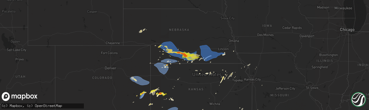
Hail Map on May 3, 2024
The weather event on May 3, 2024 includes Hail, Tornado, and Wind maps. 14 states and 503 cities were impacted and suffered possible damage. The total estimated number of properties impacted is 40,070.
Hail
Tornado
Wind
40,070
Estimated number of impacted properties by a 1.00" hail or larger12,244
Estimated number of impacted properties by a 1.75" hail or larger6,887
Estimated number of impacted properties by a 2.50" hail or largerStates Impacted by Hail Map on May 3, 2024
Storm reports
Alabama
| Date | Description |
|---|---|
| 05/03/20245:18 PM CDT | Tree down in hollywood... Al at the intersection of county road 33 and county road 470; time estimated based on radar. Radar evidence does not support a severe storm at |
Kansas
| Date | Description |
|---|---|
| 05/03/20246:55 PM CDT | Report from mping: half dollar |
| 05/03/20246:52 PM CDT | Public report of around 1 inch diameter hail in tribune. |
| 05/03/20244:19 AM CDT | Em reports damage to outbuildings at two locations within a mile of each other west of huron. Based on images and radar data... It appears to be straight line winds bet |
| 05/02/20249:50 PM CDT | Asos station khlc hill city. |
| 05/02/20249:47 PM CDT | Delayed report of a truck flipped... Likely due to strong winds. |
| 05/02/20249:31 PM CDT | Asos station khlc hill city. |
| 05/02/20249:21 PM CDT | Mesonet station up840 9.0 w winona |
| 05/02/20248:42 PM CDT | A local report indicates 1.00 inch wind near 1 NW Friend |
| 05/02/20248:38 PM CDT | West side of herndon reports up to hail golf ball sized hail. |
| 05/02/20248:35 PM CDT | Awos station kcbk 2 n colby. |
| 05/02/20248:29 PM CDT | Mesonet station ur350 kismws. |
| 05/02/20248:19 PM CDT | Additional 1 inch hail reported with the funnel cloud report. |
| 05/02/20248:10 PM CDT | [landspout] video/photos of possible landspout/gustnado/tornado. |
| 05/02/20248:02 PM CDT | Trained spotter reports golf ball sized hail with heavy rain and about 25 mph wind gusts. |
| 05/02/20248:01 PM CDT | Numerous 0.75 to 1.5 inch live tree limbs blown down. Large 5.5 inch diameter dead tree limb also down. Reported 0.67 hundredths of rain. Time estimated via radar. |
| 05/02/20247:57 PM CDT | Up830 reported a 59 mph gust. |
| 05/02/20247:35 PM CDT | Awos station koel 2 ese oakley. |
Georgia
| Date | Description |
|---|---|
| 05/03/20245:50 PM CDT | Tree on powerlines. |
| 05/03/20245:50 PM CDT | Corrects previous tstm wnd dmg report from 2 wsw peach state speedway. Tree on powerlines near jett roberts rd and village dr. |
| 05/03/20245:50 PM CDT | Corrects previous tstm wnd dmg report from 3 w peach state speedway. Chicken coup lifted off ground and several trees down. |
| 05/02/20248:45 PM CDT | Chicken coup lifted off ground and several trees down. |
Virginia
| Date | Description |
|---|---|
| 05/03/20246:45 PM CDT | Report of a tree and power line down in the mt. Solon area. Time estimated. |
New Mexico
| Date | Description |
|---|---|
| 05/03/20245:50 PM CDT | A local report indicates 1.00 inch wind near 2 NW Clayton |
| 05/03/20245:25 PM CDT | A local report indicates 1.00 inch wind near Grenville |
| 05/03/20245:22 PM CDT | A local report indicates 1.00 inch wind near 1 NW Grenville |
Oklahoma
| Date | Description |
|---|---|
| 05/02/20249:43 PM CDT | Phone call report. |
| 05/02/20249:21 PM CDT | Via spotter network. |
| 05/02/20249:15 PM CDT | Report from mping: quarter |
| 05/02/20248:57 PM CDT | Report from mping: quarter |
| 05/02/20248:57 PM CDT | A local report indicates 1.25 inch wind near Elgin |
Texas
| Date | Description |
|---|---|
| 05/03/20246:48 PM CDT | Remote area southwest of eden. |
| 05/03/20246:48 PM CDT | Ping pong ball size hail found on the side of the road between matador and whiteflat. Time estimated from radar. |
| 05/03/20246:43 PM CDT | Report from mping: golf ball |
| 05/03/20246:39 PM CDT | Report from mping: grapefruit |
| 05/03/20246:37 PM CDT | Report from mping: baseball+ |
| 05/03/20246:35 PM CDT | Called in quarter sized hail. |
| 05/03/20246:31 PM CDT | West texas mesonet site at fort lancaster. |
| 05/03/20246:27 PM CDT | A local report indicates 1.00 inch wind near 2 ENE Wall |
| 05/03/20246:26 PM CDT | A local report indicates 59 MPH wind near 2 SSE San Angelo |
| 05/03/20246:19 PM CDT | Hail report from 7849 ripple rd off of hwy 87. |
| 05/03/20246:18 PM CDT | A local report indicates 2.75 inch wind near Wall |
| 05/03/20246:18 PM CDT | Trees and fences damaged. Minor cosmetic damage reported to houses in the area. |
| 05/03/20246:17 PM CDT | A local report indicates 2.50 inch wind near 2 WNW Wall |
| 05/03/20246:17 PM CDT | West texas mesonet site. |
| 05/03/20246:10 PM CDT | A local report indicates 1.75 inch wind near 4 ENE San Angelo |
| 05/03/20246:07 PM CDT | Baseball size hail and hail damage reported near fm 308 near the concho river. |
| 05/03/20246:04 PM CDT | Brief tornado. |
| 05/03/20245:57 PM CDT | A local report indicates 1.75 inch wind near 6 W Harriet |
| 05/03/20245:29 PM CDT | A local report indicates 2.00 inch wind near Dickens |
| 05/03/20245:24 PM CDT | A local report indicates 1.75 inch wind near 4 NNW Orient |
| 05/03/20245:08 PM CDT | West texas mesonet site. |
| 05/03/20245:02 PM CDT | A local report indicates 2.75 inch wind near 7 SSW Bronte |
| 05/03/20244:53 PM CDT | Very large tornado. |
| 05/03/20244:40 PM CDT | A local report indicates 1.75 inch wind near 10 S Silver |
| 05/03/20244:33 PM CDT | Brief tornado touchdown north-northeast of hale center. |
| 05/03/20244:12 PM CDT | Several golf ball sized hailstones observed falling on live webcam. |
| 05/03/20243:45 PM CDT | A local report indicates 2.00 inch wind near 3 W Fluvanna |
| 05/03/20243:45 PM CDT | A local report indicates 2.75 inch wind near Fluvanna |
| 05/03/20243:45 PM CDT | A local report indicates a tornado near 6 SSW Silver |
| 05/03/20243:45 PM CDT | A local report indicates 59 MPH wind near 3 WNW Fluvanna |
| 05/02/202410:24 PM CDT | This wind gust occurred under a thunderstorm anvil... And was not caused by a notable thunderstorm on radar. |
| 05/02/20249:40 PM CDT | Social media report. |
| 05/02/20249:23 PM CDT | A local report indicates 1.50 inch wind near Miami |
| 05/02/20249:03 PM CDT | Social media report of golf ball to tennis ball sized hail just south of cleo. |
| 05/02/20247:44 PM CDT | A local report indicates 1.75 inch wind near 6 NNW Boys Ranch |
| 05/02/20247:33 PM CDT | West texas mesonet site. |
| 05/02/20247:26 PM CDT | Quitaque vfd reports hailstones ranging from 2.25 to 3.5 inches in diameter. |
| 05/02/20247:18 PM CDT | Snapped power poles along fm2393. Radar estimated time. |
| 05/02/20247:12 PM CDT | Report from mping: quarter |
Colorado
| Date | Description |
|---|---|
| 05/03/20246:07 PM CDT | Trained spotter estimated winds gusting 50 to 60 mph. Time estimated based on radar. |
| 05/03/20245:00 PM CDT | Asos station klaa lamar airport. |
| 05/02/20247:25 PM CDT | Mesonet station up711 7.7 nw boyero |
| 05/02/20247:19 PM CDT | Kcostrat21 reported a gust of 61 mph. |
| 05/02/20247:00 PM CDT | Corrects previous non-tstm wnd gst report from hugo. Mesonet station ew0539 hugo. |
Nebraska
| Date | Description |
|---|---|
| 05/03/20246:50 PM CDT | Rsois measurement. |
| 05/03/20246:43 PM CDT | Asos station klbf north platte airport. |
| 05/03/20249:10 AM CDT | A local report indicates 2.00 inch wind near Holdrege |
| 05/03/202412:15 AM CDT | Mesonet recorded 67mph at 12:07am. |
| 05/02/202411:53 PM CDT | Heavy rain with wind gusts of 50-60mph. |
| 05/02/202411:35 PM CDT | Facebook photo of power pole damage. Power outages were reported in the central city and palmer areas. Time estimated from radar. |
| 05/02/202411:30 PM CDT | Mesonet recorded a 79 mph wind gust at 11:30pm. |
| 05/02/202411:18 PM CDT | Asos records 58 mph wind gust at 11:18pm. |
| 05/02/202411:16 PM CDT | Est 50-60mph with heavy rain and near zero visibility. |
| 05/02/202411:15 PM CDT | Nws employee estimates 60 to 65 mph winds in doniphan. |
| 05/02/202411:10 PM CDT | Livestock trailer truck flipped over at junction of hwy 136e and hwy14. |
| 05/02/202411:07 PM CDT | A local report indicates 64 MPH wind near 2 N Hastings |
| 05/02/202411:01 PM CDT | Viewer reported damage 4s of lawrence. Some sheds were damaged along with some tree tops. |
| 05/02/202411:00 PM CDT | A local report indicates 64 MPH wind near Grand Island Airport |
| 05/02/202411:00 PM CDT | Corrects previous tstm wnd gst report of 64 mph from grand island airport. |
| 05/02/202410:58 PM CDT | A local report indicates 63 MPH wind near 2 NNE Norman |
| 05/02/202410:51 PM CDT | Deputy reported damage from a possible tornado north and northeast of guide rock. Tree damage was reported along with a barn shifted off its foundation. Time estimated |
| 05/02/202410:19 PM CDT | A local report indicates 68 MPH wind near 4 N Kearney |
| 05/02/202410:14 PM CDT | A local report indicates 60 MPH wind near 3 NNE Kearney |
| 05/02/202410:08 PM CDT | Report on social media of quarter sized hail near the hwy 10 and 4 junction. Time estimated from radar. |
| 05/02/202410:00 PM CDT | A local report indicates 62 MPH wind near 5 SSE Odessa |
| 05/02/20249:59 PM CDT | A local report indicates 58 MPH wind near 3 E Riverdale |
| 05/02/20249:55 PM CDT | A local report indicates 60 MPH wind near 1 E Odessa |
| 05/02/20249:45 PM CDT | A local report indicates 60 MPH wind near 8 S Elm Creek |
| 05/02/20249:36 PM CDT | A local report indicates 58 MPH wind near 7 N Loomis |
| 05/02/20249:36 PM CDT | Corrects previous flood report from 7 n loomis. |
| 05/02/20249:35 PM CDT | Moved through between 935 through 940. |
| 05/02/20249:29 PM CDT | A local report indicates 59 MPH wind near 2 ESE Overton |
| 05/02/20249:15 PM CDT | A local report indicates 67 MPH wind near 5 NNW Holdrege |
| 05/02/20249:13 PM CDT | Report from mping: quarter |
| 05/02/20249:13 PM CDT | Tornado damage confirmed north of ragan. Time estimated from radar. Survey still ongoing. |
| 05/02/20249:11 PM CDT | Tornado damage confirmed north and northeast of holdrege. Time estimated from radar. Survey still ongoing. |
| 05/02/20249:10 PM CDT | Report on social media of golf ball size hail in holdrege. |
| 05/02/20249:10 PM CDT | Report on social media of half dollar sized hail in holdrege. |
| 05/02/20249:10 PM CDT | Corrects previous hail report from holdrege. |
| 05/02/20249:08 PM CDT | Pea to quarter sized hail. |
| 05/02/20248:56 PM CDT | A local report indicates 1.00 inch wind near Loomis |
| 05/02/20248:56 PM CDT | House damaged from possible tornado 1 west of atlanta on facebook. Time estimated from radar. |
| 05/02/20248:53 PM CDT | Tornado damage confirmed 2w of atlanta. Time estimated from radar. Damage survey is still ongoing. |
| 05/02/20248:39 PM CDT | A local report indicates 1.75 inch wind near 1 NW Bertrand |
| 05/02/20248:34 PM CDT | Report on social media of 2 inch hail near smithfield. Time estimated from radar. |
| 05/02/20248:28 PM CDT | A local report indicates 1.00 inch wind near Elwood |
| 05/02/20248:13 PM CDT | A local report indicates 1.75 inch wind near 7 S Eustis |
| 05/02/20248:05 PM CDT | A local report indicates 1.50 inch wind near 4 S Eustis |
| 05/02/20247:59 PM CDT | Personal weather station. |
| 05/02/20247:58 PM CDT | A local report indicates 62 MPH wind near 5 N Cambridge |
| 05/02/20247:49 PM CDT | A local report indicates 71 MPH wind near 1 E Mccook |
| 05/02/20247:42 PM CDT | Trained spotter 1 north of trenton dam reported estimated 60 mph wing gust. No hail. |
Cities Impacted by Hail Map on May 3, 2024
- Port Arthur, TX
- Anahuac, TX
- Hockley, TX
- Cameron, LA
- Galena Park, TX
- Houston, TX
- Channelview, TX
- Pasadena, TX
- Lovelady, TX
- Crockett, TX
- Cleveland, TX
- Coldspring, TX
- Conroe, TX
- Anderson, TX
- Montgomery, TX
- Richards, TX
- Katy, TX
- Richmond, TX
- Willis, TX
- Winnie, TX
- Crosby, TX
- Beaumont, TX
- New Caney, TX
- Splendora, TX
- Porter, TX
- Broadwater, NE
- Bridgeport, NE
- Huffman, TX
- Magnolia, TX
- Dayton, TX
- Westbrook, TX
- Oshkosh, NE
- Ball Ground, GA
- Normangee, TX
- Colorado City, TX
- Ellsworth, NE
- Columbus, MS
- Baytown, TX
- Highlands, TX
- Franklin, TX
- West Point, MS
- Loraine, TX
- Springer, NM
- Ira, TX
- Snyder, TX
- Fluvanna, TX
- Las Animas, CO
- Maryneal, TX
- Robert Lee, TX
- San Angelo, TX
- Miles, TX
- Justiceburg, TX
- La Porte, TX
- Deer Park, TX
- Blackwell, TX
- Chappell, NE
- Hale Center, TX
- Kress, TX
- Gail, TX
- Shepherd, TX
- Post, TX
- New Market, AL
- Bronte, TX
- Plainview, TX
- Wiley, CO
- Reform, AL
- Hasty, CO
- McClave, CO
- Braselton, GA
- Happy, TX
- Eads, CO
- Adrian, TX
- Hoschton, GA
- Grenville, NM
- Fort Stockton, TX
- Jefferson, GA
- Pendergrass, GA
- Lamar, CO
- Sheridan Lake, CO
- Norton, TX
- Ballinger, TX
- Dryden, TX
- Spur, TX
- Paint Rock, TX
- Eola, TX
- Vega, TX
- Crosbyton, TX
- Mereta, TX
- Dickens, TX
- Ogallala, NE
- Grant, NE
- Lorenzo, TX
- Ralls, TX
- Mcadoo, TX
- Hartley, TX
- Channing, TX
- Madrid, NE
- Paxton, NE
- Elsie, NE
- Clayton, NM
- Afton, TX
- Iraan, TX
- Ozona, TX
- Menard, TX
- Goodfellow Afb, TX
- Syracuse, KS
- Holly, CO
- Wauneta, NE
- Floydada, TX
- Wall, TX
- Eden, TX
- Vancourt, TX
- Wallace, NE
- Roaring Springs, TX
- Tribune, KS
- Woodson, TX
- Hayes Center, NE
- Wray, CO
- Haigler, NE
- Henrietta, TX
- Ovalo, TX
- Walsh, CO
- Dickens, NE
- Matador, TX
- Benkelman, NE
- Hershey, NE
- Manter, KS
- Sheffield, TX
- Graham, TX
- Wellfleet, NE
- Eldorado, TX
- Lockney, TX
- Jacksboro, TX
- Maywood, NE
- North Platte, NE
- Bryson, TX
- Palisade, NE
- Maxwell, NE
- Sutherland, NE
- Leoti, KS
- Genoa, CO
- Hugo, CO
- Kendall, KS
- Wichita Falls, TX
- Arriba, CO
- Flomot, TX
- Turkey, TX
- Moorefield, NE
- Curtis, NE
- Brady, NE
- Quitaque, TX
- Bridgewater, VA
- McCook, NE
- Lakin, KS
- Santa Anna, TX
- Coleman, TX
- Stockville, NE
- Barnhart, TX
- Brownwood, TX
- Christoval, TX
- Flagler, CO
- Kit Carson, CO
- Saint Francis, KS
- Bird City, KS
- McDonald, KS
- Stratton, NE
- Max, NE
- Mertzon, TX
- Fort McKavett, TX
- Cozad, NE
- Eustis, NE
- Farnam, NE
- Gothenburg, NE
- Deerfield, KS
- Sterling City, TX
- Cambridge, NE
- Bartley, NE
- Indianola, NE
- Culbertson, NE
- Trenton, NE
- Colby, KS
- Atwood, KS
- Elwood, NE
- Early, TX
- Zephyr, TX
- Marienthal, KS
- Edson, KS
- Junction, TX
- Blanket, TX
- Geronimo, OK
- Walters, OK
- Big Lake, TX
- Pampa, TX
- Miami, TX
- Seibert, CO
- Vona, CO
- Cheyenne Wells, CO
- Stratton, CO
- Arapahoe, CO
- Liberal, KS
- Hugoton, KS
- Smithfield, NE
- Bertrand, NE
- Garden City, KS
- Lawton, OK
- Holcomb, KS
- Edison, NE
- Arapahoe, NE
- Lebanon, NE
- London, TX
- Hamilton, TX
- Kismet, KS
- Plains, KS
- Satanta, KS
- Meade, KS
- Sublette, KS
- Fowler, KS
- Scott City, KS
- Levant, KS
- Gem, KS
- Ludell, KS
- Herndon, KS
- Oberlin, KS
- Danbury, NE
- Wilsonville, NE
- Oxford, NE
- Holbrook, NE
- Holdrege, NE
- Orleans, NE
- Loomis, NE
- Atlanta, NE
- Overton, NE
- Canadian, TX
- Higgins, TX
- Skellytown, TX
- Summertown, TN
- Hohenwald, TN
- Elgin, OK
- Elm Creek, NE
- Axtell, NE
- Funk, NE
- Minden, NE
- Miller, NE
- Lexington, NE
- Wakeeney, KS
- Collyer, KS
- Hampshire, TN
- Ingalls, KS
- Hendley, NE
- Anadarko, OK
- Fort Cobb, OK
- Carnegie, OK
- Fletcher, OK
- Cyril, OK
- Borger, TX
- Sonora, TX
- Cement, OK
- Apache, OK
- Roosevelt, TX
- Chickasha, OK
- Verden, OK
- Gracemont, OK
- Cimarron, KS
- Alma, NE
- Amber, OK
- Wilcox, NE
- Beaver City, NE
- Republican City, NE
- Hildreth, NE
- Norton, KS
- Minneola, KS
- Montezuma, KS
- Ensign, KS
- Naponee, NE
- Bloomington, NE
- Heartwell, NE
- Gate, OK
- Binger, OK
- Dighton, KS
- Pocasset, OK
- Minco, OK
- Kearney, NE
- Arnett, OK
- Ninnekah, OK
- Franklin, NE
- Upland, NE
- Campbell, NE
- Riverton, NE
- Smith Center, KS
- Kensington, KS
- Rocksprings, TX
- Woodward, OK
- Briscoe, TX
- Buffalo, OK
- Holstein, NE
- Durham, OK
- Inavale, NE
- Bladen, NE
- Kenesaw, NE
- Roseland, NE
- Blue Hill, NE
- Ethelsville, AL
- Mooreland, OK
- Red Cloud, NE
- Sharon, OK
- Ayr, NE
- Hastings, NE
- Glenvil, NE
- Superior, NE
- Newcastle, TX
- Freedom, OK
- Waynoka, OK
- Taloga, OK
- Seiling, OK
- Lawrence, NE
- Nelson, NE
- Guide Rock, NE
- Camargo, OK
- Trumbull, NE
- Doniphan, NE
- Phillips, NE
- Giltner, NE
- Grand Island, NE
- Inland, NE
- Fairfield, NE
- Deweese, NE
- Harvard, NE
- Clay Center, NE
- Edgar, NE
- Davenport, NE
- Oak, NE
- Ruskin, NE
- Aurora, NE
- Chapman, NE
- Ong, NE
- Saronville, NE
- Marquette, NE
- Sutton, NE
- Hampton, NE
- Deshler, NE
- Hebron, NE
- Henderson, NE
- Shickley, NE
- Carleton, NE
- Geneva, NE
- Grafton, NE
- Bruning, NE
- Belvidere, NE
- Strang, NE
- Fairmont, NE
- McCool Junction, NE
- Alexandria, NE
- Ohiowa, NE
- Milligan, NE
- Tobias, NE
- York, NE
- Bradshaw, NE
- Cheyenne, OK
- Chester, OK
- Alva, OK
- Fairview, OK
- Sweetwater, OK
- Central City, NE
- Alda, NE
- Exeter, NE
- Portis, KS
- Hardtner, KS
- Helena, OK
- Hammon, OK
- Medicine Lodge, KS
- Kiowa, KS
- Glen Elder, KS
- Downs, KS
- Gaylord, KS
- Elk City, OK
- Esbon, KS
- Attica, KS
- Aline, OK
- Lake City, KS
- Dacoma, OK
- Butler, OK
- Carmen, OK
- Cherokee, OK
- Western, NE
- Daykin, NE
- Fairbury, NE
- Friend, NE
- Swanton, NE
- Wilber, NE
- Dorchester, NE
- Burlington, OK
- Jet, OK
- Mankato, KS
- Harper, KS
- Manchester, OK
- Waldron, KS
- Hazelton, KS
- Chester, NE
- Beloit, KS
- Crete, NE
- Hallam, NE
- Clatonia, NE
- Wakita, OK
- Anthony, KS
- Bluff City, KS
- Plymouth, NE
- Freeport, KS
- Boise City, OK
- De Witt, NE
- Argonia, KS
- Danville, KS
- Caldwell, KS
- Milton, KS
- Norwich, KS
- Firth, NE
- Martell, NE
- Cortland, NE
- Pickrell, NE
- Conway Springs, KS
- Medford, OK
- Adams, NE
- Haven, KS
- Burrton, KS
- Concordia, KS
- Glasco, KS
- Hickman, NE
- Douglas, NE
- Aurora, KS
- Geuda Springs, KS
- South Haven, KS
- Newkirk, OK
- Clyde, KS
- Miltonvale, KS
- Arkansas City, KS
- Alberta, AL
- Carrollton, AL
- Hillsboro, KS
- Dunbar, NE
- Nebraska City, NE
- Pawhuska, OK
- Shidler, OK
- Randolph, KS
- Talmage, NE
- Chapman, KS
- Junction City, KS
- Waterville, KS
- Hope, KS
- Barnes, KS
- Green, KS
- Galveston, TX
- Greenleaf, KS
- Rosston, OK
- Ashland, KS
- Laverne, OK
- Riley, KS
- Fairfax, OK
- Burbank, OK
- Fort Riley, KS
- Sedan, KS
- Cedar Vale, KS
- Olsburg, KS
- Manhattan, KS
- Ogden, KS
- Frankfort, KS
- Westmoreland, KS
- Saint George, KS
- Wamego, KS
- Mounds, OK
- Beggs, OK
- Okmulgee, OK
- Belvue, KS
- Onaga, KS
- Havensville, KS
- Emmett, KS
- Saint Marys, KS
- Haskell, OK
- Bixby, OK
- Mayetta, KS
- Delia, KS
- Thayer, KS
- Silver Lake, KS
- Rossville, KS
- Soldier, KS
- Circleville, KS
- Parsons, KS
- Redbird, OK
- Porter, OK
- Holton, KS
- Coweta, OK
- Horton, KS
- Galesburg, KS
- Everest, KS
- Muscotah, KS
- Troy, KS
- Savannah, MO
- Amazonia, MO
- Saint Joseph, MO
- Sulphur Springs, AR
- Osborn, MO
- Cameron, MO
- Centerview, MO
- Jasper, MO
- Golden City, MO