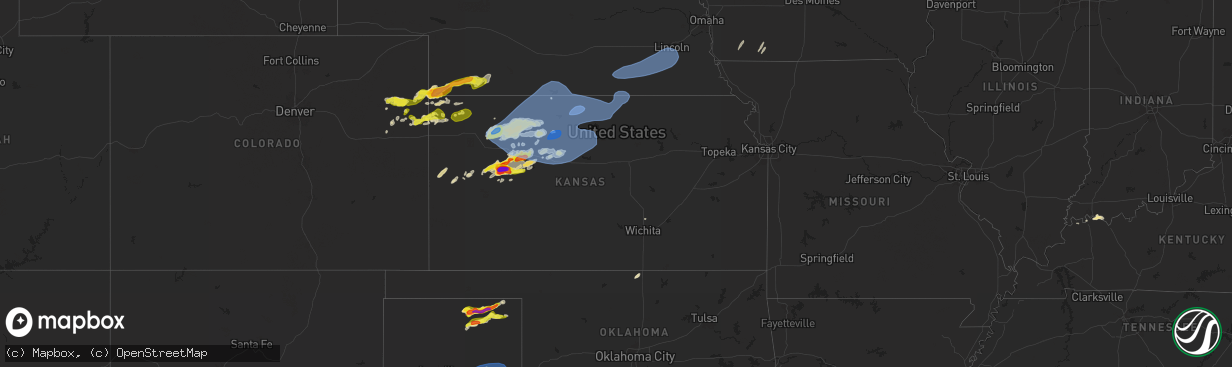
Hail Map in Kansas on May 1, 2024
The weather event in Kansas on May 1, 2024 includes Wind, Hail, and Tornado maps. 12 states and 454 cities were impacted and suffered possible damage. The total estimated number of properties impacted is 2,260.
Wind
Hail
Tornado
2,260
Estimated number of impacted properties by a 1.00" hail or larger402
Estimated number of impacted properties by a 1.75" hail or larger110
Estimated number of impacted properties by a 2.50" hail or largerStorm reports in Kansas
Kansas
| Date | Description |
|---|---|
| 05/01/20246:50 PM CDT | Live video feed from storm chaser showed them holding hailstones of approximately golf ball size. Location and hail size approximate. |
| 05/01/20246:45 PM CDT | Facebook picture of several hailstones matching the size of a quarter. |
| 05/01/20246:26 PM CDT | [landspout] brief landspout with ground circulation about 100 yds east of hwy 23. Video sent in. |
| 05/01/20241:34 AM CDT | Personal weather station. |
| 05/01/20241:02 AM CDT | Ks mesonet. |
| 05/01/202412:50 AM CDT | Trained spotter measured on home weather station and called in the report. |
| 05/01/202412:30 AM CDT | Dispatch reports some tree damage in town. Time estimated from radar. |
| 05/01/202412:30 AM CDT | Delayed report of a shed with damage 5 miles southeast of hill city. Timing based on radar and nearby asos. |
| 05/01/202412:30 AM CDT | Delayed report of exceptional damage to a large shed. One wall blown in... Roof blown away and substructure partially collapsed... Metal siding blown/peeled away. |
| 05/01/202412:24 AM CDT | New outbuilding destroyed. Also reports of trees down around the area. |
| 05/01/202412:20 AM CDT | Dispatch reported a tree down on k9 highway. Time estimated from radar. |
| 05/01/202412:15 AM CDT | A local report indicates 79 MPH wind near Smith Center Airport |
| 05/01/202412:15 AM CDT | Dispatch reports a tree and some branches down in town... Along with damage to a store sign. |
| 05/01/202412:09 AM CDT | A local report indicates 68 MPH wind near Smith Center Airport |
| 04/30/202411:49 PM CDT | A local report indicates 61 MPH wind near 3 WSW Agra |
| 04/30/202411:49 PM CDT | Ksu mesonet. |
| 04/30/202411:44 PM CDT | Raws station. |
| 04/30/202411:40 PM CDT | A local report indicates 60 MPH wind near 5 WSW Agra |
| 04/30/202411:35 PM CDT | A local report indicates 63 MPH wind near Phillipsburg Airport |
| 04/30/202411:30 PM CDT | Corrects time of previous tstm wnd dmg report from phillipsburg. Dispatch reports some tree damage in town. Time estimated from radar. |
| 04/30/202411:30 PM CDT | Corrects previous tstm wnd dmg report from 7 sse bogue. Delayed report of exceptional damage to a large shed. One wall blown in... Roof blown away and substructure part |
| 04/30/202411:30 PM CDT | Corrects previous tstm wnd dmg report from 5 se hill city. Delayed report of a shed with damage 5 miles southeast of hill city. Timing based on radar and nearby asos. |
| 04/30/202411:29 PM CDT | Ksu mesonet. |
| 04/30/202411:25 PM CDT | Corrects time of previous tstm wnd dmg report from 3 e logan. Dispatch reported a tree down on k9 highway. Time estimated from radar. |
| 04/30/202411:04 PM CDT | Weatherunderground site kkslenor20. |
| 04/30/202411:01 PM CDT | Weatherunderground site kkslenor7. |
| 04/30/202410:55 PM CDT | Kansas mesonet. Wind gust measured at 10 meter height above ground. |
| 04/30/202410:44 PM CDT | Weatherunderground site kkspark1. |
| 04/30/202410:39 PM CDT | Weatherunderground site kkshoxie18. |
| 04/30/202410:38 PM CDT | Weatherunderground site kkshoxie18. |
| 04/30/202410:35 PM CDT | Weatherunderground site kkshoxie18. |
| 04/30/202410:15 PM CDT | Weatherunderground site kkshoxie16. |
| 04/30/202410:15 PM CDT | Delayed reported of tennis ball sized hail that caused damage at a house. |
| 04/30/202410:00 PM CDT | Hail the size of quarters fell for a duration of 5 minutes. |
| 04/30/20249:35 PM CDT | A local report indicates 1.00 inch wind near WaKeeney |
| 04/30/20249:15 PM CDT | Corrects previous hail report from 25 se gove. Delayed reported of tennis ball sized hail that caused damage at a house. |
| 04/30/20249:12 PM CDT | [landspout] pictures of a landspout. |
| 04/30/20248:55 PM CDT | [landspout] video and pictures of a landspout/possible tornado. |
| 04/30/20248:52 PM CDT | [landspout] corrects previous landspout report from 21 sse gove. Multiple media outlets reported a possible landspout near the gove/lane county line. Location estimate |
| 04/30/20248:40 PM CDT | A local report indicates 1.75 inch wind near 4 SW WaKeeney |
| 04/30/20248:15 PM CDT | A local report indicates 4.00 inch wind near 15 S Gove |
| 04/30/20248:14 PM CDT | Live feed from storm chaser showing softball size hail. Hail size and location estimated. |
| 04/30/20248:14 PM CDT | Live f |
| 04/30/20248:10 PM CDT | Broadcast media provided pictures of hailstones 3.75 to 4.50 inches in diameter. |
| 04/30/20247:40 PM CDT | Delayed report. Baseball sized hail reported at rd g and hwy 23. Time radar estimated. Report via scott and lane counites ems. |
All States Impacted by Hail Map on May 1, 2024
Cities Impacted by Hail Map on May 1, 2024
- Hollister, OK
- Frederick, OK
- Loveland, OK
- Valley Center, KS
- Tuttle, OK
- Atoka, OK
- Wapanucka, OK
- Coleman, OK
- Caddo, OK
- Caney, OK
- Tupelo, OK
- Coalgate, OK
- Centrahoma, OK
- Medford, OK
- Deer Creek, OK
- Braman, OK
- Nardin, OK
- Fort Stockton, TX
- Alpine, TX
- Belle Glade, FL
- Clarendon, TX
- Waverly, GA
- Brunswick, GA
- Marathon, TX
- Pampa, TX
- Arcadia, FL
- Stinnett, TX
- Spearman, TX
- Mclean, TX
- Prairie Hill, TX
- Miami, TX
- Perryton, TX
- Andrews, TX
- Milburn, OK
- Stonewall, OK
- Lelia Lake, TX
- Hedley, TX
- Coolidge, TX
- Groesbeck, TX
- Seminole, TX
- Floydada, TX
- Lehigh Acres, FL
- Idalou, TX
- Claude, TX
- Lockney, TX
- Turkey, TX
- Mexia, TX
- Seagraves, TX
- Quitaque, TX
- Kermit, TX
- Immokalee, FL
- Lorenzo, TX
- Naples, FL
- Grinnell, KS
- Healy, KS
- Brownfield, TX
- Waverly, KY
- Ralls, TX
- Clifton, TX
- Meridian, TX
- Valley Mills, TX
- Corydon, KY
- Lamesa, TX
- Welch, TX
- Ackerly, TX
- Denver City, TX
- Wilson, TX
- Lubbock, TX
- Tahoka, TX
- Gove, KS
- Evansville, IN
- Henderson, KY
- Silverton, TX
- Blanco, TX
- Reed, KY
- Spottsville, KY
- Walnut Springs, TX
- Iredell, TX
- Kendalia, TX
- Boerne, TX
- Newburgh, IN
- Normangee, TX
- Meadow, TX
- Morgan, TX
- Akron, CO
- Scott City, KS
- Jewett, TX
- Centerville, TX
- Oakley, KS
- Gruver, TX
- Teague, TX
- Wolfforth, TX
- Ropesville, TX
- Marquez, TX
- Glen Rose, TX
- Shallowater, TX
- Yuma, CO
- Johnson City, TX
- Buffalo, TX
- Leona, TX
- Richland, IN
- Rockport, IN
- Quinter, KS
- Slaton, TX
- Jasper, TX
- Donie, TX
- Park, KS
- Anton, CO
- Gail, TX
- Dripping Springs, TX
- Joes, CO
- Eckley, CO
- Williamsville, MO
- Greenville, MO
- Lakeview, TX
- Loop, TX
- Odonnell, TX
- Abernathy, TX
- Crosbyton, TX
- New Deal, TX
- Post, TX
- Ransom Canyon, TX
- Spur, TX
- Justiceburg, TX
- Canadian, TX
- Oakwood, TX
- Midway, TX
- Petersburg, TX
- Austin, TX
- Buda, TX
- Vernon, CO
- Wray, CO
- Kirk, CO
- Plainview, TX
- Hale Center, TX
- Collyer, KS
- Crockett, TX
- Thornton, TX
- Kress, TX
- Higgins, TX
- Haigler, NE
- Saint Francis, KS
- Cope, CO
- Seibert, CO
- Snyder, TX
- Flagler, CO
- Prairie Du Rocher, IL
- Bloomsdale, MO
- Vona, CO
- Childress, TX
- Valmeyer, IL
- Dighton, KS
- Waterloo, IL
- Wakeeney, KS
- Parks, NE
- Lovelady, TX
- Evansville, IL
- Red Bud, IL
- Tulia, TX
- Fults, IL
- Stratton, CO
- Fluvanna, TX
- Matador, TX
- Booker, TX
- Benkelman, NE
- Ozona, TX
- Idalia, CO
- Burlington, CO
- Trinity, TX
- Jayton, TX
- Max, NE
- Palisade, NE
- Stratton, NE
- Sonora, TX
- Paint Rock, TX
- Bird City, KS
- Aspermont, TX
- Utica, KS
- Taylor, TX
- Girard, TX
- Old Glory, TX
- Memphis, TX
- McDonald, KS
- Kanorado, KS
- Goodland, KS
- Trenton, NE
- Ballinger, TX
- Rowena, TX
- Paducah, TX
- Eldorado, TX
- Thrall, TX
- Culbertson, NE
- Voss, TX
- Eden, TX
- Thorndale, TX
- Fredericksburg, TX
- Haskell, TX
- Quanah, TX
- Throckmorton, TX
- Rexford, KS
- Ransom, KS
- Willow City, TX
- McCook, NE
- Madisonville, TX
- Rule, TX
- London, TX
- Winters, TX
- Llano, TX
- Selden, KS
- Hoxie, KS
- Ogallah, KS
- Crowell, TX
- Hawley, TX
- Junction, TX
- Rotan, TX
- Millersview, TX
- Groom, TX
- Wellington, TX
- Quail, TX
- Shamrock, TX
- Edson, KS
- Colby, KS
- Atwood, KS
- Rockdale, TX
- Groveton, TX
- Seymour, TX
- Lexington, TX
- Doole, TX
- Ellis, KS
- Huntsville, TX
- Tribune, KS
- Melvin, TX
- Lohn, TX
- Milano, TX
- Caldwell, TX
- Mason, TX
- Bedias, TX
- Coupland, TX
- Sharon Springs, KS
- Pointblank, TX
- Morland, KS
- Hill City, KS
- Penokee, KS
- Jennings, KS
- Lenora, KS
- Clayton, KS
- Richards, TX
- Altus, OK
- Anson, TX
- Oakhurst, TX
- Rockwood, TX
- Dresden, KS
- Norton, KS
- Grainfield, KS
- Eldorado, OK
- Mangum, OK
- Gould, OK
- Duke, OK
- Blair, OK
- Olustee, OK
- Altus Afb, OK
- Mountain Park, OK
- Headrick, OK
- Elmer, OK
- Snyder, OK
- Tipton, OK
- Davidson, OK
- Odell, TX
- Vernon, TX
- Chillicothe, TX
- Livingston, TX
- Onalaska, TX
- Leoti, KS
- Miles, TX
- Electra, TX
- Bogue, KS
- Stockton, KS
- Phillipsburg, KS
- Harper, TX
- Doss, TX
- Palco, KS
- Damar, KS
- Newcastle, TX
- Coldspring, TX
- Hearne, TX
- Kensington, KS
- Winona, KS
- Anderson, TX
- New Waverly, TX
- Almena, KS
- Stamford, NE
- Orleans, NE
- Beaver City, NE
- Alma, NE
- Prairie View, KS
- Long Island, KS
- Logan, KS
- Republican City, NE
- Bloomington, NE
- Agra, KS
- Naponee, NE
- Riverton, NE
- Franklin, NE
- Glade, KS
- Smith Center, KS
- Kirwin, KS
- Hays, KS
- Woodston, KS
- Gaylord, KS
- Athol, KS
- Natoma, KS
- Plainville, KS
- Cedar, KS
- Portis, KS
- Lebanon, KS
- Osborne, KS
- Esbon, KS
- Catharine, KS
- Alton, KS
- Victoria, KS
- Montgomery, TX
- Lawton, OK
- Chattanooga, OK
- Faxon, OK
- Indiahoma, OK
- Cache, OK
- Walters, OK
- Geronimo, OK
- Grandfield, OK
- Elgin, OK
- Fletcher, OK
- Rush Springs, OK
- Marlow, OK
- Duncan, OK
- Devol, OK
- Comanche, OK
- Randlett, OK
- Temple, OK
- Ninnekah, OK
- Chickasha, OK
- Blanchard, OK
- Alex, OK
- Bradley, OK
- Burnet, TX
- Marble Falls, TX
- Beeler, KS
- Kingsland, TX
- Gorham, KS
- Burr Oak, KS
- Downs, KS
- Paradise, KS
- Mankato, KS
- Luray, KS
- Formoso, KS
- Tipton, KS
- Waldo, KS
- Beloit, KS
- Cawker City, KS
- Randall, KS
- Jewell, KS
- Glen Elder, KS
- Sylvan Grove, KS
- Russell, KS
- Lucas, KS
- Hunter, KS
- Walker, KS
- Bunker Hill, KS
- Willis, TX
- Belleville, KS
- Webber, KS
- Scandia, KS
- Republic, KS
- Courtland, KS
- Hardy, NE
- Byron, NE
- Deshler, NE
- Chester, NE
- Cleveland, TX
- Conroe, TX
- Shepherd, TX
- Goodrich, TX
- Talpa, TX
- Warren, TX
- Shenandoah, IA
- Saratoga, TX
- Woodville, TX
- Kountze, TX
- Essex, IA
- Clarinda, IA
- Dayton, TX
- Sainte Genevieve, MO
- Huffman, TX
- Crosby, TX
- Gatesville, TX
- Moody, TX
- Liberty, TX
- Gravity, IA
- New Market, IA
- McGregor, TX
- Lenox, IA
- Bedford, IA
- Oglesby, TX
- Sharpsburg, IA
- Hull, TX
- Troy, TX
- Eddy, TX
- Lorena, TX
- Bruceville, TX
- Devers, TX
- Sour Lake, TX
- Batson, TX
- Oak, NE
- Davenport, NE
- Edgar, NE
- Ong, NE
- Shickley, NE
- Geneva, NE
- Belvidere, NE
- Strang, NE
- Bruning, NE
- Carleton, NE
- Ohiowa, NE
- Milford, NE
- Crete, NE
- Milligan, NE
- Lincoln, NE
- Dorchester, NE
- Western, NE
- Pleasant Dale, NE
- Friend, NE
- Tobias, NE
- Exeter, NE
- Denton, NE
- Daykin, NE
- De Witt, NE
- Cortland, NE
- Wilber, NE
- Martell, NE
- Hallam, NE
- Alexandria, NE
- Swanton, NE
- Clatonia, NE
- Beaumont, TX
- Navasota, TX
- Washington, TX
- Chilton, TX
- Sprague, NE
- Firth, NE
- Hickman, NE
- Roca, NE
- Bennet, NE
- Crawford, TX
- Waller, TX
- Hempstead, TX


