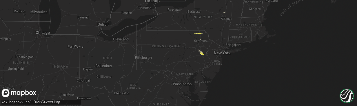
Hail Map in Pennsylvania on April 30, 2024
The weather event in Pennsylvania on April 30, 2024 includes Hail, Wind, and Tornado maps. 11 states and 603 cities were impacted and suffered possible damage. The total estimated number of properties impacted is 29,319.
Hail
Wind
Tornado
29,319
Estimated number of impacted properties by a 1.00" hail or larger0
Estimated number of impacted properties by a 1.75" hail or larger0
Estimated number of impacted properties by a 2.50" hail or largerStorm reports in Pennsylvania
Pennsylvania
| Date | Description |
|---|---|
| 04/30/20246:58 PM CDT | A few trees reported down across plainfield township. Some power outages and cell phone reception outages in the area. Time estimated from radar. |
| 04/30/20246:55 PM CDT | 16 minutes of dime to quarter sized hail in north catasauqua. Time estimated from radar. |
| 04/30/20246:55 PM CDT | Updates previous hail report from north catasauqua. 16 minutes of dime to quarter sized hail in north catasauqua. Hail briefly grew to half dollar size. Time estimated |
| 04/30/20246:53 PM CDT | A local report indicates 1.00 inch wind near Whitehall Twp |
| 04/30/20246:52 PM CDT | Trained spotter reports max hail size of 1.25 inches fell from 7:52-7:56pm. |
| 04/30/20246:50 PM CDT | Report from mping: quarter |
| 04/30/20246:49 PM CDT | A few trees reported down across moore township. Power outages in the area as well. Time estimated from radar. |
| 04/30/20246:45 PM CDT | Report from cocorahs station schnecksville 1.7 ene. |
| 04/30/20246:35 PM CDT | Updates previous hail report in slatington. |
| 04/30/20241:52 PM CDT | A local report indicates 1.00 inch wind near Harford |
| 04/30/20241:52 PM CDT | Tree down blocking roadway. Time estimated from radar. |
| 04/30/20241:25 PM CDT | A local report indicates 1.00 inch wind near Montrose |
| 04/30/20241:25 PM CDT | Tree down. Time estimated from radar. |
All States Impacted by Hail Map on April 30, 2024
Cities Impacted by Hail Map on April 30, 2024
- Clarkson, NE
- Leigh, NE
- Creston, NE
- Madison, NE
- Stanton, NE
- Pilger, NE
- Ballston Lake, NY
- Ballston Spa, NY
- Dodge, NE
- Howells, NE
- West Point, NE
- Saratoga Springs, NY
- Brewton, AL
- Andalusia, AL
- Elliott, IA
- Griswold, IA
- Cumberland, IA
- Massena, IA
- Montrose, PA
- Lawton, PA
- Westville, FL
- Bonifay, FL
- New Milford, PA
- Kingsley, PA
- Geneva, AL
- Harford, PA
- Susquehanna, PA
- Jackson, PA
- Thompson, PA
- Cooperstown, NY
- North Bend, NE
- Morse Bluff, NE
- Union Dale, PA
- Ames, NE
- Hooper, NE
- Cedar Bluffs, NE
- Scribner, NE
- Otoe, NE
- Nebraska City, NE
- Nehawka, NE
- Dunbar, NE
- Fremont, NE
- Blair, NE
- Nickerson, NE
- Arlington, NE
- Herman, NE
- Union, NE
- Modale, IA
- Missouri Valley, IA
- Thurman, IA
- Pacific Junction, IA
- Tabor, IA
- Glenwood, IA
- Malvern, IA
- Plattsmouth, NE
- Murray, NE
- Hartington, NE
- Craig, NE
- Mondamin, IA
- Hastings, IA
- Tekamah, NE
- Emerson, IA
- Blue Rapids, KS
- Frankfort, KS
- Pisgah, IA
- Logan, IA
- Woodbine, IA
- Little Sioux, IA
- Iraan, TX
- Moorhead, IA
- Dunlap, IA
- Fort Stockton, TX
- Henderson, IA
- Red Oak, IA
- Vermillion, KS
- Fay, OK
- Oakwood, OK
- Thomas, OK
- Le Mars, IA
- Mangum, OK
- Scranton, PA
- Remsen, IA
- Granite, OK
- Centralia, KS
- Steinauer, NE
- Elk Creek, NE
- Humboldt, NE
- Table Rock, NE
- Grant, IA
- Villisca, IA
- Watonga, OK
- Lewis, IA
- Carson, IA
- Oakland, IA
- Canton, OK
- Marysville, KS
- Home, KS
- Westmoreland, KS
- Olsburg, KS
- Lone Wolf, OK
- Auburn, NE
- Corning, IA
- Seneca, KS
- Westphalia, IA
- Earling, IA
- Panama, IA
- Portsmouth, IA
- Harlan, IA
- Custer City, OK
- Paullina, IA
- Marcus, IA
- Granville, IA
- Dill City, OK
- Corning, KS
- Nodaway, IA
- Onaga, KS
- Sentinel, OK
- Cordell, OK
- Goff, KS
- Kirkman, IA
- Irwin, IA
- Defiance, IA
- Manilla, IA
- Midkiff, TX
- Midland, TX
- Ringwood, OK
- Meno, OK
- Johnson, NE
- Halstead, KS
- Braddyville, IA
- Elmo, MO
- Ute, IA
- Burrton, KS
- Corn, OK
- Taloga, OK
- Ozona, TX
- Garden City, TX
- Hobart, OK
- White City, KS
- Sedgwick, KS
- Junction City, KS
- Mount Hope, KS
- Clarinda, IA
- Bedford, IA
- New Market, IA
- Peru, NE
- Bridgewater, IA
- Stella, NE
- Manning, IA
- Prescott, IA
- Fontanelle, IA
- Orient, IA
- Stanton, IA
- Haven, KS
- Shambaugh, IA
- Clearmont, MO
- Herington, KS
- Aspinwall, IA
- Greenfield, IA
- Clinton, OK
- Council Grove, KS
- Creston, IA
- Arapaho, OK
- Sabetha, KS
- Shubert, NE
- Nemaha, NE
- Newton, KS
- Gravity, IA
- Colwich, KS
- Weatherford, OK
- Peabody, KS
- Hillsboro, KS
- Dawson, NE
- Carroll, IA
- Arcadia, IA
- Halbur, IA
- Wamego, KS
- Jet, OK
- Audubon, IA
- Marion, KS
- Lost Springs, KS
- Rock Port, MO
- Hamburg, IA
- Merrill, IA
- Walton, KS
- Enid, OK
- Primghar, IA
- Sutherland, IA
- Burdick, KS
- Lincolnville, KS
- Wetmore, KS
- Kremlin, OK
- Bentley, KS
- Belvue, KS
- Saint Marys, KS
- Emmett, KS
- Delia, KS
- Soldier, KS
- Havensville, KS
- Geary, OK
- Murdock, KS
- Chillicothe, TX
- Vernon, TX
- Cheney, KS
- Wilsey, KS
- Paducah, TX
- Coon Rapids, IA
- Pond Creek, OK
- Nash, OK
- Sharpsburg, IA
- Clearfield, IA
- Riverton, IA
- Westboro, MO
- Alta Vista, KS
- Dwight, KS
- Templeton, IA
- Dedham, IA
- Gray, IA
- Falls City, NE
- Fairfax, MO
- Verdon, NE
- Quanah, TX
- Wiota, IA
- Scranton, IA
- Whitewater, KS
- Macksburg, IA
- Lorimor, IA
- Winterset, IA
- Big Spring, TX
- Maize, KS
- Valley Center, KS
- Garden Plain, KS
- Goddard, KS
- North Newton, KS
- Andale, KS
- Craig, MO
- Seymour, TX
- Kingman, KS
- Diagonal, IA
- Benton, IA
- Florence, KS
- Northboro, IA
- Shenandoah, IA
- Bayard, IA
- Afton, IA
- Viola, KS
- Milton, KS
- Wichita, KS
- Eldorado, OK
- Netawaka, KS
- Whiting, KS
- Mayetta, KS
- Hoyt, KS
- Rulo, NE
- Mound City, MO
- Maitland, MO
- Skidmore, MO
- Olustee, OK
- Gotebo, OK
- Jefferson, IA
- Bagley, IA
- Ellston, IA
- Tingley, IA
- Rossville, KS
- Coin, IA
- College Springs, IA
- Blanchard, IA
- Hiawatha, KS
- Peru, IA
- Silver Lake, KS
- Norwich, KS
- Kellerton, IA
- Mount Ayr, IA
- Topeka, KS
- Jamaica, IA
- Harper, KS
- Danville, KS
- Attica, KS
- Crowell, TX
- Benton, KS
- Kechi, KS
- Greenwich, KS
- Douglass, KS
- Coahoma, TX
- Westbrook, TX
- Rippey, IA
- Robinson, KS
- Medford, OK
- Glidden, IA
- Ralston, IA
- Nesquehoning, PA
- Alma, KS
- Allen, KS
- Grand River, IA
- Spivey, KS
- Truro, IA
- Saint Charles, IA
- Yale, IA
- Ogden, IA
- Perry, IA
- Murray, IA
- Dawson, IA
- Colorado City, TX
- Andover, KS
- Grand Junction, IA
- Boone, IA
- Woodward, IA
- Madrid, IA
- Sheffield, TX
- New Virginia, IA
- Indianola, IA
- Saint Marys, IA
- Thayer, IA
- Osceola, IA
- Lenox, IA
- Redfield, IA
- Clearwater, KS
- Winfield, KS
- Oxford, KS
- Weldon, IA
- Van Wert, IA
- Decatur, IA
- Leon, IA
- Argonia, KS
- Anthony, KS
- Augusta, KS
- Graham, MO
- Towanda, KS
- Meriden, KS
- Grantville, KS
- Shannon City, IA
- Garden Grove, IA
- Humeston, IA
- El Dorado, KS
- Leon, KS
- Schnecksville, PA
- Slatington, PA
- Rose Hill, KS
- Derby, KS
- Coplay, PA
- Laurys Station, PA
- Allentown, PA
- Orefield, PA
- Whitehall, PA
- Northampton, PA
- Tecumseh, KS
- Catasauqua, PA
- Barnard, MO
- Maryville, MO
- Udall, KS
- Cassoday, KS
- Mcconnell Afb, KS
- Conway Springs, KS
- Burlington Junction, MO
- Cromwell, IA
- Seiling, OK
- Luther, IA
- Walnutport, PA
- Elmer, OK
- Longdale, OK
- Burns, KS
- Peck, KS
- Haysville, KS
- Matfield Green, KS
- Slatedale, PA
- Milo, IA
- Lamont, OK
- Cherryville, PA
- Atlanta, KS
- Perry, KS
- Ozawkie, KS
- Frederick, OK
- Tipton, OK
- Roosevelt, OK
- Bluff City, KS
- Pickering, MO
- Dryden, TX
- Corydon, IA
- Lehighton, PA
- Conception Junction, MO
- Guilford, MO
- Germansville, PA
- Jim Thorpe, PA
- Woodburn, IA
- Bethlehem, PA
- Hopkins, MO
- Sheridan, MO
- Parnell, MO
- Ravenwood, MO
- Oskaloosa, KS
- Lecompton, KS
- Ames, IA
- Prole, IA
- Rock, KS
- Mulvane, KS
- Millerton, IA
- Chariton, IA
- Russell, IA
- McLouth, KS
- Lawrence, KS
- Stanberry, MO
- Conception, MO
- Loraine, TX
- Caldwell, KS
- Belle Plaine, KS
- Wellington, KS
- Mayfield, KS
- Ackworth, IA
- Lacona, IA
- Snyder, OK
- Tonganoxie, KS
- Freeport, KS
- Burden, KS
- Rosalia, KS
- Eureka, KS
- Piedmont, KS
- Beaumont, KS
- Latham, KS
- Leavenworth, KS
- Cambridge, KS
- Grenola, KS
- Hamilton, KS
- Promise City, IA
- Plano, IA
- Melrose, IA
- Waldron, KS
- Amorita, OK
- Kiowa, KS
- Alva, OK
- Hazelton, KS
- Mystic, IA
- Moravia, IA
- Centerville, IA
- Mountain View, OK
- Burlington, OK
- Lawton, OK
- Lucas, IA
- Liberty Center, IA
- Worth, MO
- Grant City, MO
- Denver, MO
- Southard, OK
- Eudora, KS
- Mountain Park, OK
- Patterson, IA
- Gentry, MO
- Moulton, IA
- Udell, IA
- Cedar Vale, KS
- Dexter, KS
- Carnegie, OK
- Derby, IA
- Martinsville, MO
- Hatfield, MO
- Eagleville, MO
- Hermleigh, TX
- De Soto, KS
- Hitchcock, OK
- Manchester, OK
- Albia, IA
- Clyde, MO
- Okeene, OK
- Fluvanna, TX
- Albany, MO
- Hollister, OK
- Ridgeway, MO
- Unionville, IA
- McCaulley, TX
- Big Lake, TX
- Bloomfield, IA
- Snyder, TX
- New Hampton, MO
- Elk Falls, KS
- Altus, OK
- Blair, OK
- Longton, KS
- Wakita, OK
- South Haven, KS
- Sedan, KS
- Elgin, OK
- Apache, OK
- Bethany, MO
- Moline, KS
- Fredonia, KS
- Headrick, OK
- Pulaski, IA
- Geuda Springs, KS
- Peru, KS
- Niotaze, KS
- Havana, KS
- Gilman City, MO
- Blakesburg, IA
- Ehrhardt, SC
- Cherokee, OK
- Fairfax, SC
- Olar, SC
- Brunson, SC
- Braman, OK
- Lodge, SC
- Ottumwa, IA
- Elk City, KS
- Howard, KS
- Independence, KS
- Pawhuska, OK
- Chautauqua, KS
- Caney, KS
- Copan, OK
- Loveland, OK
- Indiahoma, OK
- Spickard, MO
- Newkirk, OK
- Princeton, MO
- Cache, OK
- Blackwell, OK
- Arkansas City, KS
- Maple City, KS
- Wann, OK
- Dearing, KS
- Tyro, KS
- Coffeyville, KS
- Ponca City, OK
- Edgerton, KS
- Drakesville, IA
- Liberty, KS
- Lenapah, OK
- S Coffeyville, OK
- Dewey, OK
- Floris, IA
- Selma, IA
- Bamberg, SC
- Branchville, SC
- Dennis, KS
- Kaw City, OK
- Burbank, OK
- Douds, IA
- Fairfax, OK
- Chattanooga, OK
- Walters, OK
- Tonkawa, OK
- Nowata, OK
- Delaware, OK
- Red Rock, OK
- Grandfield, OK
- Bartlesville, OK
- Marland, OK
- Davidson, OK
- Ralston, OK
- Pawnee, OK
- Hunter, OK
- Garber, OK
- Comanche, OK
- Devol, OK
- Duncan, OK
- Pryor, OK
- Goltry, OK
- Billings, OK
- Loco, OK
- Ratliff City, OK
- Jennings, OK
- Yale, OK
- Mannford, OK
- Perry, OK
- Randlett, OK
- Maramec, OK
- Terlton, OK
- Healdton, OK
- Graham, OK
- Springer, OK
- Hennepin, OK
- Wilson, OK
- Wichita Falls, TX
- Petrolia, TX
- Sand Springs, OK
- Sapulpa, OK
- Davis, OK
- Byers, TX
- Covington, OK
- Waurika, OK
- Ringling, OK
- Ryan, OK
- Lone Grove, OK
- Tulsa, OK
- Jenks, OK
- Bixby, OK
- Cleveland, OK
- Carmen, OK
- Dacoma, OK
- Farragut, IA
- Waukomis, OK
- Helena, OK
- Heavener, OK
- Nardin, OK
- Lookeba, OK
- Hinton, OK
- Binger, OK
- Chickasha, OK
- Foster, OK
- Lindsay, OK
- Elmore City, OK
- Calumet, OK
- Okarche, OK
- Cyril, OK
- Purcell, OK


