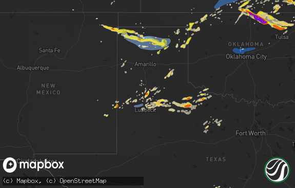
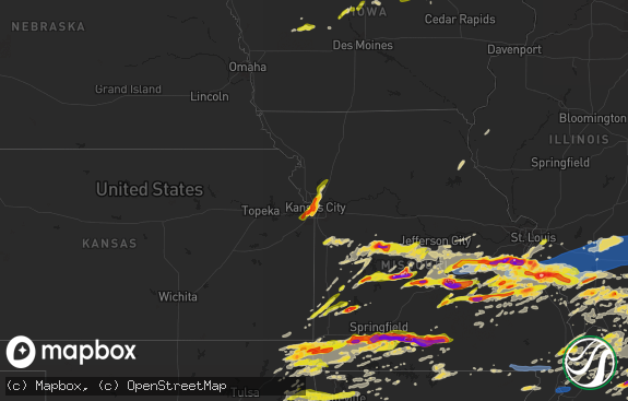
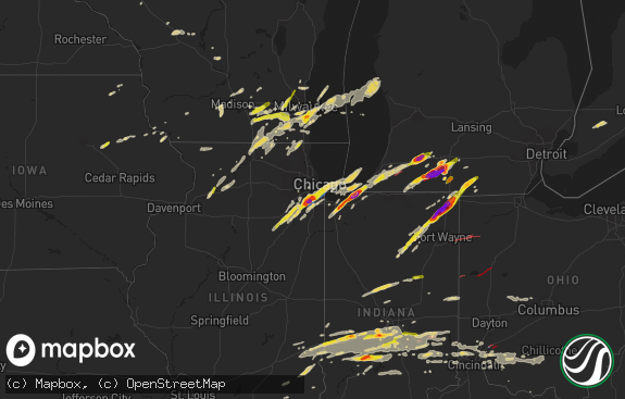
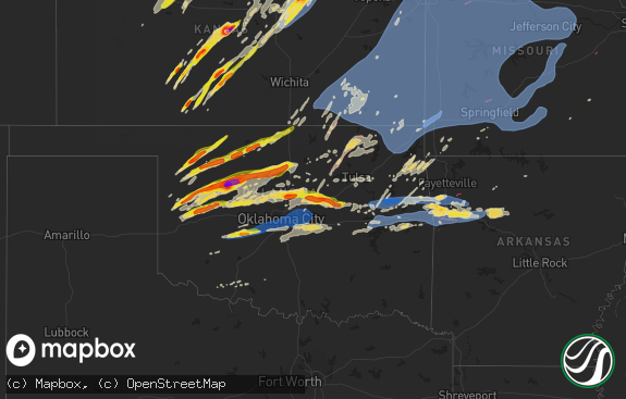
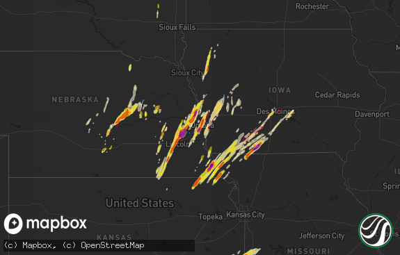
Hail Map in Iowa on April 30, 2024
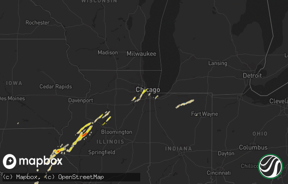
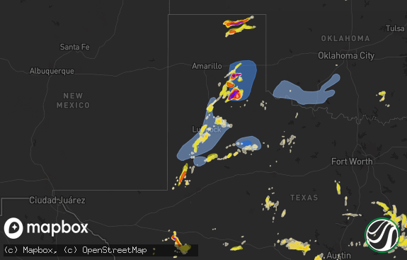
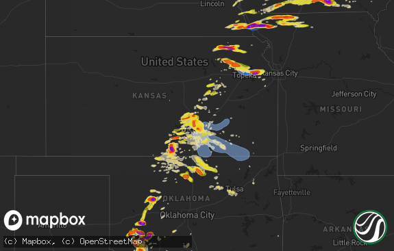
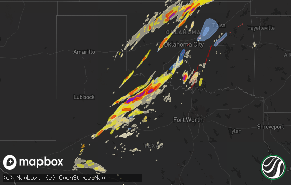
The weather event in Iowa on April 30, 2024 includes Hail, Wind, and Tornado maps. 11 states and 603 cities were impacted and suffered possible damage. The total estimated number of properties impacted is 42,118.

Hail
Wind
Tornado
42,118
Estimated number of impacted properties by a 1.00" hail or larger8,426
Estimated number of impacted properties by a 1.75" hail or larger1,835
Estimated number of impacted properties by a 2.50" hail or largerStorm reports in Iowa
Iowa
| Date | Description |
|---|---|
| 04/30/20246:48 PM CDT | Em relayed image of quarter sized hail just north of garden grove. Time estimated from radar. |
| 04/30/20246:43 PM CDT | Near green valley lake. |
| 04/30/20246:43 PM CDT | Up to quarter sized hail. |
| 04/30/20246:43 PM CDT | Variety of change hail. Biggest size is quarters. |
| 04/30/20246:38 PM CDT | Up to quarter sized hail. |
| 04/30/20246:38 PM CDT | Spotter relayed hail up to 1 inch in size just west of i-35 between osceola and truro. Copious amounts of hail overall. Time estimated from radar. |
| 04/30/20246:28 PM CDT | Spotter relayed copious amounts of hail... Up to quarter in size. Just west of i-35 between osceola and truro. Location and time estimated from radar. |
| 04/30/20246:24 PM CDT | Report from mping: quarter |
| 04/30/20246:20 PM CDT | Report from mping: half dollar |
| 04/30/20246:18 PM CDT | Up to quarter sized hail near east county line. |
| 04/30/20246:15 PM CDT | Photo from who tv viewer. |
| 04/30/20246:13 PM CDT | Report from mping: half dollar |
| 04/30/20246:12 PM CDT | Delayed report by trained spotter... Measured up to 1.75 inch hail stones. Shredded leaves. |
| 04/30/20246:11 PM CDT | A local report indicates 1.00 inch wind near Lorimor |
| 04/30/20246:08 PM CDT | Relayed by broadcast meteorologist. Delayed report... Time estimated by radar. |
| 04/30/20246:05 PM CDT | A local report indicates 1.00 inch wind near Rippey |
| 04/30/20246:03 PM CDT | A local report indicates 1.00 inch wind near 1 S Truro |
| 04/30/20246:03 PM CDT | Near rea rd and creamery rd. Time estimated from radar. |
| 04/30/20245:57 PM CDT | Storm inflow gust on personal weather station. |
| 04/30/20245:54 PM CDT | Trees in road. |
| 04/30/20245:51 PM CDT | A local report indicates 1.00 inch wind near Bagley |
| 04/30/20245:40 PM CDT | Report from mping: ping pong ball |
| 04/30/20245:33 PM CDT | Nickel to quarter sized hail. |
| 04/30/20245:28 PM CDT | Damage to trees and damage to house. Time estimated by radar. |
| 04/30/20245:24 PM CDT | A local report indicates 1.00 inch wind near 3 WNW Orient |
| 04/30/20245:22 PM CDT | A local report indicates 1.00 inch wind near 2 ESE Orient |
| 04/30/20245:21 PM CDT | A local report indicates 1.00 inch wind near 5 SE Riverton |
| 04/30/20244:59 PM CDT | A local report indicates 1.00 inch wind near 3 S Bridgewater |
| 04/30/20244:38 PM CDT | Up to quarter sized hail. |
| 04/30/20244:37 PM CDT | Delayed report. |
| 04/30/20244:26 PM CDT | A local report indicates 1.00 inch wind near 1 NNE Grant |
| 04/30/20244:13 PM CDT | Personal weather station. |
| 04/30/20244:05 PM CDT | A local report indicates 1.75 inch wind near Elliott |
| 04/30/20244:04 PM CDT | A local report indicates 1.00 inch wind near 6 S Granville |
| 04/30/20243:47 PM CDT | A local report indicates 2.25 inch wind near Malvern |
| 04/30/20243:33 PM CDT | A local report indicates 1.75 inch wind near Malvern |
| 04/30/20243:33 PM CDT | Corrects previous hail report from malvern. Time based on radar. |
| 04/30/20243:25 PM CDT | A local report indicates 1.75 inch wind near 4 ESE Glenwood |
| 04/30/20243:25 PM CDT | Dot automated station. |
| 04/30/20243:24 PM CDT | A local report indicates 1.00 inch wind near 2 SE Malvern |
| 04/29/20248:30 PM CDT | A local report indicates 1.00 inch wind near 2 E Melrose |
| 04/29/20247:50 PM CDT | Delayed report - social media picture of hail north of centerville. |
| 04/29/20247:35 PM CDT | Rathbun lake - appanoose co 911. |
| 04/29/20247:28 PM CDT | Delayed report via social media. |
| 04/29/20247:20 PM CDT | Suspected brief tornado near millerton with damage |
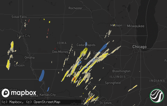
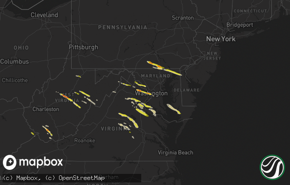
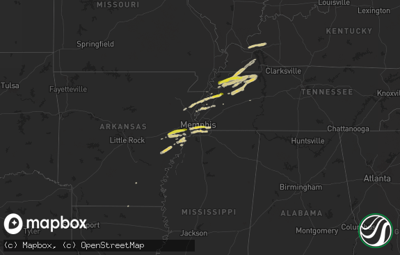
All States Impacted by Hail Map on April 30, 2024
Cities Impacted by Hail Map on April 30, 2024
- Clarkson, NE
- Leigh, NE
- Creston, NE
- Madison, NE
- Stanton, NE
- Pilger, NE
- Ballston Lake, NY
- Ballston Spa, NY
- Dodge, NE
- Howells, NE
- West Point, NE
- Saratoga Springs, NY
- Brewton, AL
- Andalusia, AL
- Elliott, IA
- Griswold, IA
- Cumberland, IA
- Massena, IA
- Montrose, PA
- Lawton, PA
- Westville, FL
- Bonifay, FL
- New Milford, PA
- Kingsley, PA
- Geneva, AL
- Harford, PA
- Susquehanna, PA
- Jackson, PA
- Thompson, PA
- Cooperstown, NY
- North Bend, NE
- Morse Bluff, NE
- Union Dale, PA
- Ames, NE
- Hooper, NE
- Cedar Bluffs, NE
- Scribner, NE
- Otoe, NE
- Nebraska City, NE
- Nehawka, NE
- Dunbar, NE
- Fremont, NE
- Blair, NE
- Nickerson, NE
- Arlington, NE
- Herman, NE
- Union, NE
- Modale, IA
- Missouri Valley, IA
- Thurman, IA
- Pacific Junction, IA
- Tabor, IA
- Glenwood, IA
- Malvern, IA
- Plattsmouth, NE
- Murray, NE
- Hartington, NE
- Craig, NE
- Mondamin, IA
- Hastings, IA
- Tekamah, NE
- Emerson, IA
- Blue Rapids, KS
- Frankfort, KS
- Pisgah, IA
- Logan, IA
- Woodbine, IA
- Little Sioux, IA
- Iraan, TX
- Moorhead, IA
- Dunlap, IA
- Fort Stockton, TX
- Henderson, IA
- Red Oak, IA
- Vermillion, KS
- Fay, OK
- Oakwood, OK
- Thomas, OK
- Le Mars, IA
- Mangum, OK
- Scranton, PA
- Remsen, IA
- Granite, OK
- Centralia, KS
- Steinauer, NE
- Elk Creek, NE
- Humboldt, NE
- Table Rock, NE
- Grant, IA
- Villisca, IA
- Watonga, OK
- Lewis, IA
- Carson, IA
- Oakland, IA
- Canton, OK
- Marysville, KS
- Home, KS
- Westmoreland, KS
- Olsburg, KS
- Lone Wolf, OK
- Auburn, NE
- Corning, IA
- Seneca, KS
- Westphalia, IA
- Earling, IA
- Panama, IA
- Portsmouth, IA
- Harlan, IA
- Custer City, OK
- Paullina, IA
- Marcus, IA
- Granville, IA
- Dill City, OK
- Corning, KS
- Nodaway, IA
- Onaga, KS
- Sentinel, OK
- Cordell, OK
- Goff, KS
- Kirkman, IA
- Irwin, IA
- Defiance, IA
- Manilla, IA
- Midkiff, TX
- Midland, TX
- Ringwood, OK
- Meno, OK
- Johnson, NE
- Halstead, KS
- Braddyville, IA
- Elmo, MO
- Ute, IA
- Burrton, KS
- Corn, OK
- Taloga, OK
- Ozona, TX
- Garden City, TX
- Hobart, OK
- White City, KS
- Sedgwick, KS
- Junction City, KS
- Mount Hope, KS
- Clarinda, IA
- Bedford, IA
- New Market, IA
- Peru, NE
- Bridgewater, IA
- Stella, NE
- Manning, IA
- Prescott, IA
- Fontanelle, IA
- Orient, IA
- Stanton, IA
- Haven, KS
- Shambaugh, IA
- Clearmont, MO
- Herington, KS
- Aspinwall, IA
- Greenfield, IA
- Clinton, OK
- Council Grove, KS
- Creston, IA
- Arapaho, OK
- Sabetha, KS
- Shubert, NE
- Nemaha, NE
- Newton, KS
- Gravity, IA
- Colwich, KS
- Weatherford, OK
- Peabody, KS
- Hillsboro, KS
- Dawson, NE
- Carroll, IA
- Arcadia, IA
- Halbur, IA
- Wamego, KS
- Jet, OK
- Audubon, IA
- Marion, KS
- Lost Springs, KS
- Rock Port, MO
- Hamburg, IA
- Merrill, IA
- Walton, KS
- Enid, OK
- Primghar, IA
- Sutherland, IA
- Burdick, KS
- Lincolnville, KS
- Wetmore, KS
- Kremlin, OK
- Bentley, KS
- Belvue, KS
- Saint Marys, KS
- Emmett, KS
- Delia, KS
- Soldier, KS
- Havensville, KS
- Geary, OK
- Murdock, KS
- Chillicothe, TX
- Vernon, TX
- Cheney, KS
- Wilsey, KS
- Paducah, TX
- Coon Rapids, IA
- Pond Creek, OK
- Nash, OK
- Sharpsburg, IA
- Clearfield, IA
- Riverton, IA
- Westboro, MO
- Alta Vista, KS
- Dwight, KS
- Templeton, IA
- Dedham, IA
- Gray, IA
- Falls City, NE
- Fairfax, MO
- Verdon, NE
- Quanah, TX
- Wiota, IA
- Scranton, IA
- Whitewater, KS
- Macksburg, IA
- Lorimor, IA
- Winterset, IA
- Big Spring, TX
- Maize, KS
- Valley Center, KS
- Garden Plain, KS
- Goddard, KS
- North Newton, KS
- Andale, KS
- Craig, MO
- Seymour, TX
- Kingman, KS
- Diagonal, IA
- Benton, IA
- Florence, KS
- Northboro, IA
- Shenandoah, IA
- Bayard, IA
- Afton, IA
- Viola, KS
- Milton, KS
- Wichita, KS
- Eldorado, OK
- Netawaka, KS
- Whiting, KS
- Mayetta, KS
- Hoyt, KS
- Rulo, NE
- Mound City, MO
- Maitland, MO
- Skidmore, MO
- Olustee, OK
- Gotebo, OK
- Jefferson, IA
- Bagley, IA
- Ellston, IA
- Tingley, IA
- Rossville, KS
- Coin, IA
- College Springs, IA
- Blanchard, IA
- Hiawatha, KS
- Peru, IA
- Silver Lake, KS
- Norwich, KS
- Kellerton, IA
- Mount Ayr, IA
- Topeka, KS
- Jamaica, IA
- Harper, KS
- Danville, KS
- Attica, KS
- Crowell, TX
- Benton, KS
- Kechi, KS
- Greenwich, KS
- Douglass, KS
- Coahoma, TX
- Westbrook, TX
- Rippey, IA
- Robinson, KS
- Medford, OK
- Glidden, IA
- Ralston, IA
- Nesquehoning, PA
- Alma, KS
- Allen, KS
- Grand River, IA
- Spivey, KS
- Truro, IA
- Saint Charles, IA
- Yale, IA
- Ogden, IA
- Perry, IA
- Murray, IA
- Dawson, IA
- Colorado City, TX
- Andover, KS
- Grand Junction, IA
- Boone, IA
- Woodward, IA
- Madrid, IA
- Sheffield, TX
- New Virginia, IA
- Indianola, IA
- Saint Marys, IA
- Thayer, IA
- Osceola, IA
- Lenox, IA
- Redfield, IA
- Clearwater, KS
- Winfield, KS
- Oxford, KS
- Weldon, IA
- Van Wert, IA
- Decatur, IA
- Leon, IA
- Argonia, KS
- Anthony, KS
- Augusta, KS
- Graham, MO
- Towanda, KS
- Meriden, KS
- Grantville, KS
- Shannon City, IA
- Garden Grove, IA
- Humeston, IA
- El Dorado, KS
- Leon, KS
- Schnecksville, PA
- Slatington, PA
- Rose Hill, KS
- Derby, KS
- Coplay, PA
- Laurys Station, PA
- Allentown, PA
- Orefield, PA
- Whitehall, PA
- Northampton, PA
- Tecumseh, KS
- Catasauqua, PA
- Barnard, MO
- Maryville, MO
- Udall, KS
- Cassoday, KS
- Mcconnell Afb, KS
- Conway Springs, KS
- Burlington Junction, MO
- Cromwell, IA
- Seiling, OK
- Luther, IA
- Walnutport, PA
- Elmer, OK
- Longdale, OK
- Burns, KS
- Peck, KS
- Haysville, KS
- Matfield Green, KS
- Slatedale, PA
- Milo, IA
- Lamont, OK
- Cherryville, PA
- Atlanta, KS
- Perry, KS
- Ozawkie, KS
- Frederick, OK
- Tipton, OK
- Roosevelt, OK
- Bluff City, KS
- Pickering, MO
- Dryden, TX
- Corydon, IA
- Lehighton, PA
- Conception Junction, MO
- Guilford, MO
- Germansville, PA
- Jim Thorpe, PA
- Woodburn, IA
- Bethlehem, PA
- Hopkins, MO
- Sheridan, MO
- Parnell, MO
- Ravenwood, MO
- Oskaloosa, KS
- Lecompton, KS
- Ames, IA
- Prole, IA
- Rock, KS
- Mulvane, KS
- Millerton, IA
- Chariton, IA
- Russell, IA
- McLouth, KS
- Lawrence, KS
- Stanberry, MO
- Conception, MO
- Loraine, TX
- Caldwell, KS
- Belle Plaine, KS
- Wellington, KS
- Mayfield, KS
- Ackworth, IA
- Lacona, IA
- Snyder, OK
- Tonganoxie, KS
- Freeport, KS
- Burden, KS
- Rosalia, KS
- Eureka, KS
- Piedmont, KS
- Beaumont, KS
- Latham, KS
- Leavenworth, KS
- Cambridge, KS
- Grenola, KS
- Hamilton, KS
- Promise City, IA
- Plano, IA
- Melrose, IA
- Waldron, KS
- Amorita, OK
- Kiowa, KS
- Alva, OK
- Hazelton, KS
- Mystic, IA
- Moravia, IA
- Centerville, IA
- Mountain View, OK
- Burlington, OK
- Lawton, OK
- Lucas, IA
- Liberty Center, IA
- Worth, MO
- Grant City, MO
- Denver, MO
- Southard, OK
- Eudora, KS
- Mountain Park, OK
- Patterson, IA
- Gentry, MO
- Moulton, IA
- Udell, IA
- Cedar Vale, KS
- Dexter, KS
- Carnegie, OK
- Derby, IA
- Martinsville, MO
- Hatfield, MO
- Eagleville, MO
- Hermleigh, TX
- De Soto, KS
- Hitchcock, OK
- Manchester, OK
- Albia, IA
- Clyde, MO
- Okeene, OK
- Fluvanna, TX
- Albany, MO
- Hollister, OK
- Ridgeway, MO
- Unionville, IA
- McCaulley, TX
- Big Lake, TX
- Bloomfield, IA
- Snyder, TX
- New Hampton, MO
- Elk Falls, KS
- Altus, OK
- Blair, OK
- Longton, KS
- Wakita, OK
- South Haven, KS
- Sedan, KS
- Elgin, OK
- Apache, OK
- Bethany, MO
- Moline, KS
- Fredonia, KS
- Headrick, OK
- Pulaski, IA
- Geuda Springs, KS
- Peru, KS
- Niotaze, KS
- Havana, KS
- Gilman City, MO
- Blakesburg, IA
- Ehrhardt, SC
- Cherokee, OK
- Fairfax, SC
- Olar, SC
- Brunson, SC
- Braman, OK
- Lodge, SC
- Ottumwa, IA
- Elk City, KS
- Howard, KS
- Independence, KS
- Pawhuska, OK
- Chautauqua, KS
- Caney, KS
- Copan, OK
- Loveland, OK
- Indiahoma, OK
- Spickard, MO
- Newkirk, OK
- Princeton, MO
- Cache, OK
- Blackwell, OK
- Arkansas City, KS
- Maple City, KS
- Wann, OK
- Dearing, KS
- Tyro, KS
- Coffeyville, KS
- Ponca City, OK
- Edgerton, KS
- Drakesville, IA
- Liberty, KS
- Lenapah, OK
- S Coffeyville, OK
- Dewey, OK
- Floris, IA
- Selma, IA
- Bamberg, SC
- Branchville, SC
- Dennis, KS
- Kaw City, OK
- Burbank, OK
- Douds, IA
- Fairfax, OK
- Chattanooga, OK
- Walters, OK
- Tonkawa, OK
- Nowata, OK
- Delaware, OK
- Red Rock, OK
- Grandfield, OK
- Bartlesville, OK
- Marland, OK
- Davidson, OK
- Ralston, OK
- Pawnee, OK
- Hunter, OK
- Garber, OK
- Comanche, OK
- Devol, OK
- Duncan, OK
- Pryor, OK
- Goltry, OK
- Billings, OK
- Loco, OK
- Ratliff City, OK
- Jennings, OK
- Yale, OK
- Mannford, OK
- Perry, OK
- Randlett, OK
- Maramec, OK
- Terlton, OK
- Healdton, OK
- Graham, OK
- Springer, OK
- Hennepin, OK
- Wilson, OK
- Wichita Falls, TX
- Petrolia, TX
- Sand Springs, OK
- Sapulpa, OK
- Davis, OK
- Byers, TX
- Covington, OK
- Waurika, OK
- Ringling, OK
- Ryan, OK
- Lone Grove, OK
- Tulsa, OK
- Jenks, OK
- Bixby, OK
- Cleveland, OK
- Carmen, OK
- Dacoma, OK
- Farragut, IA
- Waukomis, OK
- Helena, OK
- Heavener, OK
- Nardin, OK
- Lookeba, OK
- Hinton, OK
- Binger, OK
- Chickasha, OK
- Foster, OK
- Lindsay, OK
- Elmore City, OK
- Calumet, OK
- Okarche, OK
- Cyril, OK
- Purcell, OK
