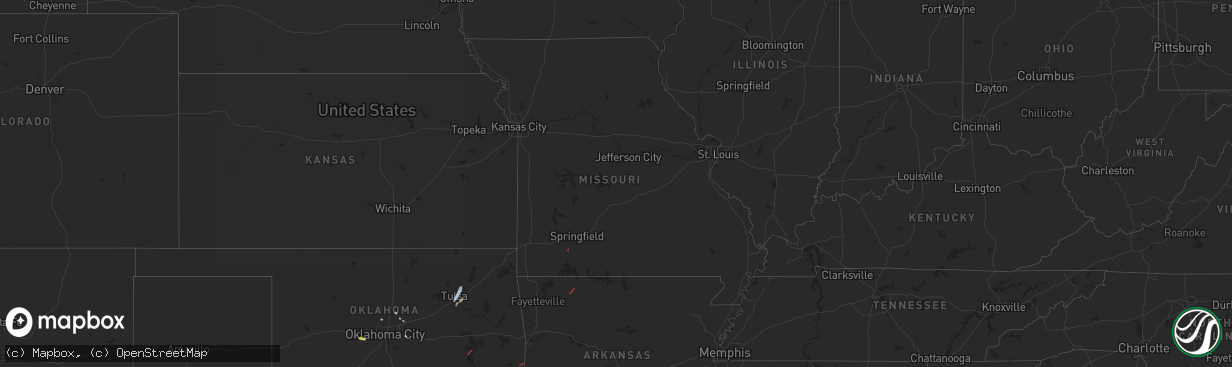
Hail Map in Missouri on April 28, 2024
The weather event in Missouri on April 28, 2024 includes Hail, Tornado, and Wind maps. 6 states and 185 cities were impacted and suffered possible damage. The total estimated number of properties impacted is 0.
Hail
Tornado
Wind
0
Estimated number of impacted properties by a 1.00" hail or larger0
Estimated number of impacted properties by a 1.75" hail or larger0
Estimated number of impacted properties by a 2.50" hail or largerStorm reports in Missouri
Missouri
| Date | Description |
|---|---|
| 04/28/202410:00 AM CDT | Sac osage electric cooperative reported multiple broken poles resulting in a power outage. |
| 04/28/20241:11 AM CDT | Power lines down at route 21 and macon road south of potosi. Time estimated based on radar. |
| 04/27/20248:22 PM CDT | Trees down at state highways k and m in clever. |
| 04/27/20248:22 PM CDT | Delayed report. Tree down on home on k highway south of union city. Time estimated from radar. |
| 04/27/20248:20 PM CDT | A brief... Weak ef-0 tornado occurred... With a path length of 0.41 miles and a width of 100 yards. Maximum wind speeds were 80 mph... Causing trees to uproot and damag |
Cities Impacted by Hail Map on April 28, 2024
- Buckley, MI
- Kingsley, MI
- Fife Lake, MI
- South Boardman, MI
- Pleasanton, TX
- Floresville, TX
- Moore, TX
- Bigfoot, TX
- Poteet, TX
- Poth, TX
- Georgetown, TX
- Chilton, TX
- Falls City, TX
- Riesel, TX
- Marlin, TX
- Groesbeck, TX
- Rogers, TX
- Mart, TX
- Kosse, TX
- Thornton, TX
- Stockdale, TX
- Eddy, TX
- Rosebud, TX
- Lott, TX
- Burlington, TX
- Buckholts, TX
- Holland, TX
- Bartlett, TX
- Mexia, TX
- Bremond, TX
- Reagan, TX
- Teague, TX
- Fairfield, TX
- Buffalo, TX
- Oakwood, TX
- Calvert, TX
- Donie, TX
- Palestine, TX
- Tennessee Colony, TX
- Jewett, TX
- Franklin, TX
- Jacksonville, TX
- Montalba, TX
- Marquez, TX
- Troup, TX
- Frankston, TX
- Centerville, TX
- Hearne, TX
- Elkhart, TX
- Somerville, TX
- Mcalester, OK
- Tulsa, OK
- Normangee, TX
- Rusk, TX
- Canadian, OK
- Broken Arrow, OK
- Grapeland, TX
- College Station, TX
- Leona, TX
- Reklaw, TX
- Anderson, TX
- Laneville, TX
- Owasso, OK
- Madisonville, TX
- Henderson, TX
- Iola, TX
- Bryan, TX
- Cushing, TX
- Mount Enterprise, TX
- Tatum, TX
- Crockett, TX
- Beckville, TX
- North Zulch, TX
- Lovelady, TX
- Bedias, TX
- Alto, TX
- Carthage, TX
- Long Branch, TX
- Marshall, TX
- Shreveport, LA
- Waskom, TX
- Greenwood, LA
- De Berry, TX
- Jenks, OK
- Union City, OK
- Wells, TX
- Mooringsport, LA
- Karnack, TX
- Blanchard, LA
- Midway, TX
- Trinity, TX
- Huntsville, TX
- Heavener, OK
- Tenaha, TX
- Groveton, TX
- Flint, TX
- Billings, MO
- Clever, MO
- Edmond, OK
- Joaquin, TX
- Nacogdoches, TX
- Meridian, OK
- Guthrie, OK
- Luther, OK
- Wellston, OK
- San Augustine, TX
- Center, TX
- Chireno, TX
- Corrigan, TX
- Wortham, TX
- Diboll, TX
- Huntington, TX
- Lufkin, TX
- Navasota, TX
- Chester, TX
- Alpena, AR
- Green Forest, AR
- Zavalla, TX
- Mcloud, OK
- Oakhurst, TX
- Shawnee, OK
- Plantersville, TX
- Colmesneil, TX
- Jasper, TX
- Montgomery, TX
- Woodville, TX
- Richards, TX
- Milam, TX
- Hemphill, TX
- Bronson, TX
- Brookeland, TX
- Broaddus, TX
- Coldspring, TX
- Pointblank, TX
- Hillister, TX
- Pennington, TX
- Collinsville, OK
- Livingston, TX
- Shepherd, TX
- Goodrich, TX
- Florien, LA
- Anacoco, LA
- Hornbeck, LA
- Kirbyville, TX
- Spurger, TX
- Fred, TX
- Silsbee, TX
- Buna, TX
- Cleveland, TX
- Georgetown, LA
- Alexandria, LA
- Pineville, LA
- Boyce, LA
- Olla, LA
- Willis, TX
- New Waverly, TX
- Tullos, LA
- Call, TX
- Bon Wier, TX
- New Caney, TX
- La Porte, TX
- Pasadena, TX
- Baytown, TX
- Dayton, TX
- Deridder, LA
- Vidor, TX
- Wallisville, TX
- Deweyville, TX
- Liberty, TX
- Anahuac, TX
- Orange, TX
- Sulphur, LA
- Vinton, LA
- Hankamer, TX
- Seabrook, TX
- Houston, TX
- Devers, TX
- Bethany, LA
- Keithville, LA
- Bossier City, LA
- Barksdale Afb, LA
- Haughton, LA
- Texas City, TX
- Port Bolivar, TX
- Cameron, LA


