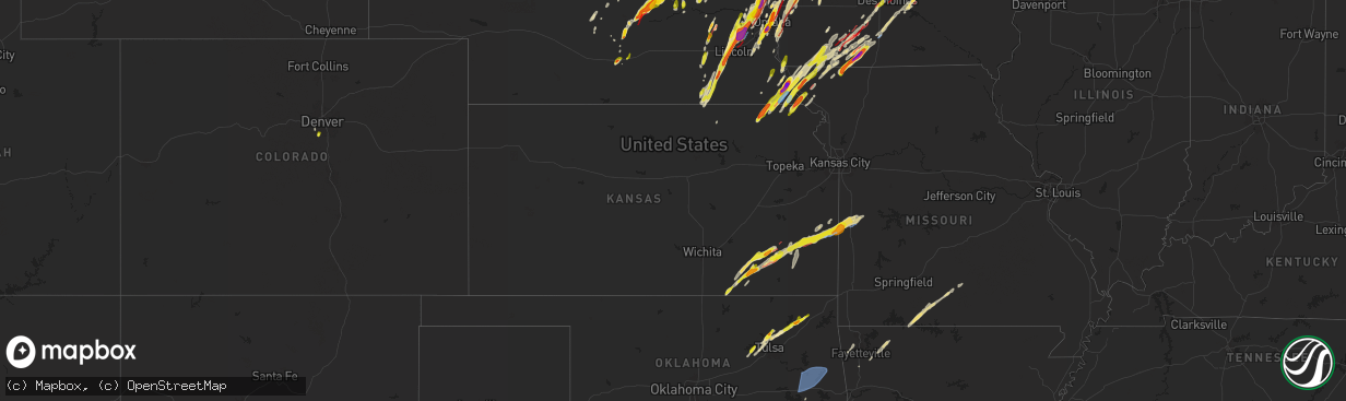
Hail Map in Kansas on April 26, 2024
The weather event in Kansas on April 26, 2024 includes Wind, Tornado, and Hail maps. 10 states and 690 cities were impacted and suffered possible damage. The total estimated number of properties impacted is 9,670.
Wind
Tornado
Hail
9,670
Estimated number of impacted properties by a 1.00" hail or larger927
Estimated number of impacted properties by a 1.75" hail or larger0
Estimated number of impacted properties by a 2.50" hail or largerStorm reports in Kansas
Kansas
| Date | Description |
|---|---|
| 04/26/20246:12 PM CDT | A local report indicates 1.25 inch wind near Fulton |
| 04/26/20246:01 PM CDT | Large trees down. |
| 04/26/20245:45 PM CDT | Spotter indicated brief touchdown. |
| 04/26/20245:30 PM CDT | A local report indicates 1.25 inch wind near 4 N Uniontown |
| 04/26/20245:29 PM CDT | A weak ef-0 tornado occurred... With a path length of 3.12 miles and a width of 75 yards. Maximum wind speeds of 85 mph led to siding damage on a home... Five outbuildi |
| 04/26/20245:17 PM CDT | A local report indicates 1.25 inch wind near 4 N Elsmore |
| 04/26/20245:02 PM CDT | Storm chaser video showed brief tornado. |
| 04/26/20244:11 PM CDT | Emergency manager reported golf ball size hail. |
| 04/26/20244:10 PM CDT | A local report indicates 1.50 inch wind near Baileyville |
| 04/26/20244:00 PM CDT | A local report indicates 1.00 inch wind near 1 W New Albany |
| 04/26/20243:52 PM CDT | A local report indicates a tornado near 4 SSW Yates Center |
| 04/26/20243:43 PM CDT | Video confirmation of a tornado. |
| 04/26/20243:42 PM CDT | Storm chaser report. |
| 04/26/20243:41 PM CDT | May have had a wall cloud initially. |
| 04/26/20243:12 PM CDT | A local report indicates 1.50 inch wind near 3 NW Fall River |
| 04/26/20243:03 PM CDT | A local report indicates 1.50 inch wind near 4 W Moline |
| 04/26/20243:01 PM CDT | A local report indicates 1.00 inch wind near 2 NW Severy |
| 04/26/20242:51 PM CDT | A local report indicates 1.00 inch wind near 2 N Howard |
All States Impacted by Hail Map on April 26, 2024
Cities Impacted by Hail Map on April 26, 2024
- Newalla, OK
- Mcloud, OK
- Oktaha, OK
- Muskogee, OK
- Warner, OK
- Checotah, OK
- Porum, OK
- Fort Gibson, OK
- Braggs, OK
- Cherryvale, KS
- Neodesha, KS
- Thayer, KS
- Webbers Falls, OK
- Tahlequah, OK
- Gore, OK
- Broken Bow, NE
- Chanute, KS
- Altoona, KS
- Oconto, NE
- Vian, OK
- Park Hill, OK
- Cookson, OK
- Welling, OK
- Ansley, NE
- Lone Grove, OK
- Ardmore, OK
- Springer, OK
- Bunch, OK
- Comstock, NE
- Blanco, OK
- Pittsburg, OK
- Hartshorne, OK
- Mcalester, OK
- Kiowa, OK
- Savanna, OK
- Wilburton, OK
- Haileyville, OK
- Krebs, OK
- Quinton, OK
- Red Oak, OK
- Kinta, OK
- Mccurtain, OK
- Ord, NE
- Sulphur, OK
- Mill Creek, OK
- Elyria, NE
- Roff, OK
- Fitzhugh, OK
- Burwell, NE
- Stonewall, OK
- Mason, TX
- Valley Spring, TX
- Llano, TX
- Castell, TX
- Iredell, TX
- Glen Rose, TX
- Rainbow, TX
- Nemo, TX
- Walnut Springs, TX
- Cherokee, TX
- Cleburne, TX
- Granbury, TX
- Verdigre, NE
- Orchard, NE
- Tow, TX
- San Saba, TX
- Lampasas, TX
- Evant, TX
- Gatesville, TX
- Lometa, TX
- Kempner, TX
- Copperas Cove, TX
- Fort Worth, TX
- Aledo, TX
- Naval Air Station Jrb, TX
- Jonesboro, TX
- Purmela, TX
- Hamilton, TX
- Kopperl, TX
- Denton, TX
- Lake Dallas, TX
- Argyle, TX
- Lewisville, TX
- Little Elm, TX
- Meridian, TX
- Morgan, TX
- Hico, TX
- Cranfills Gap, TX
- Valley Mills, TX
- Aubrey, TX
- Elkins, AR
- Winslow, AR
- Ravenna, NE
- Oglesby, TX
- Crawford, TX
- Keene, TX
- Burleson, TX
- Joshua, TX
- Fayetteville, AR
- Crowley, TX
- Mansfield, TX
- Kennedale, TX
- Arlington, TX
- McGregor, TX
- Anthon, IA
- Oto, IA
- Huntsville, AR
- Wesley, AR
- Godley, TX
- Clifton, TX
- Alvarado, TX
- Bend, TX
- Grand Prairie, TX
- Correctionville, IA
- Pierson, IA
- Brayton, IA
- Exira, IA
- Atlantic, IA
- Rockville, NE
- Keller, TX
- Elk Horn, IA
- Harlan, IA
- Haslet, TX
- Euless, TX
- Washta, IA
- Marcus, IA
- Quimby, IA
- Cleghorn, IA
- China Spring, TX
- Waco, TX
- Audubon, IA
- Flower Mound, TX
- Irwin, IA
- Kimballton, IA
- Kirkman, IA
- West, TX
- Grapevine, TX
- Coppell, TX
- North Richland Hills, TX
- Southlake, TX
- Colleyville, TX
- Berryville, AR
- Adair, IA
- Guthrie Center, IA
- Hamlin, IA
- Meriden, IA
- Kearney, NE
- Coon Rapids, IA
- Narka, KS
- Ashton, NE
- Abbott, TX
- Hubbell, NE
- Reynolds, NE
- Axtell, NE
- Minden, NE
- Manning, IA
- Penelope, TX
- Elba, NE
- Farwell, NE
- Paullina, IA
- Sulphur Springs, TX
- Larrabee, IA
- Cherokee, IA
- Hebron, NE
- Fairbury, NE
- Mahaska, KS
- Van Alstyne, TX
- Whitney, TX
- Hillsboro, TX
- Omaha, AR
- Ridgedale, MO
- Hollister, MO
- Aquilla, TX
- Scotia, NE
- Frost, TX
- Cedarcreek, MO
- Kirbyville, MO
- Blum, TX
- Alexandria, NE
- Rio Vista, TX
- Tobias, NE
- Daykin, NE
- Friend, NE
- Jansen, NE
- Plymouth, NE
- Wolbach, NE
- Saint Paul, NE
- Gibbon, NE
- Shelton, NE
- Greeley, NE
- Purdon, TX
- Barry, TX
- Primghar, IA
- Kissee Mills, MO
- Rueter, MO
- Grandview, TX
- Covington, TX
- Pleasanton, NE
- Western, NE
- Swanton, NE
- Sutherland, IA
- Hartley, IA
- Exeter, NE
- Linn, KS
- Mount Vernon, TX
- De Witt, NE
- Beaver Crossing, NE
- Wilber, NE
- Crete, NE
- Bradleyville, MO
- Ava, MO
- Thornfield, MO
- Cordova, NE
- Milford, NE
- Pontotoc, TX
- Maple City, KS
- Arkansas City, KS
- Dexter, KS
- Corsicana, TX
- Denton, NE
- Pleasant Dale, NE
- Cambridge, KS
- Newkirk, OK
- Utica, NE
- Stringtown, OK
- Lane, OK
- Squires, MO
- Bynum, TX
- Atoka, OK
- Spalding, NE
- Lincoln, NE
- Martell, NE
- Cedar Rapids, NE
- Primrose, NE
- North Loup, NE
- Malone, TX
- Norwood, MO
- Drury, MO
- Seward, NE
- Daisy, OK
- Cedar Hill, TX
- Genoa, NE
- Saint Edward, NE
- Staplehurst, NE
- Ulysses, NE
- Cedar Vale, KS
- Grenola, KS
- Howard, KS
- Piedmont, KS
- Raymond, NE
- Malcolm, NE
- Mountain Grove, MO
- Vanzant, MO
- Severy, KS
- Fall River, KS
- Waverly, NE
- Davey, NE
- Ceresco, NE
- Dwight, NE
- Cabool, MO
- Mertens, TX
- Moline, KS
- Elk Falls, KS
- Greenwood, NE
- Ashland, NE
- Wahoo, NE
- Ithaca, NE
- David City, NE
- Mead, NE
- Albion, NE
- Elgin, NE
- Brainard, NE
- Salem, SD
- Yutan, NE
- Fredonia, KS
- Toronto, KS
- Waterloo, NE
- Valley, NE
- Winfred, SD
- Petersburg, NE
- Itasca, TX
- Clearwater, NE
- Oakdale, NE
- Neligh, NE
- Maypearl, TX
- Milford, TX
- Valparaiso, NE
- Longton, KS
- Elkhorn, NE
- Newman Grove, NE
- Ennis, TX
- Scroggins, TX
- Scurry, TX
- Rosser, TX
- Waxahachie, TX
- Bennington, NE
- Arlington, NE
- Kennard, NE
- Blooming Grove, TX
- Italy, TX
- Blair, NE
- Washington, NE
- Colon, NE
- Fremont, NE
- Leesburg, TX
- Winnsboro, TX
- Vermillion, KS
- Palmyra, NE
- Platte Center, NE
- Humphrey, NE
- Mount Pleasant, TX
- Winfield, TX
- Centralia, KS
- Baileyville, KS
- Columbus, NE
- Elmwood, NE
- Murdock, NE
- Weeping Water, NE
- Weston, NE
- Bristow, OK
- Mannford, OK
- Yates Center, KS
- Creston, NE
- Leigh, NE
- Benedict, KS
- Seneca, KS
- Sand Springs, OK
- Cleveland, OK
- Tulsa, OK
- Wills Point, TX
- Kemp, TX
- Steinauer, NE
- Table Rock, NE
- Pawnee City, NE
- Unadilla, NE
- Louisville, NE
- Buffalo, KS
- Pittsburg, TX
- Terrell, TX
- Sapulpa, OK
- Rising City, NE
- Rice, TX
- Chatfield, TX
- Kaufman, TX
- Mabank, TX
- Johnson, NE
- Brock, NE
- Auburn, NE
- Missouri Valley, IA
- Modale, IA
- Maywood, NE
- Holstein, NE
- Hayes Center, NE
- Haxtun, CO
- Fleming, CO
- Edgar, NE
- Eustis, NE
- Geneva, NE
- Ohiowa, NE
- Hastings, NE
- Cortland, NE
- Moorefield, NE
- Milligan, NE
- Sutton, NE
- Sterling, CO
- Stockville, NE
- Funk, NE
- Evans, CO
- Ayr, NE
- Sterling, NE
- Elwood, NE
- Champion, NE
- Kersey, CO
- Curtis, NE
- Adams, NE
- Greeley, CO
- Cook, NE
- Roseland, NE
- Holyoke, CO
- McCook, NE
- Akron, CO
- Bertrand, NE
- Clay Center, NE
- Glenvil, NE
- Clatonia, NE
- Wauneta, NE
- Firth, NE
- Holdrege, NE
- Snyder, CO
- Otis, CO
- Loomis, NE
- Merino, CO
- Shickley, NE
- Palisade, NE
- Enders, NE
- Imperial, NE
- Weldona, CO
- Bern, KS
- Du Bois, NE
- Humboldt, NE
- Dawson, NE
- Sperry, OK
- Skiatook, OK
- Edgewood, TX
- Springfield, NE
- Manley, NE
- Cedar Creek, NE
- Fruitvale, TX
- Elk Creek, NE
- Springdale, AR
- Siloam Springs, AR
- Point, TX
- Yantis, TX
- Emory, TX
- Lincoln, AR
- Herman, NE
- Humboldt, KS
- Nebraska City, NE
- Bellwood, NE
- La Vista, NE
- Papillion, NE
- Omaha, NE
- Mondamin, IA
- Bellevue, NE
- Julian, NE
- Talmage, NE
- Oneida, KS
- Sabetha, KS
- Como, TX
- Canton, TX
- Alba, TX
- Grand Saline, TX
- Plattsmouth, NE
- Union, NE
- Lindsay, NE
- Iola, KS
- La Harpe, KS
- Carter Lake, IA
- Crescent, IA
- Hamburg, IA
- Rock Port, MO
- Sidney, IA
- Council Bluffs, IA
- Palmer, TX
- Pacific Junction, IA
- Glenwood, IA
- Collinsville, OK
- Owasso, OK
- Peru, NE
- Gretna, NE
- Verdon, NE
- Salem, NE
- Stella, NE
- Shubert, NE
- Madison, NE
- Little Sioux, IA
- Pisgah, IA
- Pickton, TX
- Saltillo, TX
- Nemaha, NE
- Elsmore, KS
- Moran, KS
- Falls City, NE
- Tekamah, NE
- Honey Creek, IA
- Ben Wheeler, TX
- Van, TX
- Neola, IA
- McClelland, IA
- Uniontown, KS
- Bronson, KS
- Fort Calhoun, NE
- Silver Creek, NE
- Nash, TX
- Texarkana, TX
- Savonburg, KS
- Oologah, OK
- Claremore, OK
- Morrill, KS
- Brownville, NE
- Logan, IA
- Mineola, TX
- Lindale, TX
- Quitman, TX
- Soldier, IA
- Hiawatha, KS
- Underwood, IA
- Fairfax, MO
- Moorhead, IA
- Chelsea, OK
- Minden, IA
- Hawkins, TX
- Rulo, NE
- Craig, MO
- Shelby, IA
- Mapleton, KS
- Redfield, KS
- Fulton, KS
- White Cloud, KS
- Daingerfield, TX
- Omaha, TX
- Tarkio, MO
- Westboro, MO
- Naples, TX
- Blue Mound, KS
- Fort Scott, KS
- Prescott, KS
- Burlington Junction, MO
- Hughes Springs, TX
- Marietta, TX
- Linden, TX
- Douglassville, TX
- Simms, TX
- Portsmouth, IA
- Hume, MO
- Rich Hill, MO
- Trinidad, TX
- Big Cabin, OK
- Persia, IA
- Blanchard, IA
- Eustace, TX
- Coin, IA
- Northboro, IA
- Elmo, MO
- Clearmont, MO
- Vinita, OK
- Mound City, MO
- Atlanta, TX
- Hooks, TX
- Maud, TX
- New Boston, TX
- Gilmer, TX
- Westphalia, IA
- Earling, IA
- Defiance, IA
- Foster, MO
- Butler, MO
- Skidmore, MO
- Forest City, MO
- Panama, IA
- Okolona, AR
- Clarinda, IA
- College Springs, IA
- Braddyville, IA
- Shambaugh, IA
- Malakoff, TX
- Queen City, TX
- Maitland, MO
- Texarkana, AR
- Fouke, AR
- Treynor, IA
- Manilla, IA
- Nodaway, IA
- New Market, IA
- Oregon, MO
- Arkadelphia, AR
- Villisca, IA
- Bedford, IA
- Amity, AR
- Lenox, IA
- Benton, AR
- Kincaid, KS
- Donaldson, AR
- Friendship, AR
- Bismarck, AR
- Gravity, IA
- Lonsdale, AR
- Hot Springs National Park, AR
- Malvern, AR
- Hot Springs Village, AR
- Corning, IA
- Garland City, AR
- Fulton, AR
- Lewisville, AR
- Hope, AR
- Denison, IA
- Alexander, AR
- Little Rock, AR
- Paron, AR
- Sharpsburg, IA
- Prescott, IA
- Mound City, KS
- Creston, IA
- Cromwell, IA
- Roland, AR
- Littleton, CO
- Sheridan, MO
- Grant City, MO
- Redding, IA
- Blockton, IA
- Afton, IA
- Avoca, IA
- Pleasanton, KS
- Maumelle, AR
- Ramona, OK
- Mayflower, AR
- Massena, IA
- Conway, AR
- Hancock, IA
- Pickering, MO
- Maryville, MO
- Hopkins, MO
- Mount Ayr, IA
- North Little Rock, AR
- Sherwood, AR
- Aspinwall, IA
- Arcadia, IA
- Westside, IA
- Lorimor, IA
- Morrison, CO
- Fontanelle, IA
- Kellerton, IA
- Tingley, IA
- Ellston, IA
- Cabot, AR
- Jacksonville, AR
- Little Rock Air Force Base, AR
- Carroll, IA
- Breda, IA
- Cookville, TX
- Winterset, IA
- Auburn, IA
- Lake City, IA
- Peru, IA
- Ward, AR
- McRae, AR
- Austin, AR
- Beebe, AR
- Clearfield, IA
- Diagonal, IA
- Benton, IA
- Cumming, IA
- Van Meter, IA
- Prole, IA
- Grand River, IA
- Murray, IA
- Searcy, AR
- Garner, AR
- Osceola, IA
- Shannon City, IA
- Des Moines, IA
- Pleasant Hill, IA
- Altoona, IA
- New Virginia, IA
- West Des Moines, IA
- Indianola, IA
- De Kalb, TX
- Ackworth, IA
- Milo, IA
- Gibsland, LA
- Thayer, IA
- Swan, IA
- Athens, LA
- Carlisle, IA
- Ravenwood, MO
- Parnell, MO
- Pleasantville, IA
- Runnells, IA
- Prairie City, IA
- Monroe, IA
- Hartford, IA
- Monticello, AR
- Homer, LA
- Minden, LA
- Ashdown, AR
- Foreman, AR
- Newton, IA
- Farmerville, LA
- Macksburg, IA
- Marion, LA
- Windsor Heights, IA
- Fort Towson, OK
- Clive, IA
- Urbandale, IA
- Huttig, AR
- Ringold, OK
- Rattan, OK
- Rufe, OK
- Valliant, OK
- Broken Bow, OK
- Hermitage, AR
- Hamburg, AR
- Crossett, AR
- Ramona, SD
- Otley, IA
- Fountain Hill, AR
- Bethel, OK
- Smithville, OK
- Honobia, OK
- Matador, TX


