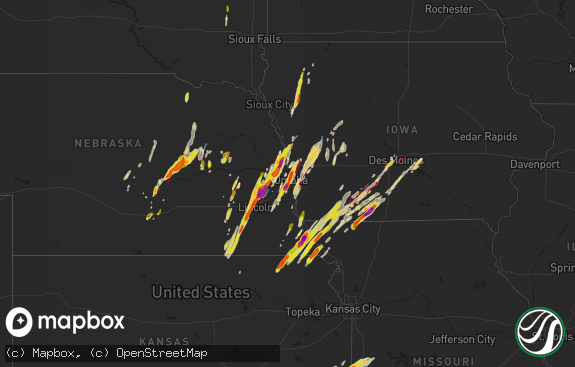
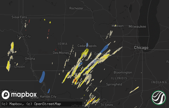
Hail Map in Iowa on April 26, 2024
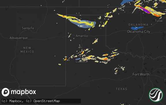
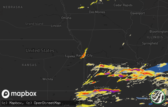
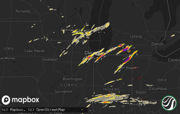
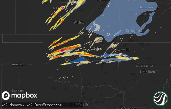
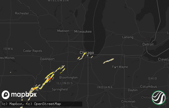
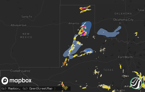
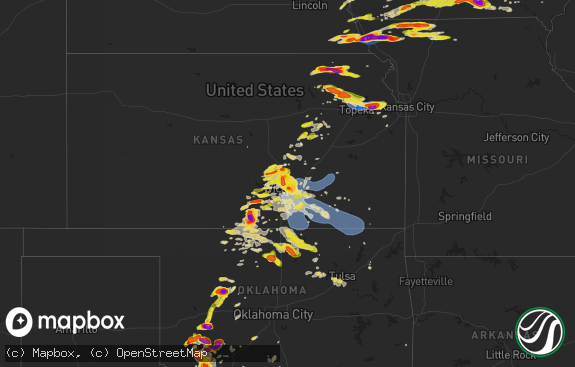
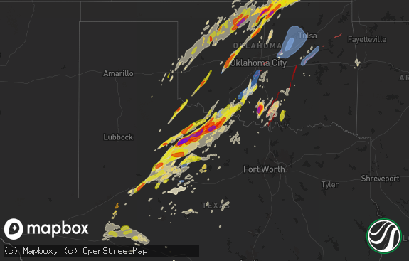
The weather event in Iowa on April 26, 2024 includes Wind, Tornado, and Hail maps. 10 states and 690 cities were impacted and suffered possible damage. The total estimated number of properties impacted is 12,148.

Wind
Tornado
Hail
12,148
Estimated number of impacted properties by a 1.00" hail or larger2,920
Estimated number of impacted properties by a 1.75" hail or larger2,421
Estimated number of impacted properties by a 2.50" hail or largerStorm reports in Iowa
Iowa
| Date | Description |
|---|---|
| 04/26/20246:58 PM CDT | Storm chaser shared a picture of a tornado just west of manilla. |
| 04/26/20246:55 PM CDT | Delayed report. Media relayed photo of tornado approximately 1 mile northeast of defiance... Iowa. |
| 04/26/20246:51 PM CDT | Delayed report. Video of tornado producing damage. One outbuilding destroyed. |
| 04/26/20246:51 PM CDT | A second round of storms moved across shelby and crawford counties. An ef1 tornado developed just a few blocks outside of defiance... Near the track that the first torn |
| 04/26/20246:28 PM CDT | An ef2 tornado damage track begins near the v&w petersen wildlife management area... And moved almost due north from that point... Tracking just to the west of manilla. |
| 04/26/20246:17 PM CDT | A local report indicates a tornado near 2 E Westphalia |
| 04/26/20246:16 PM CDT | Delayed report. |
| 04/26/20246:08 PM CDT | A local report indicates 1.00 inch wind near 1 SE Clarinda |
| 04/26/20246:06 PM CDT | Home destroyed. |
| 04/26/20246:05 PM CDT | Multi vortex tornado. |
| 04/26/20246:05 PM CDT | Significant damage between portsmith and harlan. Destroyed home... Cars flipped. |
| 04/26/20245:59 PM CDT | A local report indicates a tornado near Tennant |
| 04/26/20245:57 PM CDT | Multiple destroyed outbuildings and a home that lost a roof. Time estimated from radar. |
| 04/26/20245:50 PM CDT | Very large tornado crossing interstate 80. |
| 04/26/20245:49 PM CDT | Multiple houses damaged. |
| 04/26/20245:47 PM CDT | Very large multi vortex tornado. At least 1/3 mile wide. |
| 04/26/20245:45 PM CDT | Large tornado destroying homes. |
| 04/26/20245:41 PM CDT | Very large tornado. |
| 04/26/20245:41 PM CDT | A local report indicates a tornado near 4 ESE Logan |
| 04/26/20245:40 PM CDT | A local report indicates a tornado near 3 ESE Neola |
| 04/26/20245:33 PM CDT | A local report indicates a tornado near 2 SE Underwood |
| 04/26/20245:28 PM CDT | A local report indicates a tornado near 3 SE Underwood |
| 04/26/20245:25 PM CDT | *** 1 fatal... 3 inj *** an ef3 tornado developed approximately 3 miles east of mcclelland... And developed prior to the dissipation of the tornado that tracked near tr |
| 04/26/20245:20 PM CDT | A local report indicates a tornado near 7 WNW Neola |
| 04/26/20245:14 PM CDT | A local report indicates a tornado near 6 WSW Treynor |
| 04/26/20245:13 PM CDT | A local report indicates a tornado near 6 W Treynor |
| 04/26/20245:09 PM CDT | A local report indicates a tornado near 7 SE Council Bluffs |
| 04/26/20245:08 PM CDT | This ef3 tornado damage path began near aspen road... Just west of 240th street. The tornado tracked toward the north northeast... Snapping trees and electrical poles a |
| 04/26/20245:07 PM CDT | A local report indicates a tornado near 1 S Crescent |
| 04/26/20245:05 PM CDT | A local report indicates a tornado near 3 NNE Pisgah |
| 04/26/20245:01 PM CDT | A local report indicates a tornado near 3 ENE Carter Lake |
| 04/26/20244:57 PM CDT | A local report indicates a tornado near 2 NNW Pacific Junction |
| 04/26/20244:55 PM CDT | A local report indicates 1.75 inch wind near Carter Lake |
| 04/26/20244:52 PM CDT | An ef1 tornado damage path began approximately 1 mile north of pacific junction... Where the tornado was also reported by a trained spotter. The tornado crossed highway |
| 04/26/20244:35 PM CDT | Tornado near modale looks like it roped out. |
| 04/26/20244:20 PM CDT | A local report indicates a tornado near 5 SSW Modale |
| 04/26/202412:55 PM CDT | Quarter sized hail and heavy rain. |
| 04/26/202412:47 PM CDT | Report and photo via social media. |
| 04/26/202412:30 PM CDT | Quarter to half dollar sized hail reported by the cherokee county em. Time matched up to radar. |
| 04/26/202412:04 PM CDT | Report via social media. |
| 04/25/202411:03 PM CDT | A local report indicates a tornado near 4 S Osceola |
| 04/25/20249:41 PM CDT | Reports of damage in monroe. Time estimated from radar. |
| 04/25/20249:41 PM CDT | *** 1 inj *** reports of damage in monroe. Time estimated from radar. Update for injury. |
| 04/25/20248:59 PM CDT | Power flashes reported near pleasant hill. Tds also noted on radar. |
| 04/25/20248:56 PM CDT | Reported by general public. |
| 04/25/20248:54 PM CDT | Structure damage to a home with possible injury. |
| 04/25/20248:36 PM CDT | Damage reported near osceola. Trees and power lines down. Time estimated from radar. |
| 04/25/20248:36 PM CDT | Report from mping: quarter |
| 04/25/20248:29 PM CDT | Corrects previous tornado report from 4 s osceola. Time estimated. |
| 04/25/20248:19 PM CDT | Tornadic debris signature noted on radar. |
| 04/25/20248:18 PM CDT | Reported to the south of patterson. |
| 04/25/20248:15 PM CDT | Delayed report. Video submitted via social media. Briefly touched down and lifted west of martensdale. Location estimated from radar. |
| 04/25/20248:15 PM CDT | Time estimated from radar. Measured by personal weather station. |
| 04/25/20248:03 PM CDT | A local report indicates 3.00 inch wind near Mount Ayr |
| 04/25/20247:58 PM CDT | Tornado near word of life church. |
| 04/25/20247:54 PM CDT | Large tornado near afton moving northeast. Debris field reported with damage. |
| 04/25/20247:47 PM CDT | Delayed report. Report of tornado between mt ayr and kellerton. Exact location estimated from radar. |
| 04/25/20247:45 PM CDT | Corrects previous hail report from mount ayr. |
| 04/25/20247:31 PM CDT | A local report indicates a tornado near 2 NW Afton |
| 04/25/20247:28 PM CDT | A local report indicates 1.00 inch wind near 2 SSW Delphos |
| 04/25/20247:28 PM CDT | Trained spotter reported tornado on the ground east of creston. Time and location estimated from radar. |
| 04/25/20247:25 PM CDT | Power poles with debris on us highway 34 between creston and afton. Highway is closed. |
| 04/25/20247:15 PM CDT | Tornado reported to the southwest of macksburg. |
| 04/25/20247:10 PM CDT | Near 205th and highway 25. |
| 04/25/20247:09 PM CDT | Tornado with debris near the hospital in creston. |
| 04/25/20247:04 PM CDT | Tornado on the ground... Heading northeast. |
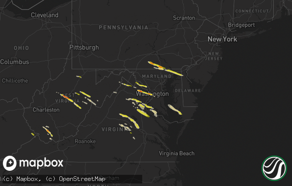
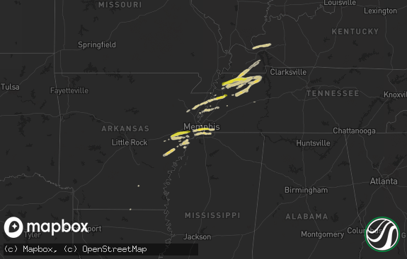
All States Impacted by Hail Map on April 26, 2024
Cities Impacted by Hail Map on April 26, 2024
- Newalla, OK
- Mcloud, OK
- Oktaha, OK
- Muskogee, OK
- Warner, OK
- Checotah, OK
- Porum, OK
- Fort Gibson, OK
- Braggs, OK
- Cherryvale, KS
- Neodesha, KS
- Thayer, KS
- Webbers Falls, OK
- Tahlequah, OK
- Gore, OK
- Broken Bow, NE
- Chanute, KS
- Altoona, KS
- Oconto, NE
- Vian, OK
- Park Hill, OK
- Cookson, OK
- Welling, OK
- Ansley, NE
- Lone Grove, OK
- Ardmore, OK
- Springer, OK
- Bunch, OK
- Comstock, NE
- Blanco, OK
- Pittsburg, OK
- Hartshorne, OK
- Mcalester, OK
- Kiowa, OK
- Savanna, OK
- Wilburton, OK
- Haileyville, OK
- Krebs, OK
- Quinton, OK
- Red Oak, OK
- Kinta, OK
- Mccurtain, OK
- Ord, NE
- Sulphur, OK
- Mill Creek, OK
- Elyria, NE
- Roff, OK
- Fitzhugh, OK
- Burwell, NE
- Stonewall, OK
- Mason, TX
- Valley Spring, TX
- Llano, TX
- Castell, TX
- Iredell, TX
- Glen Rose, TX
- Rainbow, TX
- Nemo, TX
- Walnut Springs, TX
- Cherokee, TX
- Cleburne, TX
- Granbury, TX
- Verdigre, NE
- Orchard, NE
- Tow, TX
- San Saba, TX
- Lampasas, TX
- Evant, TX
- Gatesville, TX
- Lometa, TX
- Kempner, TX
- Copperas Cove, TX
- Fort Worth, TX
- Aledo, TX
- Naval Air Station Jrb, TX
- Jonesboro, TX
- Purmela, TX
- Hamilton, TX
- Kopperl, TX
- Denton, TX
- Lake Dallas, TX
- Argyle, TX
- Lewisville, TX
- Little Elm, TX
- Meridian, TX
- Morgan, TX
- Hico, TX
- Cranfills Gap, TX
- Valley Mills, TX
- Aubrey, TX
- Elkins, AR
- Winslow, AR
- Ravenna, NE
- Oglesby, TX
- Crawford, TX
- Keene, TX
- Burleson, TX
- Joshua, TX
- Fayetteville, AR
- Crowley, TX
- Mansfield, TX
- Kennedale, TX
- Arlington, TX
- McGregor, TX
- Anthon, IA
- Oto, IA
- Huntsville, AR
- Wesley, AR
- Godley, TX
- Clifton, TX
- Alvarado, TX
- Bend, TX
- Grand Prairie, TX
- Correctionville, IA
- Pierson, IA
- Brayton, IA
- Exira, IA
- Atlantic, IA
- Rockville, NE
- Keller, TX
- Elk Horn, IA
- Harlan, IA
- Haslet, TX
- Euless, TX
- Washta, IA
- Marcus, IA
- Quimby, IA
- Cleghorn, IA
- China Spring, TX
- Waco, TX
- Audubon, IA
- Flower Mound, TX
- Irwin, IA
- Kimballton, IA
- Kirkman, IA
- West, TX
- Grapevine, TX
- Coppell, TX
- North Richland Hills, TX
- Southlake, TX
- Colleyville, TX
- Berryville, AR
- Adair, IA
- Guthrie Center, IA
- Hamlin, IA
- Meriden, IA
- Kearney, NE
- Coon Rapids, IA
- Narka, KS
- Ashton, NE
- Abbott, TX
- Hubbell, NE
- Reynolds, NE
- Axtell, NE
- Minden, NE
- Manning, IA
- Penelope, TX
- Elba, NE
- Farwell, NE
- Paullina, IA
- Sulphur Springs, TX
- Larrabee, IA
- Cherokee, IA
- Hebron, NE
- Fairbury, NE
- Mahaska, KS
- Van Alstyne, TX
- Whitney, TX
- Hillsboro, TX
- Omaha, AR
- Ridgedale, MO
- Hollister, MO
- Aquilla, TX
- Scotia, NE
- Frost, TX
- Cedarcreek, MO
- Kirbyville, MO
- Blum, TX
- Alexandria, NE
- Rio Vista, TX
- Tobias, NE
- Daykin, NE
- Friend, NE
- Jansen, NE
- Plymouth, NE
- Wolbach, NE
- Saint Paul, NE
- Gibbon, NE
- Shelton, NE
- Greeley, NE
- Purdon, TX
- Barry, TX
- Primghar, IA
- Kissee Mills, MO
- Rueter, MO
- Grandview, TX
- Covington, TX
- Pleasanton, NE
- Western, NE
- Swanton, NE
- Sutherland, IA
- Hartley, IA
- Exeter, NE
- Linn, KS
- Mount Vernon, TX
- De Witt, NE
- Beaver Crossing, NE
- Wilber, NE
- Crete, NE
- Bradleyville, MO
- Ava, MO
- Thornfield, MO
- Cordova, NE
- Milford, NE
- Pontotoc, TX
- Maple City, KS
- Arkansas City, KS
- Dexter, KS
- Corsicana, TX
- Denton, NE
- Pleasant Dale, NE
- Cambridge, KS
- Newkirk, OK
- Utica, NE
- Stringtown, OK
- Lane, OK
- Squires, MO
- Bynum, TX
- Atoka, OK
- Spalding, NE
- Lincoln, NE
- Martell, NE
- Cedar Rapids, NE
- Primrose, NE
- North Loup, NE
- Malone, TX
- Norwood, MO
- Drury, MO
- Seward, NE
- Daisy, OK
- Cedar Hill, TX
- Genoa, NE
- Saint Edward, NE
- Staplehurst, NE
- Ulysses, NE
- Cedar Vale, KS
- Grenola, KS
- Howard, KS
- Piedmont, KS
- Raymond, NE
- Malcolm, NE
- Mountain Grove, MO
- Vanzant, MO
- Severy, KS
- Fall River, KS
- Waverly, NE
- Davey, NE
- Ceresco, NE
- Dwight, NE
- Cabool, MO
- Mertens, TX
- Moline, KS
- Elk Falls, KS
- Greenwood, NE
- Ashland, NE
- Wahoo, NE
- Ithaca, NE
- David City, NE
- Mead, NE
- Albion, NE
- Elgin, NE
- Brainard, NE
- Salem, SD
- Yutan, NE
- Fredonia, KS
- Toronto, KS
- Waterloo, NE
- Valley, NE
- Winfred, SD
- Petersburg, NE
- Itasca, TX
- Clearwater, NE
- Oakdale, NE
- Neligh, NE
- Maypearl, TX
- Milford, TX
- Valparaiso, NE
- Longton, KS
- Elkhorn, NE
- Newman Grove, NE
- Ennis, TX
- Scroggins, TX
- Scurry, TX
- Rosser, TX
- Waxahachie, TX
- Bennington, NE
- Arlington, NE
- Kennard, NE
- Blooming Grove, TX
- Italy, TX
- Blair, NE
- Washington, NE
- Colon, NE
- Fremont, NE
- Leesburg, TX
- Winnsboro, TX
- Vermillion, KS
- Palmyra, NE
- Platte Center, NE
- Humphrey, NE
- Mount Pleasant, TX
- Winfield, TX
- Centralia, KS
- Baileyville, KS
- Columbus, NE
- Elmwood, NE
- Murdock, NE
- Weeping Water, NE
- Weston, NE
- Bristow, OK
- Mannford, OK
- Yates Center, KS
- Creston, NE
- Leigh, NE
- Benedict, KS
- Seneca, KS
- Sand Springs, OK
- Cleveland, OK
- Tulsa, OK
- Wills Point, TX
- Kemp, TX
- Steinauer, NE
- Table Rock, NE
- Pawnee City, NE
- Unadilla, NE
- Louisville, NE
- Buffalo, KS
- Pittsburg, TX
- Terrell, TX
- Sapulpa, OK
- Rising City, NE
- Rice, TX
- Chatfield, TX
- Kaufman, TX
- Mabank, TX
- Johnson, NE
- Brock, NE
- Auburn, NE
- Missouri Valley, IA
- Modale, IA
- Maywood, NE
- Holstein, NE
- Hayes Center, NE
- Haxtun, CO
- Fleming, CO
- Edgar, NE
- Eustis, NE
- Geneva, NE
- Ohiowa, NE
- Hastings, NE
- Cortland, NE
- Moorefield, NE
- Milligan, NE
- Sutton, NE
- Sterling, CO
- Stockville, NE
- Funk, NE
- Evans, CO
- Ayr, NE
- Sterling, NE
- Elwood, NE
- Champion, NE
- Kersey, CO
- Curtis, NE
- Adams, NE
- Greeley, CO
- Cook, NE
- Roseland, NE
- Holyoke, CO
- McCook, NE
- Akron, CO
- Bertrand, NE
- Clay Center, NE
- Glenvil, NE
- Clatonia, NE
- Wauneta, NE
- Firth, NE
- Holdrege, NE
- Snyder, CO
- Otis, CO
- Loomis, NE
- Merino, CO
- Shickley, NE
- Palisade, NE
- Enders, NE
- Imperial, NE
- Weldona, CO
- Bern, KS
- Du Bois, NE
- Humboldt, NE
- Dawson, NE
- Sperry, OK
- Skiatook, OK
- Edgewood, TX
- Springfield, NE
- Manley, NE
- Cedar Creek, NE
- Fruitvale, TX
- Elk Creek, NE
- Springdale, AR
- Siloam Springs, AR
- Point, TX
- Yantis, TX
- Emory, TX
- Lincoln, AR
- Herman, NE
- Humboldt, KS
- Nebraska City, NE
- Bellwood, NE
- La Vista, NE
- Papillion, NE
- Omaha, NE
- Mondamin, IA
- Bellevue, NE
- Julian, NE
- Talmage, NE
- Oneida, KS
- Sabetha, KS
- Como, TX
- Canton, TX
- Alba, TX
- Grand Saline, TX
- Plattsmouth, NE
- Union, NE
- Lindsay, NE
- Iola, KS
- La Harpe, KS
- Carter Lake, IA
- Crescent, IA
- Hamburg, IA
- Rock Port, MO
- Sidney, IA
- Council Bluffs, IA
- Palmer, TX
- Pacific Junction, IA
- Glenwood, IA
- Collinsville, OK
- Owasso, OK
- Peru, NE
- Gretna, NE
- Verdon, NE
- Salem, NE
- Stella, NE
- Shubert, NE
- Madison, NE
- Little Sioux, IA
- Pisgah, IA
- Pickton, TX
- Saltillo, TX
- Nemaha, NE
- Elsmore, KS
- Moran, KS
- Falls City, NE
- Tekamah, NE
- Honey Creek, IA
- Ben Wheeler, TX
- Van, TX
- Neola, IA
- McClelland, IA
- Uniontown, KS
- Bronson, KS
- Fort Calhoun, NE
- Silver Creek, NE
- Nash, TX
- Texarkana, TX
- Savonburg, KS
- Oologah, OK
- Claremore, OK
- Morrill, KS
- Brownville, NE
- Logan, IA
- Mineola, TX
- Lindale, TX
- Quitman, TX
- Soldier, IA
- Hiawatha, KS
- Underwood, IA
- Fairfax, MO
- Moorhead, IA
- Chelsea, OK
- Minden, IA
- Hawkins, TX
- Rulo, NE
- Craig, MO
- Shelby, IA
- Mapleton, KS
- Redfield, KS
- Fulton, KS
- White Cloud, KS
- Daingerfield, TX
- Omaha, TX
- Tarkio, MO
- Westboro, MO
- Naples, TX
- Blue Mound, KS
- Fort Scott, KS
- Prescott, KS
- Burlington Junction, MO
- Hughes Springs, TX
- Marietta, TX
- Linden, TX
- Douglassville, TX
- Simms, TX
- Portsmouth, IA
- Hume, MO
- Rich Hill, MO
- Trinidad, TX
- Big Cabin, OK
- Persia, IA
- Blanchard, IA
- Eustace, TX
- Coin, IA
- Northboro, IA
- Elmo, MO
- Clearmont, MO
- Vinita, OK
- Mound City, MO
- Atlanta, TX
- Hooks, TX
- Maud, TX
- New Boston, TX
- Gilmer, TX
- Westphalia, IA
- Earling, IA
- Defiance, IA
- Foster, MO
- Butler, MO
- Skidmore, MO
- Forest City, MO
- Panama, IA
- Okolona, AR
- Clarinda, IA
- College Springs, IA
- Braddyville, IA
- Shambaugh, IA
- Malakoff, TX
- Queen City, TX
- Maitland, MO
- Texarkana, AR
- Fouke, AR
- Treynor, IA
- Manilla, IA
- Nodaway, IA
- New Market, IA
- Oregon, MO
- Arkadelphia, AR
- Villisca, IA
- Bedford, IA
- Amity, AR
- Lenox, IA
- Benton, AR
- Kincaid, KS
- Donaldson, AR
- Friendship, AR
- Bismarck, AR
- Gravity, IA
- Lonsdale, AR
- Hot Springs National Park, AR
- Malvern, AR
- Hot Springs Village, AR
- Corning, IA
- Garland City, AR
- Fulton, AR
- Lewisville, AR
- Hope, AR
- Denison, IA
- Alexander, AR
- Little Rock, AR
- Paron, AR
- Sharpsburg, IA
- Prescott, IA
- Mound City, KS
- Creston, IA
- Cromwell, IA
- Roland, AR
- Littleton, CO
- Sheridan, MO
- Grant City, MO
- Redding, IA
- Blockton, IA
- Afton, IA
- Avoca, IA
- Pleasanton, KS
- Maumelle, AR
- Ramona, OK
- Mayflower, AR
- Massena, IA
- Conway, AR
- Hancock, IA
- Pickering, MO
- Maryville, MO
- Hopkins, MO
- Mount Ayr, IA
- North Little Rock, AR
- Sherwood, AR
- Aspinwall, IA
- Arcadia, IA
- Westside, IA
- Lorimor, IA
- Morrison, CO
- Fontanelle, IA
- Kellerton, IA
- Tingley, IA
- Ellston, IA
- Cabot, AR
- Jacksonville, AR
- Little Rock Air Force Base, AR
- Carroll, IA
- Breda, IA
- Cookville, TX
- Winterset, IA
- Auburn, IA
- Lake City, IA
- Peru, IA
- Ward, AR
- McRae, AR
- Austin, AR
- Beebe, AR
- Clearfield, IA
- Diagonal, IA
- Benton, IA
- Cumming, IA
- Van Meter, IA
- Prole, IA
- Grand River, IA
- Murray, IA
- Searcy, AR
- Garner, AR
- Osceola, IA
- Shannon City, IA
- Des Moines, IA
- Pleasant Hill, IA
- Altoona, IA
- New Virginia, IA
- West Des Moines, IA
- Indianola, IA
- De Kalb, TX
- Ackworth, IA
- Milo, IA
- Gibsland, LA
- Thayer, IA
- Swan, IA
- Athens, LA
- Carlisle, IA
- Ravenwood, MO
- Parnell, MO
- Pleasantville, IA
- Runnells, IA
- Prairie City, IA
- Monroe, IA
- Hartford, IA
- Monticello, AR
- Homer, LA
- Minden, LA
- Ashdown, AR
- Foreman, AR
- Newton, IA
- Farmerville, LA
- Macksburg, IA
- Marion, LA
- Windsor Heights, IA
- Fort Towson, OK
- Clive, IA
- Urbandale, IA
- Huttig, AR
- Ringold, OK
- Rattan, OK
- Rufe, OK
- Valliant, OK
- Broken Bow, OK
- Hermitage, AR
- Hamburg, AR
- Crossett, AR
- Ramona, SD
- Otley, IA
- Fountain Hill, AR
- Bethel, OK
- Smithville, OK
- Honobia, OK
- Matador, TX
