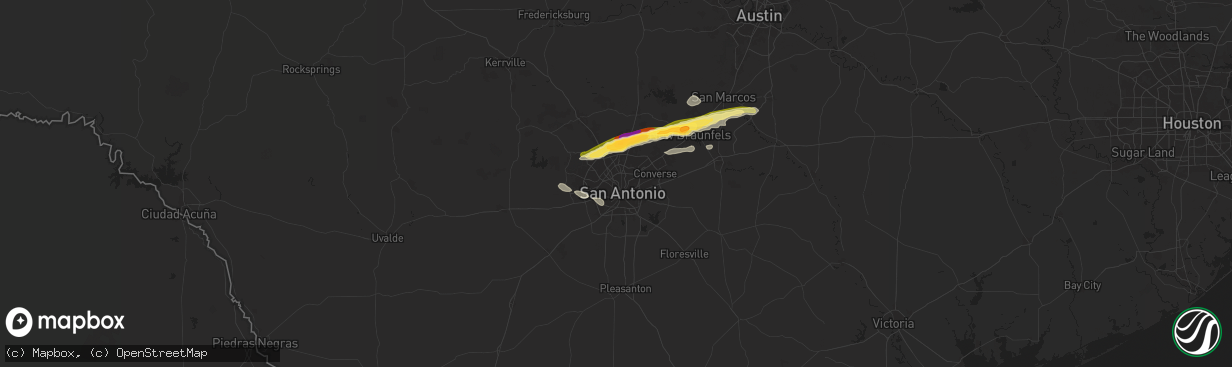
Hail Map in San Antonio, TX on April 20, 2024
The weather event in San Antonio, TX on April 20, 2024 includes Hail and Wind maps. 9 states and 254 cities were impacted and suffered possible damage. The total estimated number of properties impacted is 23,982.
Hail
Wind
23,982
Estimated number of impacted properties by a 1.00" hail or larger14,165
Estimated number of impacted properties by a 1.75" hail or larger0
Estimated number of impacted properties by a 2.50" hail or largerStorm reports in San Antonio, TX
San Antonio, TX
| Date | Description |
|---|---|
| 04/20/202412:32 AM CDT | A local report indicates 2.00 inch wind near 3 ESE Bulverde |
| 04/20/202412:30 AM CDT | A local report indicates 1.75 inch wind near 1 SW Timberwood Park |
| 04/20/202412:29 AM CDT | A local report indicates 1.25 inch wind near 2 SE Timberwood Park |
| 04/20/202412:28 AM CDT | Intersection of sparrow ridge and trinity ct; time estimated via radar. |
| 04/20/202412:25 AM CDT | A local report indicates 1.00 inch wind near 3 SE Timberwood Park |
| 04/20/202412:25 AM CDT | Intersection of hardy oak blvd and stone oak pkwy; time estimated via radar. |
| 04/20/202412:23 AM CDT | Up to 2 inch hail estimated at intersection of blanco rd and specht rd; time estimated via radar. |
| 04/20/202412:22 AM CDT | Intersection of winspirit and bobbins ridge; time estimated via radar. |
| 04/20/202412:18 AM CDT | Time estimated via radar. |
All States Impacted by Hail Map on April 20, 2024
All Cities Impacted by Hail Map on April 20, 2024
- Sanger, TX
- Aubrey, TX
- Valley View, TX
- Pilot Point, TX
- Gunter, TX
- Tioga, TX
- Celina, TX
- Delhi, LA
- Midlothian, TX
- Stanton, TX
- Tallulah, LA
- Waxahachie, TX
- Robert Lee, TX
- Newellton, LA
- Big Spring, TX
- Coahoma, TX
- Vicksburg, MS
- Welch, TX
- Wingate, TX
- Winters, TX
- Hobbs, NM
- Lamesa, TX
- Naples, TX
- Anson, TX
- Doddridge, AR
- Post, TX
- Tuscola, TX
- Merkel, TX
- Hamlin, TX
- Abilene, TX
- Buffalo Gap, TX
- Sweetwater, TX
- Pyote, TX
- Barstow, TX
- Tye, TX
- Clyde, TX
- Ovalo, TX
- Goldsboro, TX
- Baird, TX
- Lawn, TX
- Honoraville, AL
- Greenville, AL
- Luverne, AL
- Highland Home, AL
- Gaffney, SC
- Mooresboro, NC
- Blacksburg, SC
- Grady, AL
- Lapine, AL
- Clover, SC
- York, SC
- Rockingham, NC
- Hamlet, NC
- Marston, NC
- Mount Gilead, NC
- Smyrna, SC
- Goshen, AL
- Laurel Hill, NC
- New London, NC
- Troy, NC
- Rock Hill, SC
- Laurinburg, NC
- Candor, NC
- Canton, MS
- Madison, MS
- Maxton, NC
- Wagram, NC
- Biscoe, NC
- Star, NC
- Catawba, SC
- Lancaster, SC
- Red Springs, NC
- Pembroke, NC
- Bellville, TX
- Edgemoor, SC
- Norwood, NC
- Ellerbe, NC
- Shelby, NC
- Waxhaw, NC
- Lumberton, NC
- Fortson, GA
- Hamilton, GA
- Mullin, TX
- Fayetteville, NC
- Heath Springs, SC
- Hempstead, TX
- Cataula, GA
- Rochelle, GA
- Rebecca, GA
- Kershaw, SC
- Hope Mills, NC
- Fitzgerald, GA
- Jefferson, SC
- Pageland, SC
- Mount Croghan, SC
- Evergreen, NC
- Bladenboro, NC
- Bethune, SC
- Andrews, TX
- Fitzpatrick, AL
- Culloden, GA
- Kentwood, LA
- Whiteville, NC
- Clarkton, NC
- McBee, SC
- Greensburg, LA
- Grover, NC
- Chadbourn, NC
- Clarendon, NC
- Hardaway, AL
- Hartsville, SC
- Winnabow, NC
- Leland, NC
- McColl, SC
- Patrick, SC
- Roseland, LA
- Lumberton, MS
- Hallsboro, NC
- Mount Vernon, AL
- Montgomery, AL
- Lizella, GA
- Society Hill, SC
- Shannon, NC
- Atmore, AL
- Copperas Cove, TX
- Kempner, TX
- Ash, NC
- Pike Road, AL
- Mathews, AL
- Fort Hood, TX
- Macon, GA
- West Point, GA
- Nakina, NC
- Lake Waccamaw, NC
- Ovett, MS
- Rowland, NC
- Darlington, SC
- Richton, MS
- Laurel, MS
- Cecil, AL
- Sandersville, GA
- Supply, NC
- Bolivia, NC
- Waynesboro, MS
- Dillon, SC
- Latta, SC
- Milledgeville, GA
- Frisco City, AL
- Brewton, AL
- Marion, SC
- Buckatunna, MS
- State Line, MS
- Fork, SC
- Mullins, SC
- Ledbetter, TX
- Barksdale, TX
- Nichols, SC
- Warthen, GA
- Davisboro, GA
- Carmine, TX
- Rocksprings, TX
- Castleberry, AL
- Southport, NC
- Junction, TX
- Oak Island, NC
- Loris, SC
- Green Sea, SC
- Fruitdale, AL
- Chatom, AL
- Galivants Ferry, SC
- Camp Wood, TX
- Leakey, TX
- Deer Park, AL
- Aynor, SC
- Louisville, GA
- Avera, GA
- Longs, SC
- Tabor City, NC
- Conway, SC
- Little River, SC
- Rio Frio, TX
- Blenheim, SC
- McKenzie, AL
- Evergreen, AL
- Georgiana, AL
- Franklin, AL
- Whatley, AL
- Bolton, NC
- Cotulla, TX
- Forest Home, AL
- Myrtle Beach, SC
- Pine Apple, AL
- Encinal, TX
- Cerro Gordo, NC
- D Hanis, TX
- Hondo, TX
- Fort Deposit, AL
- Letohatchee, AL
- Hope Hull, AL
- Hayneville, AL
- Laredo, TX
- Freer, TX
- Rutledge, AL
- Dozier, AL
- Bandera, TX
- Mico, TX
- Troy, AL
- San Antonio, TX
- Brantley, AL
- Clinton, NC
- Elba, AL
- Rose Hill, NC
- Turkey, NC
- Magnolia, NC
- Jbsa Lackland, TX
- Georgetown, SC
- Teachey, NC
- Wallace, NC
- Willard, NC
- Gonzales, TX
- Helotes, TX
- New Braunfels, TX
- Pleasanton, TX
- Bulverde, TX
- Canyon Lake, TX
- Marion, TX
- Seguin, TX
- San Marcos, TX
- Cibolo, TX
- Schertz, TX
- Garland, NC
- Yoakum, TX
- Hallettsville, TX
- Hobson, TX
- Karnes City, TX
- Runge, TX
- Kingsbury, TX
- Harrells, NC
- Kenedy, TX
- Martindale, TX
- Nordheim, TX
- Edna, TX
- Yorktown, TX
- Goliad, TX
- Rosanky, TX
- Lockhart, TX
- Refugio, TX
- Victoria, TX
- Tivoli, TX
- Port Lavaca, TX
- Seadrift, TX
- Port O'Connor, TX
- Hemingway, SC
- Amite, LA


