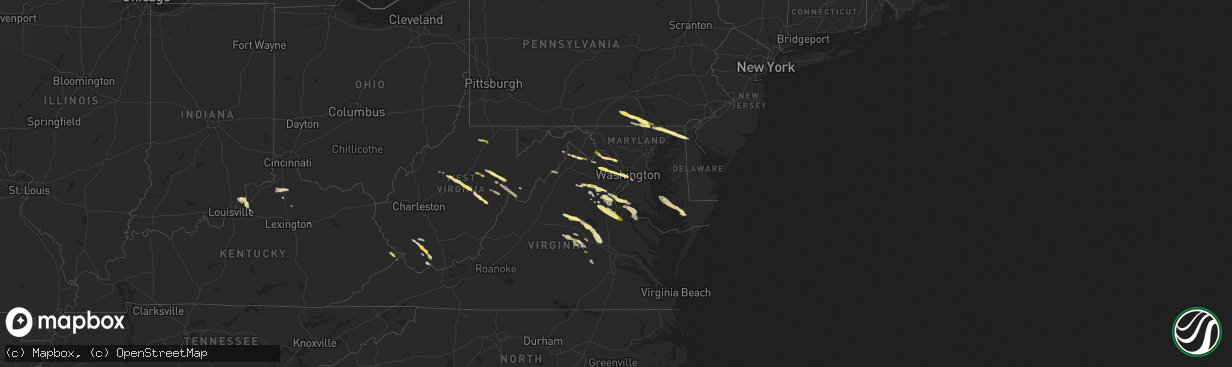
Hail Map in Maryland on April 15, 2024
The weather event in Maryland on April 15, 2024 includes Hail, Wind, and Tornado maps. 15 states and 620 cities were impacted and suffered possible damage. The total estimated number of properties impacted is 7,787.
Hail
Wind
Tornado
7,787
Estimated number of impacted properties by a 1.00" hail or larger0
Estimated number of impacted properties by a 1.75" hail or larger0
Estimated number of impacted properties by a 2.50" hail or largerStorm reports in Maryland
Maryland
| Date | Description |
|---|---|
| 04/15/20244:03 PM CDT | Cuckold creek |
| 04/15/20243:43 PM CDT | Us 301 bridge mdsha |
| 04/15/20243:43 PM CDT | A local report indicates 63 MPH wind near Us 301 Nb On Nmb At G-1 |
| 04/15/20243:43 PM CDT | A local report indicates 63 MPH wind near 4 NE Dahlgren |
| 04/15/20243:35 PM CDT | A tree was down in the bel alton area. |
| 04/15/20242:58 PM CDT | A local report indicates 1.00 inch wind near Charlestown |
| 04/15/20242:58 PM CDT | A local report indicates 1.00 inch wind near 3 NW North East |
| 04/15/20241:30 PM CDT | A local report indicates 1.00 inch wind near 3 ENE Dawsonville |
All States Impacted by Hail Map on April 15, 2024
Cities Impacted by Hail Map on April 15, 2024
- Fairmont, WV
- Winchester, VA
- High View, WV
- Berryville, VA
- Stephenson, VA
- Purcellville, VA
- Lovettsville, VA
- Waterford, VA
- Leesburg, VA
- Paeonian Springs, VA
- Dickerson, MD
- Wardensville, WV
- Beallsville, MD
- Poolesville, MD
- Boyds, MD
- Woodstock, VA
- Germantown, MD
- Coalton, WV
- Ellamore, WV
- Gaithersburg, MD
- Middleburg, VA
- Buckhannon, WV
- Carolina, WV
- Farmington, WV
- Worthington, WV
- Mabie, WV
- Norton, WV
- Beverly, WV
- Elkins, WV
- Aldie, VA
- Ashburn, VA
- Sterling, VA
- Glady, WV
- Herndon, VA
- Reston, VA
- Vienna, VA
- Oakton, VA
- Chantilly, VA
- Warrenton, VA
- French Creek, WV
- Tallmansville, WV
- Dunn Loring, VA
- Falls Church, VA
- Arlington, VA
- Adrian, WV
- Horner, WV
- Fort Myer, VA
- Midland, VA
- Catlett, VA
- Street, MD
- Pylesville, MD
- Whiteford, MD
- Washington, DC
- Round Hill, VA
- Bluemont, VA
- Amissville, VA
- Marshall, VA
- Gardners, PA
- Biglerville, PA
- Aspers, PA
- Darlington, MD
- Port Deposit, MD
- Conowingo, MD
- East Berlin, PA
- New Oxford, PA
- York Springs, PA
- Gettysburg, PA
- Abbottstown, PA
- Perryville, MD
- Havre De Grace, MD
- Alexandria, VA
- North East, MD
- Charlestown, MD
- Hanover, PA
- Spring Grove, PA
- Fort Washington, MD
- Temple Hills, MD
- Stafford, VA
- Mill Creek, WV
- Valley Bend, WV
- Elkton, MD
- Chesapeake City, MD
- Middletown, DE
- Nokesville, VA
- Nanjemoy, MD
- Quantico, VA
- Triangle, VA
- Jeffersonton, VA
- Remington, VA
- Parkton, MD
- New Freedom, PA
- White Hall, MD
- Freeland, MD
- Grantsville, WV
- Seven Valleys, PA
- Glen Rock, PA
- Washington, VA
- Barboursville, VA
- Ruckersville, VA
- Welcome, MD
- Charlottesville, VA
- Stewartstown, PA
- Shrewsbury, PA
- Newark, DE
- Normantown, WV
- Circleville, WV
- Bartow, WV
- Arnoldsburg, WV
- Bealeton, VA
- Cedarville, WV
- Gassaway, WV
- Exchange, WV
- Gordonsville, VA
- Rosedale, WV
- King George, VA
- Oxon Hill, MD
- Blue Grass, VA
- Franklin, WV
- Naval Anacost Annex, DC
- Taylors Island, MD
- Madison, MD
- Newburg, MD
- Goldvein, VA
- Fredericksburg, VA
- Railroad, PA
- Dahlgren, VA
- Glenville, PA
- Sumerduck, VA
- Richardsville, VA
- Huttonsville, WV
- Sutton, WV
- Flatwoods, WV
- Colonial Beach, VA
- Issue, MD
- Church Creek, MD
- Louisa, VA
- Woolford, MD
- Durbin, WV
- Spotsylvania, VA
- Lignum, VA
- Elkwood, VA
- Diana, WV
- Cowen, WV
- Fawn Grove, PA
- New Park, PA
- Garden City, TX
- Cobb Island, MD
- Montross, VA
- Cambridge, MD
- Crapo, MD
- Mineral, VA
- Big Spring, TX
- Port Royal, VA
- Woodford, VA
- Rappahannock Academy, VA
- Webster Springs, WV
- Colorado City, TX
- Westbrook, TX
- Vienna, MD
- Keswick, VA
- Nanticoke, MD
- Princess Anne, MD
- Tyaskin, MD
- Slatyfork, WV
- Valley Head, WV
- Bergoo, WV
- Bumpass, VA
- Bivalve, MD
- Palmyra, VA
- Scottsville, VA
- Snyder, TX
- Hermleigh, TX
- Coahoma, TX
- Montpelier, VA
- Bremo Bluff, VA
- Glen Allen, VA
- Quantico, MD
- Rockville, VA
- Beaverdam, VA
- Fork Union, VA
- Columbia, VA
- Goochland, VA
- Kents Store, VA
- Whitman, NE
- Aspermont, TX
- Hermosa, SD
- Sundance, WY
- Beulah, WY
- Sandy Hook, VA
- Gum Spring, VA
- Earlysville, VA
- Old Glory, TX
- Valentine, NE
- Kilgore, NE
- Crookston, NE
- Paducah, TX
- Custer, SD
- Charlestown, IN
- Thermopolis, WY
- Edgemont, SD
- Mullen, NE
- Aladdin, WY
- Belle Fourche, SD
- Wanblee, SD
- Kadoka, SD
- Saint Francis, SD
- Hill City, SD
- Cody, NE
- Cartersville, VA
- Goshen, KY
- Westport, KY
- La Grange, KY
- Newcastle, WY
- Hot Springs, SD
- Rapid City, SD
- Seymour, TX
- Crowell, TX
- Piedmont, SD
- Long Valley, SD
- Black Hawk, SD
- Parmelee, SD
- Keystone, SD
- Spearfish, SD
- Norris, SD
- White River, SD
- Sturgis, SD
- Powhatan, VA
- Quanah, TX
- Box Elder, SD
- Ellsworth Afb, SD
- Wall, SD
- Quinn, SD
- Chillicothe, TX
- Eldorado, OK
- Wood Lake, NE
- Wasta, SD
- Buckner, KY
- Tuthill, SD
- Moseley, VA
- Cyclone, WV
- Philip, SD
- Olustee, OK
- Altus, OK
- Glen Fork, WV
- Brenton, WV
- Pineville, WV
- Jesse, WV
- Oceana, WV
- Matheny, WV
- Elmer, OK
- Davin, WV
- Martin, SD
- Mission, SD
- Crestwood, KY
- Belvidere, SD
- Saulsville, WV
- New Richmond, WV
- Herndon, WV
- Williamstown, KY
- Dry Ridge, KY
- Ransom, KY
- Phelps, KY
- Allen, SD
- Jonesville, KY
- New Underwood, SD
- Owenton, KY
- Wood, SD
- Midland, SD
- Shelbyville, KY
- Simpsonville, KY
- Scenic, SD
- Northfork, WV
- Welch, WV
- Timber Lake, SD
- Fairburn, SD
- Anawalt, WV
- Murdo, SD
- Corinth, KY
- Kimper, KY
- Pinsonfork, KY
- Owanka, SD
- Buffalo Gap, SD
- Hurley, VA
- Draper, SD
- Caputa, SD
- Hanston, KS
- Jetmore, KS
- Falmouth, KY
- Ness City, KS
- Cynthiana, KY
- Sadieville, KY
- Fort Pierre, SD
- Pierre, SD
- Pierce, NE
- Osmond, NE
- Plainview, NE
- Mount Sterling, KY
- Okaton, SD
- Royal, NE
- Winnetoon, NE
- Orchard, NE
- Collyer, KS
- Hoxie, KS
- Creighton, NE
- Verdigre, NE
- Morland, KS
- Quinter, KS
- Bloomfield, NE
- Norton, KS
- Lenora, KS
- Almena, KS
- Chadron, NE
- Long Island, KS
- Prairie View, KS
- Beaver City, NE
- Stamford, NE
- Oxford, NE
- Center, NE
- Hayes, SD
- Dighton, KS
- Montrose, SD
- Ogallah, KS
- Waukomis, OK
- Watonga, OK
- Edison, NE
- Ellis, KS
- Damar, KS
- Stockton, KS
- Arapahoe, NE
- Kingfisher, OK
- Omega, OK
- Loyal, OK
- Humboldt, SD
- Bogue, KS
- Logan, KS
- Phillipsburg, KS
- Glade, KS
- Hoskins, NE
- Norfolk, NE
- Pender, NE
- Walthill, NE
- Enid, OK
- Rosalie, NE
- Salem, SD
- Randolph, NE
- Drummond, OK
- Wakefield, NE
- Wayne, NE
- Niobrara, NE
- Wisner, NE
- Canova, SD
- Winfred, SD
- Winnebago, NE
- Thurston, NE
- Bancroft, NE
- Beemer, NE
- Hunter, OK
- Kremlin, OK
- Hartford, SD
- Burke, SD
- Emerson, NE
- Hubbard, NE
- Avon, SD
- Lamont, OK
- Medford, OK
- Hennessey, OK
- Bison, OK
- Lexington, NE
- Elwood, NE
- Cozad, NE
- Naponee, NE
- Tyndall, SD
- Jackson, NE
- South Sioux City, NE
- Sioux City, IA
- North Sioux City, SD
- Douglas, OK
- Kensington, KS
- Homer, NE
- Jefferson, SD
- Dakota City, NE
- Republican City, NE
- Smith Center, KS
- Riverton, NE
- Wilcox, NE
- Hildreth, NE
- Bloomington, NE
- Franklin, NE
- Holdrege, NE
- Merrill, IA
- Athol, KS
- Inavale, NE
- Lebanon, KS
- Red Cloud, NE
- Campbell, NE
- Bladen, NE
- Upland, NE
- Alva, OK
- Freedom, OK
- Coldwater, KS
- Lake City, KS
- Hornick, IA
- Westfield, IA
- Axtell, NE
- Funk, NE
- Colome, SD
- Winner, SD
- Blue Hill, NE
- Roseland, NE
- Holstein, NE
- Ayr, NE
- Minden, NE
- Sumner, NE
- Eddyville, NE
- Oconto, NE
- Danbury, IA
- Mapleton, IA
- Smithland, IA
- Oto, IA
- Hinton, IA
- Anthon, IA
- Superior, NE
- Lawrence, NE
- Guide Rock, NE
- Glenvil, NE
- Nelson, NE
- Deweese, NE
- Hastings, NE
- Fairfield, NE
- Juniata, NE
- Edgar, NE
- Oak, NE
- Clay Center, NE
- Inland, NE
- Correctionville, IA
- Battle Creek, IA
- Gibbon, NE
- Kearney, NE
- Charter Oak, IA
- Denison, IA
- Eagle Butte, SD
- Davenport, NE
- Harvard, NE
- Trumbull, NE
- Gettysburg, SD
- Ida Grove, IA
- Pleasanton, NE
- Kingsley, IA
- Pierson, IA
- Schleswig, IA
- Otis, KS
- Bison, KS
- Saronville, NE
- Ong, NE
- Carleton, NE
- Kenesaw, NE
- Heartwell, NE
- Riverdale, NE
- Shelton, NE
- Alda, NE
- Wood River, NE
- Doniphan, NE
- Chapman, NE
- Ravenna, NE
- Cairo, NE
- Grand Island, NE
- Phillips, NE
- Loup City, NE
- Hazard, NE
- Dannebrog, NE
- Boelus, NE
- Ashton, NE
- Farwell, NE
- Litchfield, NE
- Saint Libory, NE
- Rockville, NE
- Giltner, NE
- Aurora, NE
- Geneva, NE
- Shickley, NE
- Sutton, NE
- Kennebec, SD
- Wessington Springs, SD
- Bruning, NE
- Strang, NE
- Saint Paul, NE
- Hampton, NE
- Marquette, NE
- Central City, NE
- Henderson, NE
- Grafton, NE
- Palmer, NE
- Elba, NE
- Arcadia, NE
- Scotia, NE
- North Loup, NE
- Archer, NE
- Wolbach, NE
- Ord, NE
- Holstein, IA
- Wessington, SD
- Manilla, IA
- Elk Point, SD
- Cushing, IA
- Corsicana, TX
- Westside, IA
- Vail, IA
- Lebanon, SD
- Fairmont, NE
- McCool Junction, NE
- York, NE
- Bradshaw, NE
- Ohiowa, NE
- Hordville, NE
- Greeley, NE
- Olpe, KS
- Emporia, KS
- Neosho Rapids, KS
- Breda, IA
- Onida, SD
- Kiron, IA
- Deloit, IA
- Tobias, NE
- Exeter, NE
- Milligan, NE
- Clarks, NE
- Polk, NE
- Elyria, NE
- Burwell, NE
- Comstock, NE
- Spalding, NE
- Primrose, NE
- Ericson, NE
- Wall Lake, IA
- Piedmont, KS
- Odebolt, IA
- Lincolnville, KS
- Eureka, KS
- Bartlett, NE
- Beaver Crossing, NE
- Garland, NE
- Crete, NE
- Milford, NE
- Seward, NE
- Malcolm, NE
- Waco, NE
- Dorchester, NE
- Benedict, NE
- Gresham, NE
- Lincoln, NE
- Western, NE
- Utica, NE
- Pleasant Dale, NE
- Stromsburg, NE
- Staplehurst, NE
- Friend, NE
- Goehner, NE
- Cordova, NE
- Denton, NE
- Bee, NE
- Harrold, SD
- Petersburg, NE
- Early, IA
- Lake View, IA
- Highmore, SD
- Holabird, SD
- Storm Lake, IA
- Elgin, NE
- Clearwater, NE
- Alta, IA
- Nemaha, IA
- Sac City, IA
- Lynch, NE
- Newell, IA
- Tolstoy, SD
- Onaka, SD
- Hoven, SD
- Bowdle, SD
- Roscoe, SD
- Albert City, IA
- Neligh, NE
- Burr Oak, KS
- Meadow Grove, NE
- Marathon, IA
- Mankato, KS
- Hazleton, IA
- Fairbank, IA
- Independence, IA
- Reliance, SD
- Lower Brule, SD
- Brunswick, NE
- Oelwein, IA
- Dodge, NE
- Lyons, NE
- West Point, NE
- Onawa, IA
- Ponca, NE
- Lebo, KS
- Oakland, NE
- Carbondale, KS
- Overbrook, KS
- Reading, KS
- Osage City, KS
- Melvern, KS
- Lyndon, KS
- Scranton, KS
- Vassar, KS
- Scribner, NE
- Berryton, KS
- Stanton, NE
- Lecompton, KS
- Howells, NE
- Rogers, NE
- Schuyler, NE
- Clarkson, NE
- Pilger, NE
- Silver Creek, NE
- Delia, KS
- Le Mars, IA
- Capon Bridge, WV


