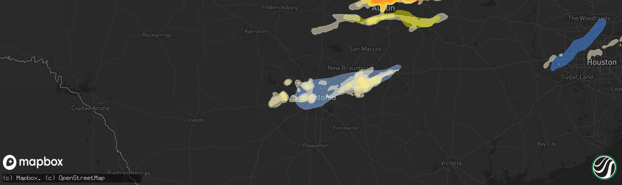
Hail Map in San Antonio, TX on April 9, 2024
The weather event in San Antonio, TX on April 9, 2024 includes Hail, Wind, and Tornado maps. 4 states and 527 cities were impacted and suffered possible damage. The total estimated number of properties impacted is 5,487.
Hail
Wind
Tornado
5,487
Estimated number of impacted properties by a 1.00" hail or larger0
Estimated number of impacted properties by a 1.75" hail or larger0
Estimated number of impacted properties by a 2.50" hail or largerStorm reports in San Antonio, TX
San Antonio, TX
| Date | Description |
|---|---|
| 04/08/202410:40 PM CDT | Measured at ksat. |
| 04/08/202410:40 PM CDT | Wind gusts to 62 mph at the san antonio international airport. |
| 04/08/202410:35 PM CDT | Wind gust to 58 mph at kelly field. |
| 04/08/202410:24 PM CDT | Report from mping quarter. |
| 04/08/202410:22 PM CDT | A local report indicates 1.00 inch wind near 6 WSW Sea World |
| 04/08/202410:13 PM CDT | Report from mping quarter. |
| 04/08/202410:02 PM CDT | Up to 1 inch in diameter hail on redbird ranch northeast of castroville. Time estimated via radar. |
All States Impacted by Hail Map on April 9, 2024
All Cities Impacted by Hail Map on April 9, 2024
- Snyder, TX
- Justiceburg, TX
- Girard, TX
- Frankston, TX
- Palestine, TX
- Jayton, TX
- Spur, TX
- Aspermont, TX
- Dickens, TX
- Stonewall, LA
- Frierson, LA
- Shreveport, LA
- Old Glory, TX
- Paducah, TX
- Elgin, TX
- Austin, TX
- Roscoe, TX
- Seymour, TX
- Thrall, TX
- Sweetwater, TX
- Thorndale, TX
- Lexington, TX
- Buckholts, TX
- Cameron, TX
- Davilla, TX
- Rockdale, TX
- Hutto, TX
- Taylor, TX
- Georgetown, TX
- Round Rock, TX
- Pflugerville, TX
- Roby, TX
- Granger, TX
- Merkel, TX
- Benjamin, TX
- Munday, TX
- Knox City, TX
- Lott, TX
- Jarrell, TX
- Bartlett, TX
- Salado, TX
- Anson, TX
- Rule, TX
- Stamford, TX
- Sylvester, TX
- Hawley, TX
- Rochester, TX
- Belton, TX
- Lampasas, TX
- Burnet, TX
- Chilton, TX
- Eddy, TX
- Moody, TX
- Troy, TX
- Temple, TX
- Haskell, TX
- Llano, TX
- Lorena, TX
- O'Brien, TX
- McCaulley, TX
- Weinert, TX
- McGregor, TX
- Abilene, TX
- Avoca, TX
- Kingsland, TX
- Mount Calm, TX
- Axtell, TX
- Lueders, TX
- Goree, TX
- Marble Falls, TX
- Throckmorton, TX
- Riesel, TX
- Killeen, TX
- Mart, TX
- Albany, TX
- Harker Heights, TX
- Lockney, TX
- Trinidad, TX
- Kerens, TX
- Malakoff, TX
- Corsicana, TX
- Bertram, TX
- Athens, TX
- Bruceville, TX
- Woodway, TX
- Maryneal, TX
- Robert Lee, TX
- Mabank, TX
- Eustace, TX
- Blackwell, TX
- Olney, TX
- Holliday, TX
- Wichita Falls, TX
- Lometa, TX
- Windthorst, TX
- Archer City, TX
- Scotland, TX
- Silverton, TX
- Quitaque, TX
- Clarendon, TX
- Gatesville, TX
- Evant, TX
- Henrietta, TX
- Floydada, TX
- Hamilton, TX
- Purmela, TX
- Jonesboro, TX
- Laneville, TX
- Mount Enterprise, TX
- Henderson, TX
- Long Branch, TX
- Carthage, TX
- Gary, TX
- Garrison, TX
- Timpson, TX
- Beckville, TX
- Keatchie, LA
- Grand Cane, LA
- Logansport, LA
- Gloster, LA
- Mansfield, LA
- Brady, TX
- Elm Grove, LA
- Bossier City, LA
- Shelbyville, TX
- Mason, TX
- Voca, TX
- Converse, LA
- Ringgold, LA
- Fredonia, TX
- San Saba, TX
- Pleasant Hill, LA
- Pelican, LA
- Heflin, LA
- Manor, TX
- Pontotoc, TX
- Cherokee, TX
- Bienville, LA
- Coushatta, LA
- Marthaville, LA
- Jamestown, LA
- Castor, LA
- Valley Spring, TX
- Saline, LA
- Campti, LA
- Simsboro, LA
- Arcadia, LA
- Ruston, LA
- Quitman, LA
- Art, TX
- Goldonna, LA
- Choudrant, LA
- Grambling, LA
- Tow, TX
- Calhoun, LA
- Downsville, LA
- Coupland, TX
- Eros, LA
- West Monroe, LA
- Dodson, LA
- Dripping Springs, TX
- Bluffton, TX
- Monroe, LA
- Rayville, LA
- Sikes, LA
- Fredericksburg, TX
- Olla, LA
- Oak Ridge, LA
- Columbia, LA
- Doss, TX
- Grayson, LA
- Kempner, TX
- Briggs, TX
- Woodville, TX
- Kelly, LA
- Round Mountain, TX
- Spicewood, TX
- Willow City, TX
- Leander, TX
- Nacogdoches, TX
- Colmesneil, TX
- Childress, TX
- Robeline, LA
- Doyline, LA
- Florence, TX
- Vicksburg, MS
- Sterlington, LA
- Horseshoe Bay, TX
- Jasper, TX
- Valley Park, MS
- Livingston, TX
- Liberty, TX
- Redwood, MS
- Tallulah, LA
- Johnson City, TX
- Liberty Hill, TX
- Warren, TX
- Hye, TX
- Cleveland, TX
- Broaddus, TX
- Bolton, MS
- Edwards, MS
- Quanah, TX
- Chester, TX
- Satartia, MS
- Bronson, TX
- Pineland, TX
- Cedar Park, TX
- Raymond, MS
- Flora, MS
- Bentonia, MS
- Chillicothe, TX
- Holland, TX
- Blanco, TX
- Boerne, TX
- Saratoga, TX
- Rogers, TX
- Little River Academy, TX
- Jackson, MS
- Madison, MS
- Clinton, MS
- Kendalia, TX
- Hull, TX
- Ridgeland, MS
- Yazoo City, MS
- Driftwood, TX
- Florien, LA
- Manchaca, TX
- Buda, TX
- Fred, TX
- Hillister, TX
- Canton, MS
- Kountze, TX
- Belmont, LA
- Batson, TX
- Tougaloo, MS
- Brandon, MS
- Davidson, OK
- Frederick, OK
- Elmer, OK
- Vernon, TX
- Odell, TX
- Tipton, OK
- Eldorado, OK
- Del Valle, TX
- Olustee, OK
- Wimberley, TX
- Pearl, MS
- Flowood, MS
- Burlington, TX
- Hondo, TX
- D Hanis, TX
- Haughton, LA
- Headrick, OK
- Altus, OK
- Hollister, OK
- Cedar Creek, TX
- Bergheim, TX
- Spring Branch, TX
- Bulverde, TX
- Sabinal, TX
- Pelahatchie, MS
- Lena, MS
- Rosebud, TX
- Bastrop, TX
- Harrold, TX
- Loveland, OK
- Grandfield, OK
- Snyder, OK
- Morton, MS
- Chattanooga, OK
- Walters, OK
- Mountain Park, OK
- Indiahoma, OK
- Batesville, TX
- Spurger, TX
- Castroville, TX
- Paige, TX
- Devol, OK
- Forest, MS
- Smithville, TX
- Carthage, MS
- Faxon, OK
- Cache, OK
- Canyon Lake, TX
- Florence, MS
- Rio Medina, TX
- Mico, TX
- San Antonio, TX
- Helotes, TX
- Braxton, MS
- McDade, TX
- Big Wells, TX
- Asherton, TX
- Carrizo Springs, TX
- Laredo, TX
- Yancey, TX
- Lawton, OK
- Geronimo, OK
- Encinal, TX
- Walnut Grove, MS
- Philadelphia, MS
- Union, MS
- Sebastopol, MS
- Cotulla, TX
- Catarina, TX
- Kirbyville, TX
- Call, TX
- Devine, TX
- Conehatta, MS
- Fort Sill, OK
- Medicine Park, OK
- Moore, TX
- Bon Wier, TX
- Bremond, TX
- Jbsa Lackland, TX
- La Coste, TX
- Reagan, TX
- Newton, TX
- Pearsall, TX
- Pulaski, MS
- Caldwell, TX
- Dime Box, TX
- Elgin, OK
- Marlow, OK
- Rush Springs, OK
- Duncan, OK
- Fletcher, OK
- Marlin, TX
- Natalia, TX
- Poteet, TX
- Lytle, TX
- Merryville, LA
- Lincoln, TX
- Crystal City, TX
- Somerville, TX
- Lake, MS
- Moscow, TX
- Corrigan, TX
- Converse, TX
- Somerset, TX
- Kosse, TX
- Burkeville, TX
- Adkins, TX
- Lawrence, MS
- Jbsa Ft Sam Houston, TX
- Von Ormy, TX
- Schertz, TX
- Universal City, TX
- Jbsa Randolph, TX
- Saint Hedwig, TX
- Cibolo, TX
- Seguin, TX
- Marion, TX
- New Braunfels, TX
- McQueeney, TX
- Bradley, OK
- Lindsay, OK
- Franklin, TX
- Decatur, MS
- Dilley, TX
- La Vernia, TX
- Thornton, TX
- Evans, LA
- Deridder, LA
- Lyons, TX
- Kingsbury, TX
- Fowlerton, TX
- Snook, TX
- Pleasanton, TX
- Elmendorf, TX
- Floresville, TX
- Jewett, TX
- Marquez, TX
- Charlotte, TX
- Diboll, TX
- Lufkin, TX
- Maysville, OK
- Wayne, OK
- Tilden, TX
- Pauls Valley, OK
- Giddings, TX
- Navasota, TX
- College Station, TX
- Jourdanton, TX
- Luling, TX
- Donie, TX
- Paoli, OK
- Leesville, TX
- Nixon, TX
- Purcell, OK
- Buffalo, TX
- Wanette, OK
- Byars, OK
- Lexington, OK
- Calliham, TX
- Gonzales, TX
- Cost, TX
- Whitsett, TX
- Three Rivers, TX
- Karnes City, TX
- Moulton, TX
- Leesville, LA
- Smiley, TX
- Westhoff, TX
- Hobson, TX
- Huntington, TX
- Zavalla, TX
- Cuero, TX
- New Llano, LA
- Flatonia, TX
- Schulenburg, TX
- Fort Polk, LA
- Weimar, TX
- Yoakum, TX
- East Bernard, TX
- La Grange, TX
- Edna, TX
- Louise, TX
- El Campo, TX
- Wallis, TX
- Fayetteville, TX
- Eagle Lake, TX
- Fulshear, TX
- Brookshire, TX
- Katy, TX
- Wharton, TX
- Mayersville, MS
- Sondheimer, LA
- Cypress, TX
- Newellton, LA
- Rolling Fork, MS
- Tomball, TX
- Copperas Cove, TX
- Houston, TX
- Onalaska, TX
- Crosby, TX
- Humble, TX
- Huffman, TX
- Ragley, LA
- Reeves, LA
- Kinder, LA
- Dry Creek, LA
- Napoleonville, LA
- Erath, LA
- Mittie, LA
- Oberlin, LA
- New Iberia, LA
- Delcambre, LA
- Pitkin, LA
- Youngsville, LA
- Abbeville, LA
- Broussard, LA
- Lafayette, LA
- Breaux Bridge, LA
- Saint Martinville, LA
- Crowley, LA
- Morse, LA
- Estherwood, LA
- Oakdale, LA
- Buna, TX
- Bandera, TX
- Rayne, LA
- Iota, LA
- Branch, LA
- Church Point, LA
- Egan, LA
- Eunice, LA
- Anahuac, TX
- Port Bolivar, TX
- Port Arthur, TX
- Winnie, TX
- Sabine Pass, TX
- Beaumont, TX
- Cameron, LA
- Groves, TX
- Bridge City, TX
- Vinton, LA
- Hackberry, LA
- Sulphur, LA
- Dequincy, LA
- Orange, TX
- Starks, LA
- Deweyville, TX
- Vidor, TX
- Port Neches, TX
- China, TX
- Lumberton, TX
- Nederland, TX
- Hamshire, TX
- Opelousas, LA
- Ville Platte, LA
- Lake Charles, LA
- Westlake, LA
- Grosse Tete, LA
- Maringouin, LA
- Bell City, LA
- Lacassine, LA
- Iowa, LA
- Jennings, LA
- Lake Arthur, LA
- Elton, LA
- Welsh, LA
- Rosedale, LA
- Washington, LA
- Richmond, TX
- Spring, TX
- Porter, TX
- Conroe, TX
- Damon, TX
- Rosharon, TX
- Alvin, TX
- Santa Fe, TX
- Dickinson, TX
- Texas City, TX
- La Marque, TX
- Bacliff, TX
- League City, TX
- Missouri City, TX
- Manvel, TX
- Pearland, TX
- Friendswood, TX
- Webster, TX
- Devers, TX
- Sour Lake, TX
- Silsbee, TX
- Nome, TX


