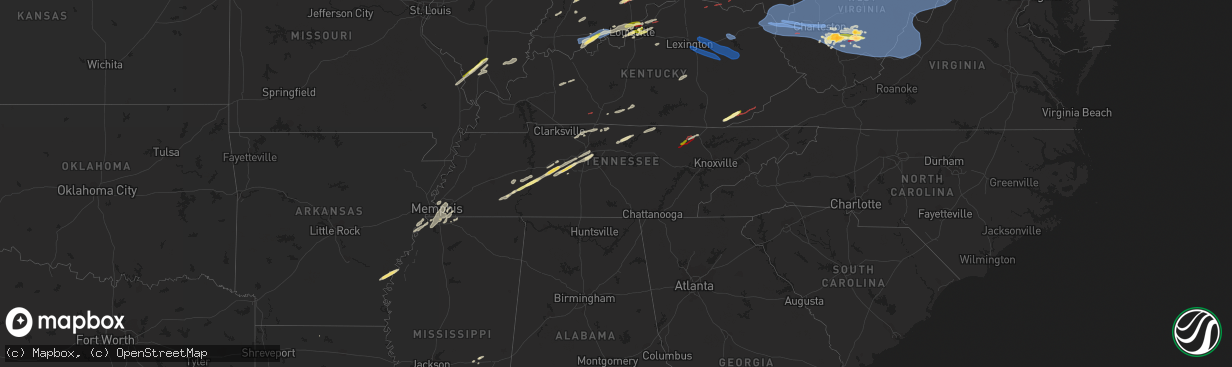
Hail Map in Tennessee on April 2, 2024
The weather event in Tennessee on April 2, 2024 includes Wind, Tornado, and Hail maps. 15 states and 706 cities were impacted and suffered possible damage. The total estimated number of properties impacted is 1,238.
Wind
Tornado
Hail
1,238
Estimated number of impacted properties by a 1.00" hail or larger0
Estimated number of impacted properties by a 1.75" hail or larger0
Estimated number of impacted properties by a 2.50" hail or largerStorm reports in Tennessee
Tennessee
| Date | Description |
|---|---|
| 04/02/20246:30 PM CDT | About 1...300 customers without power mainly in the cross plains area and west of springfield. |
| 04/02/20246:30 PM CDT | Tree down at jernigan road and archer road near cross plains. Time estimated via radar. |
| 04/02/20246:30 PM CDT | Tree down at blackwood road and wilks road in springfield. Time estimated from radar. |
| 04/02/20244:30 PM CDT | Tornado spotted along hwy 27. |
| 04/02/20244:20 PM CDT | Heavy damage reported to schuberts funeral home. |
| 04/02/202411:43 AM CDT | Large trees uprooted on hill rd near granbery elementary school. |
| 04/02/202411:43 AM CDT | Large trees uprooted on hill rd near granbery elementary school. ( |
| 04/02/202410:06 AM CDT | A local report indicates 1.00 inch wind near 4 ENE Decaturville |
| 04/02/20248:55 AM CDT | Large tree snapped and minor shingle damage in brazil community. |
| 04/02/20248:05 AM CDT | Tree down across road at sycamore view rd and main st. |
| 04/02/20248:05 AM CDT | Corrects previous hail report from 2 wsw bartlett. Tree down across road at sycamore view rd and main st. |
All States Impacted by Hail Map on April 2, 2024
Cities Impacted by Hail Map on April 2, 2024
- Watson, AR
- Brickeys, AR
- Hughes, AR
- Gunnison, MS
- Tunica, MS
- Lake Cormorant, MS
- Robinsonville, MS
- Bernice, LA
- Hernando, MS
- Nesbit, MS
- Snow Lake, AR
- Duncan, MS
- Olive Branch, MS
- Southaven, MS
- Walls, MS
- Memphis, TN
- Horn Lake, MS
- Byhalia, MS
- Cordova, TN
- Collierville, TN
- Germantown, TN
- Paris, KY
- Winchester, KY
- Mount Sterling, KY
- Lexington, KY
- Richmond, KY
- Irvine, KY
- Waco, KY
- Clay City, KY
- Jeffersonville, KY
- Stanton, KY
- Morehead, KY
- Salt Lick, KY
- Hillsboro, KY
- Owingsville, KY
- Means, KY
- Frenchburg, KY
- Ravenna, KY
- Slade, KY
- Wellington, KY
- Denniston, KY
- Campton, KY
- Ezel, KY
- Hazel Green, KY
- Kirbyville, TX
- Russell, KY
- Pedro, OH
- Ironton, OH
- Worthington, KY
- Flatwoods, KY
- Ashland, KY
- Kitts Hill, OH
- Willow Wood, OH
- South Point, OH
- Catlettsburg, KY
- Kenova, WV
- Prichard, WV
- Chesapeake, OH
- Ceredo, WV
- Huntington, WV
- Argillite, KY
- Rush, KY
- Grayson, KY
- Greenup, KY
- Fort Gay, WV
- Wayne, WV
- Louisa, KY
- Denton, KY
- East Lynn, WV
- Genoa, WV
- Lavalette, WV
- Branchland, WV
- Barboursville, WV
- Scottown, OH
- Proctorville, OH
- Ona, WV
- Glenwood, WV
- Apple Grove, WV
- Crown City, OH
- Gallipolis, OH
- West Hamlin, WV
- Waterloo, OH
- Salt Rock, WV
- Lesage, WV
- Milton, WV
- Ashton, WV
- Patriot, OH
- Newton, TX
- Harrisburg, IL
- Bethel Springs, TN
- Finger, TN
- Griffithsville, WV
- Midkiff, WV
- Culloden, WV
- Spurlockville, WV
- Hurricane, WV
- Ranger, WV
- Alkol, WV
- Myra, WV
- Hamlin, WV
- Eleanor, WV
- Yawkey, WV
- Scott Depot, WV
- Red House, WV
- Sod, WV
- Winfield, WV
- Saint Albans, WV
- Fraziers Bottom, WV
- Buffalo, WV
- Sardis, TN
- Burkeville, TX
- Evans, LA
- Deridder, LA
- Lexington, TN
- Merryville, LA
- Leesville, LA
- Enville, TN
- Reagan, TN
- Tornado, WV
- Sumerco, WV
- Julian, WV
- Ridgeview, WV
- Alum Creek, WV
- Nitro, WV
- Charleston, WV
- Ashford, WV
- Poca, WV
- Dunbar, WV
- Racine, WV
- Hernshaw, WV
- Bloomingrose, WV
- Comfort, WV
- Orgas, WV
- South Charleston, WV
- Cabin Creek, WV
- Winifrede, WV
- Nellis, WV
- Seth, WV
- Costa, WV
- Peytona, WV
- Eskdale, WV
- Tad, WV
- Elkview, WV
- Belle, WV
- Leon, WV
- Liberty, WV
- Darden, TN
- Parsons, TN
- Decaturville, TN
- Fort Polk, LA
- Scotts Hill, TN
- Bath Springs, TN
- Foster, WV
- Miami, WV
- Drybranch, WV
- East Bank, WV
- Glasgow, WV
- Blount, WV
- Cedar Grove, WV
- Hansford, WV
- Gallagher, WV
- London, WV
- Hugheston, WV
- Mammoth, WV
- Montgomery, WV
- Handley, WV
- Clendenin, WV
- Pratt, WV
- Kenna, WV
- Glen, WV
- Smithers, WV
- Swiss, WV
- Bickmore, WV
- Indore, WV
- Procious, WV
- Dixie, WV
- Powellton, WV
- Maysel, WV
- Pond Gap, WV
- Bomont, WV
- Wallback, WV
- Mount Carbon, WV
- Kimberly, WV
- Clay, WV
- Lizemores, WV
- Belva, WV
- Fayetteville, WV
- Kanawha Falls, WV
- Scarbro, WV
- Kincaid, WV
- Robson, WV
- Gauley Bridge, WV
- Linden, TN
- Pitkin, LA
- Mount Hope, WV
- Oak Hill, WV
- Ansted, WV
- Victor, WV
- Summersville, WV
- Drennen, WV
- Duck, WV
- Hico, WV
- Lansing, WV
- Glen Jean, WV
- Lookout, WV
- Thurmond, WV
- Edmond, WV
- Centerville, TN
- Monroe City, IN
- Lobelville, TN
- Wheatland, IN
- Washington, IN
- Nunnelly, TN
- Birch River, WV
- Dille, WV
- Frametown, WV
- Danese, WV
- Mount Lookout, WV
- Camden On Gauley, WV
- Calvin, WV
- Mount Nebo, WV
- Erbacon, WV
- Rainelle, WV
- Nallen, WV
- Quinwood, WV
- Tioga, WV
- Cowen, WV
- Craigsville, WV
- Pool, WV
- Nettie, WV
- Canvas, WV
- Leivasy, WV
- Fenwick, WV
- Webster Springs, WV
- Upperglade, WV
- Richwood, WV
- Charmco, WV
- Rupert, WV
- Meadow Bridge, WV
- Renick, WV
- Maxwelton, WV
- Crawley, WV
- Hillsboro, WV
- Smoot, WV
- Williamsburg, WV
- Alderson, WV
- Grassy Meadows, WV
- Asbury, WV
- Lewisburg, WV
- Montgomery, IN
- Odon, IN
- Loogootee, IN
- Duck River, TN
- Lyles, TN
- Crane, IN
- Frankford, WV
- White Sulphur Springs, WV
- Marlinton, WV
- Slatyfork, WV
- Cass, WV
- Valley Head, WV
- Buckeye, WV
- Primm Springs, TN
- Bloomfield, IN
- Springville, IN
- Owensburg, IN
- Bloomington, IN
- Troy, IN
- Lewisport, KY
- Tell City, IN
- Evanston, IN
- Grandview, IN
- Fairview, TN
- Bon Aqua, TN
- Covington, VA
- Dunmore, WV
- Hot Springs, VA
- Warm Springs, VA
- Millboro, VA
- Bacova, VA
- Green Bank, WV
- Monterey, VA
- Selma, VA
- Arbovale, WV
- Eagle Rock, VA
- Clifton Forge, VA
- Williamsville, VA
- McDowell, VA
- Iron Gate, VA
- Head Waters, VA
- Deerfield, VA
- Goshen, VA
- Doe Hill, VA
- Williamsport, TN
- Scottsville, KY
- Franklin, TN
- Santa Fe, TN
- Nashville, TN
- Branchville, IN
- Leopold, IN
- Bristow, IN
- Bedford, IN
- English, IN
- Saint Croix, IN
- Sulphur, IN
- Brentwood, TN
- Lucas, KY
- Glasgow, KY
- Rockbridge Baths, VA
- Lexington, VA
- West Augusta, VA
- Bergoo, WV
- Monterville, WV
- Bartow, WV
- Durbin, WV
- Huttonsville, WV
- Gallipolis Ferry, WV
- Henderson, WV
- Southside, WV
- Cottageville, WV
- Given, WV
- Ripley, WV
- Evans, WV
- Spencer, WV
- Le Roy, WV
- Advent, WV
- Sandyville, WV
- Reedy, WV
- Gandeeville, WV
- Gay, WV
- Palestine, WV
- Walton, WV
- Creston, WV
- Arnoldsburg, WV
- Grantsville, WV
- Big Bend, WV
- Mount Zion, WV
- Ravenswood, WV
- Elizabeth, WV
- Brohard, WV
- Macfarlan, WV
- Munday, WV
- Big Springs, WV
- Millstone, WV
- Alum Bridge, WV
- Chloe, WV
- Amma, WV
- Smithville, WV
- Looneyville, WV
- Orma, WV
- Troy, WV
- Shock, WV
- Linn, WV
- Left Hand, WV
- Coxs Mills, WV
- Normantown, WV
- Glenville, WV
- Newton, WV
- Nebo, WV
- Exchange, WV
- Copen, WV
- Sand Fork, WV
- Rosedale, WV
- Weston, WV
- Burnsville, WV
- Orlando, WV
- Jane Lew, WV
- Ivydale, WV
- Cedarville, WV
- Camden, WV
- Gassaway, WV
- Walkersville, WV
- Sutton, WV
- Napier, WV
- Buckhannon, WV
- Heaters, WV
- Flatwoods, WV
- Horner, WV
- Ireland, WV
- Ellamore, WV
- Adrian, WV
- Little Birch, WV
- Volga, WV
- French Creek, WV
- Philippi, WV
- Crawford, WV
- Rock Cave, WV
- Cleveland, WV
- Belington, WV
- Kanawha Head, WV
- Coalton, WV
- Selbyville, WV
- Hacker Valley, WV
- Diana, WV
- Montrose, WV
- Tallmansville, WV
- Mill Creek, WV
- Norton, WV
- Mabie, WV
- Hambleton, WV
- Elkins, WV
- Parsons, WV
- Pickens, WV
- Kerens, WV
- Helvetia, WV
- Thomas, WV
- Valley Bend, WV
- Beverly, WV
- Hendricks, WV
- Bowden, WV
- Cabins, WV
- Petersburg, WV
- Harman, WV
- Keyser, WV
- Seneca Rocks, WV
- Glady, WV
- Red Creek, WV
- Davis, WV
- Dryfork, WV
- Old Fields, WV
- Mount Storm, WV
- Whitmer, WV
- Maysville, WV
- Lahmansville, WV
- Milam, WV
- Delray, WV
- Riverton, WV
- Fisher, WV
- Rio, WV
- Moorefield, WV
- Sugar Grove, WV
- Upper Tract, WV
- Franklin, WV
- Brandywine, WV
- Circleville, WV
- Mathias, WV
- Blue Grass, VA
- Romney, WV
- Baker, WV
- Edinburg, VA
- Dayton, VA
- Wardensville, WV
- Yellow Spring, WV
- Basye, VA
- Fulks Run, VA
- Lost City, WV
- Criders, VA
- Star Tannery, VA
- Bergton, VA
- High View, WV
- Capon Bridge, WV
- Orkney Springs, VA
- Broadway, VA
- Hinton, VA
- Winchester, VA
- Craigsville, VA
- Bridgewater, VA
- Maurertown, VA
- Harrisonburg, VA
- Woodstock, VA
- Singers Glen, VA
- Mount Jackson, VA
- Quicksburg, VA
- Mount Solon, VA
- Swoope, VA
- Churchville, VA
- Linville, VA
- Timberville, VA
- New Market, VA
- Summer Shade, KY
- Eighty Eight, KY
- Antioch, TN
- Nashville, IN
- Cape Girardeau, MO
- Edmonton, KY
- Jackson, MO
- Lecompte, LA
- Forest Hill, LA
- Pleasant Shade, TN
- Carthage, TN
- Riddleton, TN
- Lebanon, TN
- Alto Pass, IL
- Wolf Lake, IL
- Jonesboro, IL
- Cobden, IL
- Carbondale, IL
- Goreville, IL
- Makanda, IL
- Whitleyville, TN
- Dixon Springs, TN
- Alexandria, LA
- Carterville, IL
- Herrin, IL
- Marion, IL
- Energy, IL
- Johnston City, IL
- Celina, TN
- Hilham, TN
- Allons, TN
- Buncombe, IL
- Dickson, TN
- Monroe, TN
- Natchez, MS
- Fayette, MS
- Anna, IL
- Lorman, MS
- Pineville, LA
- Eldorado, IL
- Equality, IL
- Deville, LA
- Effie, LA
- Jonesville, LA
- Monterey, LA
- Junction, IL
- Vidalia, LA
- Solsberry, IN
- Cannelburg, IN
- Ellettsville, IN
- Spencer, IN
- Jasper, IN
- Dubois, IN
- Roxie, MS
- Stanford, KY
- Hustonville, KY
- Decatur, MS
- Newton, MS
- Lawrence, MS
- Hazlehurst, MS
- Crystal Springs, MS
- Terry, MS
- Florence, MS
- Waynesburg, KY
- Arlington, TN
- Union Church, MS
- Wesson, MS
- Pattison, MS
- Hermanville, MS
- Lamar, IN
- Saint Meinrad, IN
- Dale, IN
- Santa Claus, IN
- Ferdinand, IN
- Crothersville, IN
- Leavenworth, IN
- Paris Crossing, IN
- Battletown, KY
- Depauw, IN
- Milltown, IN
- Corydon, IN
- Scottsburg, IN
- Brownstown, IN
- Bremen, KY
- Sacramento, KY
- Hawesville, KY
- Georgetown, MS
- Commiskey, IN
- Harrisville, MS
- Deputy, IN
- Marengo, IN
- Grantsburg, IN
- Austin, IN
- North Vernon, IN
- Greenville, IN
- Borden, IN
- Centertown, KY
- Crandall, IN
- Georgetown, IN
- Ramsey, IN
- New Salisbury, IN
- Palmyra, IN
- Central City, KY
- Artie, WV
- Sunbright, TN
- Robbins, TN
- Dupont, IN
- New Albany, IN
- Jeffersonville, IN
- Clarksville, IN
- Floyds Knobs, IN
- Lanesville, IN
- Prospect, KY
- Sellersburg, IN
- Charlestown, IN
- Goshen, KY
- Huntsville, TN
- Crestwood, KY
- Pioneer, TN
- Cross Plains, IN
- Madison, IN
- Versailles, IN
- Butlerville, IN
- La Grange, KY
- Cleves, OH
- Harrison, OH
- Cincinnati, OH
- Helenwood, TN
- Lawrenceburg, IN
- Aurora, IN
- Guilford, IN
- West Harrison, IN
- Oneida, TN
- Smithfield, KY
- New Castle, KY
- Eminence, KY
- Louisville, KY
- Masonic Home, KY
- Burlington, KY
- Pendleton, KY
- Sulphur, KY
- Elizabeth, IN
- Dillsboro, IN
- Canaan, IN
- Rising Sun, IN
- Shelbyville, KY
- Simpsonville, KY
- Bennington, IN
- Milan, IN
- Moores Hill, IN
- Pineville, KY
- Middlesboro, KY
- Hulen, KY
- Miracle, KY
- Greenbrier, TN
- Baxter, KY
- Wallins Creek, KY
- Dayhoit, KY
- Coldiron, KY
- Harlan, KY
- Loyall, KY
- Auburn, KY
- Brooksville, KY
- Augusta, KY
- Mount Sterling, OH
- Springfield, TN
- Cross Plains, TN
- Cottontown, TN
- White House, TN
- Adamsville, TN
- Dover, KY
- Germantown, KY
- Maysville, KY
- Ripley, OH
- Ages Brookside, KY
- Evarts, KY
- Orient, OH
- Portland, TN
- West Union, OH
- Mount Eden, KY
- Taylorsville, KY
- Baltimore, OH
- Lockbourne, OH
- Ashville, OH
- Groveport, OH
- Lithopolis, OH
- Canal Winchester, OH
- Carroll, OH
- Pickerington, OH
- Hebron, OH
- Millersport, OH
- Thornville, OH
- Buckeye Lake, OH
- Heath, OH
- Jacksontown, OH
- Glenford, OH
- Amanda, OH
- Lancaster, OH
- Mount Perry, OH
- Hopewell, OH
- Pleasant View, TN
- Zanesville, OH
- Adamsville, OH
- Nashport, OH
- Frazeysburg, OH
- Newark, OH
- Dresden, OH
- Roseville, OH
- Bethpage, TN
- Westmoreland, TN
- Marksville, LA
- Center Point, LA
- Marion, AL
- Lithonia, GA
- Conyers, GA
- Maplesville, AL
- Clanton, AL
- Andalusia, AL
- Ariton, AL
- Enterprise, AL
- Marianna, FL
- Baconton, GA
- Albany, GA
- Jacksonville, GA
- Camilla, GA
- Doerun, GA
- Sale City, GA
- Panama City, FL
- Moultrie, GA
- Sumner, GA
- Bainbridge, GA
- Norman Park, GA
- Ty Ty, GA
- Hartsfield, GA
- Omega, GA
- Bloomfield, KY
- Chaplin, KY


