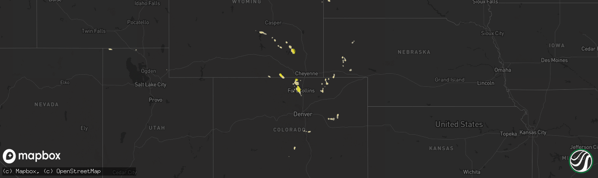
Hail Map on August 27, 2023
The weather event on August 27, 2023 includes Hail and Wind maps. 18 states and 317 cities were impacted and suffered possible damage. The total estimated number of properties impacted is 32,093.
Hail
Wind
32,093
Estimated number of impacted properties by a 1.00" hail or larger3,928
Estimated number of impacted properties by a 1.75" hail or larger0
Estimated number of impacted properties by a 2.50" hail or largerStates Impacted by Hail Map on August 27, 2023
Storm reports
Arkansas
| Date | Description |
|---|---|
| 08/27/20235:20 PM CDT | Public report of a large tree downed near stone and buck wright road just north of ashdown... Arkansas. Report relayed via broadcast media. |
Louisiana
| Date | Description |
|---|---|
| 08/27/20236:25 PM CDT | Tree down on hwy 121 towards hinestone from ditkin hwy. |
| 08/27/20236:16 PM CDT | Transformer blown down from power pole on hwy 465. Time estimated by radar. |
| 08/27/20236:05 PM CDT | Tree blown down across hwy 26. Numerous power outages reported in the area. |
| 08/27/20235:53 PM CDT | Tree down on hwy 1147 near dry creek. Time estimated by radar. |
| 08/27/20235:30 PM CDT | Pictures received from berwick of large section of tree blown onto a home... Several power poles leaning... And one power pole snapped off at the top. Time estimated by |
| 08/27/20235:26 PM CDT | Two pine trees blown down across hwy 465 in simpson. Time estimated by radar. |
| 08/27/20235:00 PM CDT | Tin roofing from a structure was peeled back and removed near hwy. 486 and u.s. Hwy 71 between clarence and campti... Louisiana. |
| 08/27/20234:31 PM CDT | Hail near golfball size reported in lacombe near hwy 434 and i-12. |
| 08/27/20234:30 PM CDT | Another spotter driving on i-12 towards slidell reported quarter to golf ball size hail along the interstate. |
| 08/27/20234:21 PM CDT | Picture of hail near ping pong ball size near lacombe. |
| 08/27/20233:00 PM CDT | Trained spotter reports trees down and damage to a home in the city of hammond. |
| 08/27/20232:15 PM CDT | Awos station khdc hammond. |
| 08/26/20239:25 PM CDT | Trees and power lines down. |
| 08/26/20239:25 PM CDT | Trees and power lines down. |
| 08/26/20238:58 PM CDT | Trees down... Power poles snapped... And lines in the road at the 10000 block of e. Kings. |
| 08/26/20238:57 PM CDT | Trees and powerlines down at multiple spots along ellerbe road. |
| 08/26/20238:55 PM CDT | Trees and powerlines down along dixie garden dr. |
| 08/26/20238:35 PM CDT | Tree down. |
| 08/26/20238:35 PM CDT | Gust to 61 kts; 70 mph at klch. |
Texas
| Date | Description |
|---|---|
| 08/27/20236:07 PM CDT | Power lines down and power poles leaning along fm937. Location approximate. |
| 08/27/20236:00 PM CDT | Delayed report: destroyed tractor barn made of sheet metal. Time approximated from radar. |
| 08/27/20235:35 PM CDT | Quarter size hail in donie. |
| 08/27/20234:15 PM CDT | Social media photo of large tree blown down. Time estimated. |
| 08/27/20233:10 PM CDT | Waco regional airport reported planes overturned and sheet metal ripped off. The asos was also damaged. |
| 08/27/20232:48 PM CDT | Report of a large tree downed near the intersection of 3206 and 3155 just west of mount enterprise... Tx. |
| 08/27/20232:30 PM CDT | 8 downed power poles on sh22 east of cranfills gap. Time estimated. |
| 08/26/20238:05 PM CDT | Trees down across road. |
Georgia
| Date | Description |
|---|---|
| 08/27/20234:45 PM CDT | 911 call center reported multiple trees down in the canon area. |
| 08/27/20234:40 PM CDT | 911 call center reported multiple trees down with one on powerlines on rice mill rd. |
| 08/27/20234:15 PM CDT | Numerous trees down and a roof blown off a house. |
| 08/27/20234:02 PM CDT | Tree down along 400 block of cherokee trail. |
| 08/27/20233:29 PM CDT | Reported a couple of trees down along montego drive near indian road. |
| 08/27/20232:35 PM CDT | Tree down across collins hill rd. |
| 08/27/20231:51 PM CDT | Asos station kcsg columbus. |
| 08/27/20231:40 PM CDT | Tree down. |
| 08/27/20231:40 PM CDT | Tree down. |
| 08/27/20231:40 PM CDT | Tree down. |
| 08/27/20231:40 PM CDT | Tree down and some roof damage to an apartment complex. |
| 08/27/20232:45 AM CDT | Tree on home at glenwood dr from strong winds and wet ground. |
| 08/27/20231:10 AM CDT | Tree down on home perry st on from strong winds and wet soil. |
| 08/27/20231:10 AM CDT | Tree down on home perry st on from strong winds and wet soil. |
Idaho
| Date | Description |
|---|---|
| 08/27/20235:17 PM CDT | Mesonet station mofi1 - moburg canyon. |
| 08/27/20234:25 PM CDT | Largest stone measured with digital calipers at 1.13 inches in diameter on stage coach circle. Hail covered the ground and drifted up to 5 inches deep. Time estimated b |
Colorado
| Date | Description |
|---|---|
| 08/27/20234:06 PM CDT | Report from mping: quarter |
| 08/27/20234:00 PM CDT | A local report indicates 1.00 inch wind near 2.5 NW Fort Collins |
| 08/27/20234:00 PM CDT | A local report indicates 1.25 inch wind near 3.5 SW Fort Collins |
North Carolina
| Date | Description |
|---|---|
| 08/27/20235:30 PM CDT | Utility company reported falling trees leading to power outages in uptown charlotte. |
| 08/27/20235:20 PM CDT | Utility company reported fallen trees leading to power outages on rocky river rd. |
| 08/27/20233:57 PM CDT | Tree down on house with a person trapped inside. Time estimated by radar. |
| 08/27/20233:56 PM CDT | Power lines down. Time estimated by radar. |
| 08/27/20233:55 PM CDT | Trees down. One on a vehicle trapping a person. Time estimated by radar. |
| 08/27/20233:55 PM CDT | Trees down at 2 locations along race street. Time estimated by radar. |
| 08/27/20233:54 PM CDT | Tree down on a house. Time estimated by radar. |
| 08/27/20233:15 PM CDT | A least 2 trees down from the storm. |
| 08/27/20233:02 PM CDT | Central alexander county fire department reports a tree down blocking the 6300 block of nc 16. |
| 08/27/20233:02 PM CDT | Central alexander county fire department reports a tree down |
| 08/27/20232:48 PM CDT | A few trees blown in this area south of ellendale. |
| 08/26/20237:15 PM CDT | A tree was reported down on a house along windstone road near village way. |
South Carolina
| Date | Description |
|---|---|
| 08/27/20233:48 PM CDT | Reported a tree down along lanford road near trading post road. |
| 08/27/20233:47 PM CDT | Spotter reported several trees down within sesquicentennial state park. Two campers had trees fall on them. There were no injuries. |
Cities Impacted by Hail Map on August 27, 2023
- Waynesboro, MS
- Collins, MS
- Garrett, WY
- Taylorsville, MS
- Mize, MS
- Mount Olive, MS
- Bosler, WY
- Wheatland, WY
- Hammond, LA
- Ponchatoula, LA
- Fort Collins, CO
- Laporte, CO
- Bellvue, CO
- Loveland, CO
- Livermore, CO
- Wellington, CO
- Statesville, NC
- Jelm, WY
- Royston, GA
- Canon, GA
- Carnesville, GA
- Lacombe, LA
- Slidell, LA
- Pearl River, LA
- Canon City, CO
- Island Park, ID
- Hartsville, SC
- Sonora, TX
- Eldorado, TX
- Natchitoches, LA
- Campti, LA
- Winnfield, LA
- Maplesville, AL
- Stanton, AL
- Newberry, SC
- Lincolnton, GA
- Weston, CO
- Coushatta, LA
- Jonesboro, TX
- Zephyr, TX
- Early, TX
- Thornton, TX
- Noble, LA
- Zwolle, LA
- Whitney, TX
- Biloxi, MS
- Diberville, MS
- Meridian, TX
- Garrison, TX
- Grouse Creek, UT
- Randolph, AL
- Morgan, TX
- Galivants Ferry, SC
- Aynor, SC
- Convent, LA
- Saint James, LA
- Paulina, LA
- Nichols, SC
- Valley Mills, TX
- Kosse, TX
- Fairfield, NC
- Abbott, TX
- West, TX
- Penelope, TX
- Crawford, TX
- Foley, AL
- Bon Secour, AL
- Mount Calm, TX
- Madisonville, LA
- Rochelle, TX
- Brady, TX
- Mandeville, LA
- Covington, LA
- Abita Springs, LA
- McGregor, TX
- Millersview, TX
- Eden, TX
- Cranfills Gap, TX
- Coffeeville, AL
- Clifton, TX
- Goldthwaite, TX
- Ellenboro, NC
- Casar, NC
- Lawndale, NC
- Jena, LA
- Loranger, LA
- Menard, TX
- Gatesville, TX
- Burgaw, NC
- Millsap, TX
- Weatherford, TX
- Aquilla, TX
- Evant, TX
- Hamilton, TX
- Prairieville, LA
- Geismar, LA
- Jewett, TX
- Perkinston, MS
- Poplarville, MS
- Perrin, TX
- Waco, TX
- Saucier, MS
- Pass Christian, MS
- Mineral Wells, TX
- Napoleonville, LA
- Henderson, TX
- Laneville, TX
- Reklaw, TX
- Arlington, TX
- Malone, TX
- Hillsboro, TX
- Engelhard, NC
- Swanquarter, NC
- Imnaha, OR
- China Spring, TX
- Kiln, MS
- Centerville, TX
- Graford, TX
- Maurepas, LA
- French Settlement, LA
- Saint Amant, LA
- Purmela, TX
- Hallsboro, NC
- Whiteville, NC
- Bridgeport, TX
- Poolville, TX
- Oakwood, TX
- Kentwood, LA
- Aledo, TX
- Franklin, TX
- Olla, LA
- Elkhart, TX
- Palestine, TX
- Gibson, LA
- Schriever, LA
- Houma, LA
- Morgan City, LA
- Richland Springs, TX
- Flomaton, AL
- Atmore, AL
- Marquez, TX
- Groesbeck, TX
- Fort Hood, TX
- Medicine Bow, WY
- Dubois, ID
- Spencer, ID
- Greensburg, LA
- Bush, LA
- Whitt, TX
- Marrero, LA
- Goldonna, LA
- Blythewood, SC
- Jacksonville, TX
- Lampasas, TX
- Axtell, TX
- Bristol, FL
- Robeline, LA
- Carriere, MS
- Picayune, MS
- Grapeland, TX
- Fort Worth, TX
- Vacherie, LA
- Diamondhead, MS
- Gulfport, MS
- Bay Saint Louis, MS
- Matthews, GA
- Wrens, GA
- Keysville, GA
- Troup, TX
- Ashdown, AR
- Mount Enterprise, TX
- Encampment, WY
- Casper, WY
- Blountstown, FL
- Paint Rock, TX
- McDavid, FL
- Walden, CO
- Century, FL
- Wewahitchka, FL
- Niceville, FL
- Thibodaux, LA
- Moss Point, MS
- Chappells, SC
- Ninety Six, SC
- Oglesby, TX
- Cresson, TX
- Riesel, TX
- Prosperity, SC
- Carlton, TX
- Lohn, TX
- Graham, TX
- Sorrento, LA
- Bay Minette, AL
- Hephzibah, GA
- Blythe, GA
- San Saba, TX
- Montevallo, AL
- Brierfield, AL
- Long Beach, MS
- Suwanee, GA
- Lake Charles, LA
- Laramie, WY
- Shreveport, LA
- Elm Grove, LA
- Bossier City, LA
- Grover, CO
- Streetman, TX
- Corsicana, TX
- Briggsdale, CO
- Florien, LA
- Many, LA
- Eunice, NM
- Pine Hill, AL
- Provencal, LA
- Wortham, TX
- Durham, NC
- Chapel Hill, NC
- Leesville, LA
- Mora, LA
- Theriot, LA
- Dix, NE
- Kimball, NE
- Lindon, CO
- Harrisonburg, LA
- Westcliffe, CO
- Alcova, WY
- Custer, SD
- Bullard, TX
- Monument, CO
- Palmer Lake, CO
- Larkspur, CO
- Vivian, LA
- Italy, TX
- Marshall, TX
- Colorado Springs, CO
- Donie, TX
- Westwego, LA
- Mexia, TX
- Buffalo, TX
- Teague, TX
- Tickfaw, LA
- Karnack, TX
- Pittsboro, NC
- Athens, TX
- Malakoff, TX
- Rodessa, LA
- Bivins, TX
- Jefferson, TX
- Elbert, CO
- Red Feather Lakes, CO
- Agate, CO
- Orchard, CO
- Dulac, LA
- Berwick, LA
- Tennessee Colony, TX
- Waveland, MS
- Milton, FL
- Branson, CO
- Dodson, LA
- Limon, CO
- Kerens, TX
- Ponce De Leon, FL
- New Raymer, CO
- Preston, GA
- Richland, GA
- Mansfield, TX
- Burleson, TX
- Deridder, LA
- Frankston, TX
- Brewton, AL
- Fairfield, TX
- Vancleave, MS
- Timpson, TX
- Defuniak Springs, FL
- Milford, TX
- Tucson, AZ
- Genoa, CO
- Gary, TX
- Jonesboro, LA
- Saluda, SC
- Saline, LA
- Drake, CO
- Enterprise, LA
- Grandview, TX
- Hico, TX
- Apex, NC
- Long Branch, TX
- Robert, LA
- Independence, LA
- Acme, LA
- Colbert, GA
- Bridgeport, NE
- Bayard, NE
- Blackville, SC
- Laurens, SC
- Ware Shoals, SC
- Cairo, GA
- Blackstock, SC
- Williston, SC
- Ferriday, LA
- Dalton, NE
- Alliance, NE
- Blakely, GA
- Sidney, NE
- Gurley, NE
- Theodore, AL
- Mobile, AL
- Donner, LA
- Luling, LA
- Boutte, LA
- Baton Rouge, LA
- Coden, AL
- Irvington, AL
- Stapleton, AL
- Bayou La Batre, AL
- Daphne, AL
- Trout, LA